Continung a very active July weather pattern, several rounds of strong to severe thunderstorms rumbled across parts of the NWS Hastings county warning area during a roughly 72-hour period between just after midnight, Saturday, July 17th, and the early morning hours of Tuesday, July 20th. The most significant severe weather episode during this time occurred during the late evening hours of July 17th, as a widespread swath of 60-90 MPH winds swept eastward across south central Nebraska, interrupting a number of Saturday evening activities near the Interstate 80 corridor.
Severe Weather:
Here are a few "highlights" from this multi-day severe weather episode, based on reports from storm spotters/chasers, local law enforcement/emergency management, and the public: Please note that these reports are PRELIMINARY:
July 17 (early morning hours):
July 17 (late evening, 9PM-Midnight):
July 20 (early morning, pre-dawn hours):
CLICK ON IMAGE below for an "interactive" map of all PRELIMINARY storm reports received by NWS Hastings, July 17-20, 2010:
 |
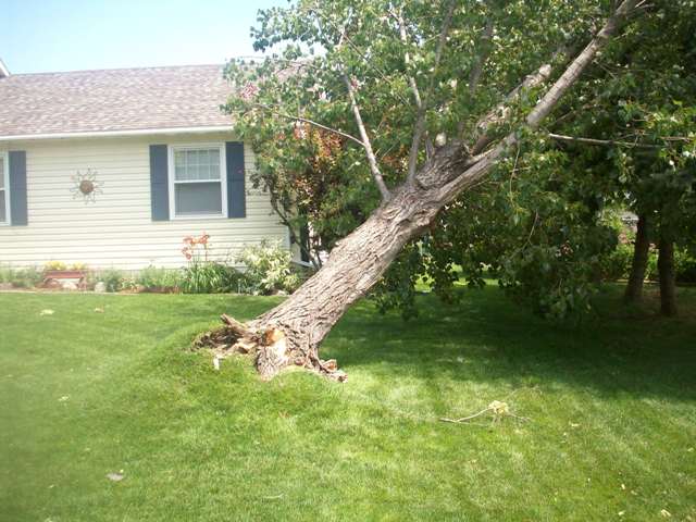
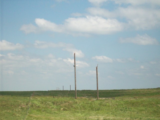
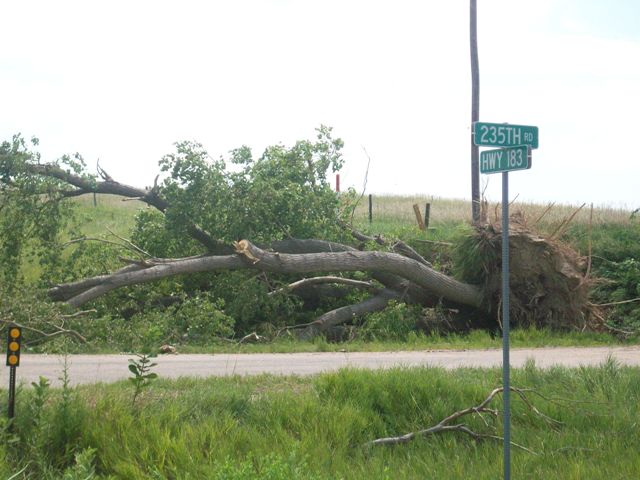
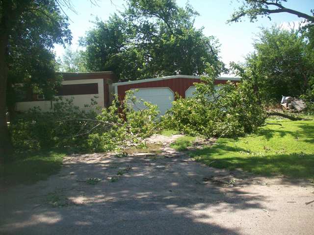
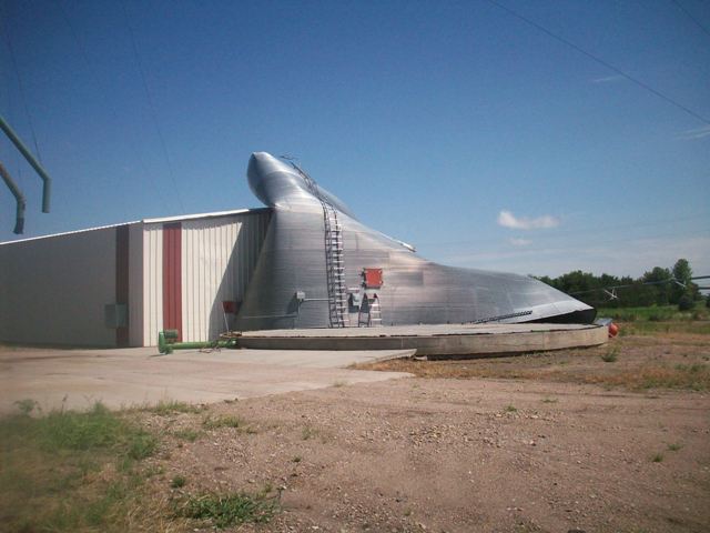
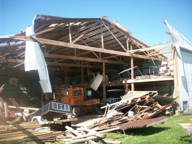
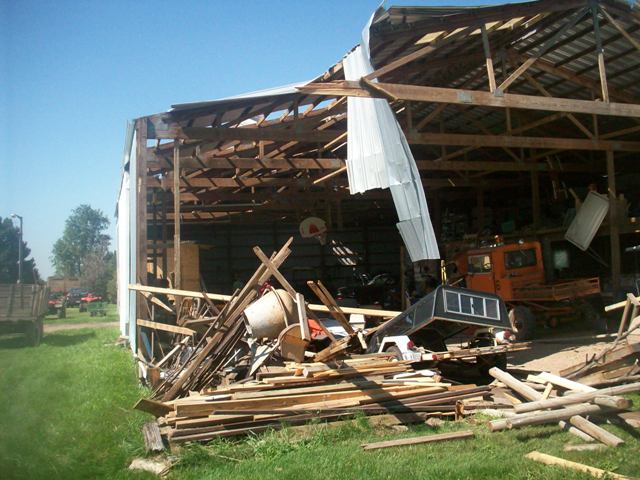
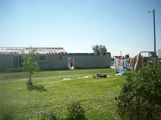
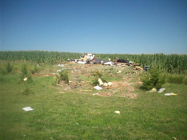
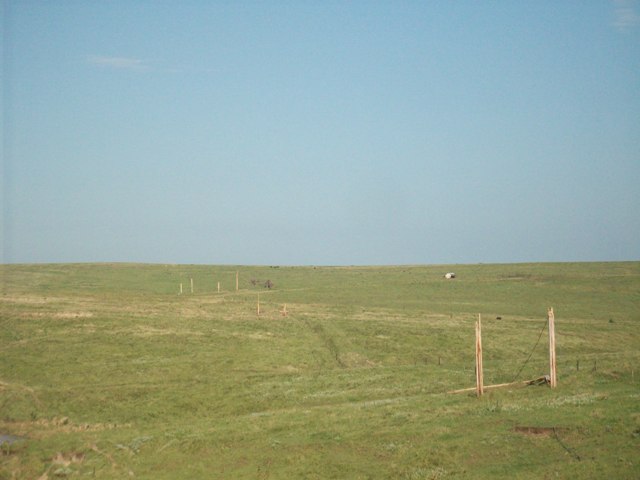
The following pictures were provided by the Buffalo County Emergency Manager. The pictures are from Saturday night,
July 17th and located across Buffalo County.
 |
 |
 |
 |
 |
|
 |
 |
 |
 |
 |
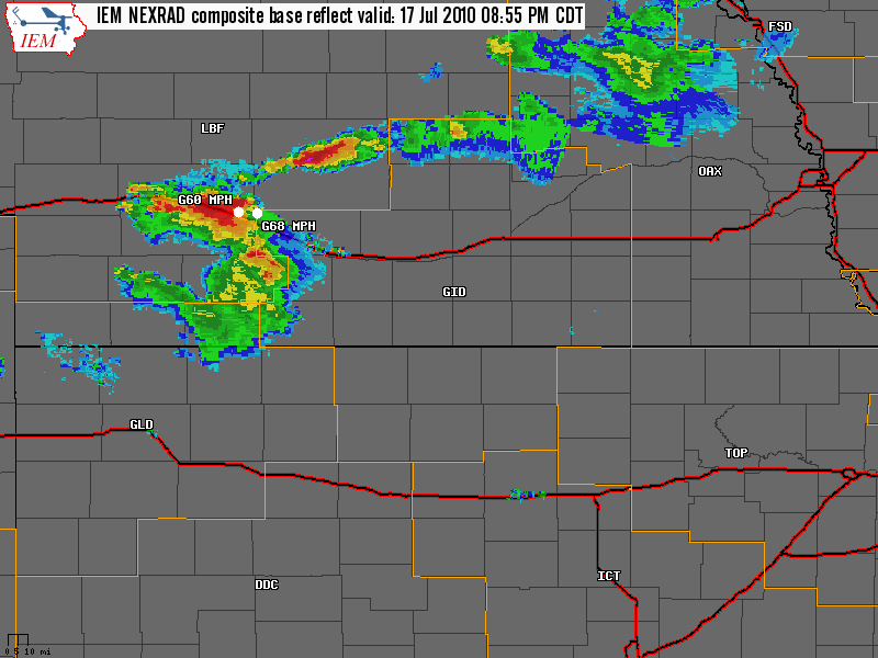
Focusing on the most damaging severe weather event during this period, the radar loop below, courtesy of the Iowa Environmental Mesonet (Iowa State University), depicts storms across southern NE between 900 PM-1145 PM , July 17, 2010:
|
- The NWS Hastings 30-county coverage area is depicted within the orange outlined area labeled "GID" - Interstate Highways are depicted by the thick red and black lines - Preliminary local storm reports pop up on the image as small white triangles (for example, "Hail 1.5" indicates hail 1.5 inches in diameter). |
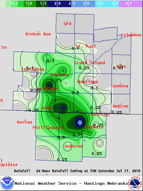
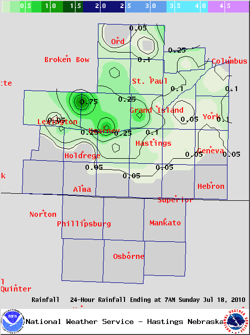
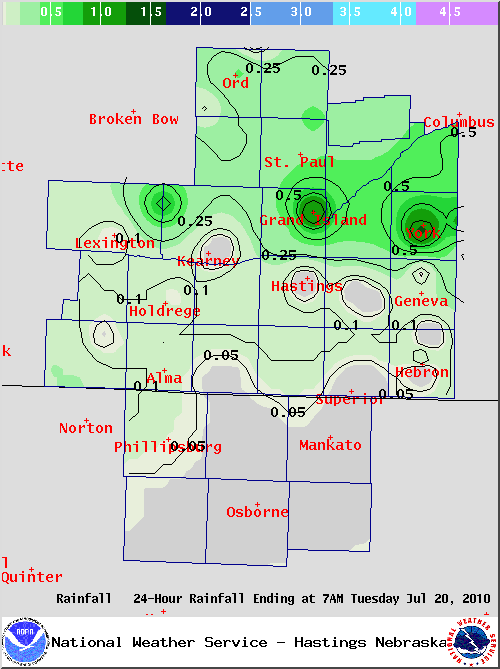
Locally Heavy Rainfall:
The graphics below depicts an approximation of 24-HOUR RAINFALL totals ending around 7 AM on the mornings of July 17th, 18th, and 20th, 2010. A few of the highest known multi-day gauge readings within the area included:
Click Here and HereTo Find Additional Daily Precipitation And Temperature Information
|
|
|
 |


 Follow us on YouTube