|
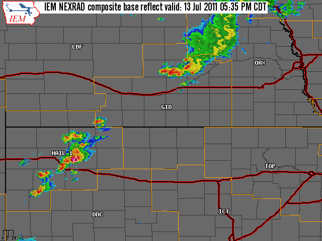
July 13, 2011 Severe Weather Event The NWS Hastings coverage area is located within the orange outlined area labeled "GID", with the Interstates in red. (Click Radar Loop To Enlarge)
|
|
|
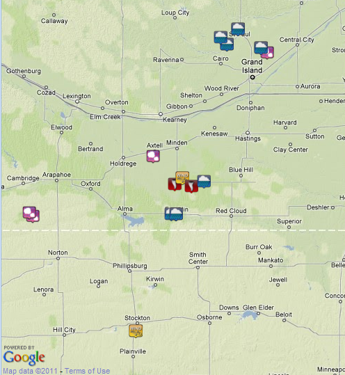
Severe Weather Summary: The early to mid evening hours brought a round of scattered thunderstorms to portions of the Hastings coverage area, driven by a weak upper level disturbance crossing the Plains and a warm frontal boundary draped through the region. These thunderstorms initiated across portions of northwestern Kansas, before shifting northeast and expanding in coverage as they crossed the Hastings coverage area. There were a number of hail reports from nickel to golf ball size, as well as wind gusts of 60-65 mph, but the most notable event was a few brief tornado touchdowns southeast and southwest of Upland in Franklin County. Thankfully, these tornadoes were weak and no damage was reported. As far as rainfall goes, it was quite spotty across the region, but a few places picked up some hefty amounts. In general, the highest totals affected parts of Franklin, Howard and Merrick Counties. Reports of 1 to over 3 inches were common in these areas. A few specific measured amounts included 3.43 inches in Franklin, and 2.99 inches in Dannebrog. Here are a few "highlights" of the event, based on reports from storm spotters, local law enforcement, emergency management, and the public:
|


 Follow us on YouTube