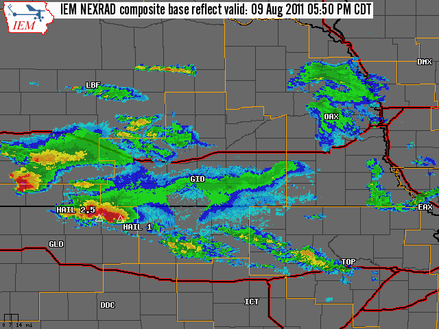
National Weather Service United States Department of Commerce

August 9, 2011

Severe Weather Event

Very Large Hail and Damaging Winds Across Western Portions of North Central Kansas

To the right is a National Weather Service Radar loop with overlayed storm reports, from 5:50 pm CDT, August 9th to 9:30 pm CDT, August 9th.

The NWS Hastings coverage area is located within the orange outlined area labeled "GID", with the Interstates in red.
 

(Click Radar Loop To Enlarge)


 Severe Weather Summary:

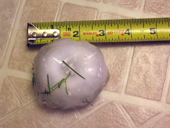
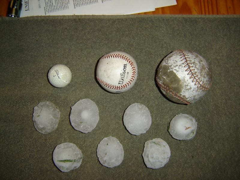
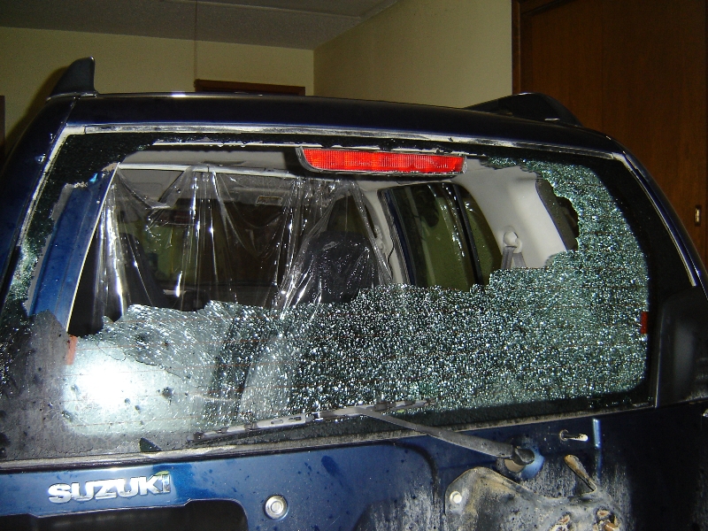
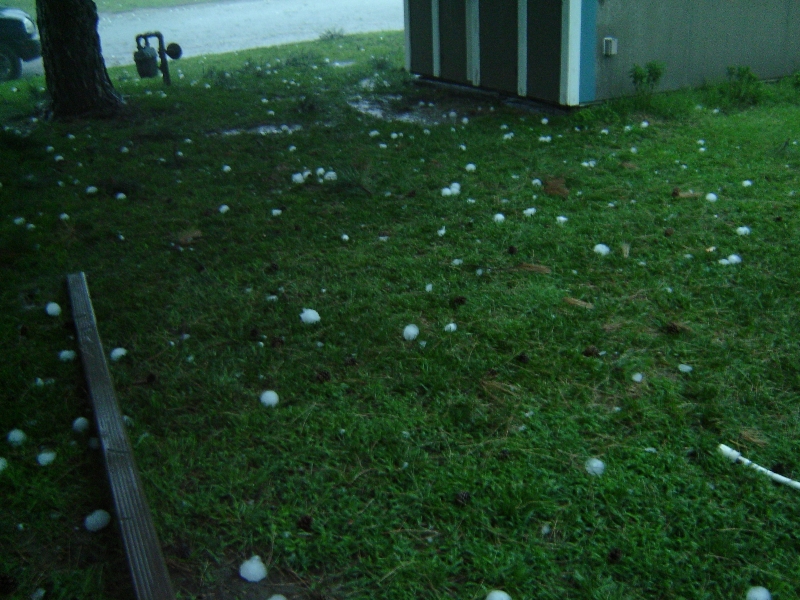
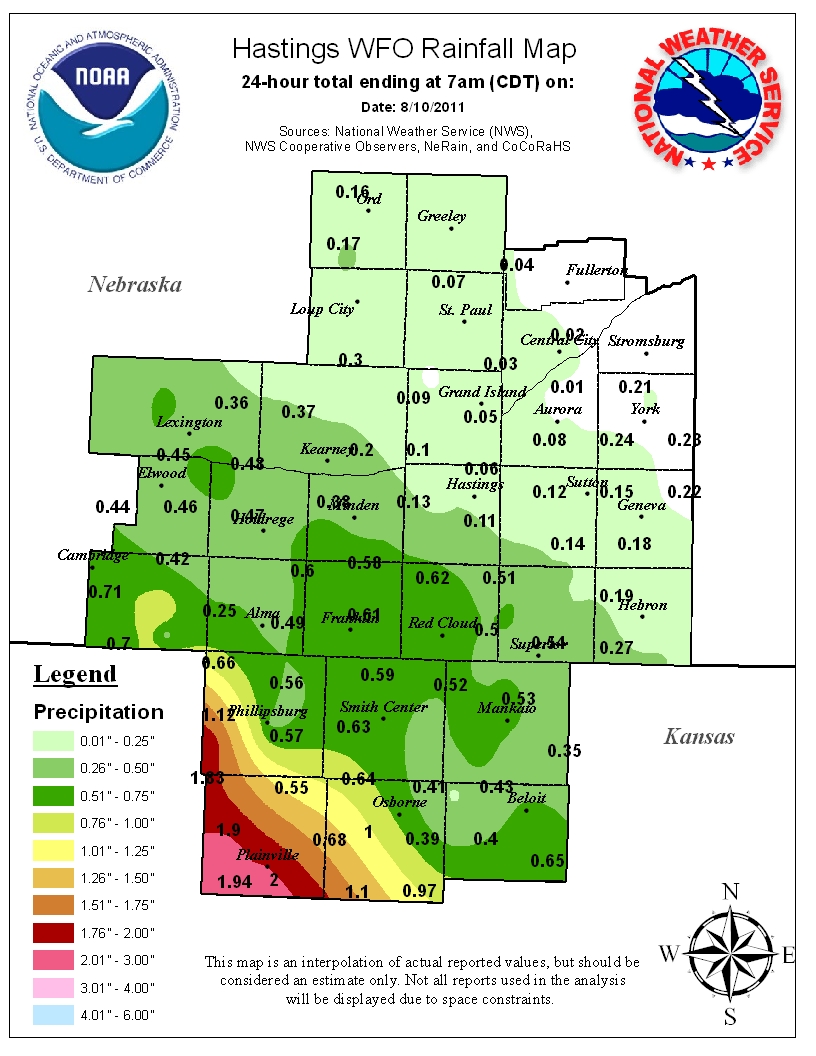
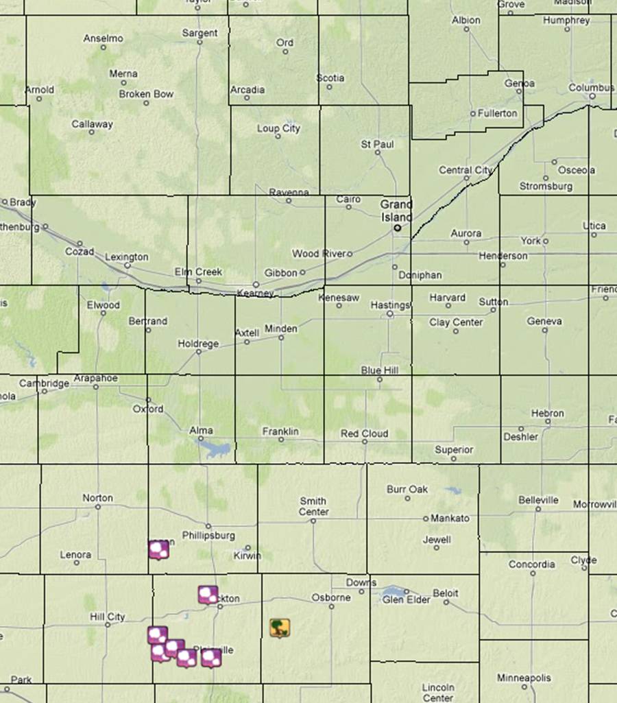
Another upper level disturbance pushing out of the Rockies and onto the Plains brought an additional round of thunderstorms across portions of the Hastings CWA, some of which were on the strong to severe side thanks to modest instability and unseasonably strong deep-layer wind shear of 40-60 knots.  Once again the severe weather came in a short amount of time, mainly between 6 and 8 pm, with the area affected by the severe weather confined to Phillips, Rooks, and Osborne Counties of North Central Kansas.  Very large hail was the main story with this event, reaching up to the size of a softball in Rooks County, though damaging winds were also reported in Osborne County. 

Here are the "highlights" of the event, based on reports from storm spotters, local law enforcement, emergency management, and the public:

  • Baseball to softball size hail was reported in and near Zurich (Rooks County) 
  • Tennis ball size hail was reported in Damar and Palco (Rooks County)   
  • Golf ball size hail was reported in and near Plainville (Rooks County) 
  • Quarter to golf ball size hail was reported in Logan (Phillips County) 
  • Strong winds resulted in snapped power poles and crop damage south of Alton (Osborne County)
 
Click Images To Enlarge

Large hail in Zurich, this photo was taken after it had melted for 30 minutes. 
Courtesy of Lou Johnson.

 Large hail in Zurich. 
Courtesy of Lou Johnson.

Large hail in Damar.
Courtesy of Becky Wells.

Damage caused by large hail in Damar.
Courtesy of Becky Wells.


 Large hail in Damar.
Courtesy of Becky Wells.

 24-hour rainfall total map ending at
7 AM, August 10, 2011


  • For an interactive listing of the PRELIMINARY storm reports, please click the linked image below: 

 August 9, 2011 Storm Reports.
Click image for detailed reports.