If you have any photos you would like to share, please feel free to post them to our Facebook or Twitter pages, or send them to our webmaster e-mail account
at: w-gid.webmaster@noaa.gov. Please let us know where the photo was taken, and at least an approximate time. Thanks!
Storm Season begins with Large Hail and a Tornado
Over South Central Nebraska and North Central Kansas
April 24th, 2016
Radar Overview |
Tornado and Hail Information |
An upper level storm system impacted the region on Sunday April 24th, 2016. This storm system caused a surface cool front to move eastward across the area. The combination of upper level forcing, and plentiful instability and shear allowed severe storms to develop along and east of the front. These storms developed during the afternoon along and east of Highway 281 in south central Nebraska and north central Kansas moving east, into the evening hours.
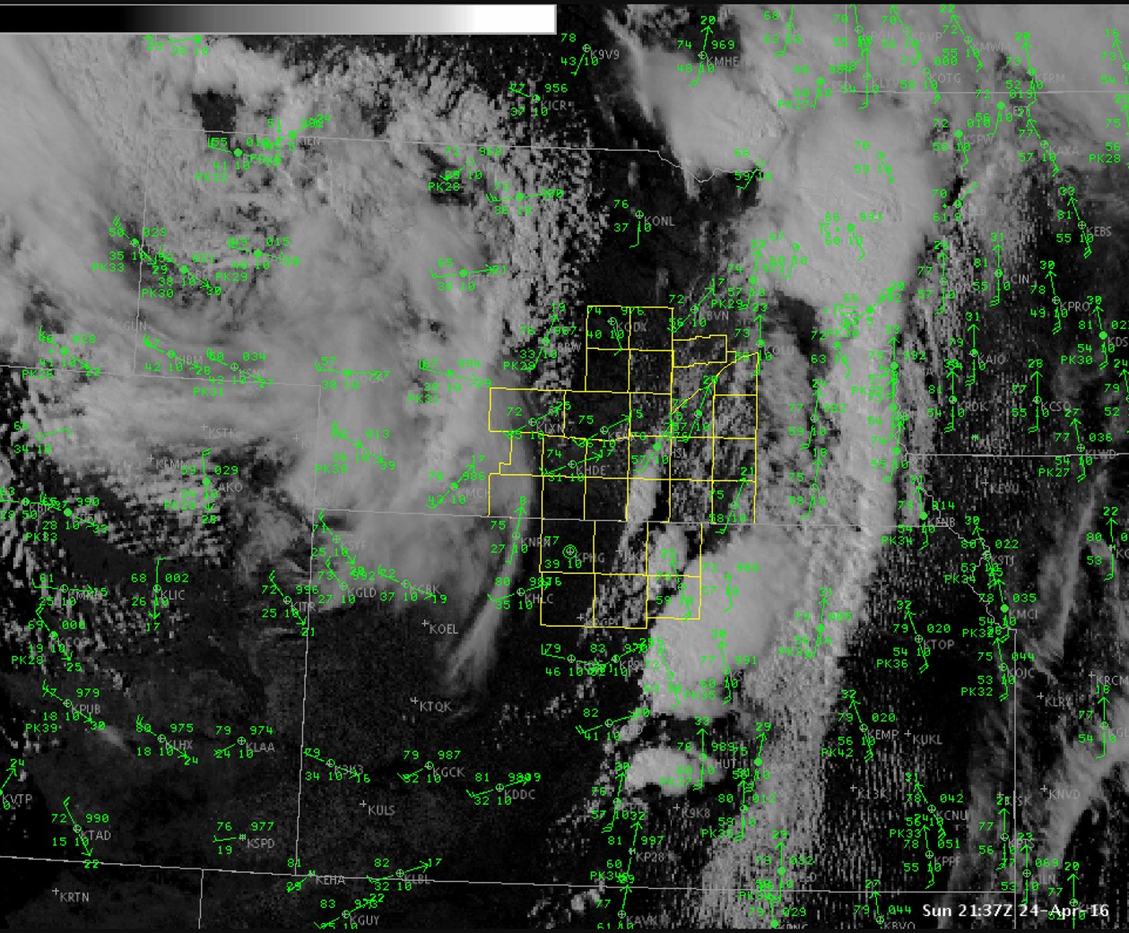 |
| Visible satellite imagery from the afternoon of November 17th. Note the well defined dry slot (cloud free area) nosing into central Kansas. |
Radar Overview
As mentioned, storms developed along and east of Highway 281 across south central Nebraska and north central Kansas. The majority of these storms impacted Jewell and Mitchell counties in Kansas and Nuckolls and Thayer counties in Nebraska before moving into northeast Kansas and southeast Nebraska. A couple of supercells dominated the event with one producing a tornado in Nuckolls county and the second producing large hail in Jewell county before moving northeast and producing a tornado in Republic county in northeast Kanasas.
 |
Tornado Information & Other Storm Reports
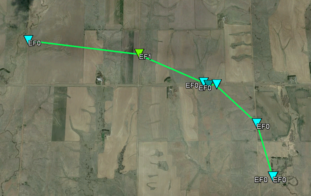
Click on image below for more detailed storm report information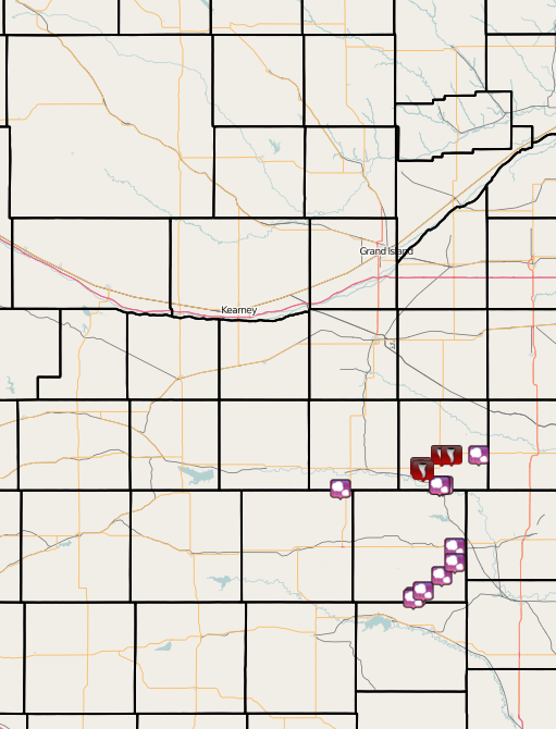 |
See the image above for the track of the two main storms and more detailed information about the storm reports that were received.
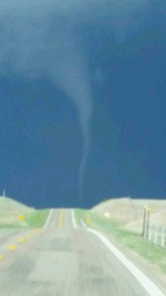
The storm over Nuckolls county produced a picturesque tornado that touched down near Highway 136 northwest of Superior, NE and tracked southeast a few miles before lifting northwest of Superior. The radar image below shows the strong rotation and radar reflectivity about the time the tornado touched down. A storm survey crew will provide more information about the track including length/width and location of the tornado.
 |
| Radar image from 6:05 p.m. CDT on April 24th |
Images of Damage Path From Storm Survey
|
Damage Path northwest of Superior |
Damage path zoomed in |
|
The storm was rated as an EF-1 with a maximum width of 300 yards. The tornado etched out a path roughly 2.8 miles long with an estimated maximum wind speed of 100 mph. |
|
Images of the Tornado
|
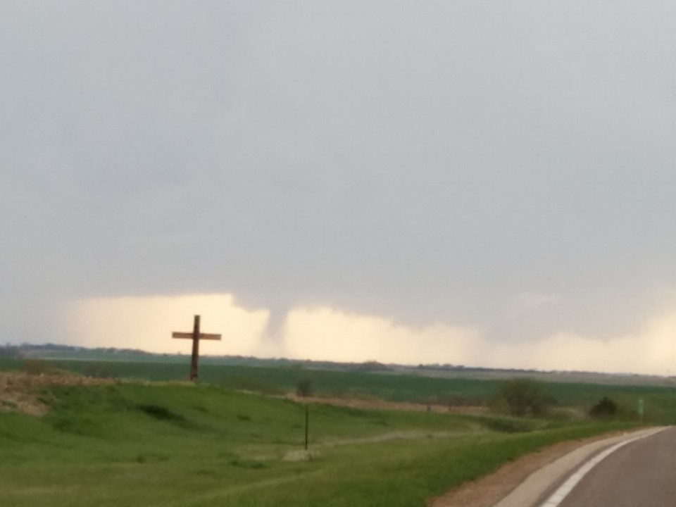
Picture taken around 606pm from southwest of Hebron on Highway 136, looking to the west. Picture courtesy of Chuck Patient |
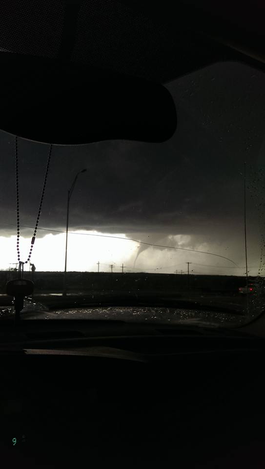
Just north of Superior |
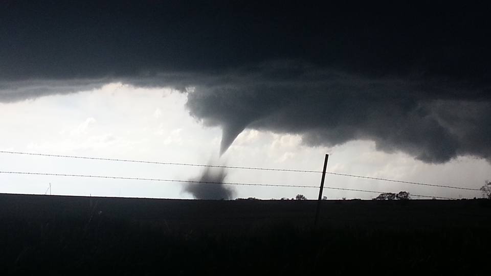
Tornado near Superior |
|
Tornado near Superior |
Tornado near Superior. Picture taken around 6:20pm |
View from West-Northwest of Superior |
|
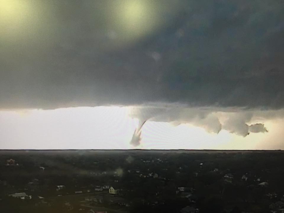
Picture from NTV News Viaero Wireless Camera Network - Picture sent to NWS Hastings facebook by Taylor Haight. |
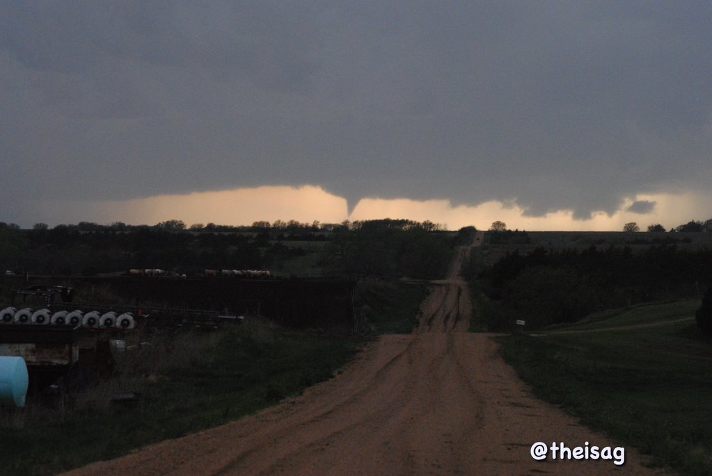
Picture of tornado off in the distance. Picture courtesy of @TheisAg received via Twitter |
Tornado east of Guide Rock |
Tornado Path Survey
|
EF0 damage of lofted debrie northwest of Superior |
EF1 damage of snapped power poles nortwest of Superior |
|
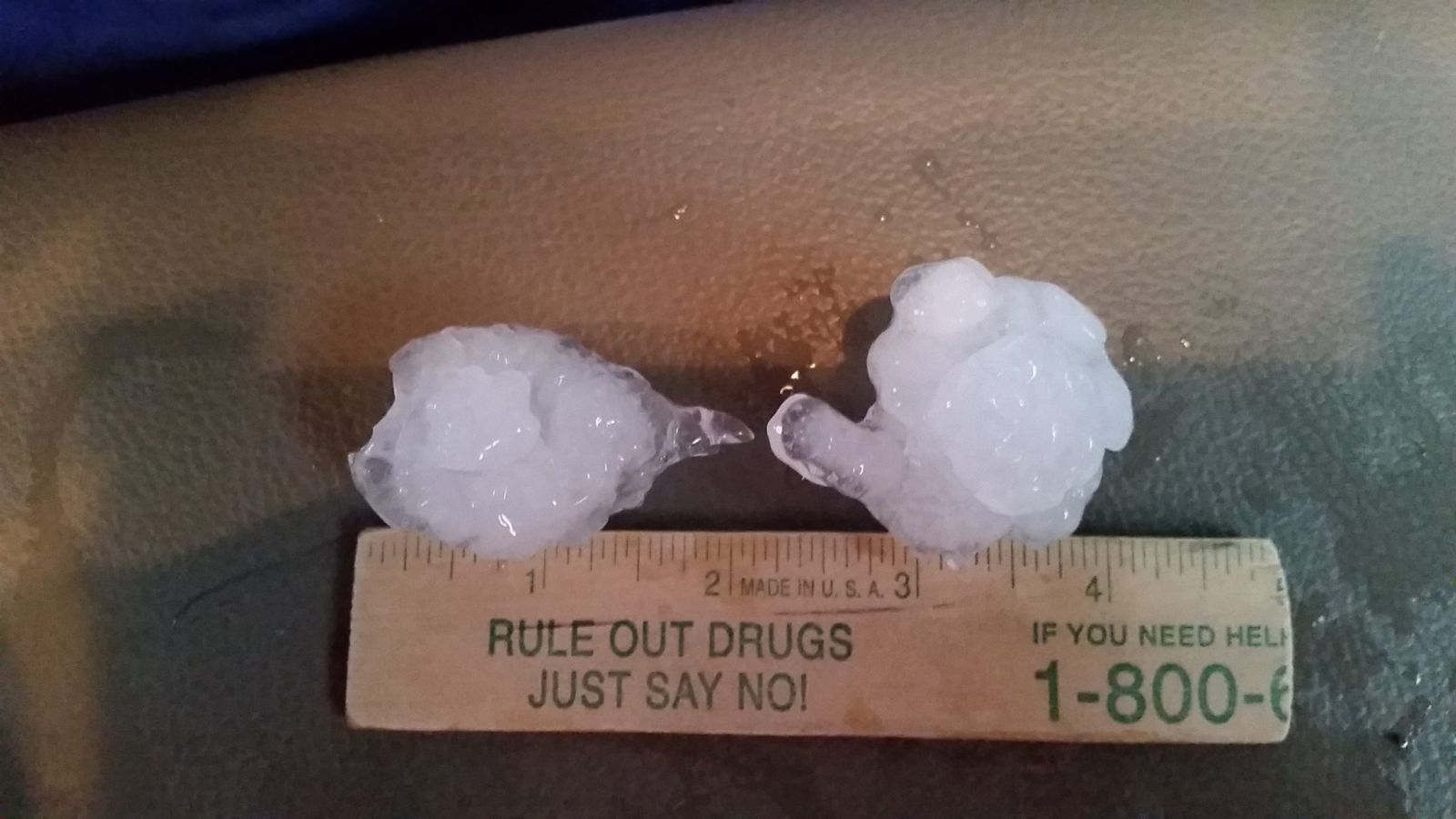
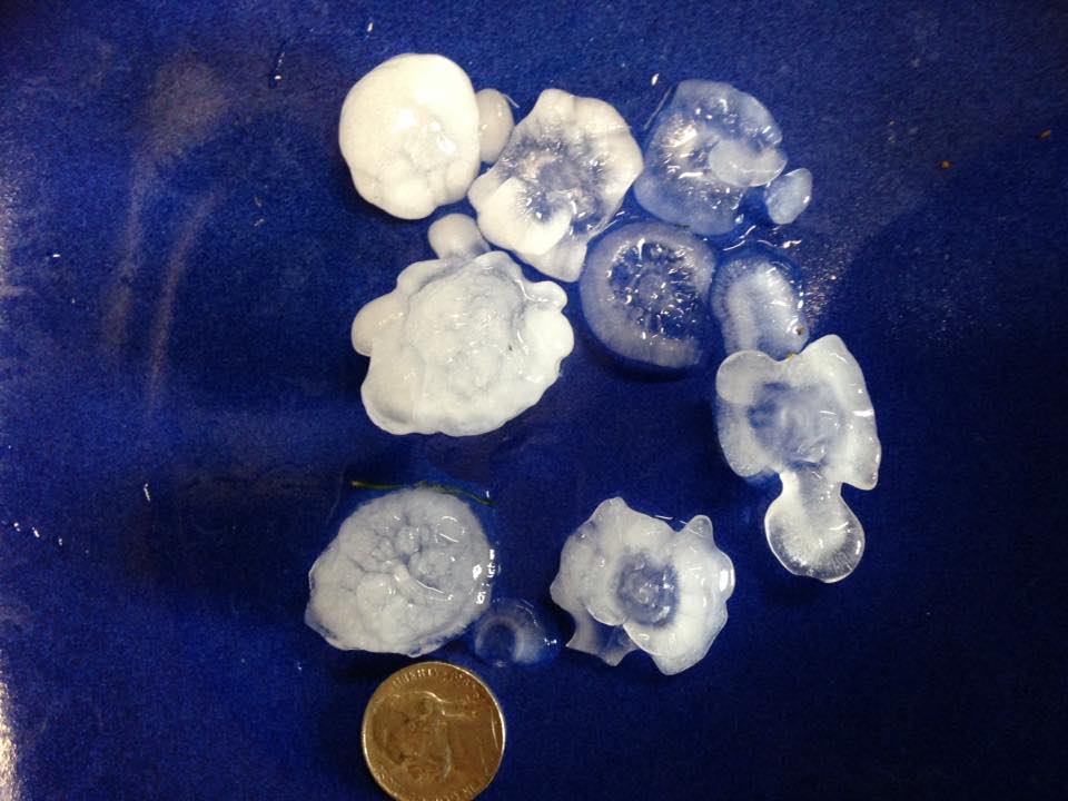
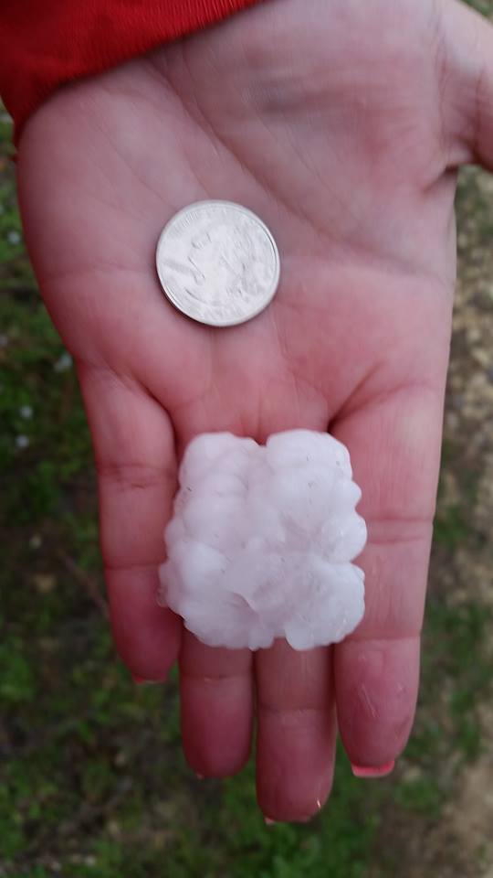
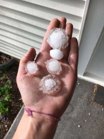
Images of Hail
|
Picture of Hail 5 miles east of of Jewell |
Hail near Superior. |
Hail southest of Red Cloud |
|
Hail in Formoso, KS. Picture from off duty NWS employee Angela Pfannkuch |
Hail on the east side of Superior |
|
 |
This page was composed by the staff at the National Weather Service in Hastings, Nebraska. |
 |


 Follow us on YouTube