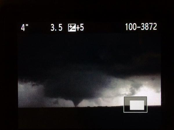
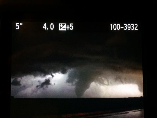
If you have any photos you would like to share, please feel free to post them to our Facebook or Twitter pages, or send them to our webmaster e-mail account at: w-gid.webmaster@noaa.gov. Please let us know where the photo was taken, and at least an approximate time. Thanks!
|
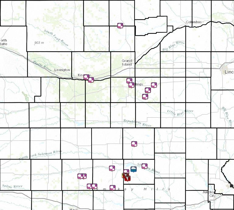
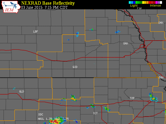
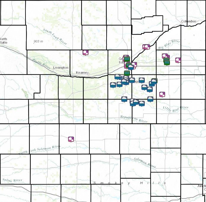
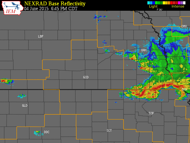
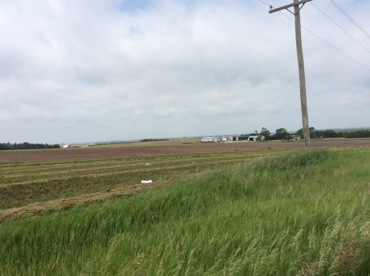
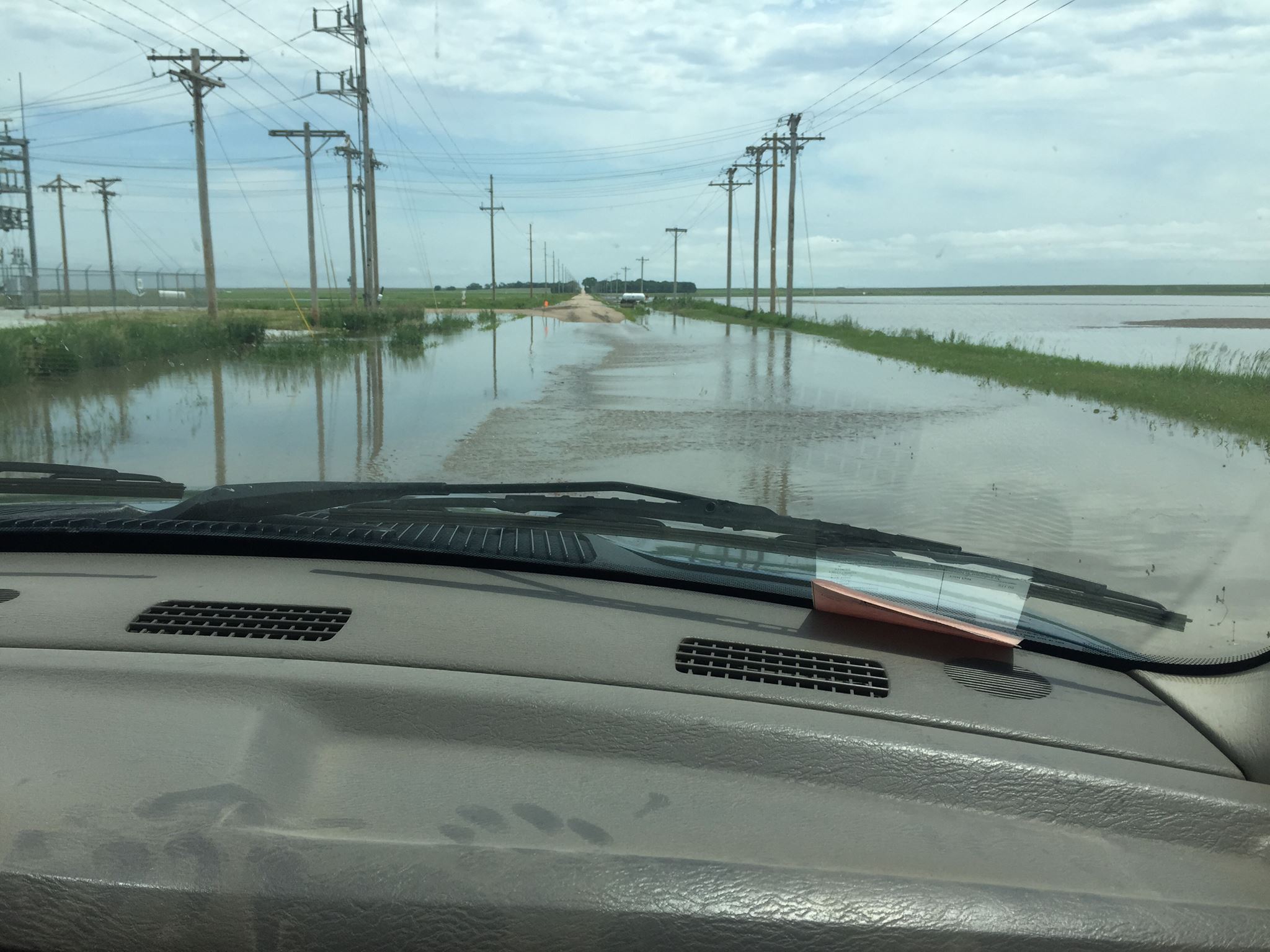
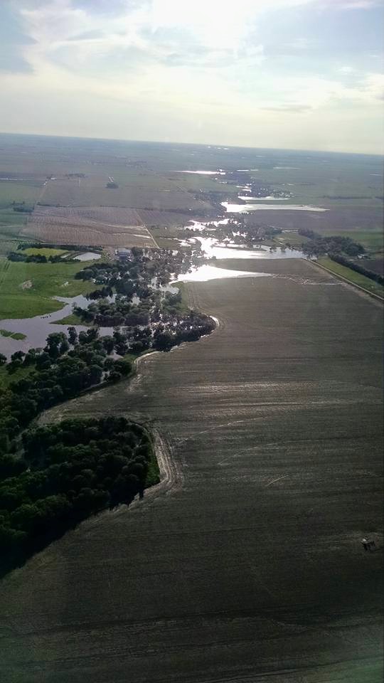
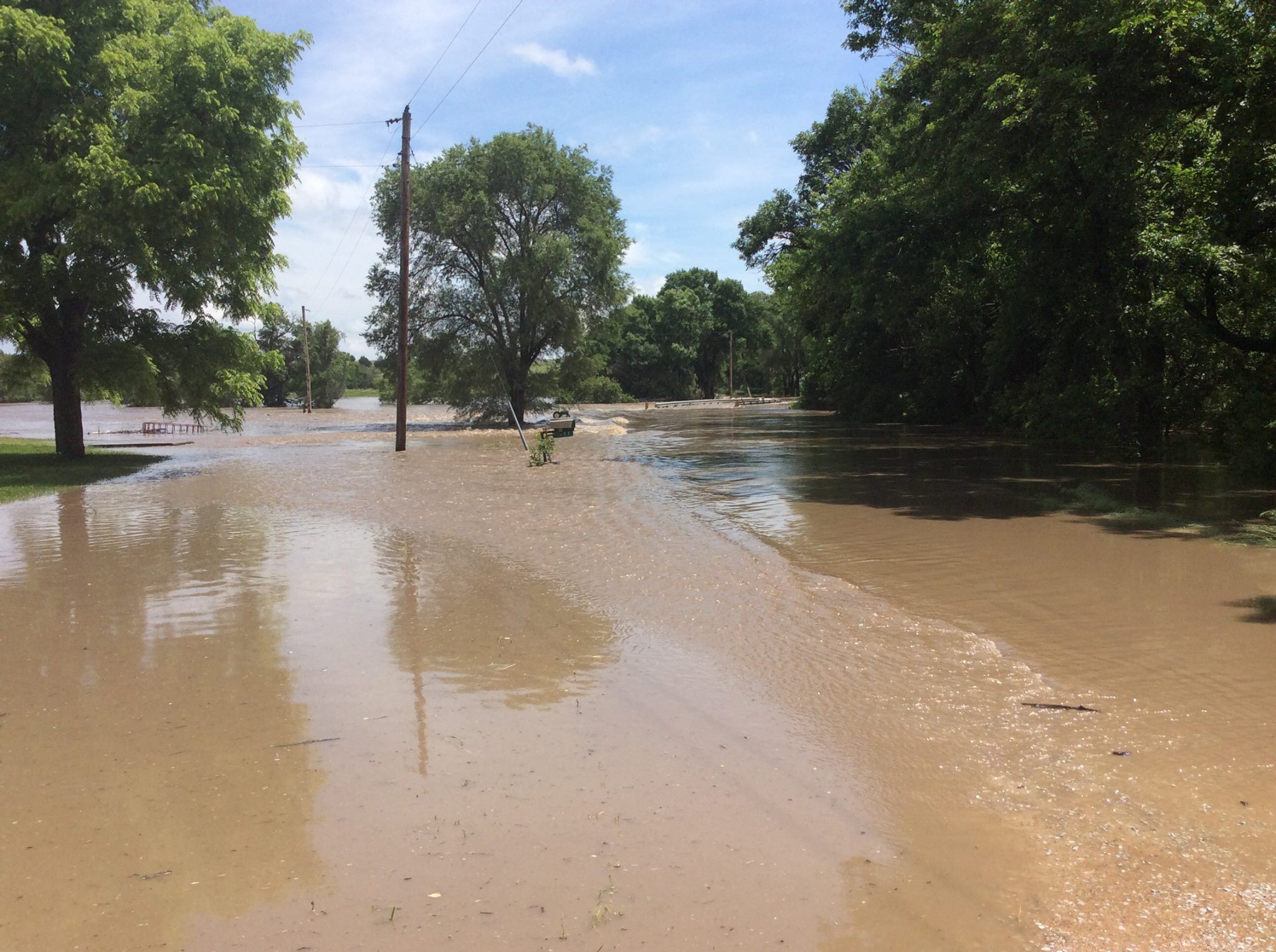
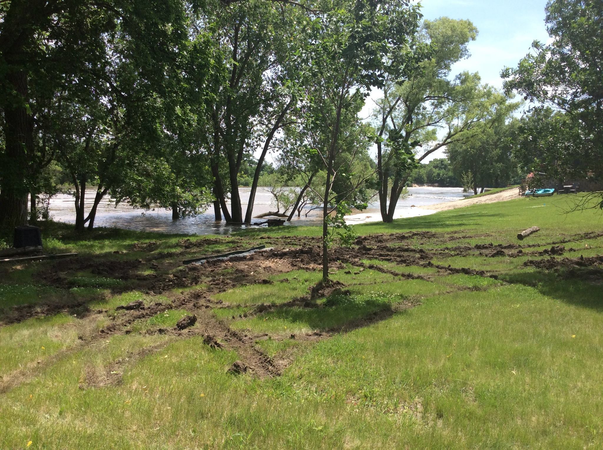
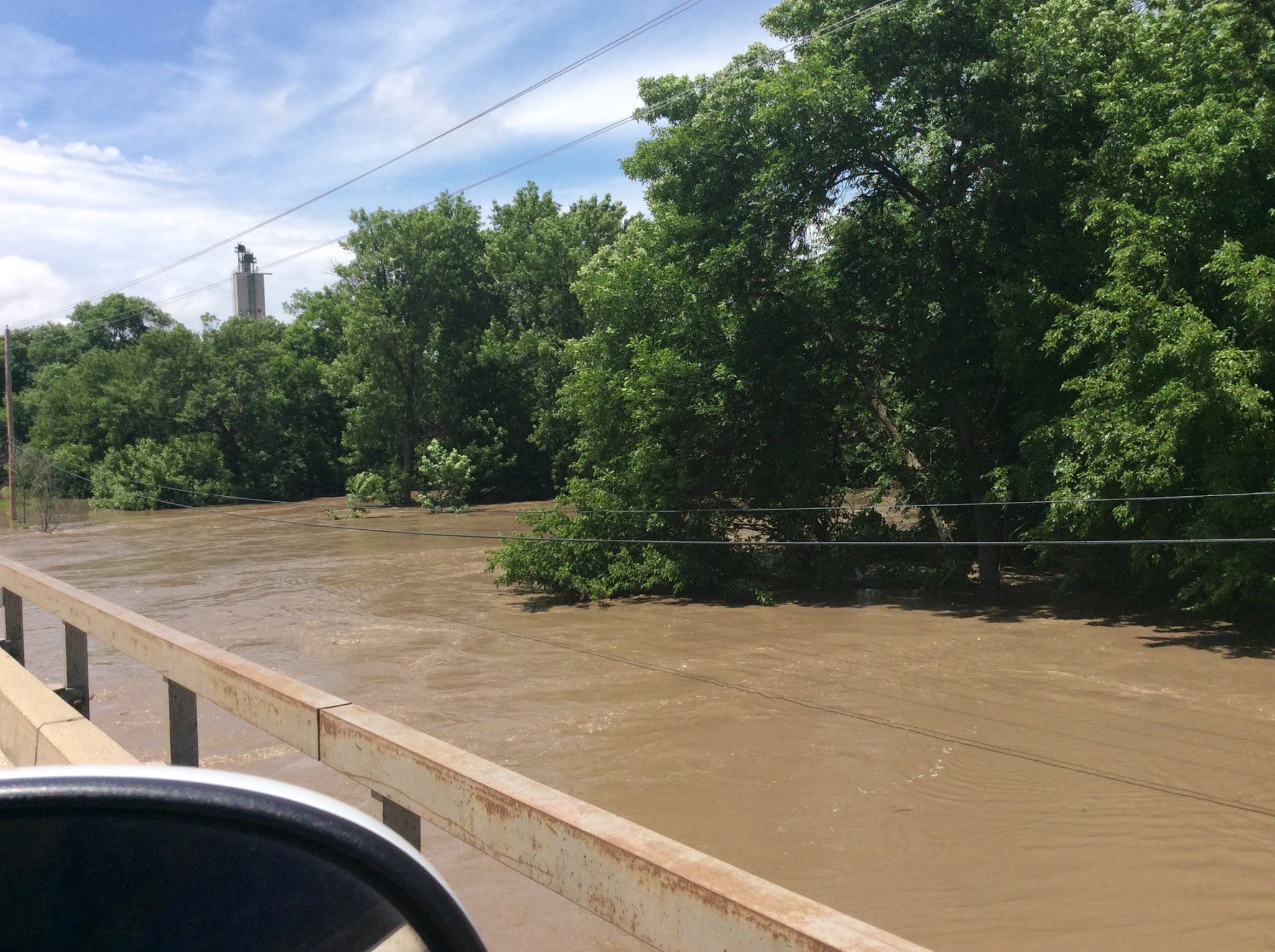
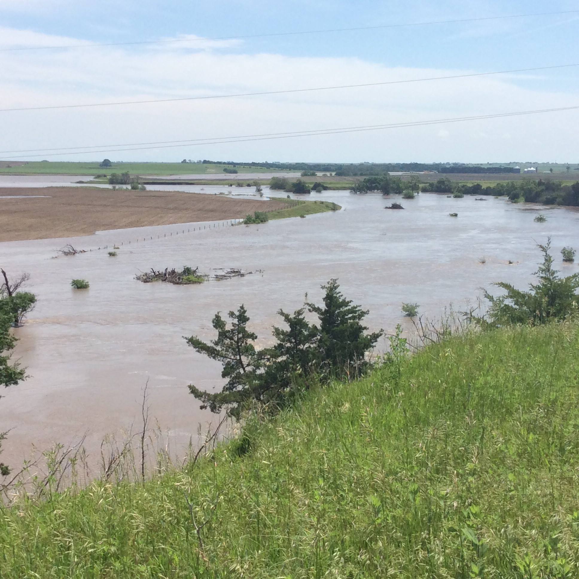
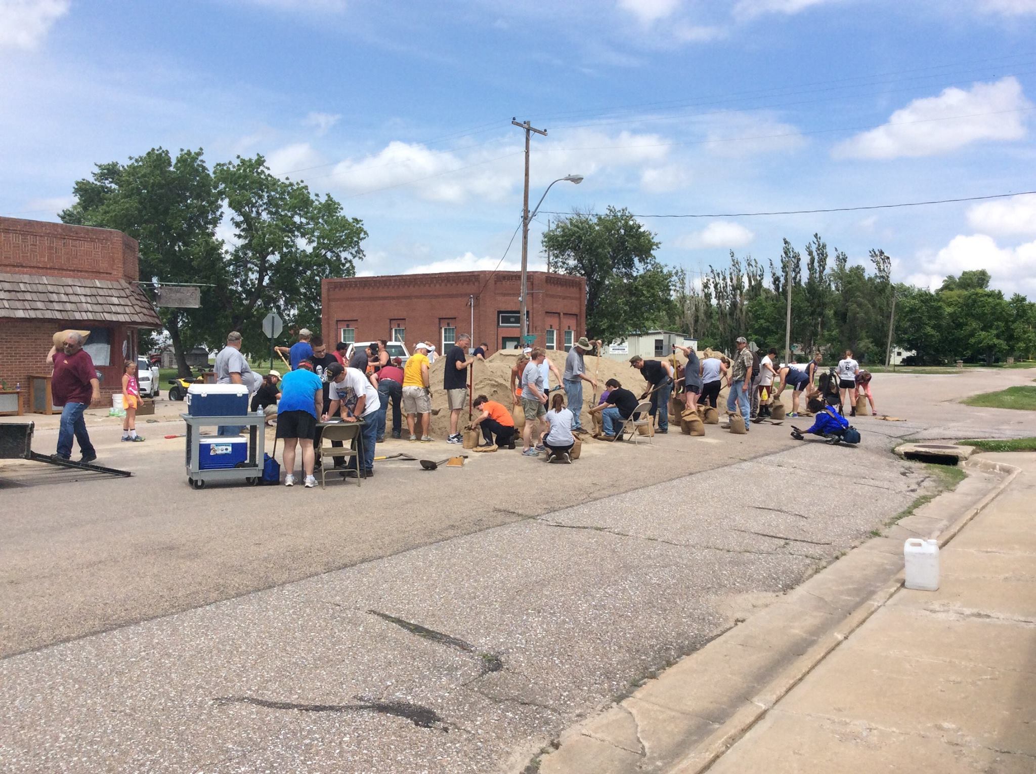
Event Summary (Note: This story focuses only on the NWS Hastings Coverage Area): During early-June 2015, a stationary front set up within the Nebraska/Kansas border region and moved very little for several days. Severe thunderstorms developed on both the evening of the 3rd and the 4th along and north of the stationary front. Severe hail and wind, along with flash flooding occurred north of the front, while a few tornadoes occurred near Tipton, KS along or just south of the front on June 3rd. Two-to-three-day rain totals over a widespread area including Hall, Adams, Hamilton, Clay, York, Fillmore, Nuckolls and Thayer counties averaged between 4 to 7 inches. Flooding and flash flooding were common and numerous roads were washed out. Along the west fork of the Big Blue River in southern York and northern Fillmore counties, significant flooding peaked in intensity between the 5th-7th, with the McCool Junction area reporting the worst flooding observed in at least 50 years! See below for more details on the flooding and heavy rainfall...
Reports from evening of June 3rd to morning of June 4th.
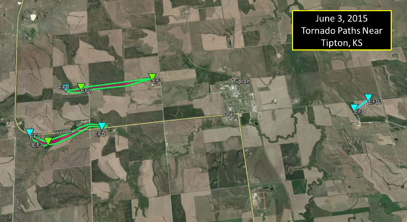
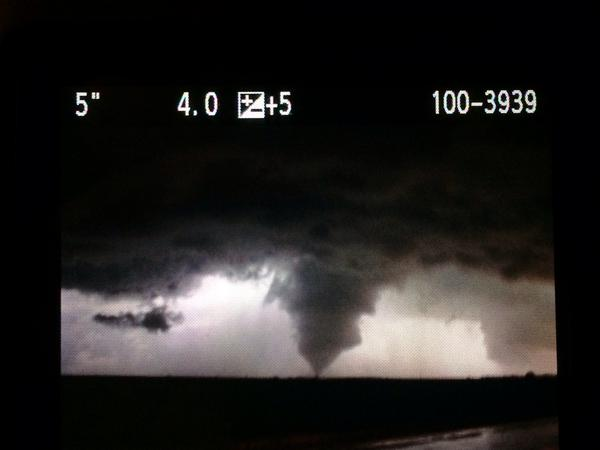
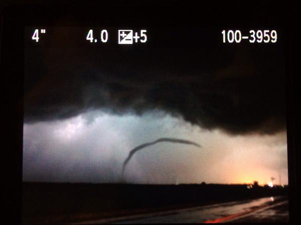
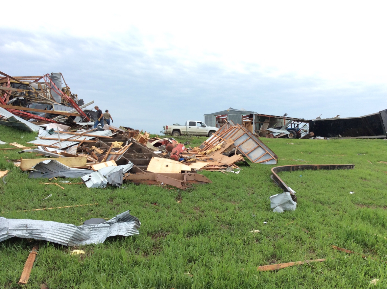
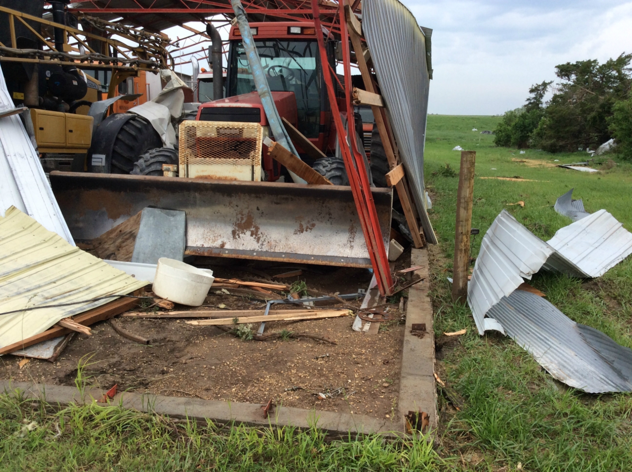
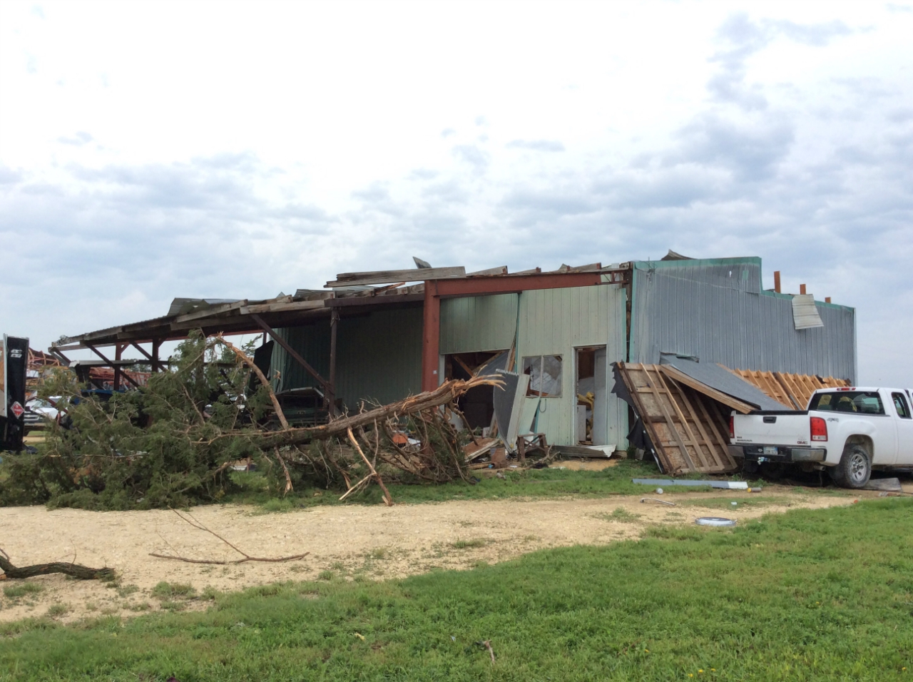
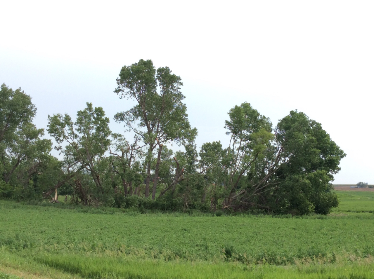
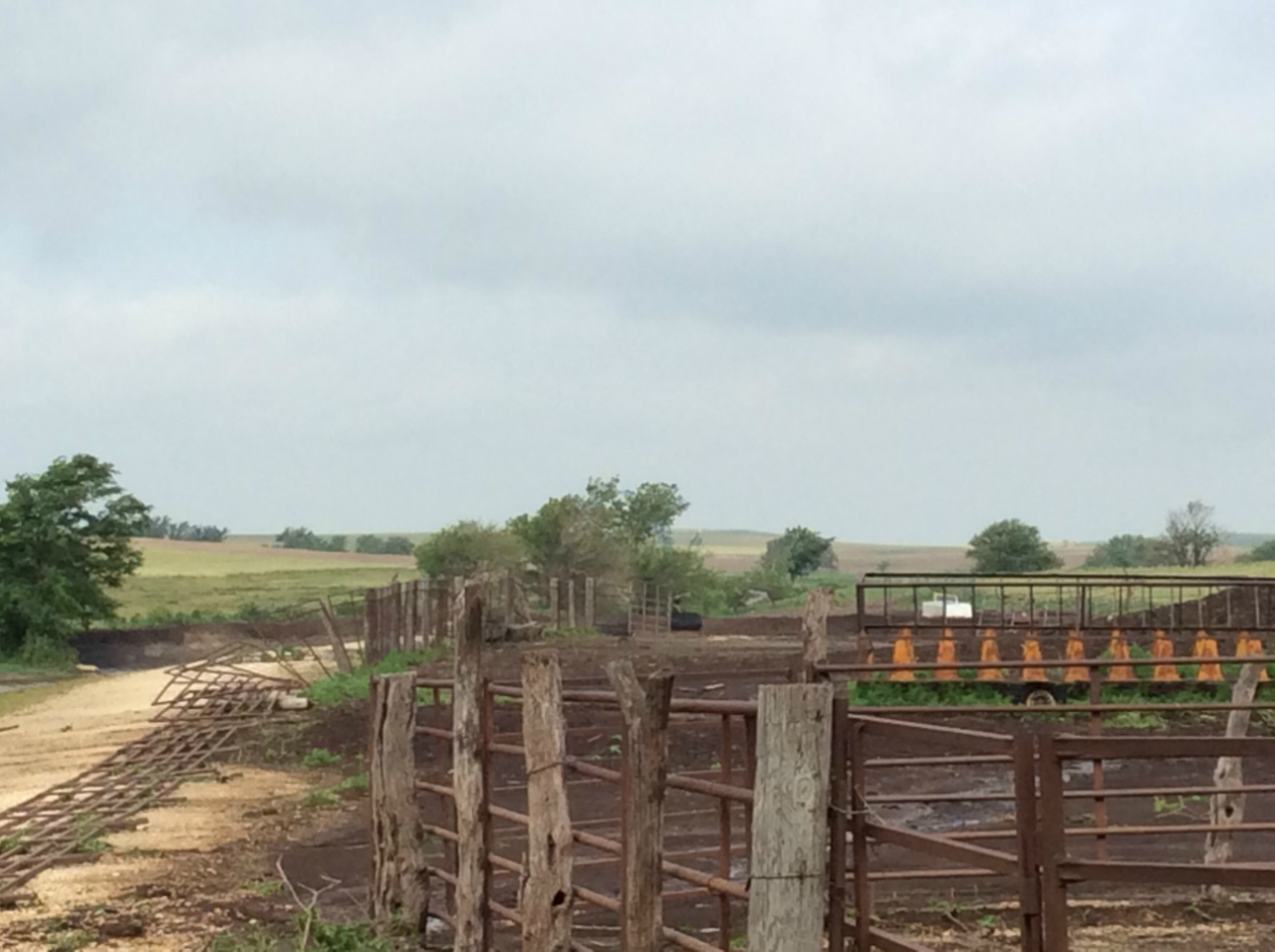
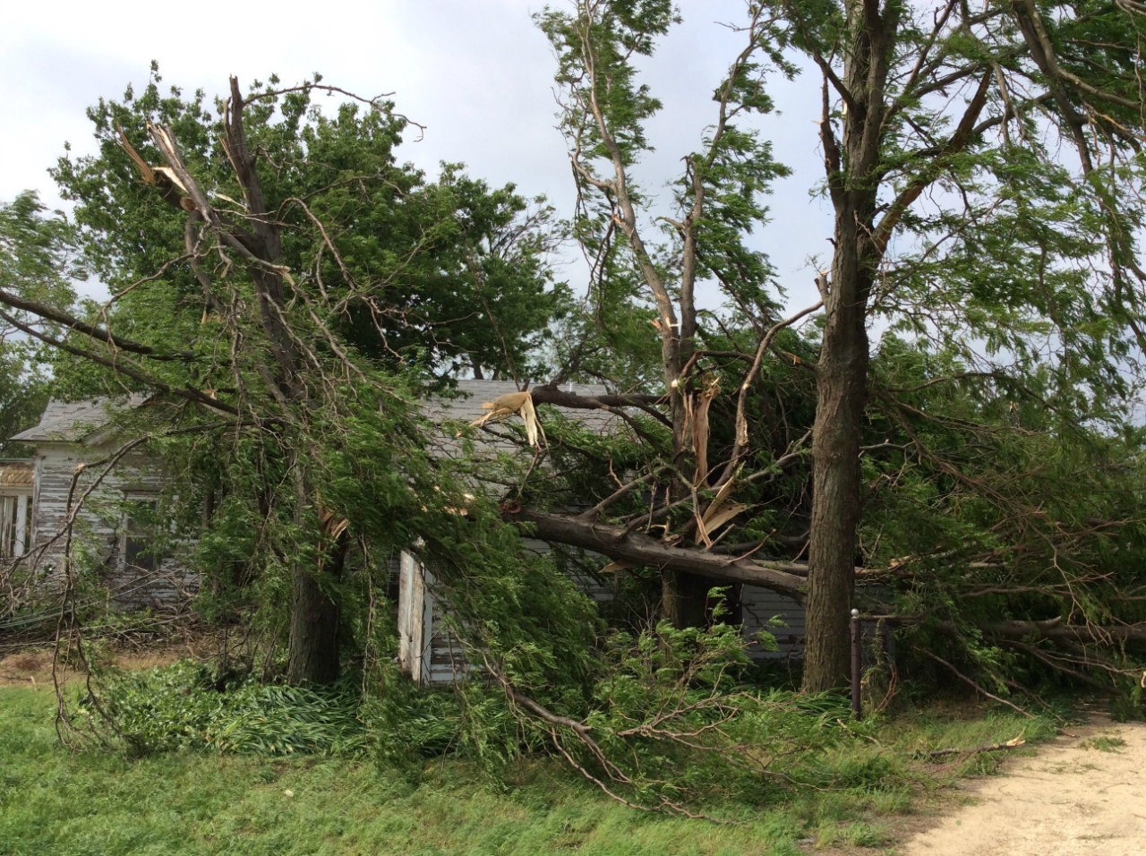
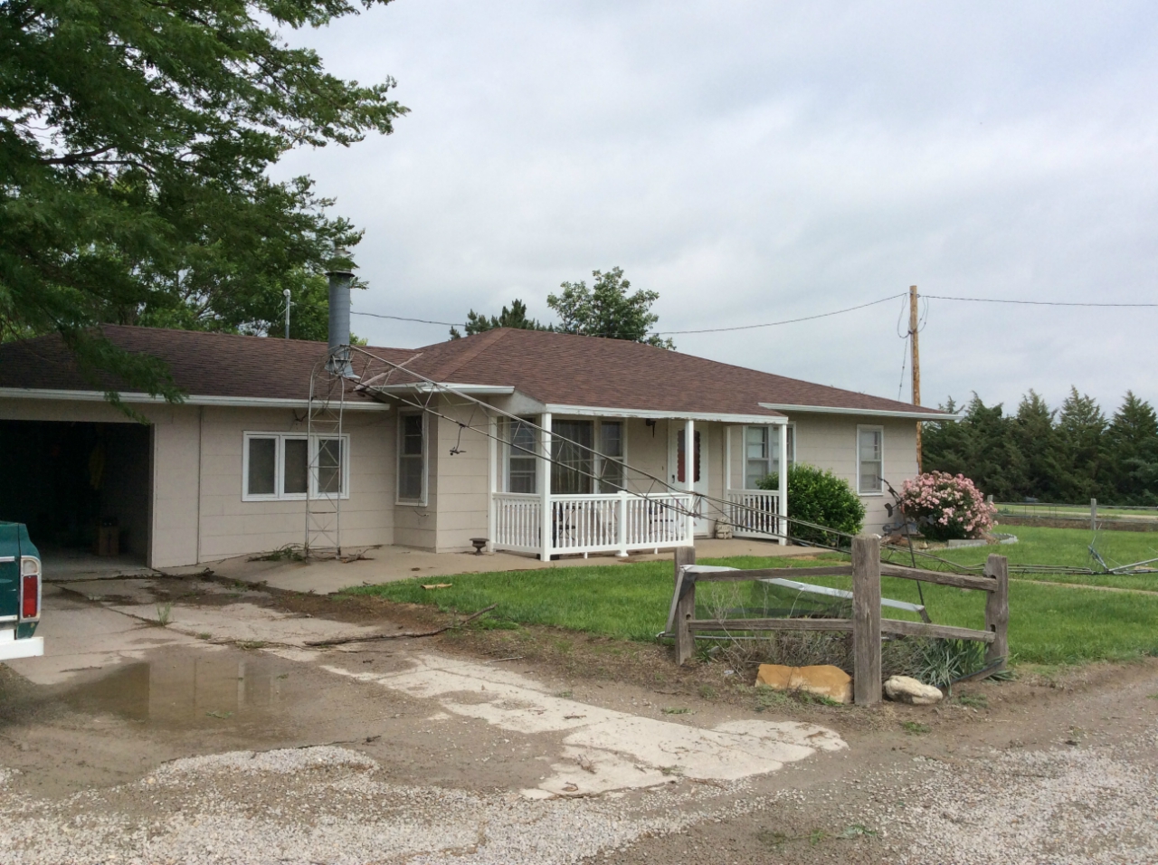
Tornado #1: 2.9 miles west of Tipton to 1.8 miles west of Tipton, Osborne County, KS. This tornado set down on the curve about 3 miles west of Tipton, and moved southeast briefly before turning more easterly in direction and lifting a little over one mile later. A farmstead near the point of touchdown had several outbuildings destroyed or heavily damaged, while tree limbs were damaged along the rest of the path. No one was living at the first farmstead hit by the tornado.
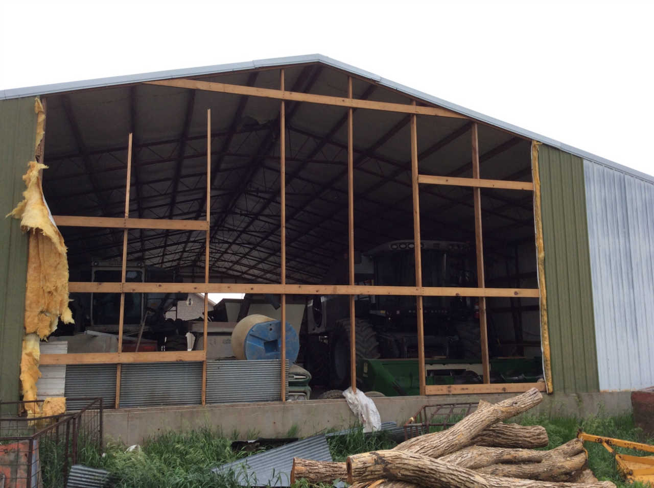
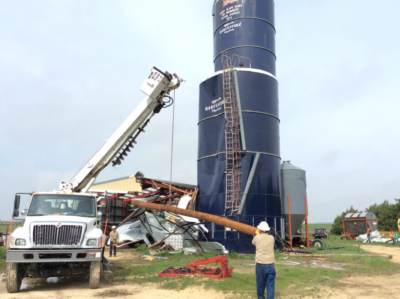
Tornado #2: 1.2 miles west-northwest of Tipton to 2.4 miles west of Tipton, Osborne County, KS. This tornado apparently moved west, and began with damage to a silo and large metal building. On its trek, the tornado tossed grain bin debris about three-quarters of a mile. The tornado narrowly missed a new home, but did do damage to a vacant home on the same property. The tornado appeared to lift in a field west of the farmstead. The movement of tornado #1 and tornado #2 suggested that the parent mesocyclone associated with the supercell was near the ground and these two tornadoes were rotating within the circulation, one to the east and the second tornado to the west. No obvious connection could be made between the two in the middle.
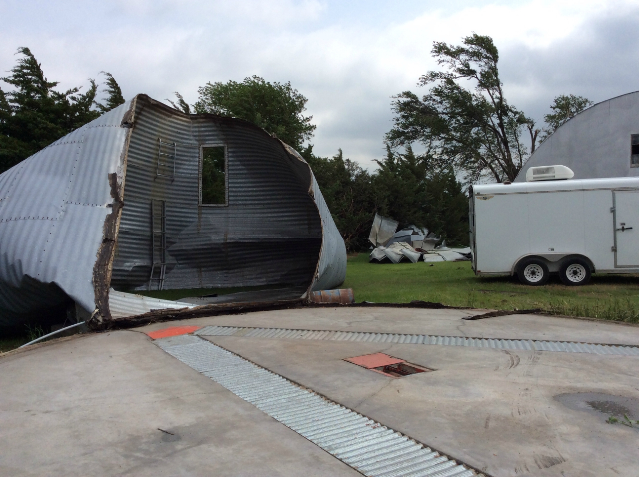
Tornado #3: 1.6 miles east southeast of Tipton to 1.9 miles east southeast of Tipton, Mitchell County, KS. This was a brief tornado which toppled an empty grain bin, topped an elm tree and knocked over a metal tv antenna before lifting a quarter mile east of its starting point.
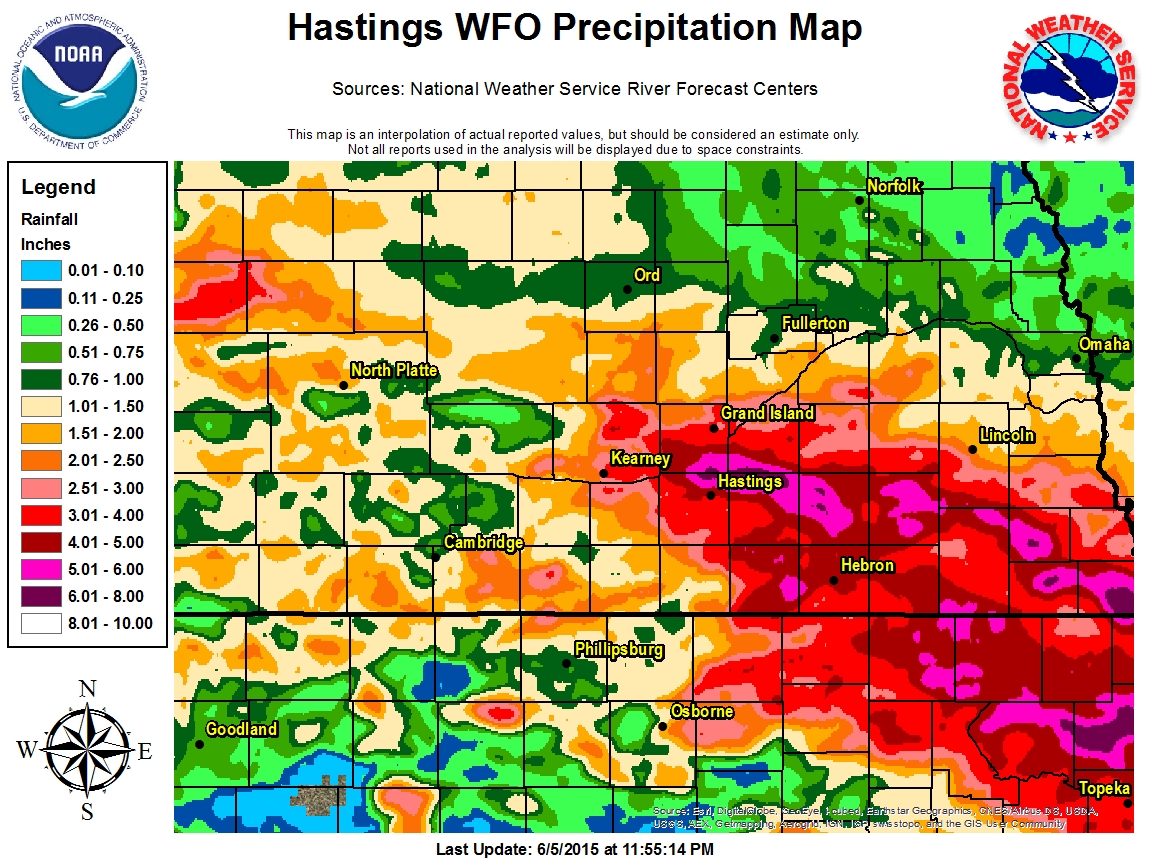
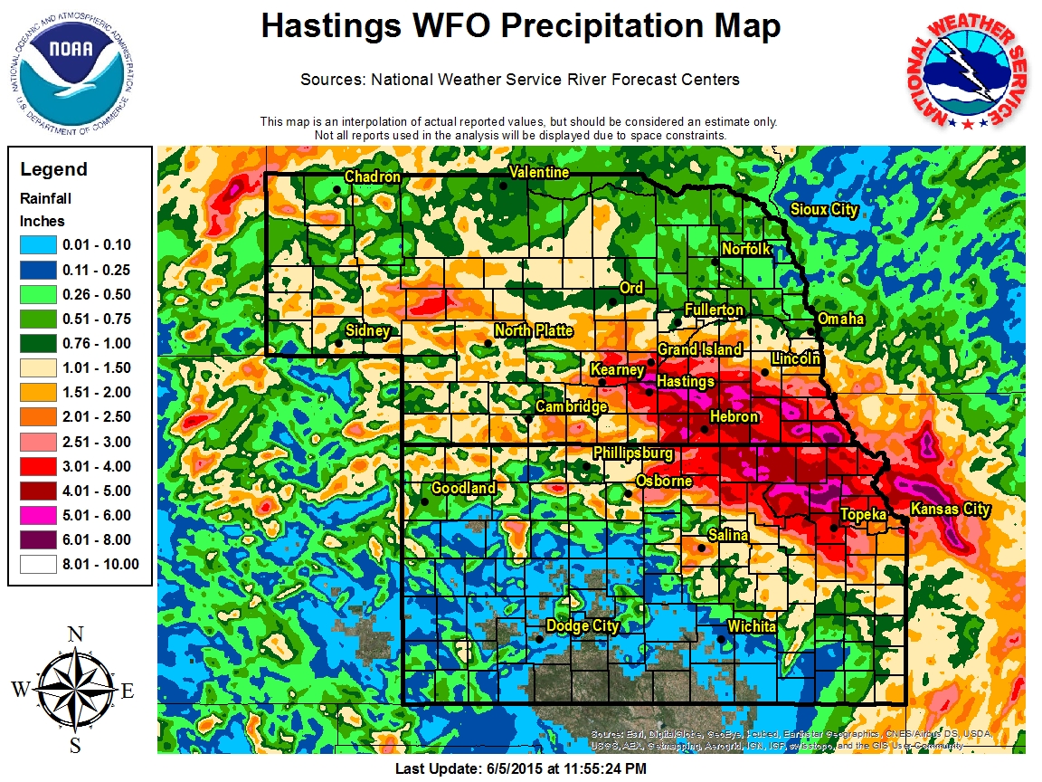
While thunderstorms had been in the forecast day after day throughout the first week of June, it was June 3rd through the 5th that really packed a punch. Several rounds of thunderstorms, some of which produced rainfall rates of more than 2 inches per hour at times, trained over portions of the area. However, not all rain was dispersed evenly across south central Nebraska and north central Kansas (see images below). While some areas saw over 5 inches in two to three days, other locations struggled to get more than a few tenths of an inch. The brief table below lists a few of the highest rainfall totals over a 72-hour period from June 3rd-5th. This encompasses rainfall that fell from midnight on the 2nd to midnight on the 5th. At Hastings airport, the total of 4.74" on the 4th marked the highest daily total on record for the month of June, and was the 3rd-highest daily rainfall total for any day of the year!
|
||||||||||||||||||||||||||||||||||||||||||||||||||||||||||||||||||||||||||||||||||||||||||||||||||||||||||||||||||||||||||||||||||||||||
 |
This page was composed by the staff at the National Weather Service in Hastings, Nebraska. |
 |


 Follow us on YouTube