Overview
|
Mainly during the mid to late afternoon hours of Monday, May 9th, isolated to scattered severe thunderstorms blossomed across various portions of the 30-county NWS Hastings coverage area (click HERE for a map). |
 NWS Hastings radar loop from 3:30 p.m. through 11:00 p.m. CDT on May 9th. The NWS Hastings coverage area is outlined in orange and labled "GID". Interstates are in red. |
Tornadoes:
|
|
||||||||||
|
||||||||||
|
Tornado #1 - East of Fairfield, NE
Track Map 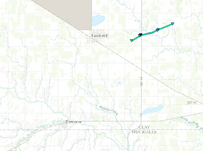 
Downloadable KMZ File |
||||||||||||||||
 |
 |
 |
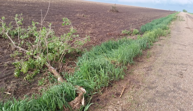 |
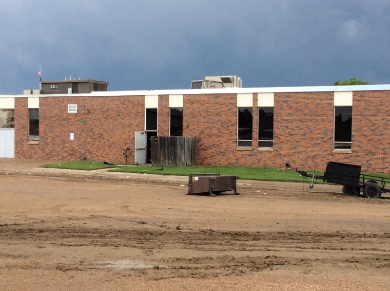
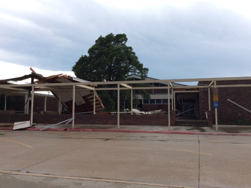
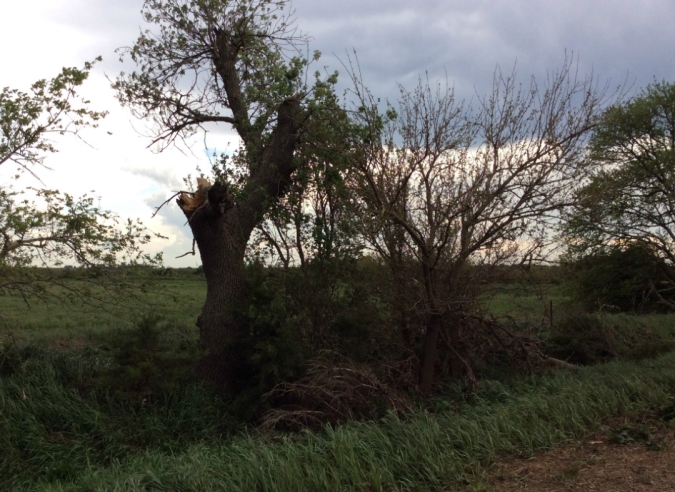
| Damage along the path of the tornado. First 2 photos are from the Sandy Creek school, second 2 photos are tree damage northeast of the school. Photos from NWS Damage Survey. |
|||
 |
 |
 |
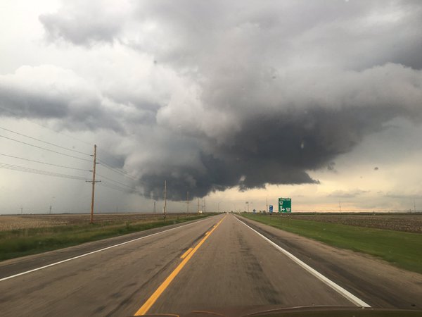
| Photos courtesy of Dustin Wilcox. | Photo courtesy of Scotty Nguyen. | |
|
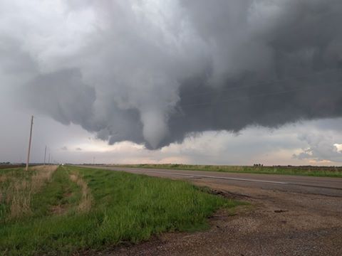
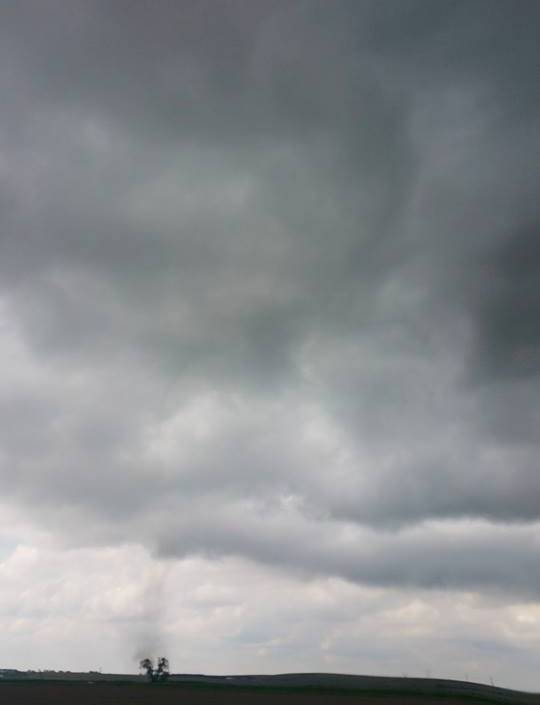
Tornado #2 - Odessa/Riverdale area
Track Map 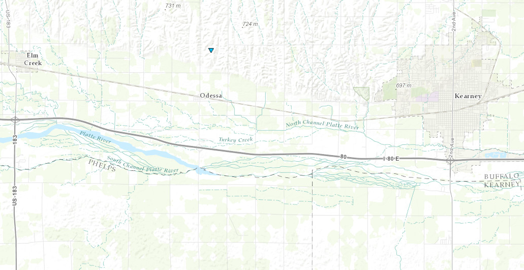
Downloadable KMZ File |
||||||||||||||||
 |
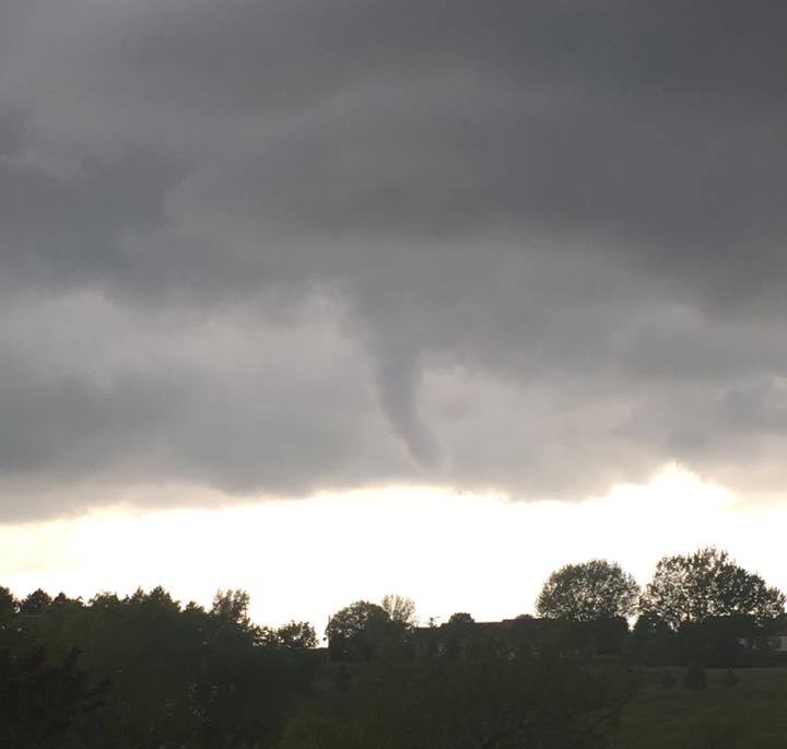 |
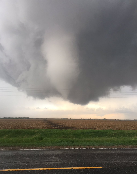
| Photo courtesy of Michael McLaughlin. | Photo courtesy of Seth Killion. |
| Landspout tornado in the Odessa/Riverdale area of western Buffalo County. | |
The Enhanced Fujita (EF) Scale classifies tornadoes into the following categories:
| EF0 Weak 65-85 mph |
EF1 Moderate 86-110 mph |
EF2 Significant 111-135 mph |
EF3 Severe 136-165 mph |
EF4 Extreme 166-200 mph |
EF5 Catastrophic 200+ mph |
 |
|||||
Photos:
 |
 |
 |
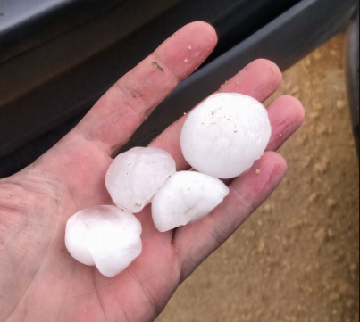 |
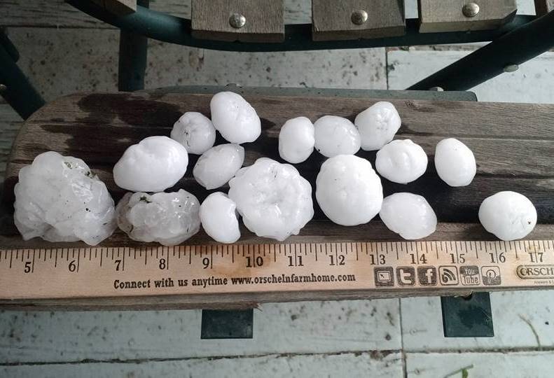
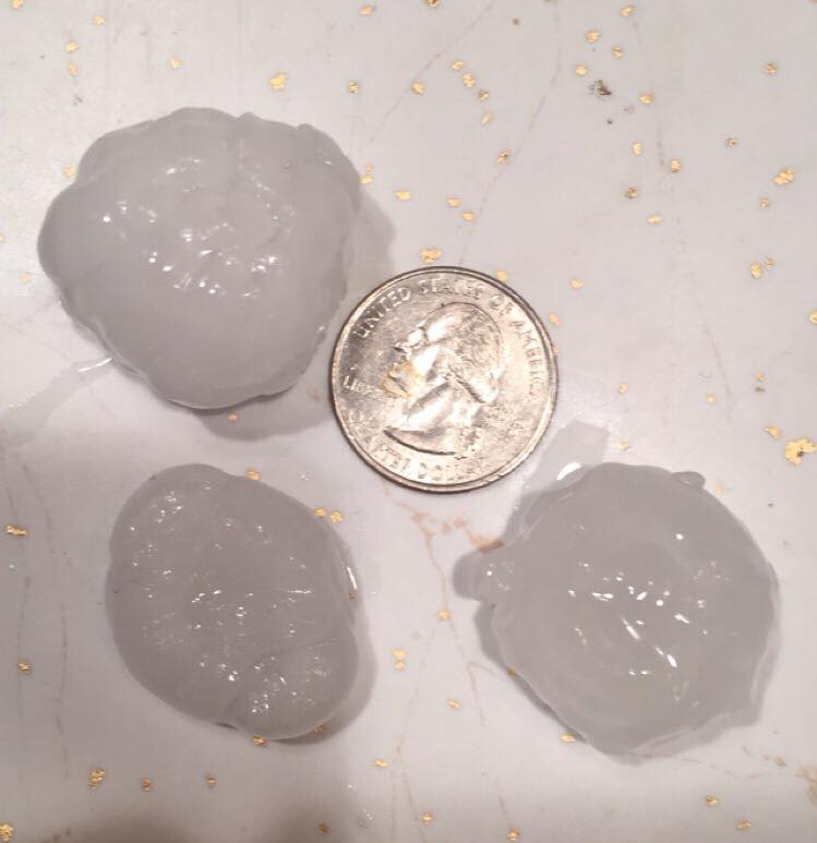
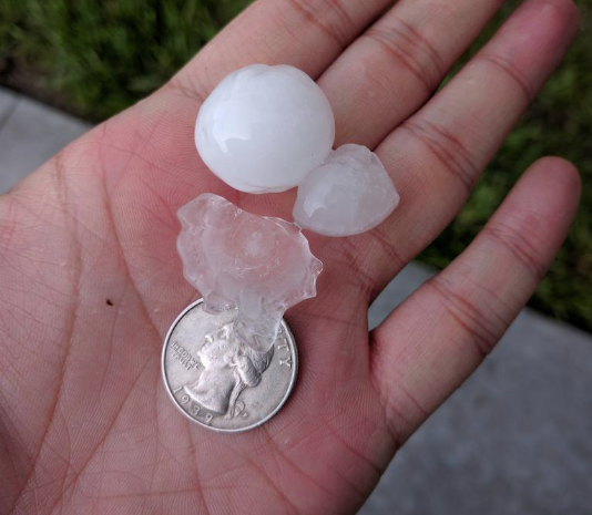
| Hail in Strang. Photo courtesy of Elissa Wolfe. |
8 miles north of Holdrege Photo courtesy of Amanda Waller. |
1 mile southeast of Mankato, KS Photo courtesy of Rodney Nonamaker. |
Near the USDA Research Center in Clay County. Photo courtesy of Twitter user @DrSnOu. |
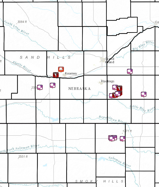
Storm Reports
Overall, the severe weather was confined to a smaller portion of the NWS Hastings coverage area. Outside of the tornado reports, hail reports ranged from the size of pennies to the size of hen eggs, with the largest hail coming from the Fillmore County, Nebraska (2" in Strang) and Jewell County, Kansas (1.75" near Mankato) areas.
Click the image below to get more detailed information about the severe weather reported across the area.
 |
 |
Media use of NWS Web News Stories is encouraged! Please acknowledge the NWS as the source of any news information accessed from this site. |
|


 Follow us on YouTube