Cold Spring Storm brings more snow
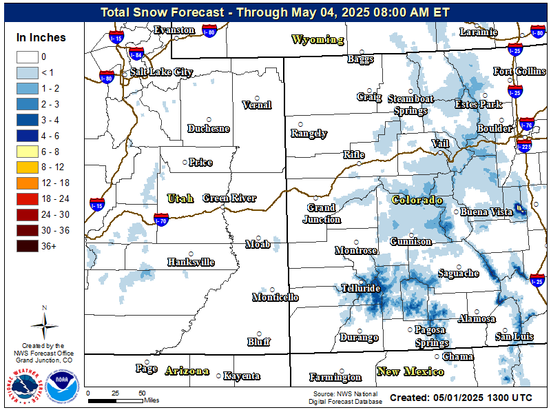
A strong upper level low pressure system will continue to bring widespread showers and isolated thunderstorms through this evening. Heavy mountain snow with locally heavy valley rainfall will occur with total snowfall amounts of 4 to 10 inches, locally higher up to 12 inches over the higher peaks. Snow levels may dip as low as 7000 feet during the morning hours, but they will climb back to near 9000 feet by the afternoon hours. The focus will be shifting from the southern mountains towards the northern and central mountains by late this morning into the afternoon as moisture wraps around the storm system upon exiting onto the Front Range. A Winter Weather Advisory remains in effect for many of the western Colorado mountains through this evening. Unsettled weather conditions will persist through the end of this week with a chance of storms each afternoon over the high terrain and a warming trend back towards normal values by the weekend (this means 80s for many of the lower valleys and 70s for the higher valleys).
Current Highlights (Winter Weather Advisories in purple)

Total snowfall expected through Friday morning


 Follow us on YouTube