Grand Junction, CO
Weather Forecast Office
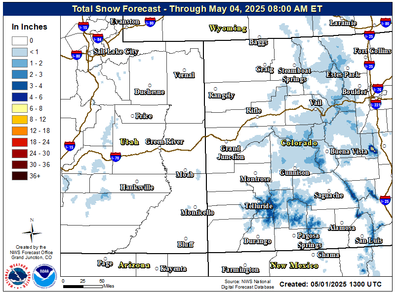
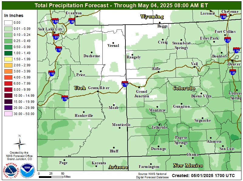
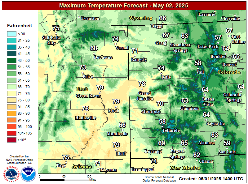
.png) A fast moving upper level disturbance and weak cold front will move south today, with scattered rain and snow showers through late this afternoon and early evening. The higher mountains of central and southern Colorado stand the best chance to see snowfall today with trace to 2 inches above 10,000 feet. Mild temperatures will keep rain below this level with lower valleys too dry to see much of any precipitation. The presence of virga in the lower valleys will result in breezy to windy conditions near any showers. A dry and warming trend is in store with daytime highs rising back above normal Wednesday through the end of the week. Another storm may impact the region towards the weekend.
A fast moving upper level disturbance and weak cold front will move south today, with scattered rain and snow showers through late this afternoon and early evening. The higher mountains of central and southern Colorado stand the best chance to see snowfall today with trace to 2 inches above 10,000 feet. Mild temperatures will keep rain below this level with lower valleys too dry to see much of any precipitation. The presence of virga in the lower valleys will result in breezy to windy conditions near any showers. A dry and warming trend is in store with daytime highs rising back above normal Wednesday through the end of the week. Another storm may impact the region towards the weekend.
Today's Weather Map

Snowfall Potential through Thursday
Total Precipitation through Thursday
Forecasted High Temperature Today

High Temperatures on Wednesday
Hazards
Detailed Hazards Viewer
Outlooks
Winter Storm Severity Index
Transportation Decision Support
National Briefing
Current Conditions
Observations
Radar
Satellite
Snow Cover
Snowfall Analysis
Precip Analysis
Social Dashboard
Forecasts
Aviation Weather
Forecast Discussion
Hurricane Center
Fire Weather
Local Area
Recreation Areas
User Defined Area
Severe Weather
Activity Planner
Recreation Areas
Winter Weather
Hydrology
Rivers and Lakes
Recreational River Report
Weather Safety
Preparedness
NOAA Weather Radio
StormReady
SkyWarn
Spotter Training Calendar
US Dept of Commerce
National Oceanic and Atmospheric Administration
National Weather Service
Grand Junction, CO
2844 Aviators Way
Grand Junction, CO 81506-8644
970-243-7007
Comments? Questions? Please Contact Us.


 Follow us on YouTube