
.gif)
National Weather Service
Goodland, KS
Tornado Climatology for the Tri-State Area
 Written evidence of tornado occurrence in the United States dates back to the late 1500s. The first confirmed tornado in the United States, according to one author, occurred at Cambridge, MA on July 8, 1680. As one can imagine, finding reliable tornado records from the 1600s and 1700s, which provide exact dates, times and location of events is difficult. By the end of the 1870s however, John Park Finley had become the nation's premier documenter of tornadoes. In 1880, he had recorded more than 100 tornadoes in a single year, the first time in history.
While tornado records became somewhat more organized starting around 1880 thanks to John Finley, for the most part there continued to be inconsistencies and irregular documentation for the nation as a whole. A more concerted effort in the counting of tornadoes began in 1916, as part of the Report of the Chief of the Weather Bureau. The annual number of tornadoes reported in the United states gradually increased from 90 in 1916 to 249 in 1949 thanks to better documentation during this period.
The "official" tornado record in the United States began in 1950 when information was collected and tabulated at the National Severe Storms Forecast Center (NSSFC) in Kansas City, Missouri. In 1953, serious efforts to count all tornadoes began since that was the first year in which the Weather Bureau (later renamed National Weather Service in 1970) began issuing tornado watches. As a result, just about all of the information contained in this document refers to events occurring in 1950 or later. For the period 1880-1949, a list of documented significant tornadoes (F2-F5) in the Tri-State area will be included (a total of 78 events). This information is taken from the book "Significant Tornadoes 1680-1991", by Thomas Grazulis.
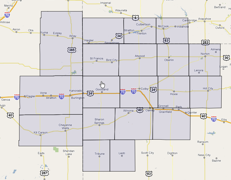
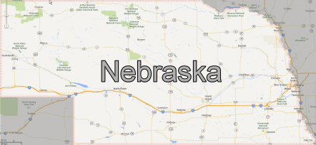
The NWS Goodland County Warning Area (CWA) covers 19 counties in three states. This region is also commonly called the "Tri-State Area". The 2010 census showed a population of 80,240 people and an area just over 21,000 square miles, equating to 3.82 people per square mile. Elevation increases rapidly from east to west across the CWA, rising from 1900 feet in eastern Graham County, Kansas, to just over 5000 feet in western Kit Carson County, Colorado.
|
The Goodland County Warning Area (CWA) |
|
 |
 |
|
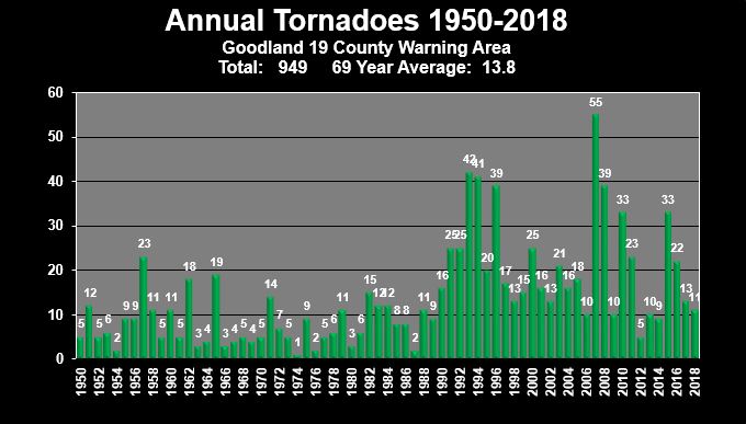
Tornado Graphs |
County Data |
|||
 |
 |
|||
|
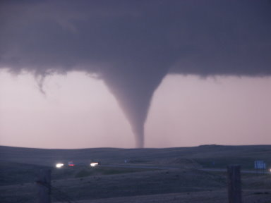
Click the image above for an overview of tornadoes in the Tri-State area. |
Use the point-and-click map above to view detailed county tornado information. |
|||
|
Tornado Information By State |
||
 |
 |
 |
|
Tables of Significant (EF2-EF5) Tornadoes |
|
.png) |
.png) |
|
Significant Tornadoes By Date |
Significant Tornadoes By County |
|
Early and Late Season Tornadoes |
.png) |
| Early season (Mar-Apr) and late season (Oct-Nov) tornadoes in the Tri-State area. |
|
Enhanced Fujita Scale |
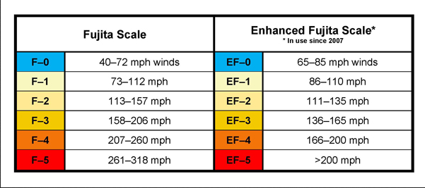 |
| Click above to learn more about the Enhanced Fujita Scale. |


 Follow us on YouTube