Cooperstown Tornado on July 5, 1994
|
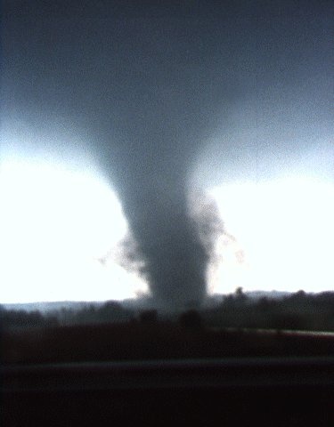
An isolated severe thunderstorm produced two tornadoes, including a strong twister that produced over $2 million in damage in Manitowoc County near the town of Cooperstown.The tornado developed at 4:43 pm CDT about 2.5 miles northwest of Maribel and traveled to near Cooperstown before dissipating at 4:55 pm CDT. The tornado, which had winds estimated at over 150 mph, damaged 26 homes, 19 vehicles and a mobile home. Two people suffered injuries in the storm. A second tornado formed at 4:53 pm CDT two miles southwest of Cooperstown and produced mainly minor damage. The picture at right was taken on Interstate 43 looking west as the storm was moving north of Maribel toward Cooperstown. Photo by Judith Fell. |
 |
The atmosphere during the afternoon of July 5, 1994, was very unstable, as a very warm and humid airmass covered the region. A storm formed south of Green Bay around 4:00 pm CDT and moved east. As the thunderstorm encountered a lake breeze near the Brown-Manitowoc County line, it increased in intensity, eventually producing two tornadoes.
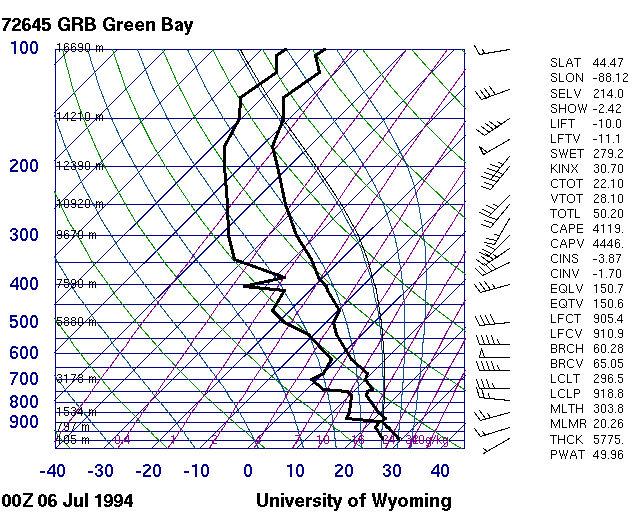 |
| Skew-T diagram of weather balloon data from Green Bay 0000 UTC July 6, 1994 (7 pm CDT July 5). The vertical temperature and humidity profile revealed a very unstable atmosphere in northeast Wisconsin. |
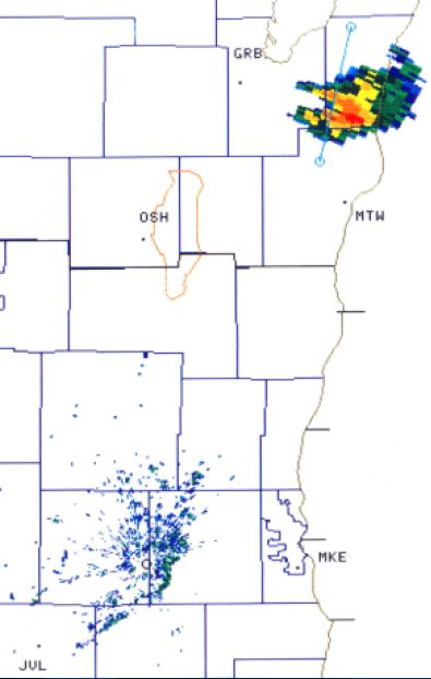
Radar
The NWS Green Bay Doppler radar was not yet operational in July 1994 (it came online in early 1995). However, the newly installed radar at NWS Milwaukee/Sullivan captured a long-range glimpse of the storm.
 |
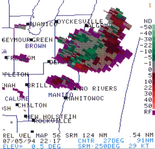 |
| Radar reflectivity (base, 0.5 degrees) at 4:48 pm CDT. The raw radar data were not archived during the first year of the radar system, so all we have available are a few crude images. | Radar velocity (storm relative, 0.5 degrees) at 5:17 pm CDT. Note the velocity couplet (bright red next to bright green) in northeast Manitowoc County. The tornado dissipated 15 to 20 minutes earlier. |


 Follow us on YouTube