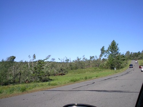
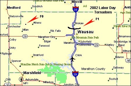
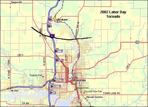
Two tornadoes struck Marathon County during the evening of Labor Day, 2002. The strongest of the two, an F1 tornado, hit just north of Wausau in central Marathon County. The twister flattened two barns, heavily damaged six homes, and caused varying degrees of damage to 25 others. Hundreds of trees were snapped and uprooted in the area affected by the storm. The Wausau tornado hit at 6:35 pm and was on the ground for at least five miles, before lifting off shortly before 6:45 pm.
A Tornado Warning was issued by the NWS Green Bay office at 6:07 pm, 28 minutes before the Wausau tornado hit.
The tornadoes and severe storms developed ahead of a strong cold front, which moved across Wisconsin on Labor Day. The same front produced the strong tornado near Ladysmith in northwest Wisconsin.
Images of the Storms
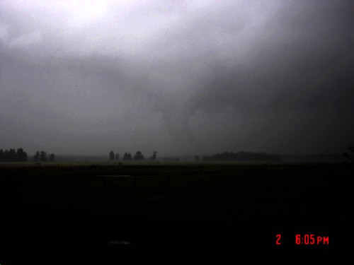 |
This is a photograph of a funnel several miles west of Athens, in extreme northeast Marathon county, taken at 6:05 pm. This tornado dissipated before reaching Athens. Picture taken by Samantha Strunk, 4.5 miles west-southwest of Athens, looking northeast. |
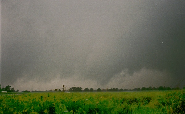 |
This image was taken at around 6:48 pm, and shows a funnel cloud just above the tree line, several miles northeast of Wausau, after causing the damage across central Marathon county. Picture taken by Scott Podgorski. |
Satellite and Radar Imagery
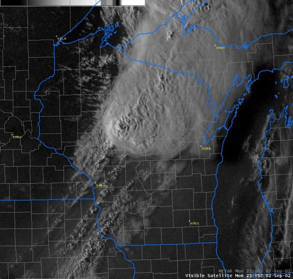 |
Visible satellite image at 6:05 pm, as the complex of thunderstorms moved into Marathon County. | |
 |
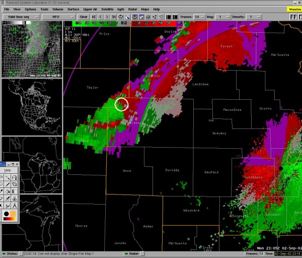 |
0.5 deg base reflectivity (L) and storm relative velocity at 6:05 pm. The area circled is the location of the weak rotation that produced the brief tornado west of Athens. |
 |
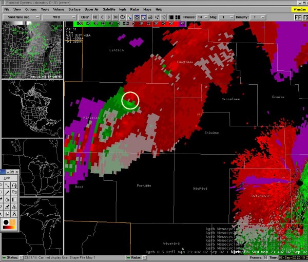 |
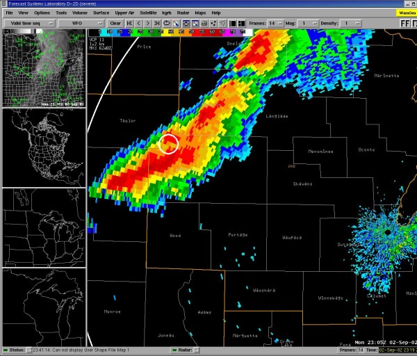
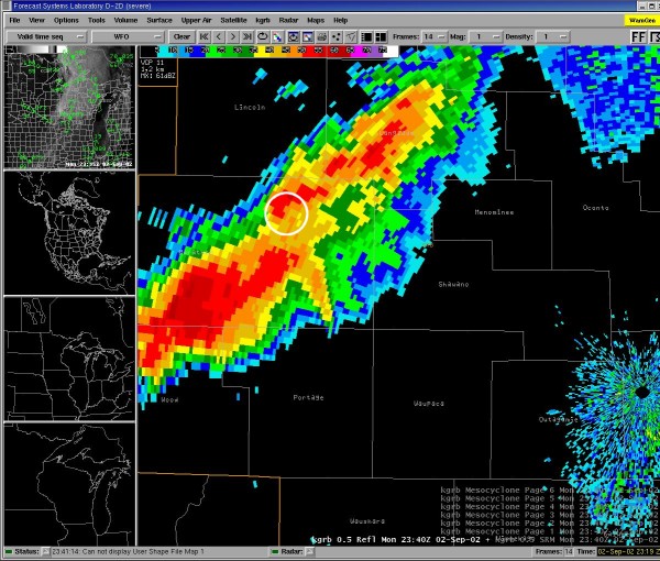
0.5 deg base reflectivity (L) and storm relative velocity at 6:40 pm. The area circled is the location of the strong rotation associated with the mesocyclone that produced the F1 tornado north of Wausau. The larger thunderstorm southwest of the tornadic cell produced wind gusts of 45 to 50 mph, heavy rain, and a little hail. |
Tornado Damage Near Wausau
Click on small images for larger picture. Photos taken by Jeff Last, NWS Green Bay.
 |
 |
Damage to a home about 5 miles northwest of Wausau. |
 |
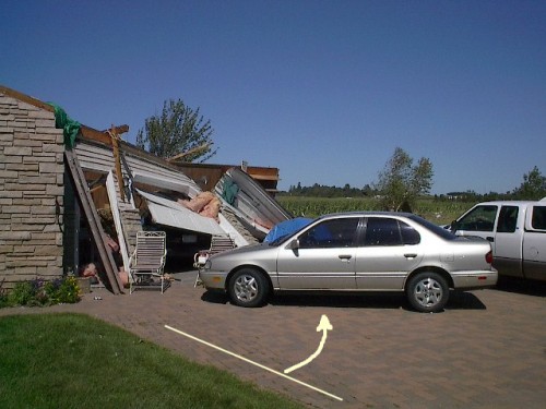 |
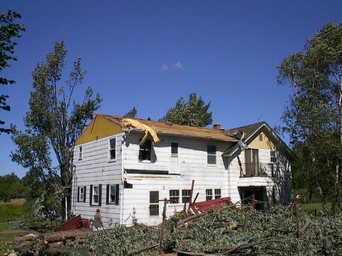
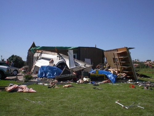
This house was located about a half mile east of the one above. It probably sustained the most severe damage. The roof of the house was torn off, leaving a poorly constructed attached garage severely damaged. Note how the car in the driveway was pushed 45 degrees by the tornadic winds. |
 |
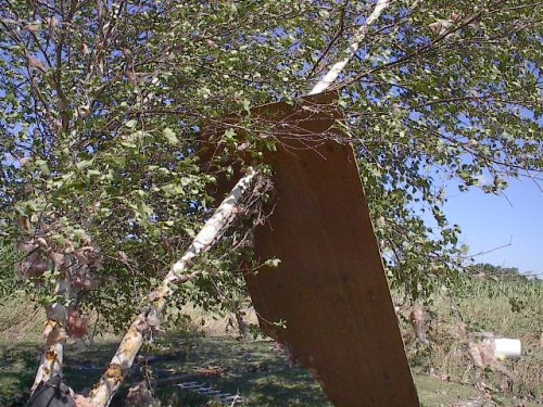 |
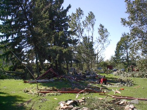
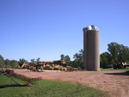
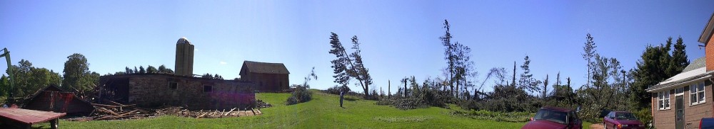
These pictures were taken on the same property. |
 |
 |
This barn was flattened by the tornado. Many pine trees on the property were snapped in half. This farmstead was located just west of Highway 51. Click here for a panoramic view of the damage at the farm. |
 |
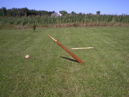
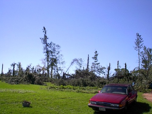
A stand of pines, about four miles north-northeast of Wausau, were snapped like matchsticks. | |


 Follow us on YouTube