
Mostly clear skies is expected overnight. Low's tonight will be around freezing especially north of I-96. Winds will be strong overnight with gusts upwards of 30 mph. Due to the winds frost is not expected. It will be quite cool this weekend, especially at night when it's looking like below freezing temperature will occur away from Lake MI. Read More >
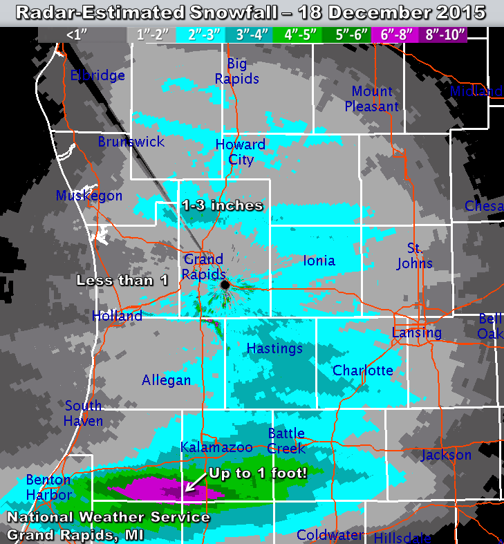
On December 18, 2015, light lake-effect snow with bands of heavy snow produced accumulations across western & southern Lower Michigan ranging from a dusting to one foot. Many traffic accidents and slide-offs occurred within heavier bursts of snow, especially in the Grand Rapids and Lansing areas. Snow initially melted on pavement before freezing into extremely slippery glare-ice.
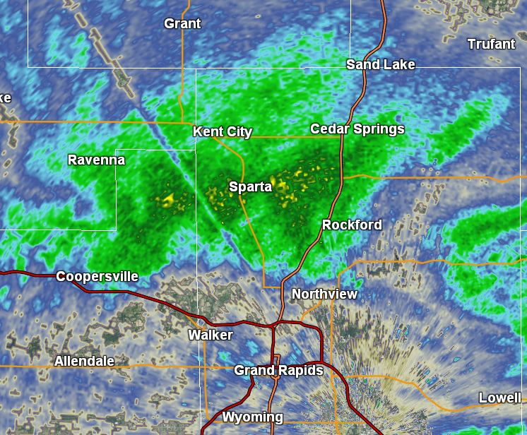
Heavy lake-effect snow affected locations north of Grand Rapids between 2:15 and 3:30 pm, turning roads into ice. This caused traffic accidents and lengthy backups on US-131 between Cedar Springs and northern Grand Rapids. Over 50 vehicles were involved in collisions or slide-offs on the highway south of Cedar Springs. Both directions of US-131 were closed hours.
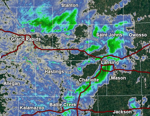
Bursts of heavy snow moved through Lansing between 3:15 and 3:45 pm. While accumulations were under an inch, temporarily icy road conditions led to slide-offs, accidents, and lengthy rush-hour backups.
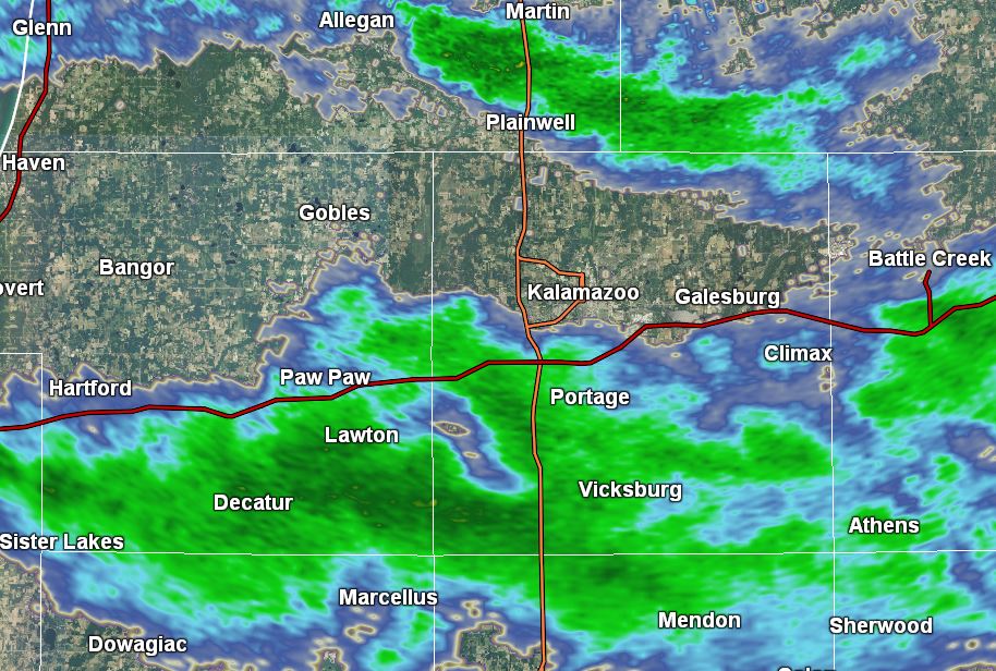
A persistent band of heavy snow parked over southern Van Buren and Kalamazoo counties between 8:00 and 11:30 pm. Large snow crystal aggregates piled up quickly, reaching over 8 inches between Decatur, Lawton, and Schoolcraft. An isolated 10-12 inches was also measured.


 Follow us on YouTube