
Clouds will increase today and rain showers will develop later this afternoon through the evening before ending. Northwest winds on the backside of this system will draw down a cooler air mass for the end of the week and weekend. It will become rather windy Friday and remain breezy Saturday. Read More >
Overview
Sunshine is expected for much of the weekend with temperatures a little above normal.
.png)

A complex of thunderstorms developed over Wisconsin late Wednesday, June 15th. The storms traveled eastward over Lake Michigan, slamming into the western coastline of Lower Michigan. Hardest hit locations were centered near and south of Muskegon, Michigan, where various wind damage reports originated. Further to the south, areas around South Haven received hail around 1 inch in diameter. Updated information will continue to be made available through this afternoon.

A line of strong thunderstorms passed over Lake Michigan. Upon landfall, wind gusts over 60 mph downed trees and power lines. Hoffmaster State Park reported several trees down within the state park. Power outages were common through the Muskegon and Norton Shores area.
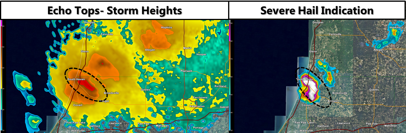
Storm echo tops (storm heights) reached above 50,000 feet! Hail indications for severe hail were high (90-100%) as the storm traveled from South Haven through Breedsville.
Click the image below for detailed information...

 |
Media use of NWS Web News Stories is encouraged! |
|


 Follow us on YouTube