
Any early morning clouds will give way to sunny skies during the morning. It will become breezy with westerly winds occasionally topping 25 mph. It will be quite cool this weekend, especially at night when it's looking like below freezing temperature will occur away from Lake MI. Read More >
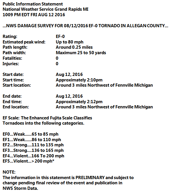
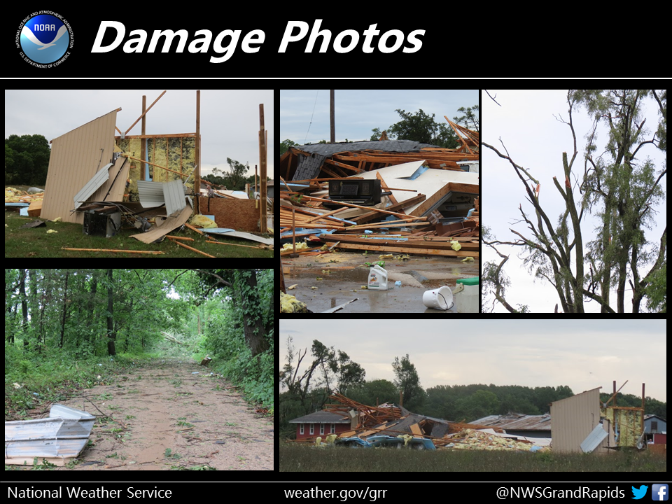
During the afternoon of August 12, 2016, a warm and very moist air mass resulted in heavy rain and thunderstorms across the southern half of Lower Michigan on August 12th, 2016. A couple of embedded strong thunderstorms developed, one of which spawned a brief EF-0 tornado east of Saugatuck. In addition, this event resulted in rainfall amounts ranging from 1-3 inches, with areas near Hastings and Portage reporting up to 5 inches of rainfall. See below for more information!
| Storm Damage | # of Injuries | # of Deaths | # of Wind Reports >= 59 mph | # of Hail Reports >= 1 in. | # of Tornado Reports |
| $75,000 | 0 | 0 | 0 | 0 | 1 |
Note: The side-by-side loop above displays radar (left) and velocity (right) for matching times. In the radar image, lighter precipitation is depicted by blues and greens, becoming heavier with shades of yellow, orange and red. The velocity image serves as a tool to determine wind direction, speed and whether rotation exists. Green and blue scale colors are heading toward the radar site, while shades of red denote wind moving away from the radar site.
Rainfall amounts greater than 5 inches were measured in Hastings and southeast of Portage. Many locations south of Muskegon to Mount Pleasant received 1 to 3 inches. Rainfall rates greater than 2 inches per hour were measured in the heaviest thunderstorms.

 |
Media use of NWS Web News Stories is encouraged! |
|


 Follow us on YouTube