
Mostly clear skies are expected through Friday morning. Highs today in the 50s will fall back into the 30s tonight. Look for areas of frost once again tonight. Rain spreads in Friday evening. Read More >
Overview
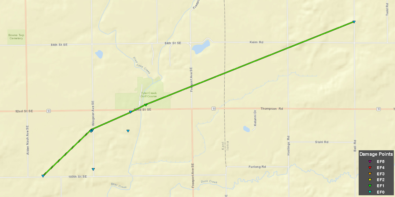
A severe thunderstorm produced a brief tornado from northwest of Freeport to southwest of Clarksville, beginning at 8:36 pm April 10, lasting for about 5 minutes, and traveling over 5 miles.
Tornado:
|
Tornado: Bowne Twp - Campbell Twp
|
||||||||||||||||
The Enhanced Fujita (EF) Scale classifies tornadoes into the following categories:
| EF0 Weak 65-85 mph |
EF1 Moderate 86-110 mph |
EF2 Significant 111-135 mph |
EF3 Severe 136-165 mph |
EF4 Extreme 166-200 mph |
EF5 Catastrophic 200+ mph |
 |
|||||
Photos:
EF-1 Tornado: Bowne Twp - Campbell Twp (Kent-Ionia Counties)
 |
 |
 |
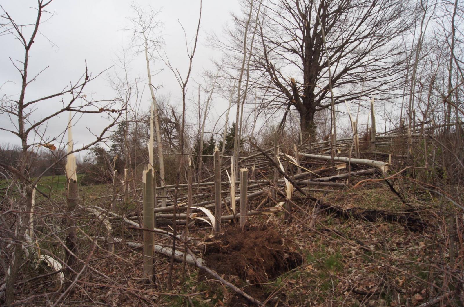 |
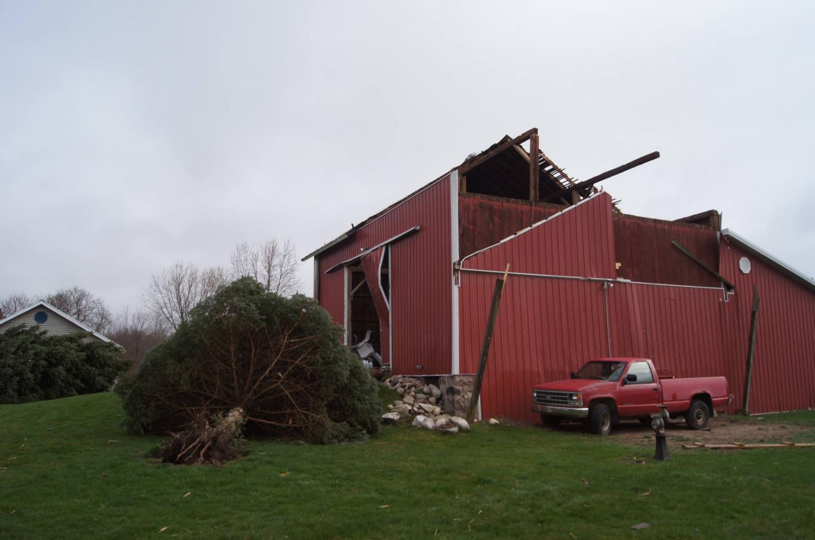
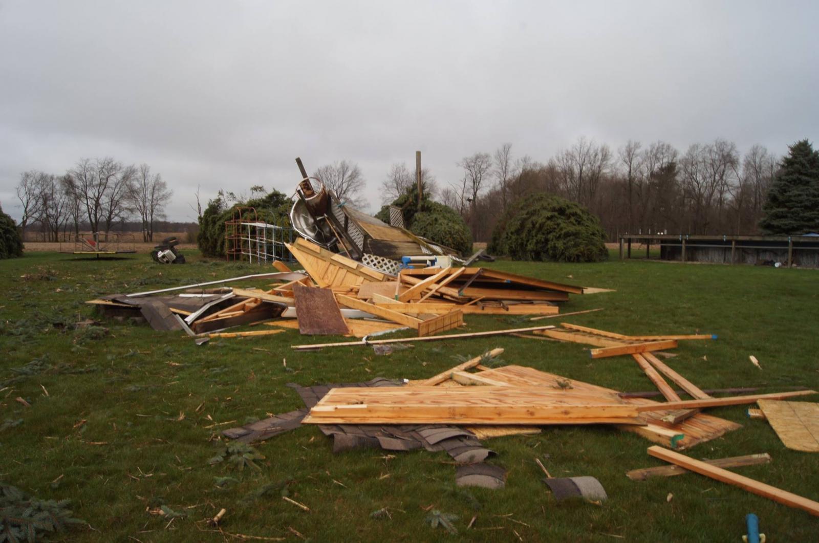
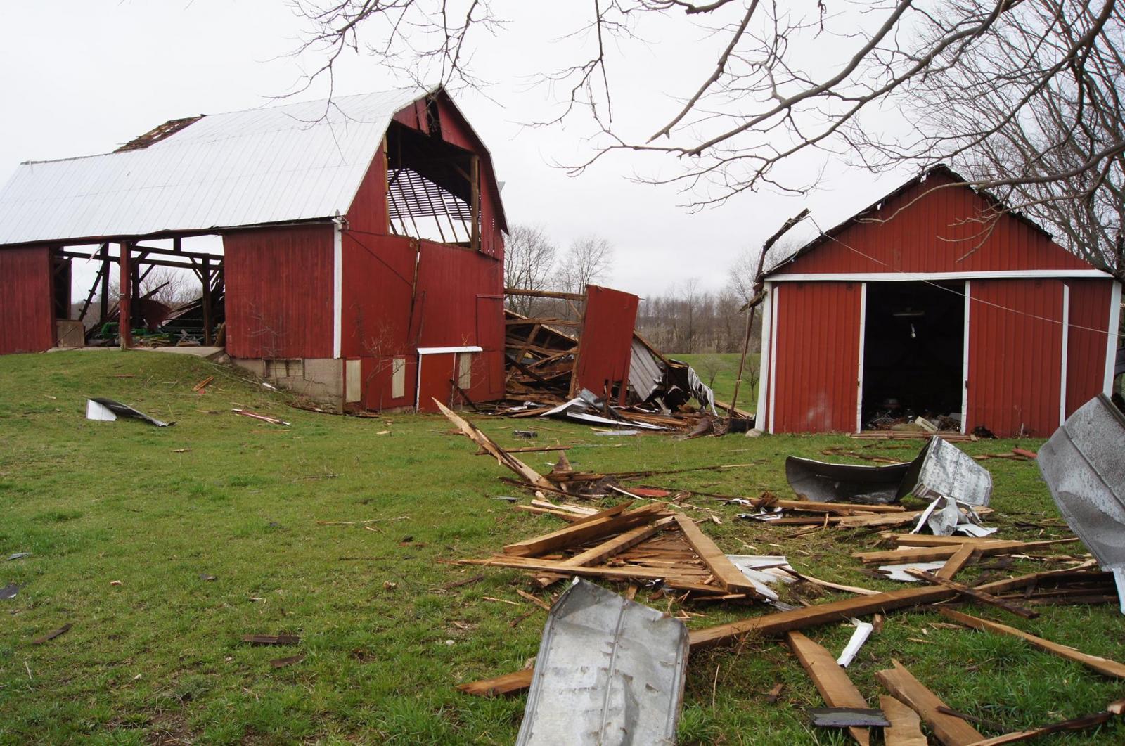
| Barn damaged on south side of 92nd St (M-50) east of Wingeier Ave. | Shed destroyed on south side of 92nd St (M-50) east of Wingeier Ave. | Damage to barn on south side of 92nd St (M-50) east of Wingeier Ave. | Damage to young aspen trees at Tyler Creek golf course on north side of 92nd St (M-50) east of Wingeier Ave. |
Radar:
Radar 8:37 PM (Left: Base Reflectivity. Right: Base Velocity)
Click on image for an animated loop from 8:29 to 8:45 PM. (3.1 MB)

Tornado debris signature in dual-pol data emerged at 8:37 PM over 92nd St (M-50)

 |
Media use of NWS Web News Stories is encouraged! Please acknowledge the NWS as the source of any news information accessed from this site. |
|


 Follow us on YouTube