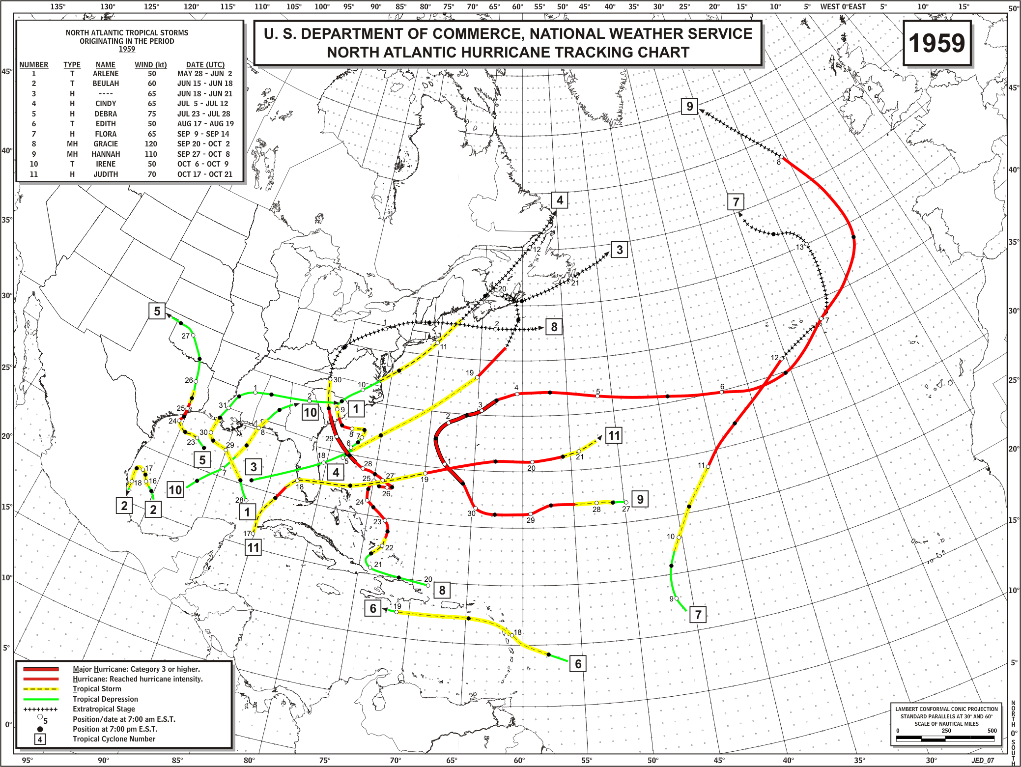
DEBRA (Cat. 1 Hurricane - July 24th landfall)
Debra was called a "mild weather upset turned suddenly into a vicious storm." Debra hit Freeport with 100 mph winds only 36 hours after forming and maintaining hurricane winds 100 miles inland. The eye passed directly over Deer Park and La Porte on the 25th. Highest Houston winds were 82 mph, and 8.08 inches of rain was recorded.
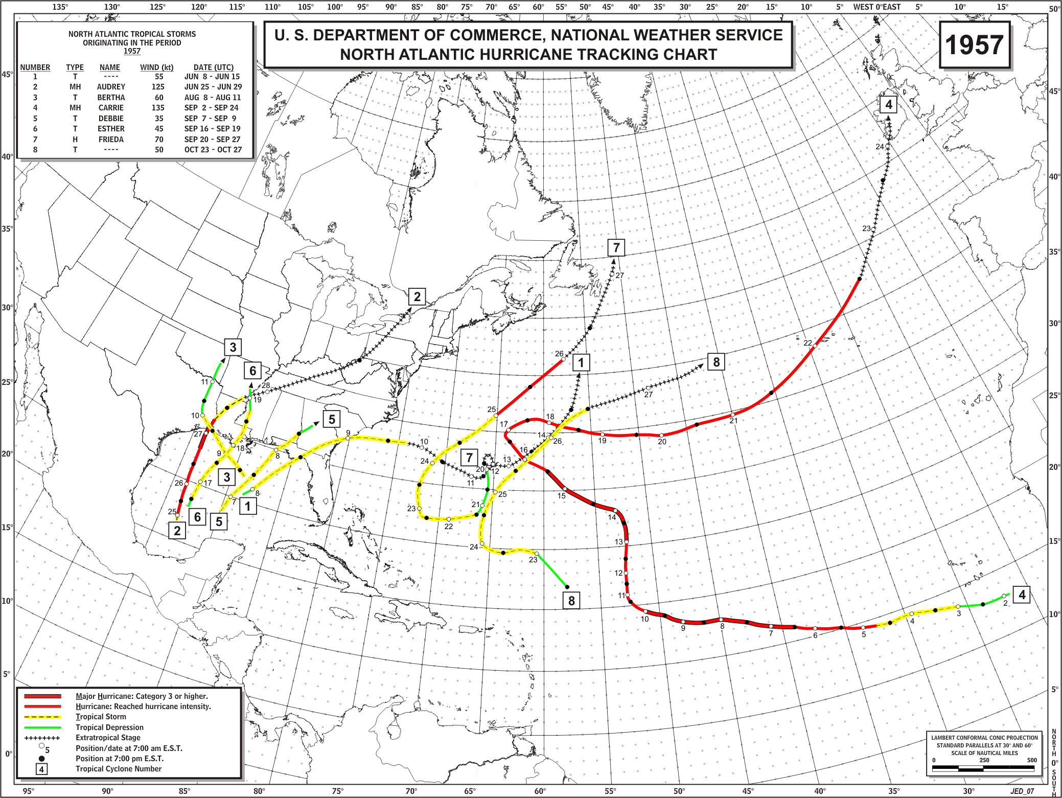
AUDREY (Cat. 4 Hurricane - June 27th landfall)
Audrey was one of the strongest and deadliest of June hurricanes. The storm made landfall near Cameron, LA with 100 mph winds and severe coastal flooding. Over 500 persons lost their lives. Audrey is noteworthy because residents along the LA coast had plenty of warning, and still 500 died. The area had not suffered a severe hurricane since 1918 and their false sense of security along with the residents' prior experience of needlessly evacuating for storms that caused little damage, prompted many to ignore the warnings. A publication by Texas A&M in 1975 suggests that the majority of persons who drowned in Audrey had climbed trees to escape rising waters were bitten by snakes also taking refuge there, then fell into the water. Total damage was $150 million. For more detailed information, see the Hurricane Audrey Page from the Lake Charles National Weather Service Office.
Statistics:
Winds (mph): gusts 150 to 180 on offshore LA oil rigs; 90-100 at Lake Charles; 105 at Sulpher, LA
Pressure (inches): 27.32 on offshore LA oil rigs, 28.52 at Port Arthur; 29.45 at High Island; 29.73 at Houston
Tides (feet): 9.0 to 13.9 LA coast
BERTHA (Tropical Storm - August 9th landfall)
Bertha began as a weak extratropical low that entered the Gulf of Mexico on August 6th and drifted slowly westward. The system slowly organized and then developed into a tropical storm on August 8th located about 100 miles south of the Mississippi River Delta. Moving generally northward, Bertha quickly organized and reached a peak intensity of 70 mph and an estimated minimum pressure of 998 millibars on the 9th before making landfall near Cameron, Louisiana. Here are some maps showing Bertha's rainfall.


 Follow us on YouTube