|
||||||||||||||||
|
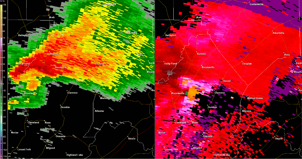
At this same time other tornadoes were impacting southern Marshall County (in association with a broad mesoscale convective vortex), this tornado tracked northeast from Blount County near County Road (CR) 21 (Big Spring Brow Road). The tornado uprooted and snapped numerous large hardwood trees from the Blount/Marshall county line to near the intersection of Cox Gap Road and Highway 64. Just farther northeast, additional trees were uprooted along Fairview Drive and between Nixon Chapel Road and Panky Road where the tornado appeared to broaden/widen its circulation before lifting before Pleasant Grove Road. |
||||||||||||||||
Radar Data
|
||||||||||||||||


 Local Radar
 Weather Map
 Follow us on YouTube