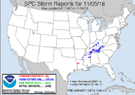
Event Summary |
|||||||
|
|||||||
|
|||||||
Tornadoes:
|
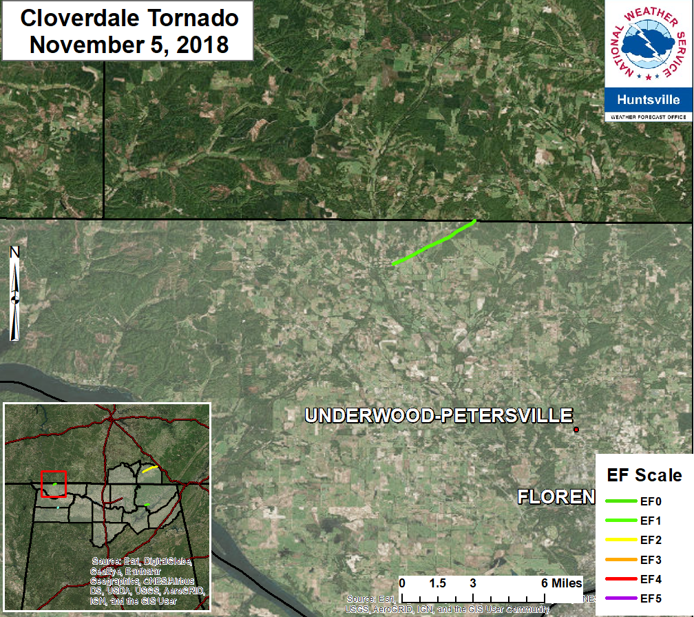
Cloverdale Tornado
|
||||||||||||||||||||||||||
|
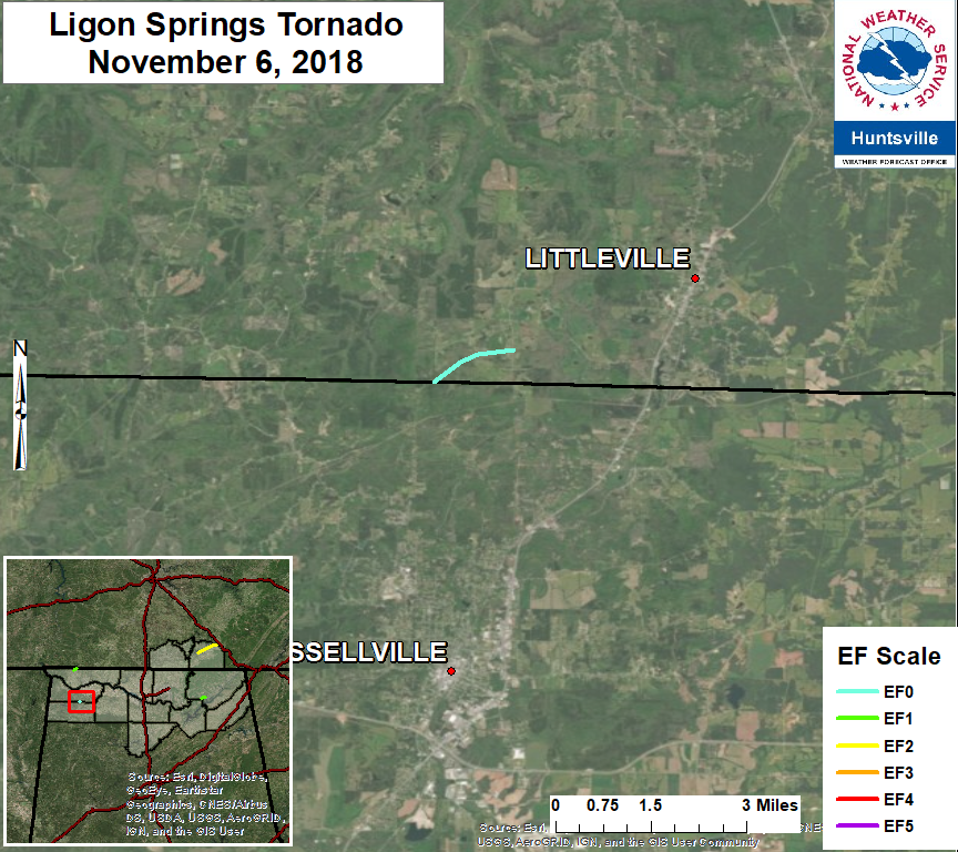
Ligon Springs Tornado
|
||||||||||||||||||||||||||
|
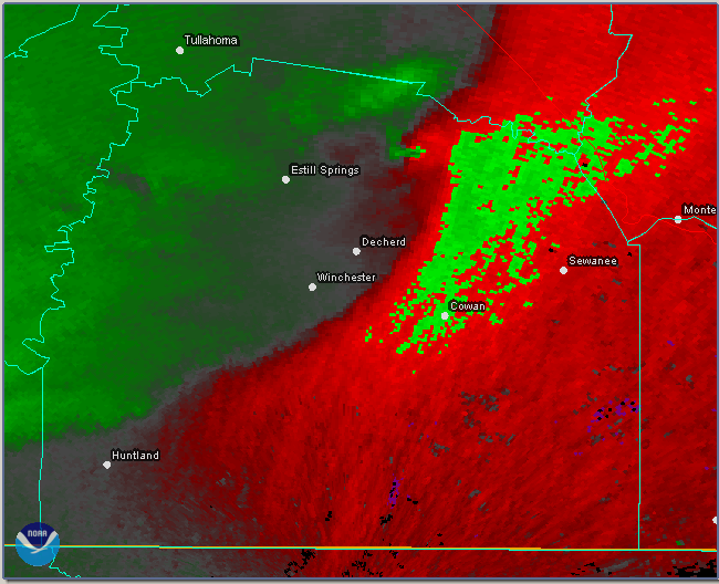
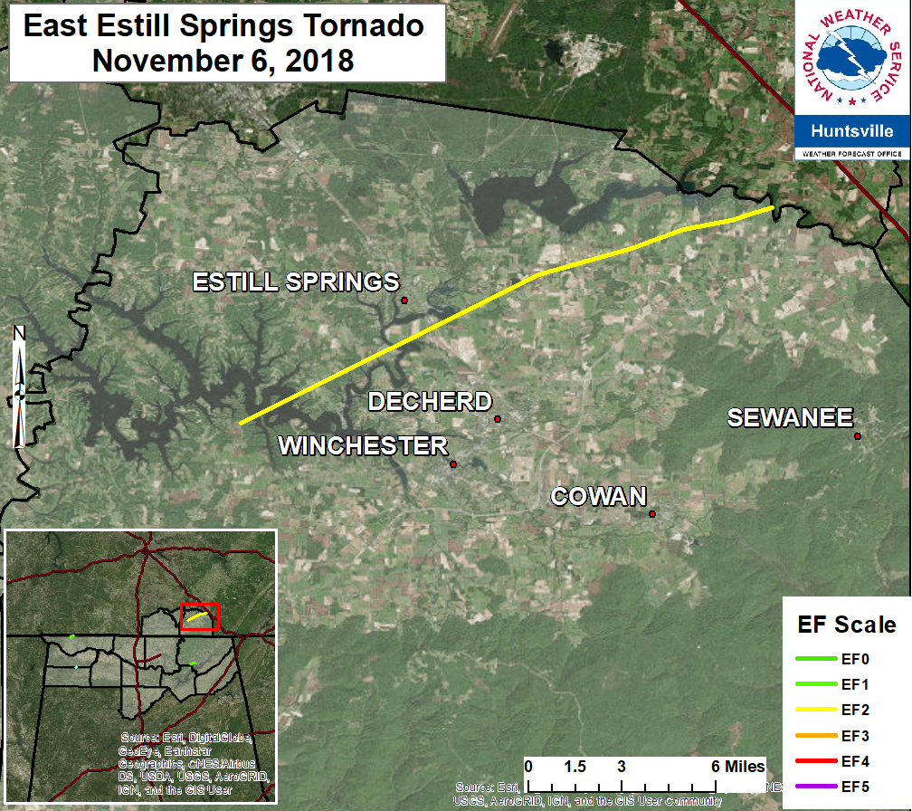
Estill Springs/Decherd Tornado
|
||||||||||||||||||||||||||
|
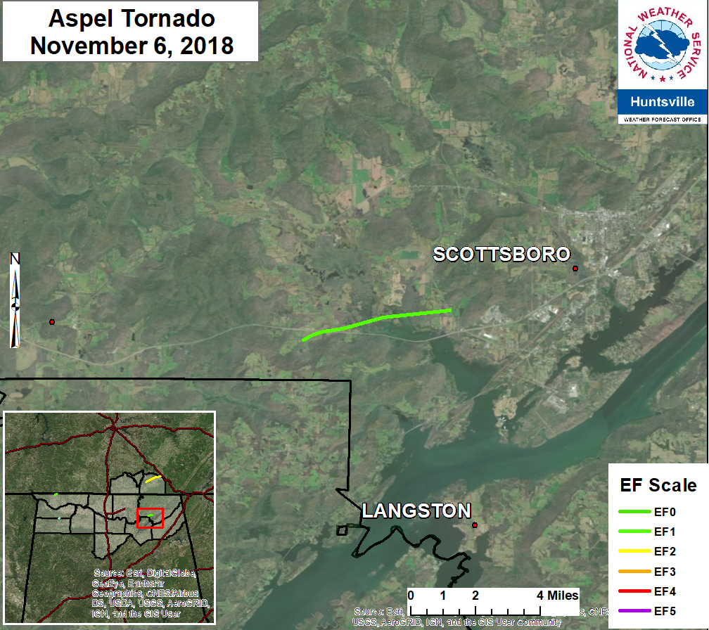
Aspel/Scottsboro Tornado
|
||||||||||||||||||||||||||
| EF0 Weak 65-85 mph |
EF1 Moderate 86-110 mph |
EF2 Significant 111-135 mph |
EF3 Severe 136-165 mph |
EF4 Extreme 166-200 mph |
EF5 Catastrophic 200+ mph |
 |
|||||
Upper Air Charts
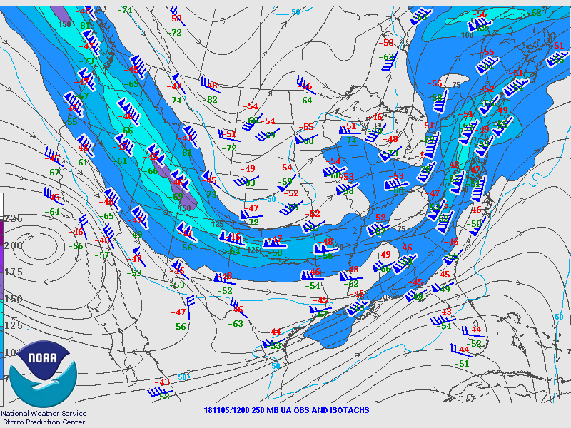
250mb Chart at 6am November 5th |
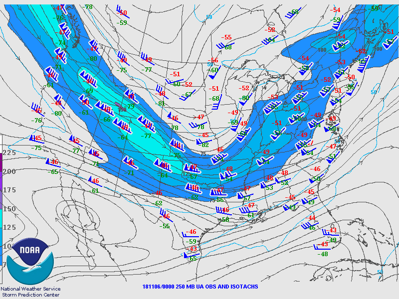
250mb Chart at 6pm November 6th |
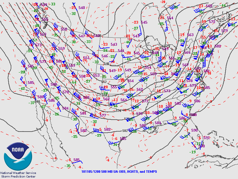
500mb Chart at 6am November 5th |
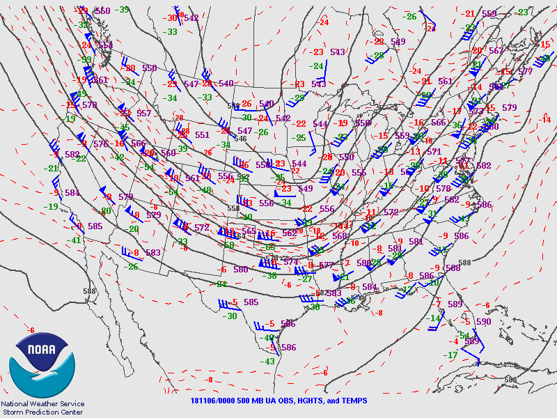
500mb Chart at 6pm November 6th |
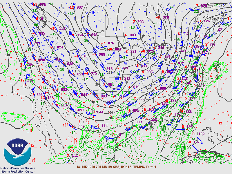
700mb Chart at 6am November 5th |
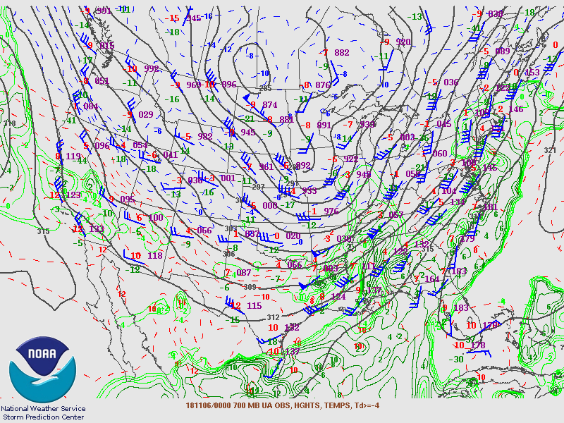
700mb Chart at 6pm November 6th |
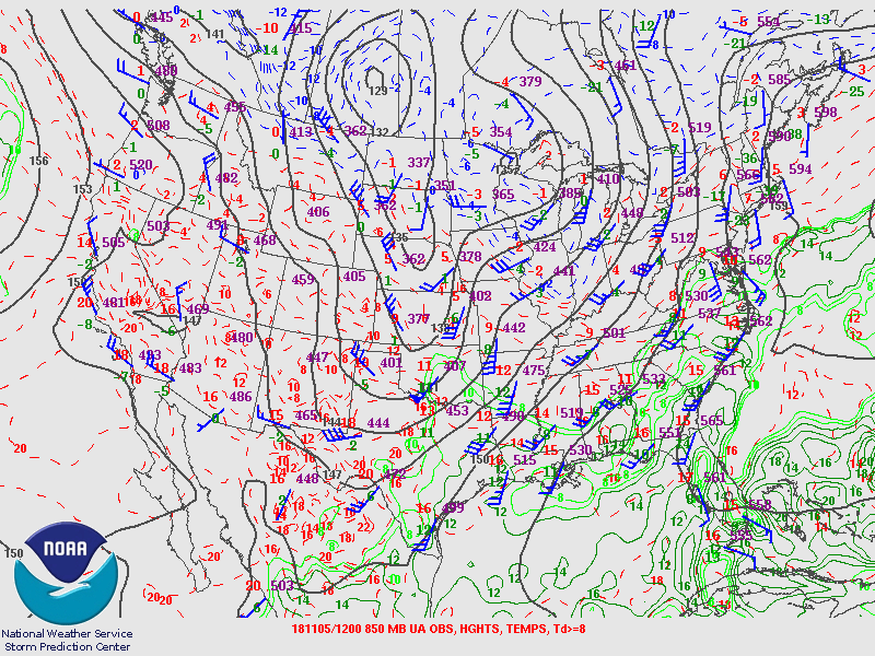
850mb Chart at 6am November 5th |
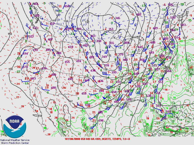
850mb Chart at 6pm November 6th |
Soundings
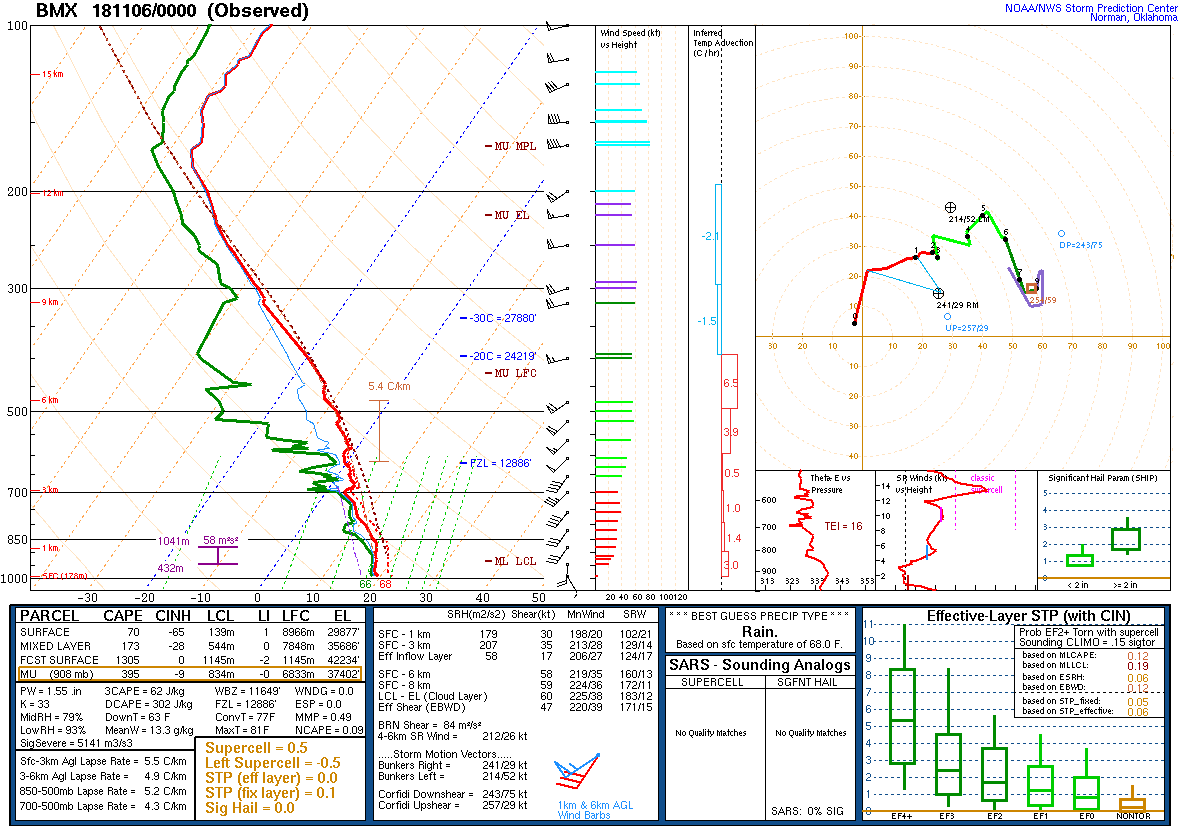
00Z Sounding Nov 6th, 2018 from BMX |
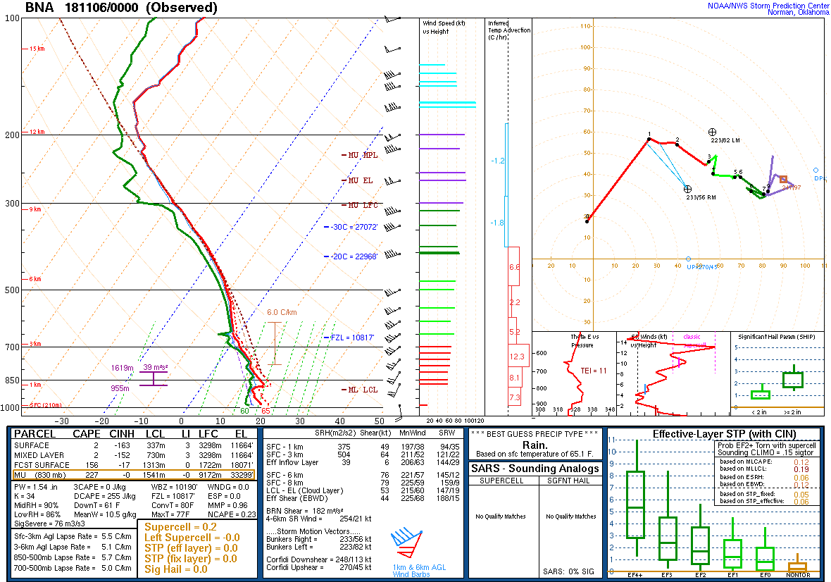
00Z Sounding Nov 6th, 2018 from BNA |
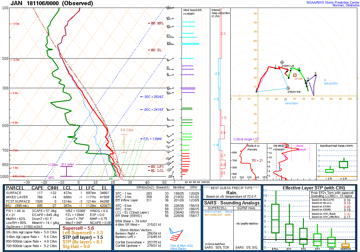
00Z Sounding Nov 6th, 2018 from JAN |
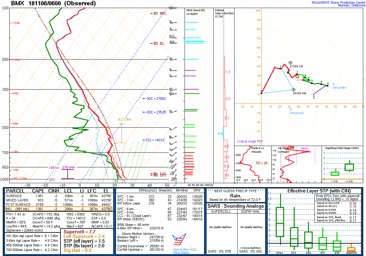
06Z Sounding Nov 6th, 2018 from BMX |
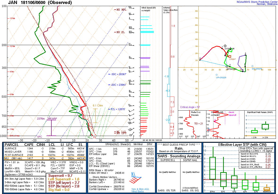
06Z Sounding Nov 6th, 2018 from JAN |
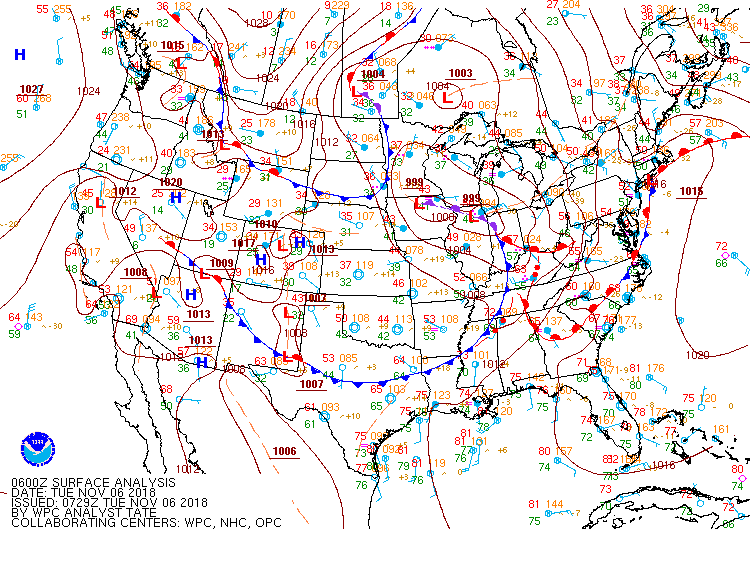
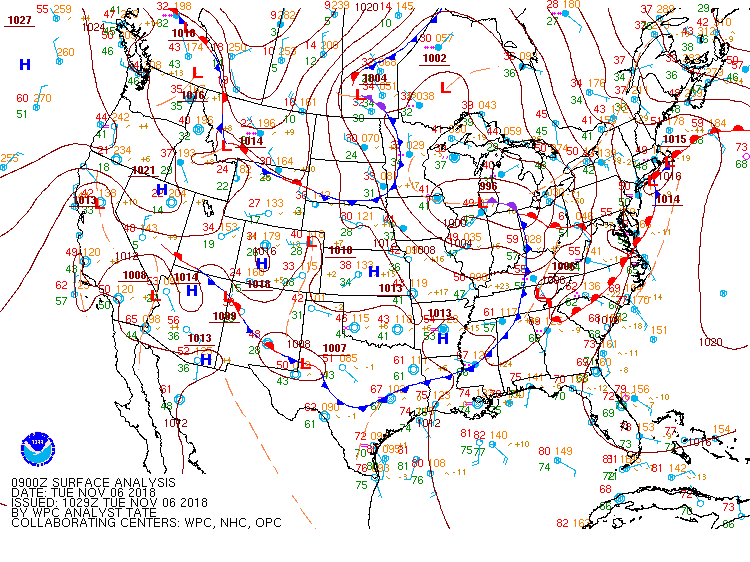
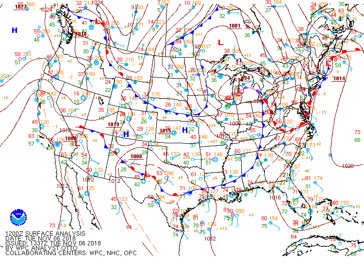
Surface Charts
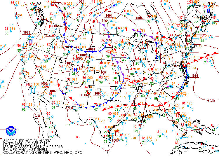
3 PM Nov 5th |
6 PM Nov 5th |
9 PM Nov 5th |
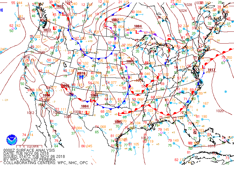
Midnight Nov 5th |
3 AM Nov 6th |
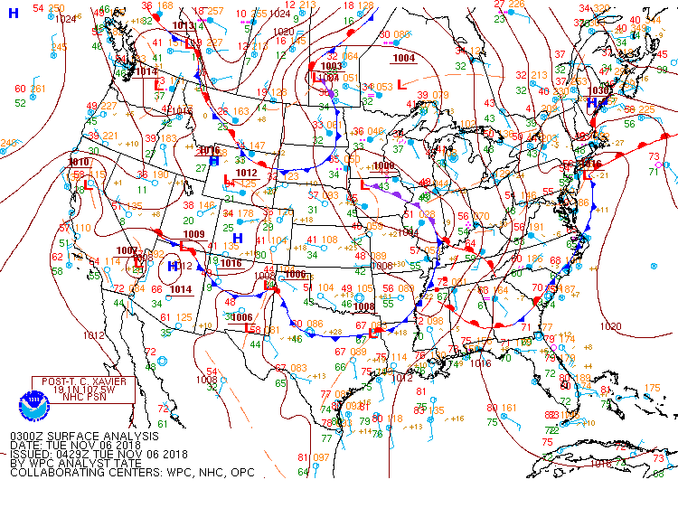
6 AM Nov 6th |
SPC Outlooks
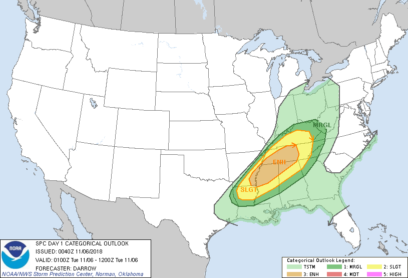
Day 1 Outlook |
||
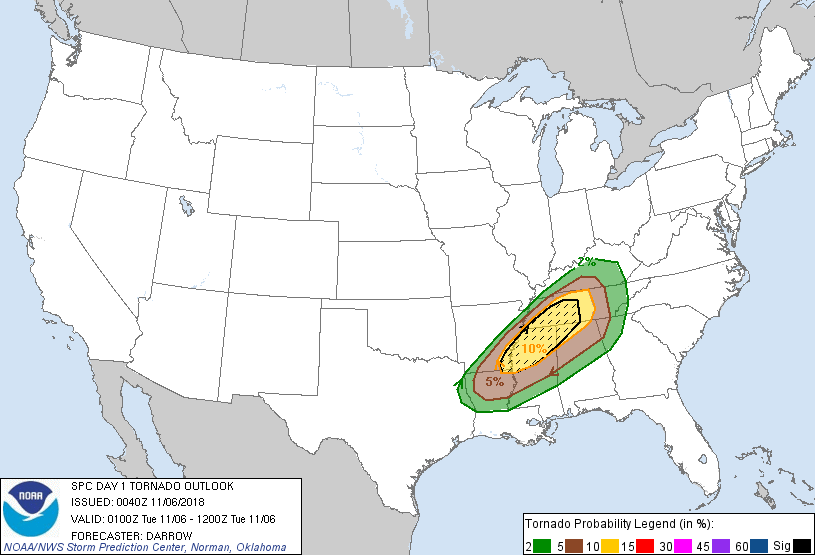
Day 1 Tornado Probability |
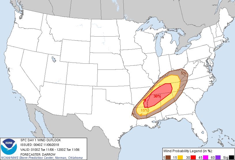
Day 1 Wind Probability |
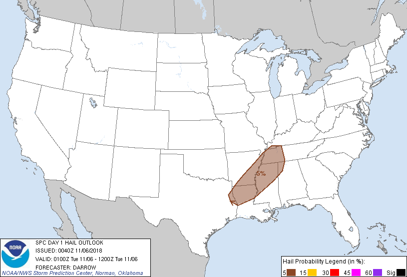
Day 1 Hail Probability |


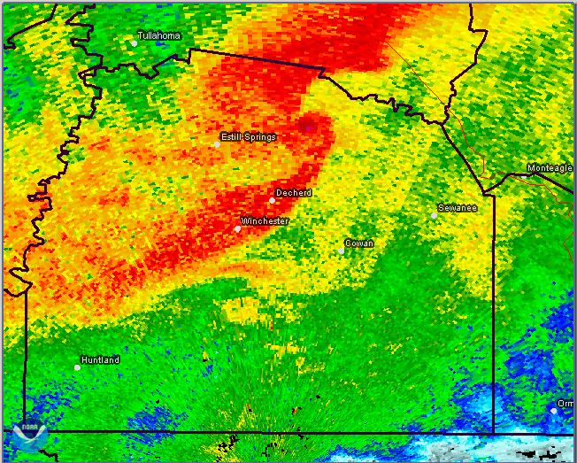
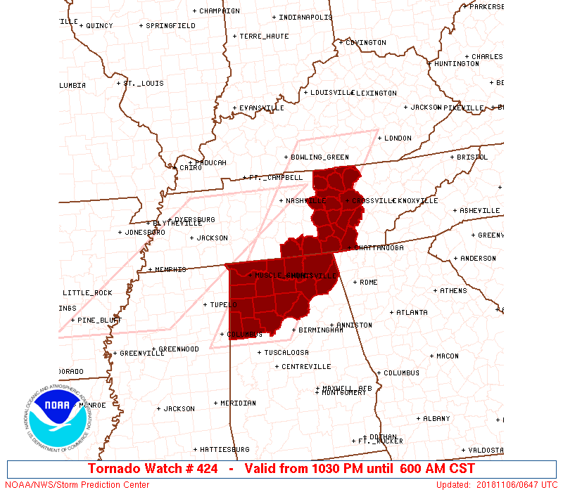
 Local Radar
 Weather Map
 Follow us on YouTube