 |
|||||||||||||||||
|
|
|||||||||||||||||
|
|||||||||||||||||
 |
|||||||||||||||||
 |
 |
||||||||||||||||
|
Summary |
|||||||||||||||||
|
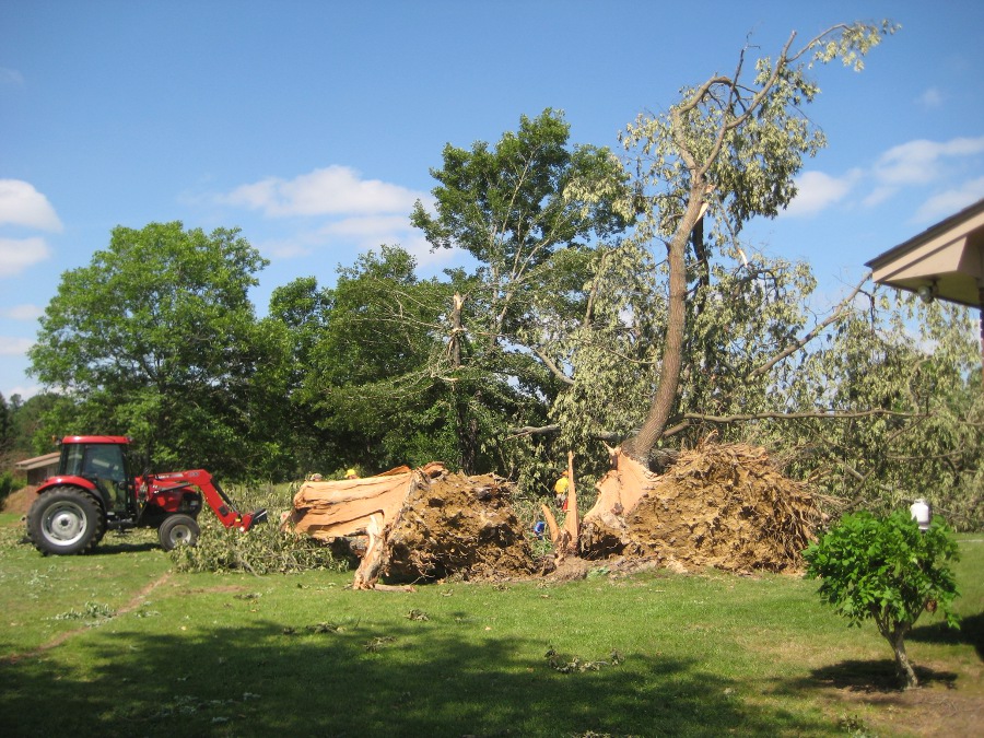
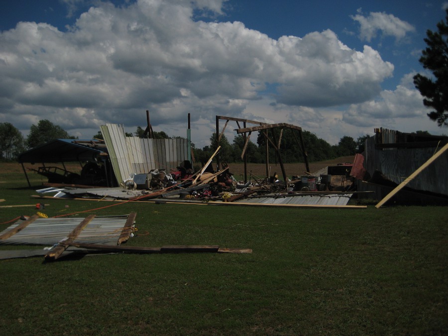
This short-lived tornado developed from a circulation that moved ahead of a fast-moving squall line. The tornado initially touched down just north of the Davis/Snake road intersection where several large trees were uprooted /snapped, one which fell on the corner of a single-story house. The tornado skipped northeast and snapped/uprooted additional trees around a residence between Fielding Road/CR 15 and Davis Road. The tornado lifted near the intersection of Fielding Road/CR 15 and Stanford Road with just a few trees snapped halfway down, along with an awning pulled off a small shed. |
|||||||||||||||||
| [ Back to Top ] | |||||||||||||||||
|
|
|||||||||||||||||
|
Central Limestone County |
|||||||||||||||||
|
|||||||||||||||||
 |
|||||||||||||||||
 |
 |
||||||||||||||||
 |
 |
||||||||||||||||
|
Summary |
|||||||||||||||||
|
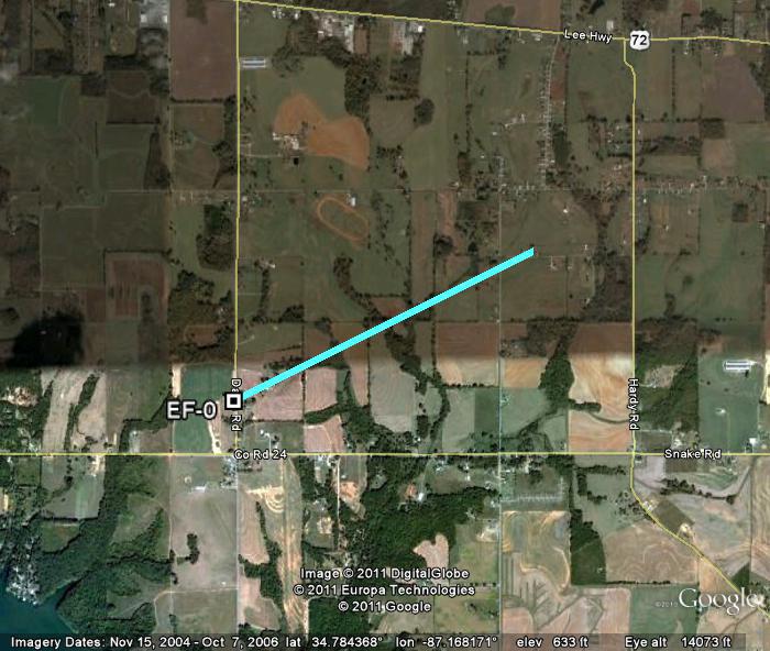
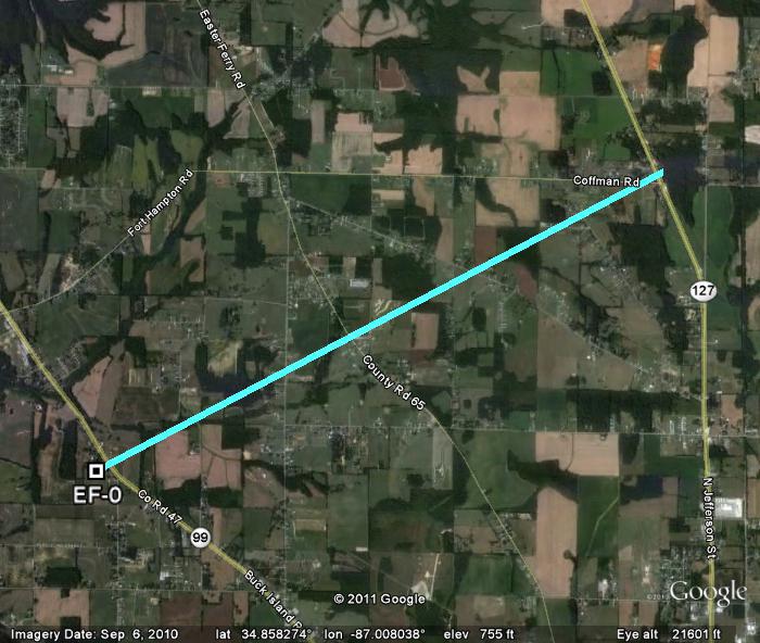
Originating from the same circulation as tornado #1, this tornado crossed Highway 99/Buck Island Road near Lydia Corey Road uprooting several large trees with one falling on the side of a house. Across the street, a large barn was severely damaged with the roof and most walls gone. The tornado continued northeast crossing Easter Ferry Road and Edgewood Road. Along Cross Key Road, several large trees were snapped/uprooted. The tornado tracked northeast snapping off the tops of several trees before lifting again near the intersection of Coffman Road and Highway 127. |
|||||||||||||||||
| [ Back to Top ] | |||||||||||||||||
|
|
|||||||||||||||||
|
Northeast Limestone/Northwest Madison County |
|||||||||||||||||
|
|||||||||||||||||
 |
|||||||||||||||||
 |
 |
||||||||||||||||
|
Summary |
|||||||||||||||||
|
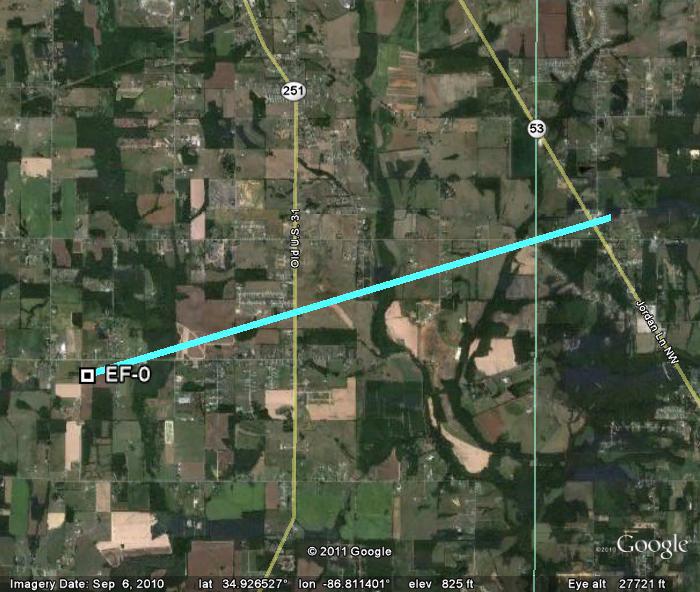
Several trees were snapped and uprooted along a southwest to northeast path beginning along Thach Road, crossing Highway 251 and ending near Bethel Road and Highway 53 (just over the Limestone/Madison County line. The most significant damage occurred along Bethel Road, just into Madison County, where several large trees were snapped and uprooted around a few homes. No significant structural damage was seen to the homes other than shingles blown off the roofs. The tornado appeared to lift just before Highway 53 north of Bethel Road. |
|||||||||||||||||
| [ Back to Top ] | |||||||||||||||||
|
|
|||||||||||||||||
|
|||||||||||||||||
 |
|||||||||||||||||
 |
 |
||||||||||||||||
|
Summary |
|||||||||||||||||
|
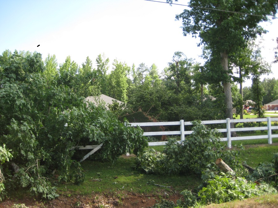
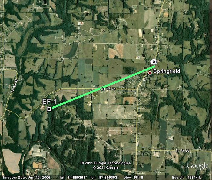
A short-lived tornado developed along a squall line of severe thunderstorms. Based on ground surveys, the tornado initially touched down just west of CR 92 about 2 miles southeast of Springfield in eastern Lauderdale County. The worst damage occurred along CR 76, about 1/2 mile west of State Highway 101, where a small barn was nearly destroyed and several large pines were snapped and uprooted. One pine fell on a home along CR 76, causing significant damage to the structure. The tornado continued northeast just crossing Highway 101 before lifting. |
|||||||||||||||||
| [ Back to Top ] | |||||||||||||||||
|
|
|||||||||||||||||
|
|||||||||||||||||
 |
|||||||||||||||||
 |
 |
||||||||||||||||
 |
 |
||||||||||||||||
|
Summary |
|||||||||||||||||
|
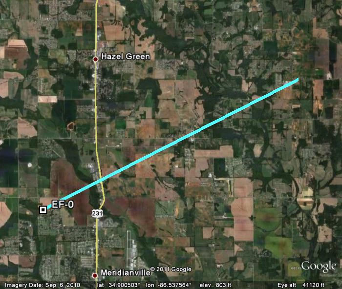
A tornado briefly touched down near Merdianville and skipped northeast snapping and uprooting trees along its path between Hazel Green and New Market. Concentrated damage began near Harwell Lane in a neighborhood off Patterson Lane. Several residences of Harwell Circle had trees snapped and uprooted with some minor structural damage (mainly torn siding and shingles pulled off the roofs). Just north and east of this location, circular, convergent patterns were seen in a wheat field approaching Patterson Lane. The tornado took out numerous trees just east of Highway 231 and north of Steger Road cutting out a path estimated at 25 yards wide and over 200 yards long. Little damage was seen from here to Walker Lane due to open fields. However, as the tornado crossed Walker Lane near Moores Mill Road, numerous large trees were snapped and uprooted between 1759 and 2255 Walker Lane. Additional snapped and uprooted smaller trees were seen just north of the Walker Lane and Butler Road intersection just before the tornado lifted. |
|||||||||||||||||
| [ Back to Top ] | |||||||||||||||||
|
|
|||||||||||||||||
|
Southeastern Colbert & Extreme Western Lawrence County |
|||||||||||||||||
|
|||||||||||||||||
 |
|||||||||||||||||
 |
 |
||||||||||||||||
 |
 |
||||||||||||||||
|
Summary |
|||||||||||||||||
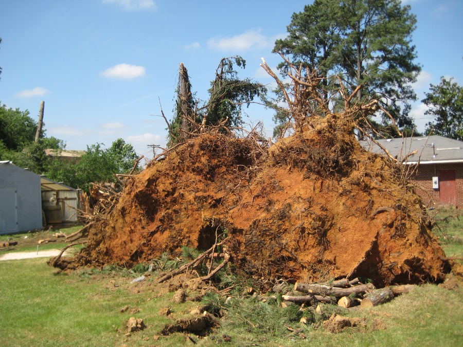
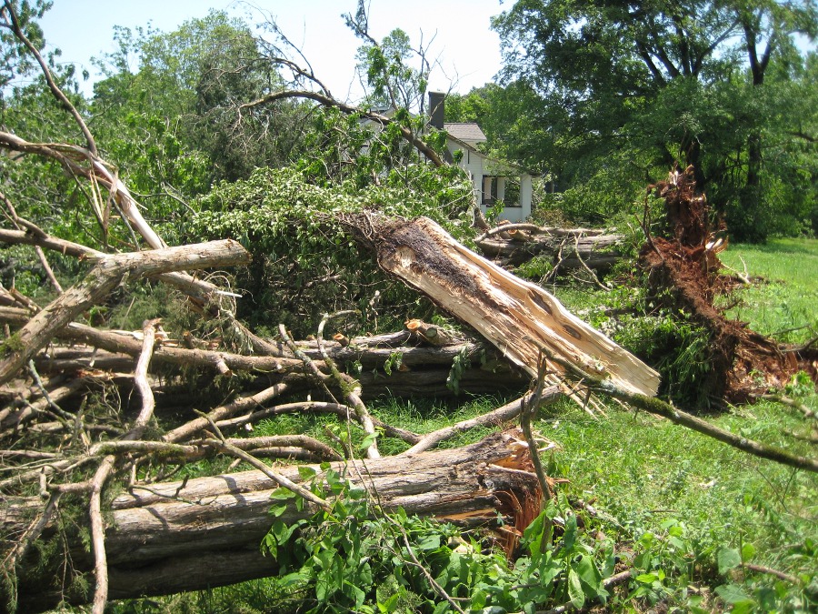
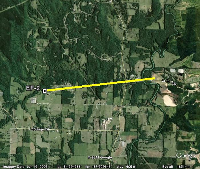
| A tornado touched down immediately west of Waldrep Loop and north of LaGrange Road in extreme southeastern Colbert County. Multiple large trees were snapped and uprooted along the path. The most significant damage occurred to a house along Waldrep Loop, where large sections of the roof structure were removed, or pushed off the adjoining carport. A chicken house across the street was completely collapsed with roofing material tossed up to 100 yards. Tree damage continued eastward to the intersection of County Line Road and Wolf Springs Road. A church at this intersection sustained roof damage, and dozens of trees were snapped and uprooted around a nearby single family home. The tornado continued eastward past the Colbert-Lawrence county line, but lifted before reaching County Road 584. | |||||||||||||||||
| [ Back to Top ] | |||||||||||||||||
|
|
|||||||||||||||||
|
East Central Limestone County |
|||||||||||||||||
|
|||||||||||||||||
 |
|||||||||||||||||
 |
 |
||||||||||||||||
|
Summary |
|||||||||||||||||
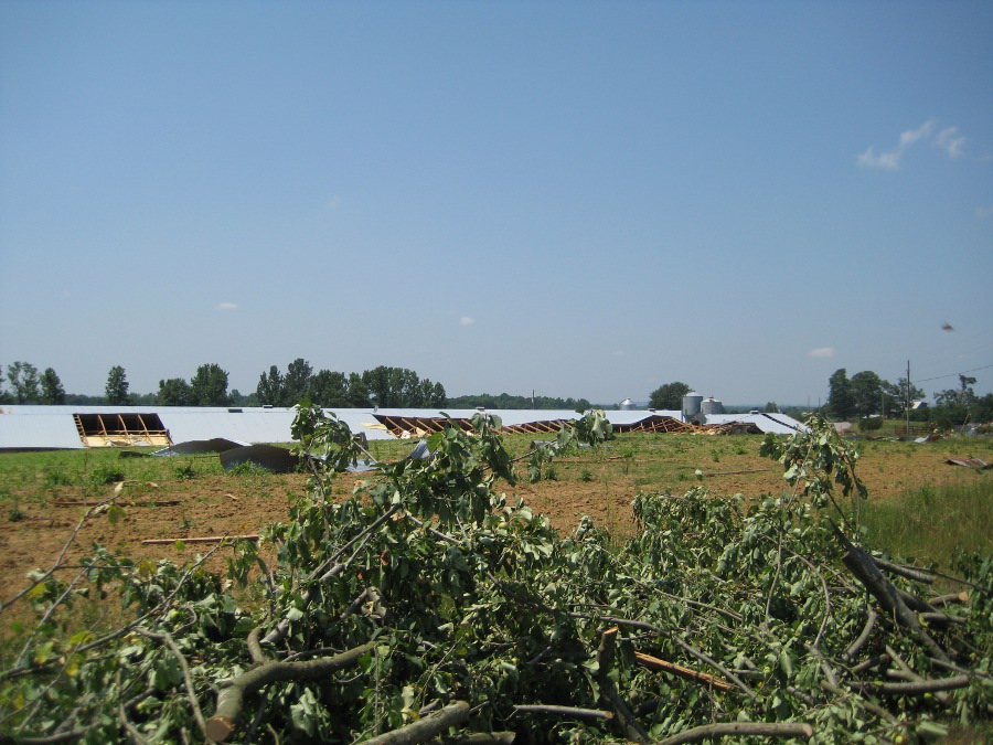
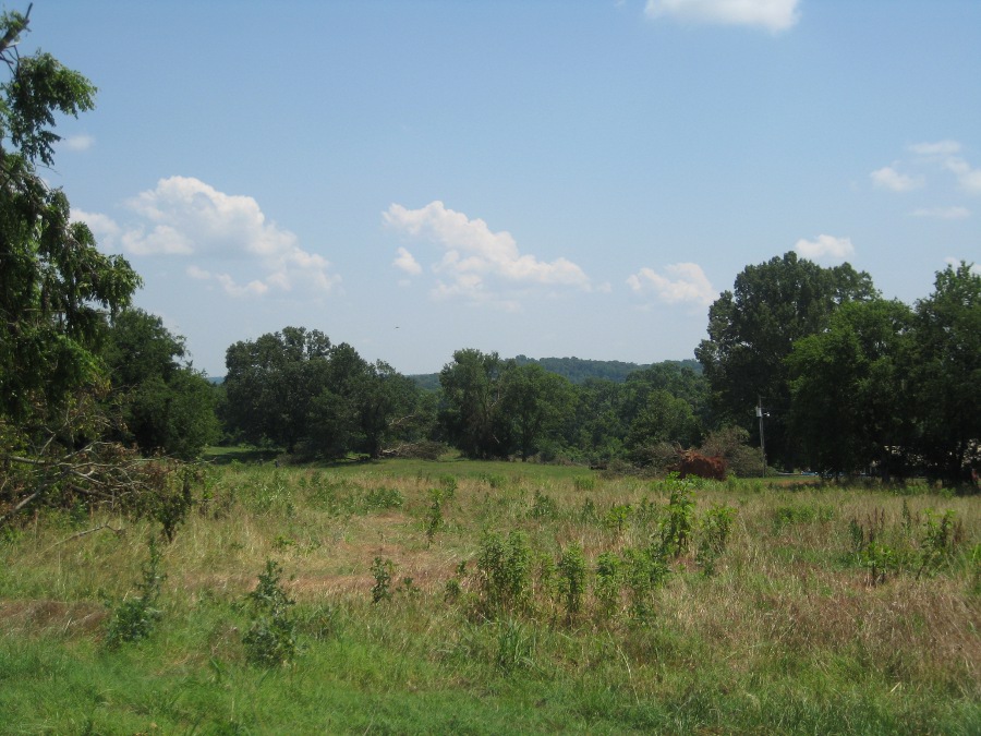
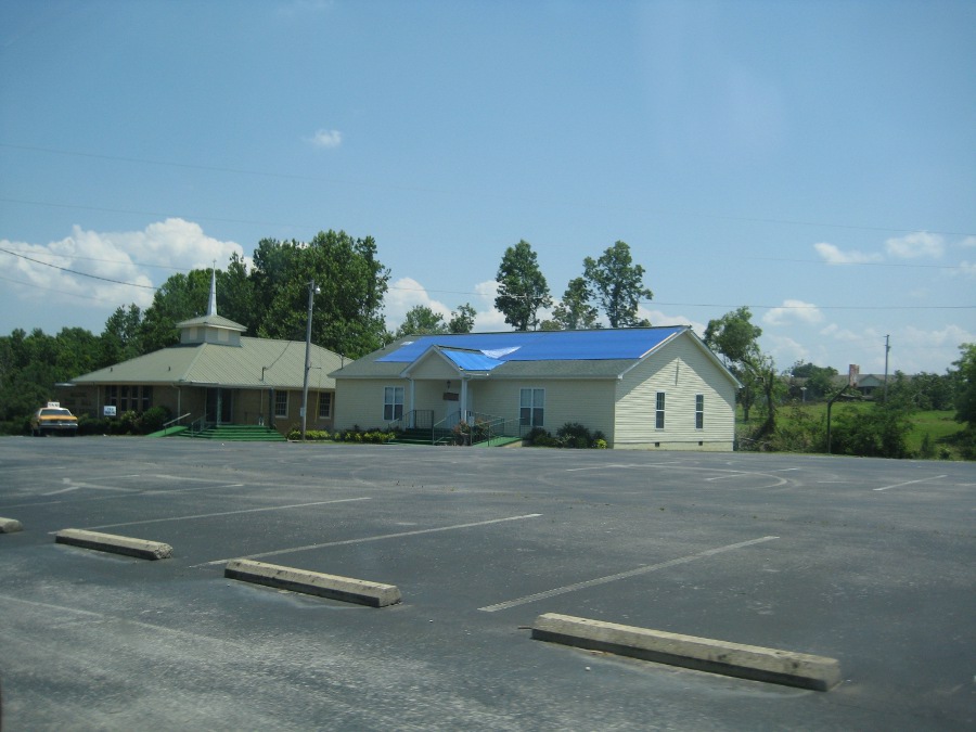
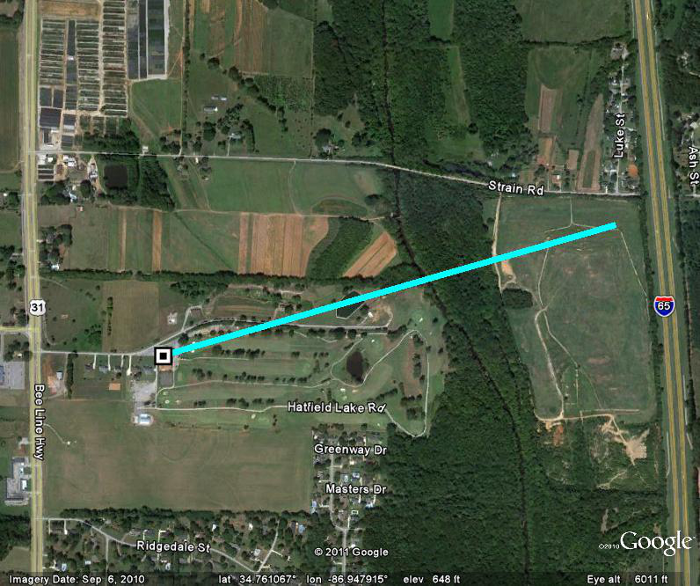
| In association with a quasi-linear convective system, a tornado briefly touched down over the Athens Country Club and Golf Course, along Hatfield Lake road, just before midnight on Wednesday (May 25th, 2011). Several trees were uprooted along its short path. Tops of other trees (Pines and Cedars) were snapped and twisted. The tornado appeared to lift just northeast of the country club around Strain road, just before Interstate 65. | |||||||||||||||||
| [ Back to Top ] | |||||||||||||||||


 Local Radar
 Weather Map
 Follow us on YouTube