|
Huntsville EF-2 Tornado |
|
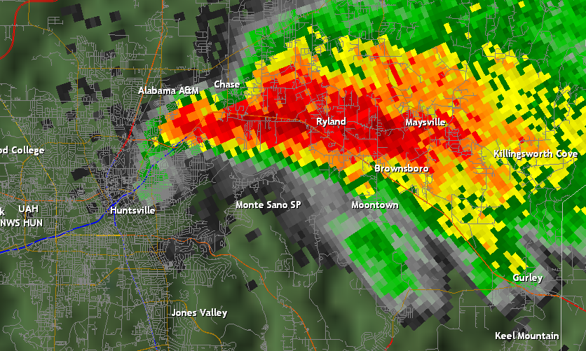
This radar image from the Hytop radar at 5:26pm shows the tornado-producing thunderstorm as it moves across eastern Madison County. At this time, heavy rainfall and small hail (indicated by the darker red colors) was occurring along the US 72 corridor east of Huntsville. The tornado, located on the southwest side of the storm, was about to lift as it approached Chapman Mountain in northeast Huntsville. Click on the image for a larger size version. |
|
|
|
|
|
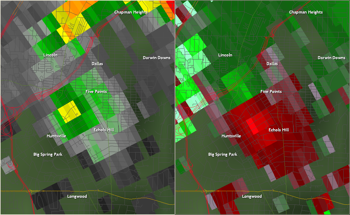
The UAH ARMOR radar had a closer view of the storm that produced the Huntsville tornado than the Hytop radar did. The above radar image from ARMOR at 5:26 pm shows reflectivity data on the left side and storm relative velocity data on the right. The velocity data shows a rotational couplet between the north side of downtown Huntsville and the Five Points area, with green pixels indicating motion toward the radar at Huntsville International Airport and red pixels indicating motion away from the radar. This rotation correlates with an area of higher reflectivity, which is possibly indicative of condensation in the wall cloud. While tornado debris have been detected on radar during multiple events in the past, photographic evidence from this event indicates there wasn't a very large debris cloud with this particular tornado. Thus, it is unlikely the reflectivity maximum is a result of tornado debris. Click on the image for a larger size version. |
|
Sewanee EF-1 Tornado
This radar image from 5:03 pm shows a tornado-producing thunderstorm moving across southern reaches of the Cumberland Plateau. The reflectivity image on the left shows rainfall intensity, and the storm relative velocity image on the right indicates wind velocity toward or away from the radar in Hytop, Alabama. At this point, a tornado was developing just east of Sewanee and southwest of Monteagle. The reflectivity shows a well-defined hook echo near St Andrews, while the velocity data shows rotation in the same area. Click on the image for a larger size version. |


 Local Radar
 Weather Map
 Follow us on YouTube