Overview
A stalled frontal boundary was draped across the region on Tuesday ahead of an approaching storm system. Widespread showers and thunderstorms with very heavy rainfall developed across the area once again. These storms inundated areas that were already saturated from recent rainfall resulting in widespread flooding across south central Kansas.
Significant flooding started during the late night hours of May 7th, when Chanute picked up around 5 inches of rainfall in only a couple hours. This caused widespread flash flooding across the city where numerous water rescues took place. Flooding became more widespread the following day.
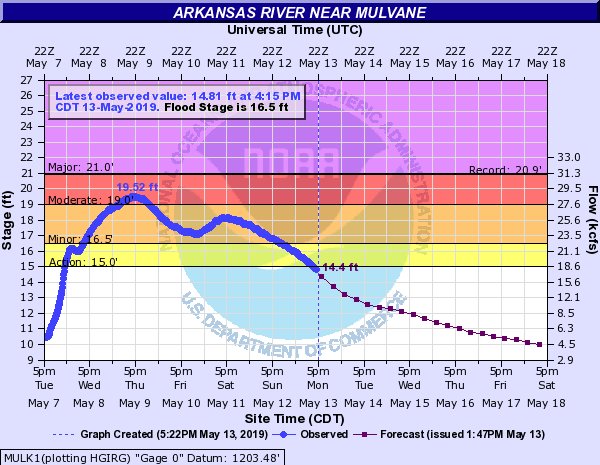
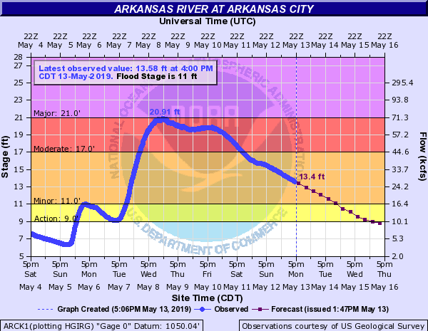
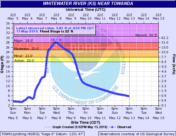
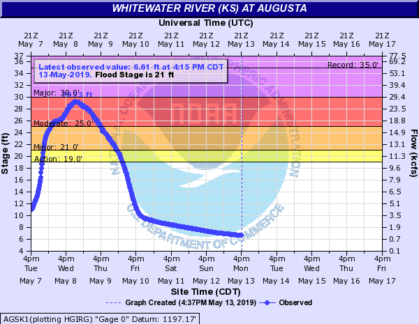
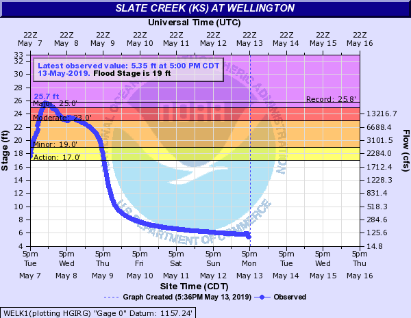
At one point, the NWS Wichita had river flood warnings out for 38 river points with 20 additional counties in an areal flood warning! The most significant flash flooding occurred during the night of May 8th, when areas southeast of Wichita picked-up between 7 and 10 inches of rainfall in a 24 hours period. Numerous water rescues took place across Mulvane, Augusta, Wellington and Rose Hill. In addition, several miles of the Kansas Turnpike was closed south of Mulvane due to the Slate Creek reaching record levels! Closing this much of the Kansas Turnpike due to flooding hasn't happened in over 30 years!
Flooding
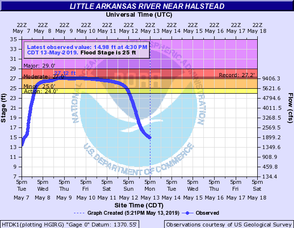
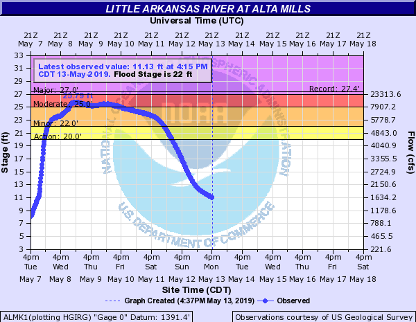
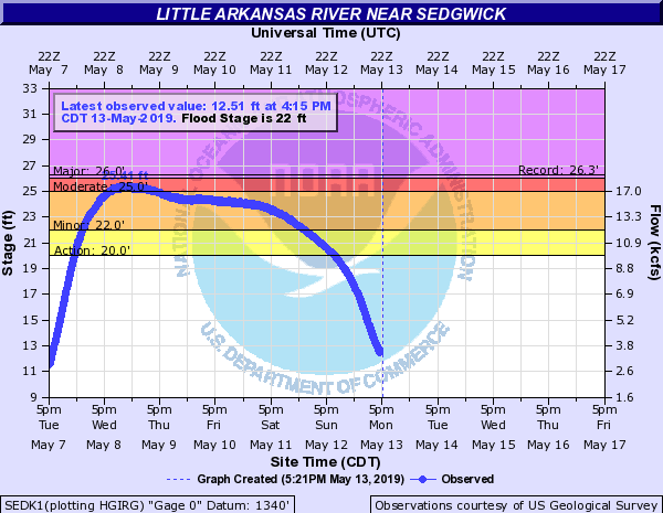
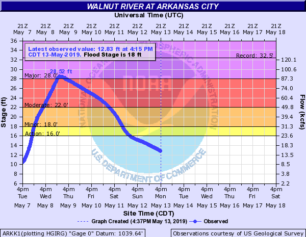
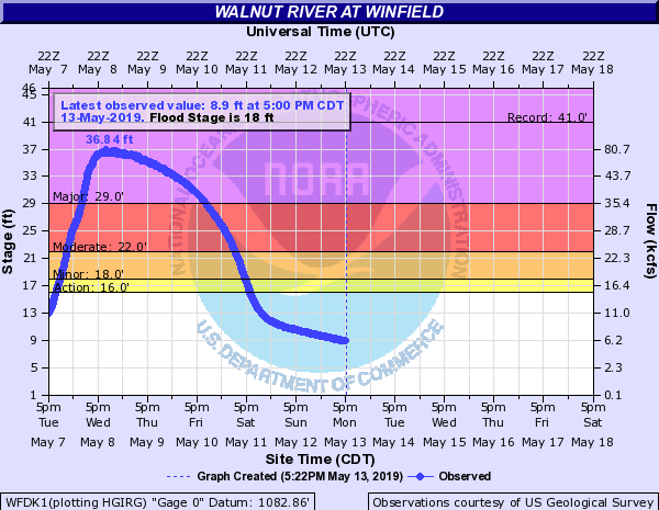
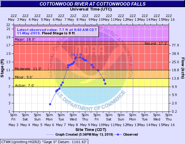
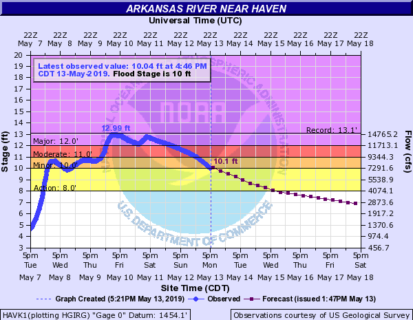
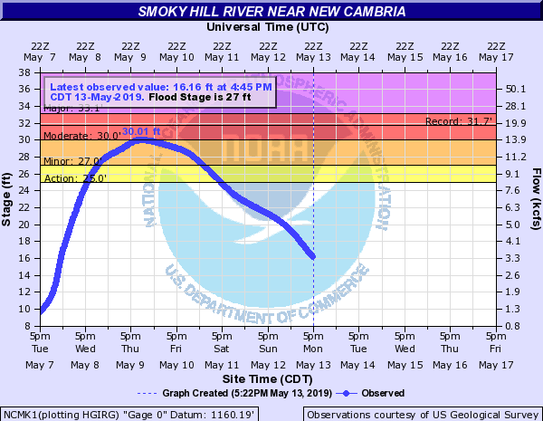
Significant flooding is occurring along many rivers and creeks in south central Kansas, some of the worst flooding in years is occurring at some locations.

Hydrographs
 |
 |
 |
 |
 |
 |
 |
 |
 |
 |
 |
 |
 |
 |
Photos & Video
|
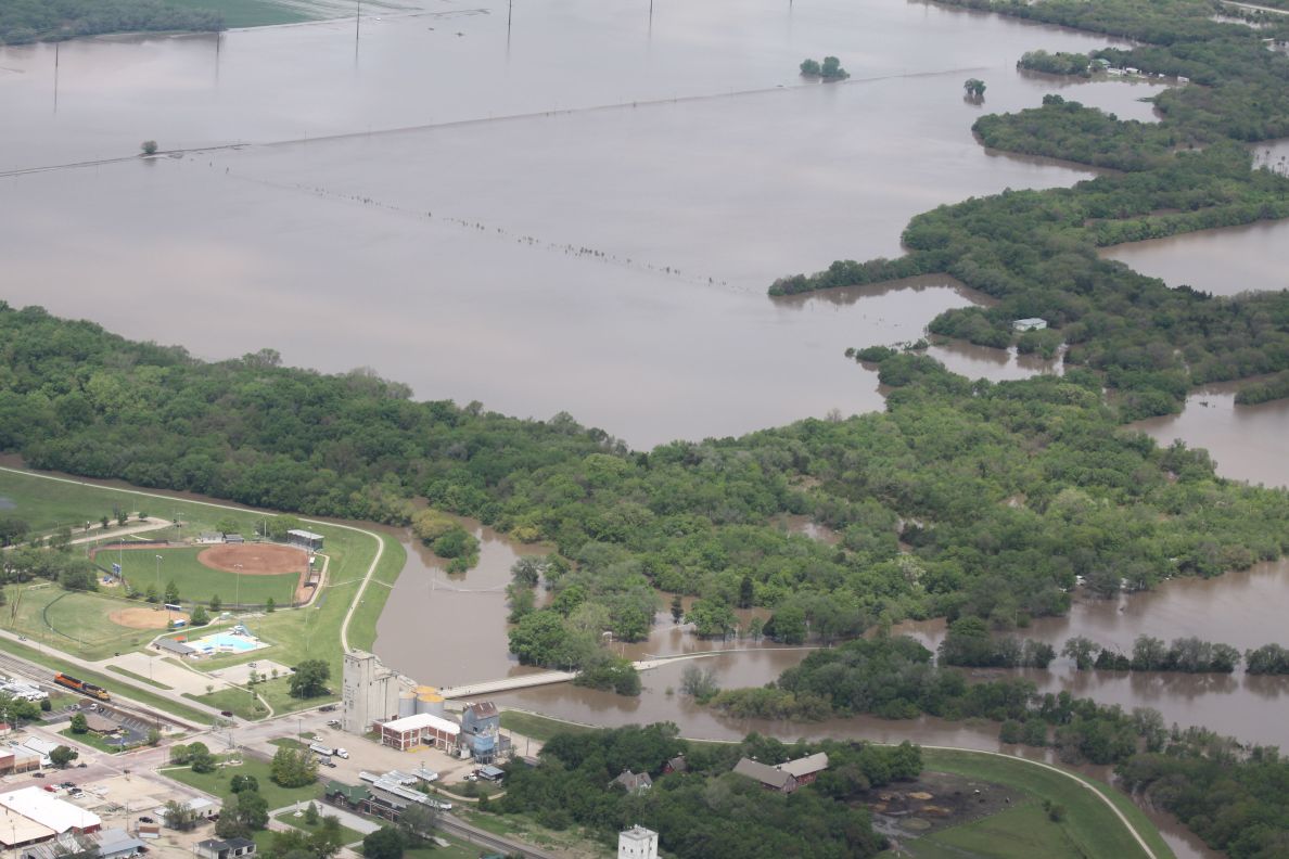
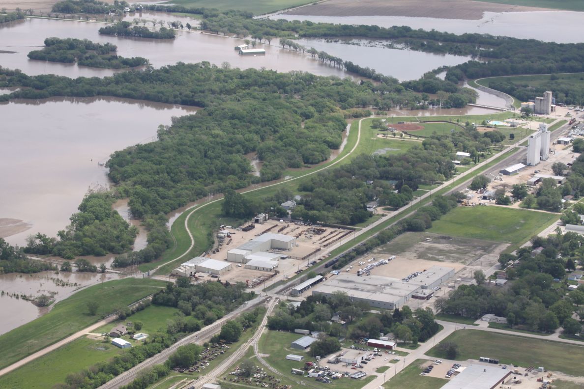
Flooding around Halstead |
Flooding around Halstead |
||
|
|
|
|
|
|
|
|
Radar
 |
| Hover and click on the image above to see an enlarged radar animation from 10 AM on Tuesday May 7 through 6 AM on Wed May 8, 2019. |
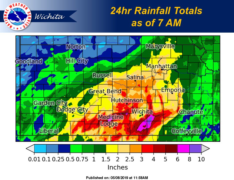
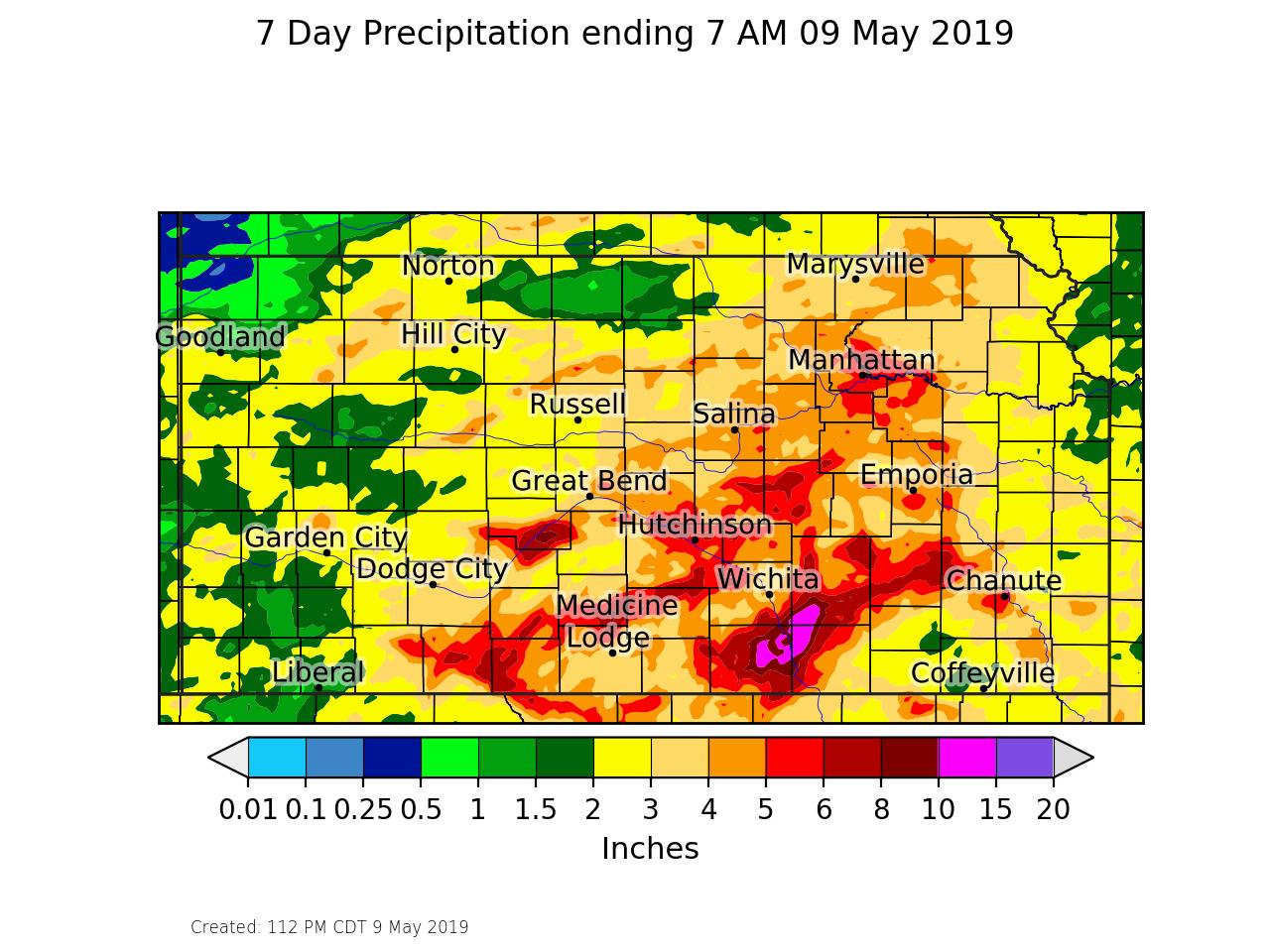
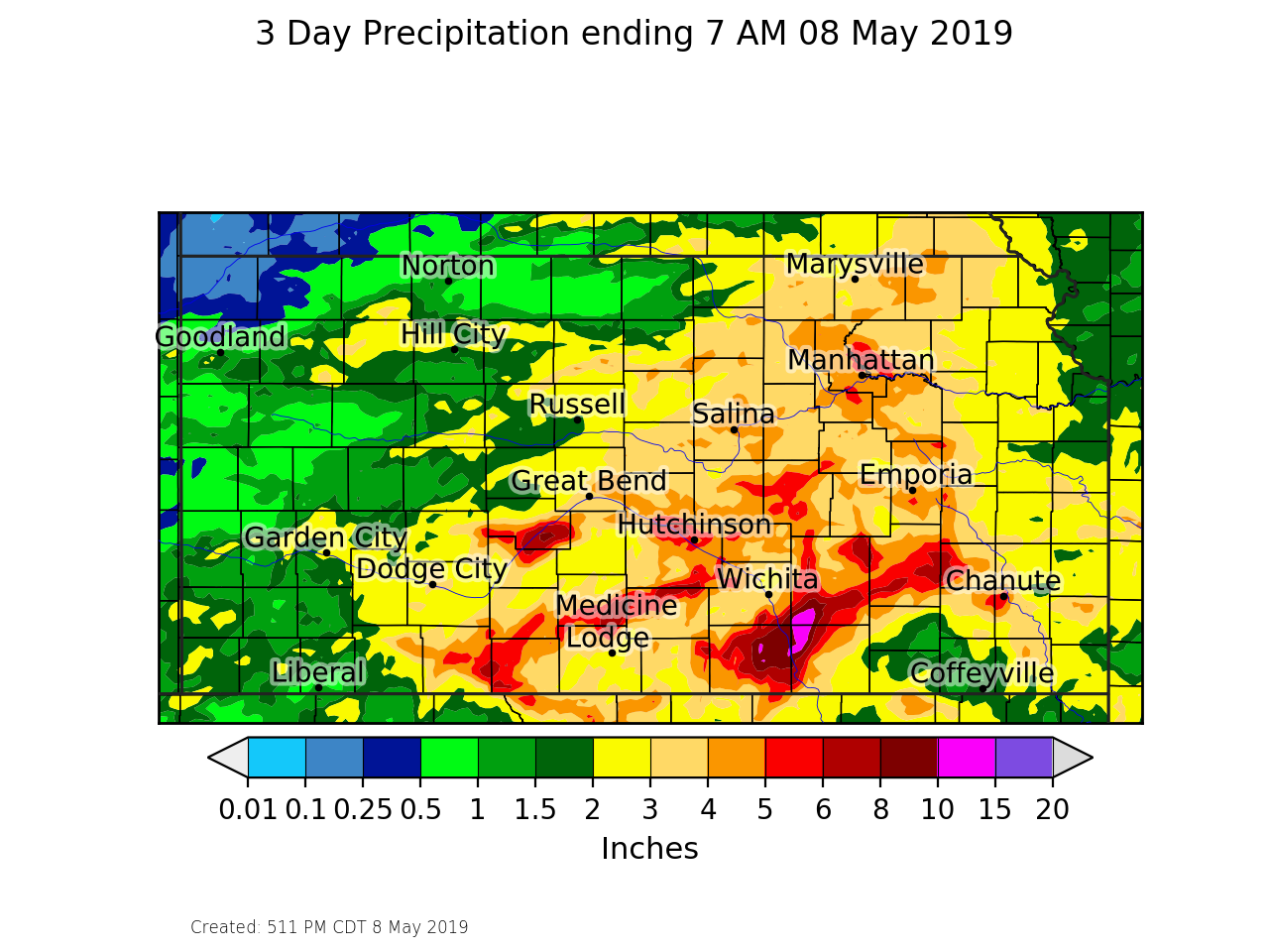
Rain Reports
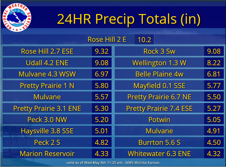 |
 |
3 day rainfall total |
 |
||
 |
Media use of NWS Web News Stories is encouraged! Please acknowledge the NWS as the source of any news information accessed from this site. |
|


 Follow us on YouTube