|
Warnings and Statements issued by NWS Wilmington, NC on 9/7/04
|
Severe Thunderstorm Warnings (SVR)
|
| 4:35 pm |
|
|
|
|
Storm Survey Team Members:
- Reid Hawkins
- Tom Matheson
- Carl Morgan
- John Quagliariello
|
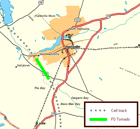
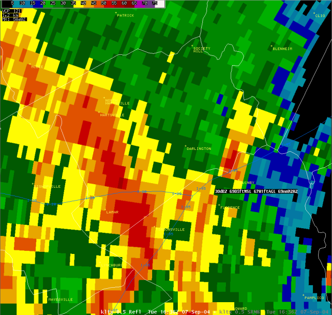
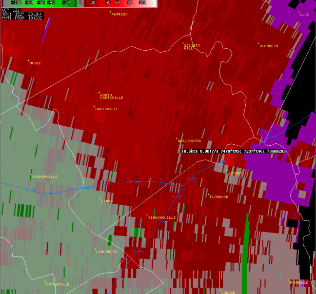
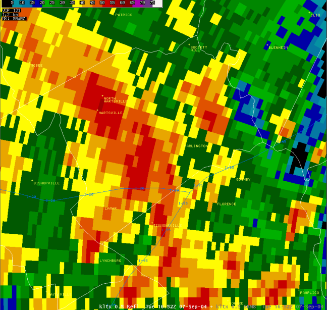
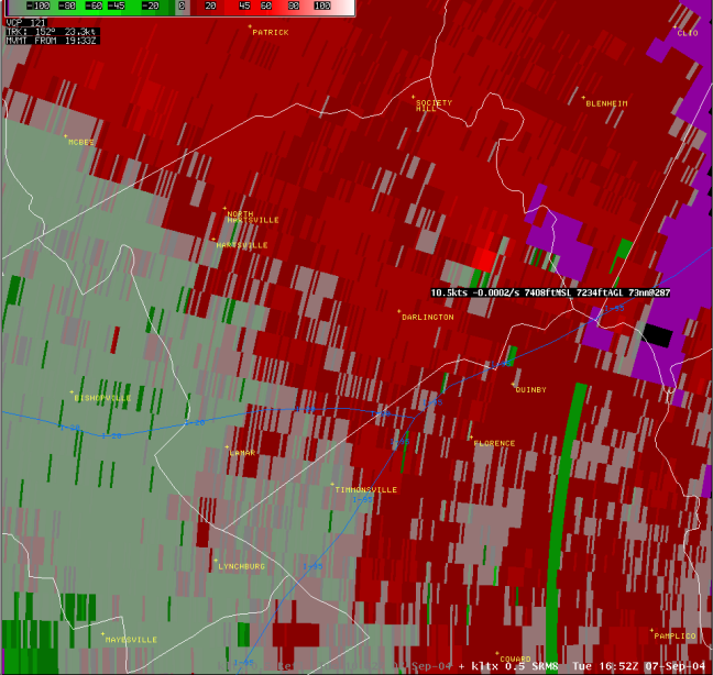
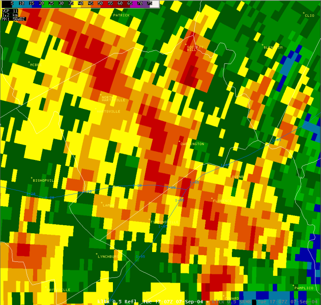
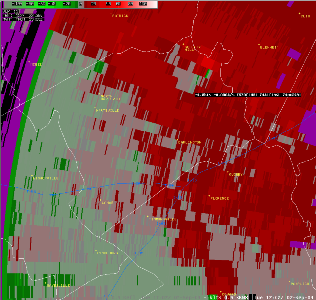
Darlington County Tornado
|
|
Time of Tornado: 12:35 pm EDT
|
|
|
| |
| Storm Information |
|
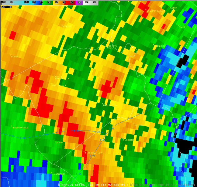
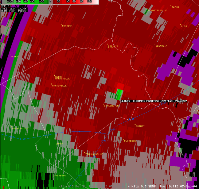
At 12:35 pm, a tornado began in Darlington County 2.7 miles SW of Hartsville and ended 2.3 miles SW of Hartsville. The total path length was 1.3 miles and the total path width was 50 yards.
|
|
| |
|
Radar Imagery (click to enlarge)
|

Base Reflectivity (Columbia, SC Radar) |
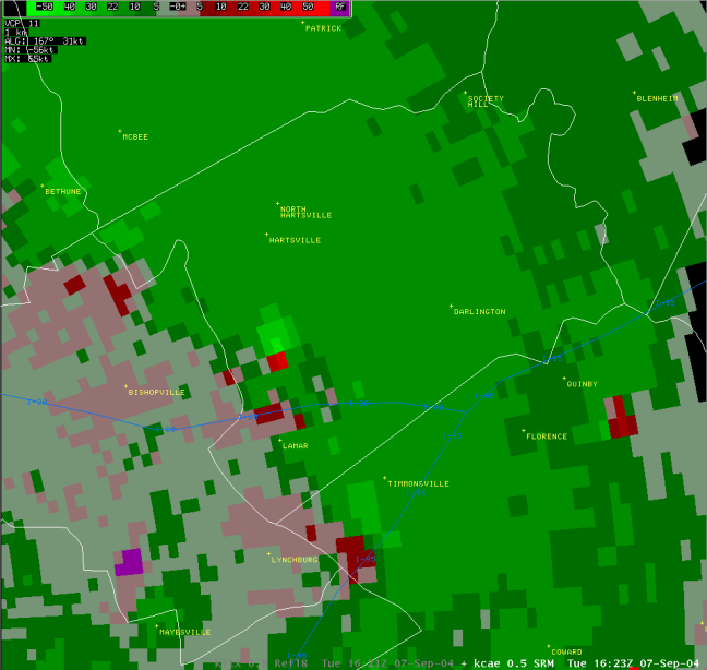
Storm Relative Velocity (Columbia, SC Radar) |
|
| |
| Storm Damage |
|
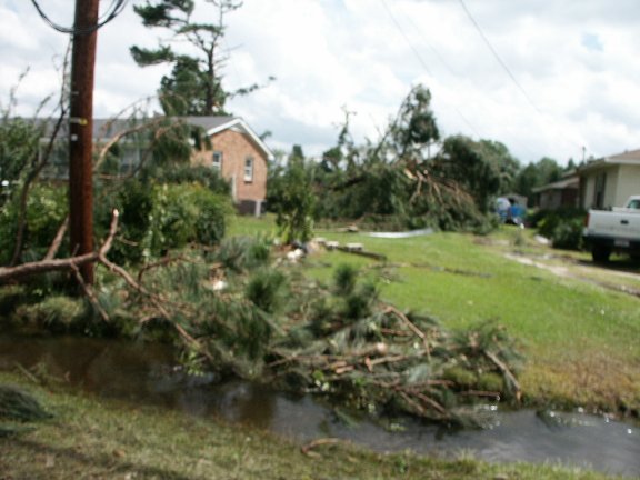
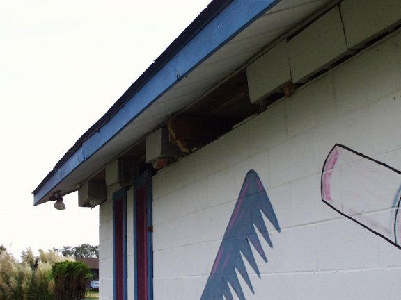
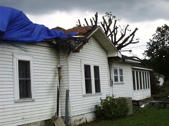
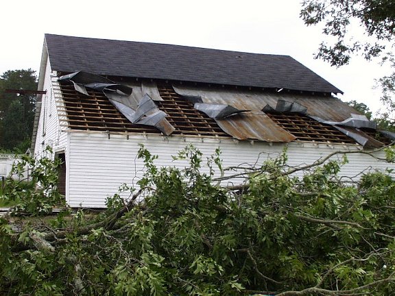
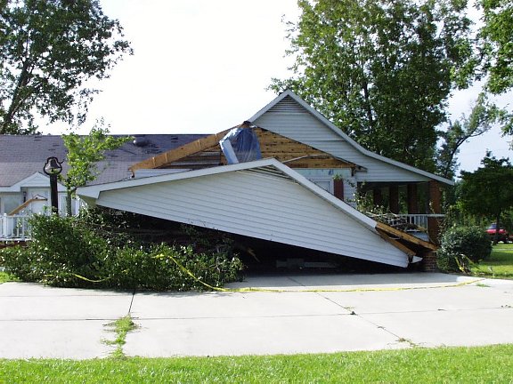
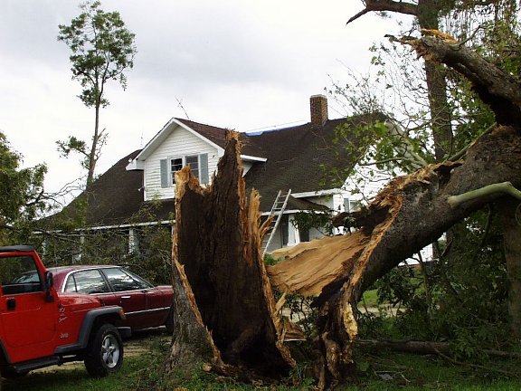
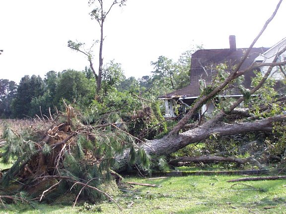
Damage was mainly in the form of several snapped trees, a few of which fell onto homes and damaged roofs. Damage was most extensive along Willis Drive, approximately 1.6 miles west of US 15 on 151. The tornado lifted and crossed 151 and the Carolina Pines Regional Medical Center, then touched down briefly in the neighborhood northwest of the medical center and snapped a few additional pine trees. Damage was rated F0.
|
|
| |
|
Storm Damage Pictures (click to enlarge)
|
 |
 |
|
| |
|
|
|
| |
|
|
|
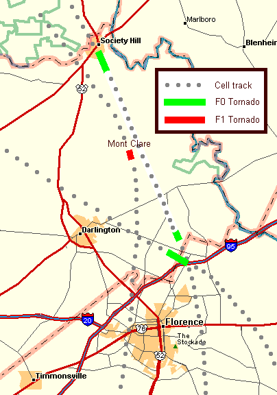
Darlington County Tornado
|
|
Time of Tornado: 1:10 pm EDT
|
|
|
| |
| Storm Information |
|
At 1:10 pm, a tornado began in Darlington County 1.0 mile S of Society Hill and ended 0.3 miles SW of Society Hill. The total path length was 0.7 miles and total path width was 50 yards.
|
|
| |
|
|
| |
| Storm Damage |
|
The tornado snapped several trees along its path. Some tree limbs caused damage to the roof of a home on Church Street. Damage was rated as F0.
|
|
| |
|
Storm Damage Pictures (click to enlarge)
|
|
-Not available
|
|
| |
|
|
| |
|
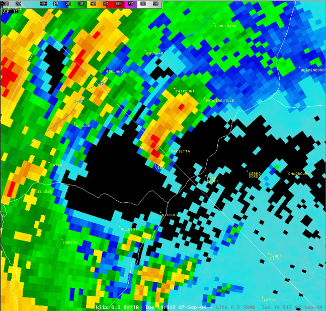
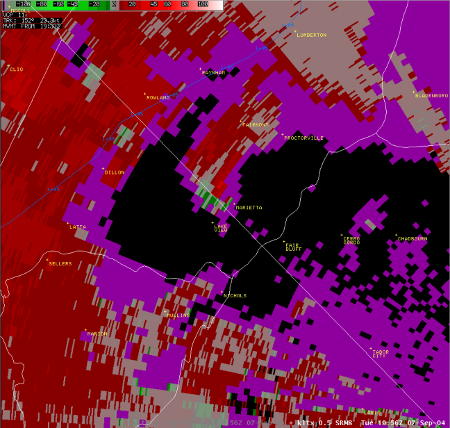
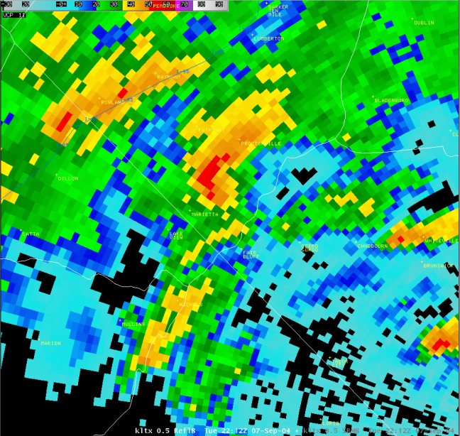
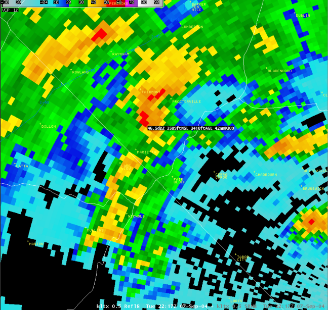
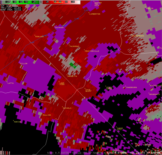
Columbus and Robeson County Tornado
|
|
Time of Tornado: 1:38 pm to 2:05 pm EDT
|
|
|
| |
| Storm Information |
|
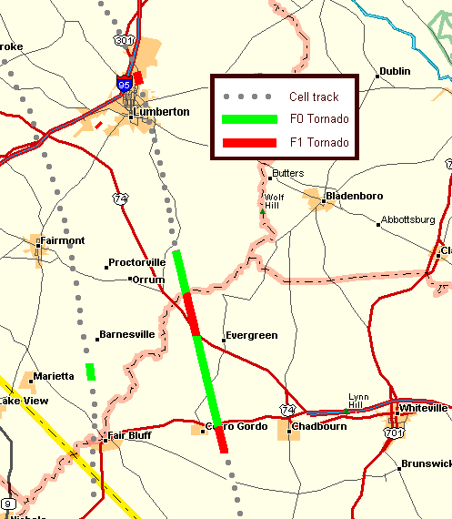
At 1:38 pm, a tornado began in Columbus County 2.8 miles ESE of Cerro Gordo. The tornado continued 10 miles across Columbus County and reached Boardman at 2:05 pm. The tornado then entered Robeson County 4.3 miles ESE of Orrum, and continued 2.9 miles before ending 2.6 miles NE of Orrum. The total path length was 12.9 miles and the total path width was 40 yards.
|
|
| |
|
|
| |
| Storm Damage |
|
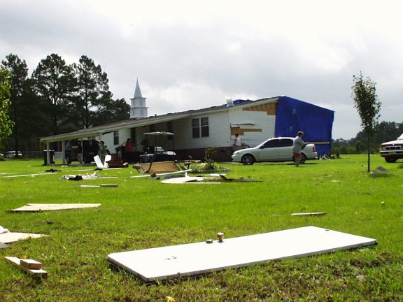
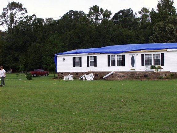
Spotty damage occurred along the path of the tornado. F1 Damage occurred on Joe Piver Road, one house was destroyed and another had roof damage. F1 damage occurred on Dolph Lewis Road, six large oak trees and one pecan tree were downed (some over 200 years old), and two chimneys were blown off the roof of a house. F1 damage occurred on Andrew Jackson Highway SW, one house was destroyed, and there was roof damage and a shed destroyed at a nearby church. F0 damage peeled up and was tossed, an unsecured shed shifted one foot off its foundation, and peach trees were knocked down. F1 damage occurred on Old 74 (West of Evergreen), a roof lifted/shifted and block walls cracked at a beauty salon. F1 damage occurred on Old Boardman Road (in Boardman), the front porch of a house was destroyed, with wood projectiles thrown 70 to 80 yards. F0 damage occurred on SR 72E, a large tree was uprooted and down across the roadway.
|
|
| |
|
|
| |
|
|
|
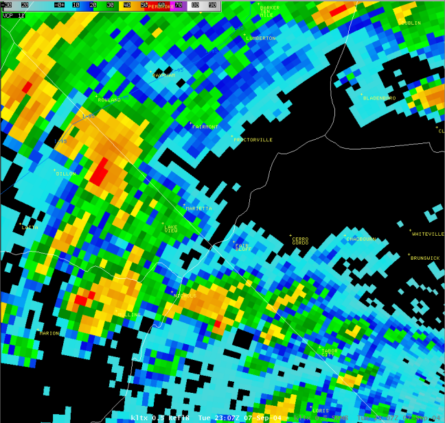
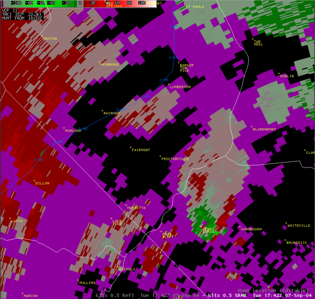
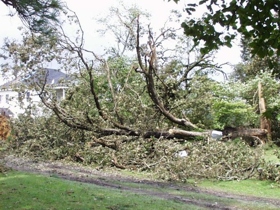
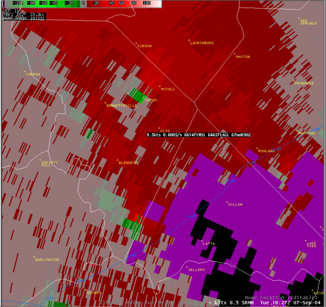
Marlboro County Tornado
|
|
Time of Tornado: 2:05 pm EDT
|
|
|
| |
| Storm Information |
|
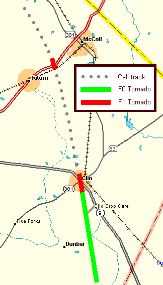
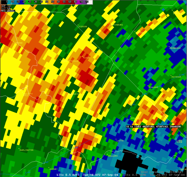
At 2:05 pm, a tornado began in Marlboro County 4.5 miles SSE of Clio and ended at Clio at 2:12 pm. The total path length was 5.0 miles and the total path width was 100 yards.
|
|
| |
|
Radar Imagery (click to enlarge)
|
Base Reflectivity |

Storm Relative Velocity |
|
| |
| Storm Damage |
|
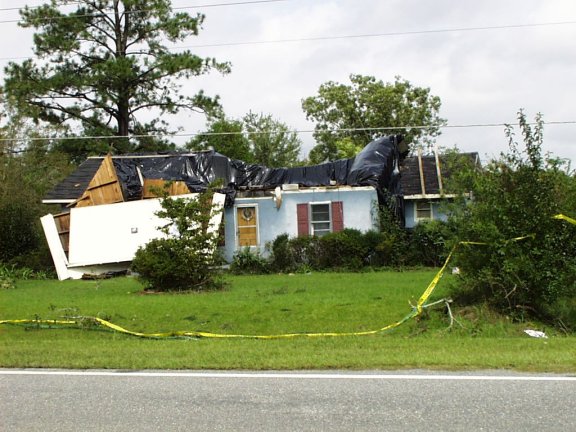
The tornado snapped a few trees on the south side of Hebron Dunbar Road. It moved north through rural areas snapping numerous trees en route to Clio. Around 2:10 pm the storm crossed the center of Clio at the intersection of SR 9 and SR 381, and this was where the most extensive damage occurred. Several dozen trees were either snapped off or uprooted. The largest downed trees were up to three feet in diameter. Most of the damage to structures appeared to be the result of falling trees. Damage was primarily F0 along the path leading to Clio, then the tornado intensified to a weak F1 when it reached town.
|
|
| |
|
Storm Damage Pictures (click to enlarge)
|
| -Not available |
|
| |
|
|
| |
|
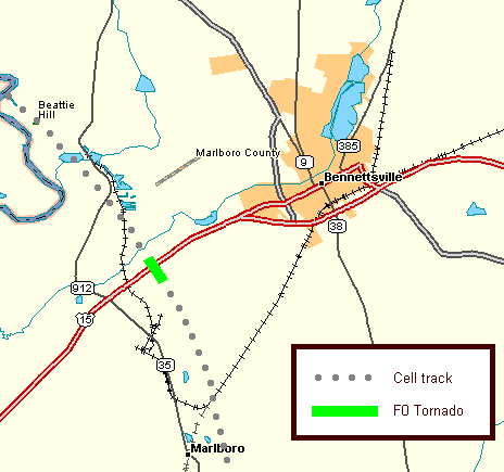
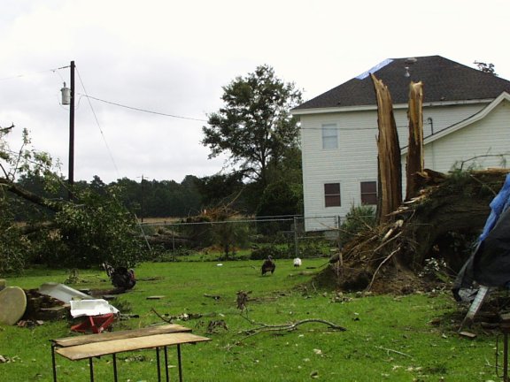
Marlboro County Tornado
|
|
Time of Tornado: 2:27 pm EDT
|
|
|
| |
| Storm Information |
|
This funnel descended from the same storm that produced the Clio tornado. At 2:27 pm, a tornado began in Marlboro County 1.5 miles SW of McColl and ended 1.5 miles SW of McColl. The total path length was 0.3 miles and the total path width was 25 yards.
|
|
| |
|
Radar Imagery (click to enlarge)
|

Base Reflectivity |

Storm Relative Velocity |
|
| |
| Storm Damage |
|
The funnel descended just south of US Route 15 along SR 35-338 and snapped limbs from a few trees. It then crossed US 15 and demolished a mobile home that was strapped down. The tornado lifted almost immediately after hitting the mobile home. Damage was rated as F1.
|
|
| |
|
|
| |
|
|
|
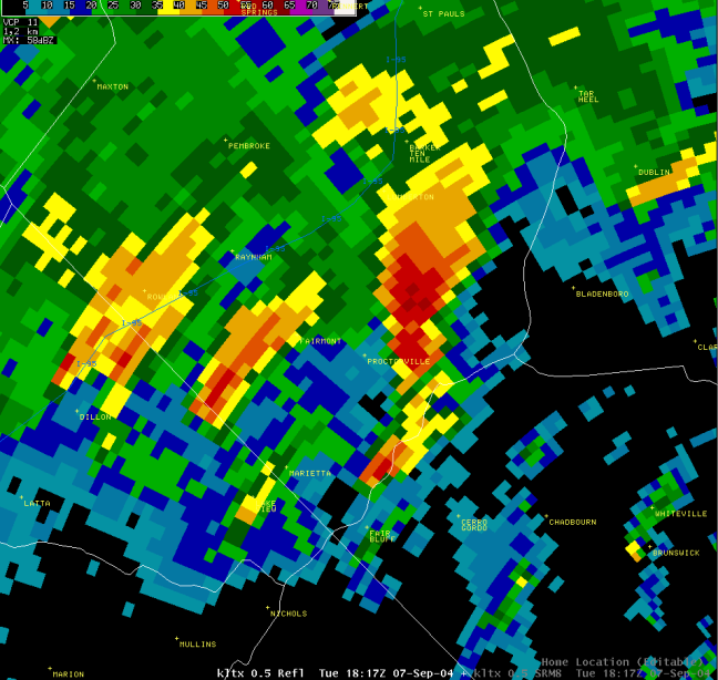
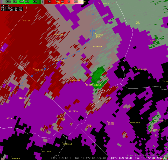
Robeson County Tornado
|
|
Time of Tornado: 2:47 pm EDT
|
|
|
| |
| Storm Information |
|
At 2:47 pm, a tornado briefly touched down in Robeson County at Lumberton. The total path length was 0.1 mile and the total path width was 10 yards.
|
|
| |
|
Radar Imagery (click to enlarge)
|

Base Reflectivity |

Storm Relative Velocity |
|
| |
| Storm Damage |
|
F0 Tornado. Brief tornado touchdown witnessed by law enforcement and fire department, no damage reported.
|
|
| |
|
Storm Damage Pictures (click to enlarge)
|
|
-Not available
|
|
| |
|
|
|
Darlington County Tornado
|
|
Time of Tornado: 3:11 pm EDT
|
|
|
| |
| Storm Information |
|
At 3:11 pm, a tornado began in Darlington County 7.1 miles NNE of Darlington and ended 7.2 miles NNE of Darlington, near Mont Clare. The total path length was 0.1 miles and the total path width was 30 yards.
|
|
| |
|
Radar Imagery (click to enlarge)
|
Base Reflectivity |
Storm Relative Velocity) |
|
| |
| Storm Damage |
|
Damage occurred to several trees and a mobile home on Flat Creek Road. The emergency managers office estimated $8K worth of damage. The tornado damage was rated as F1.
|
|
| |
|
Storm Damage Pictures (click to enlarge)
|
|
-Not Available
|
|
| |
|
|
|
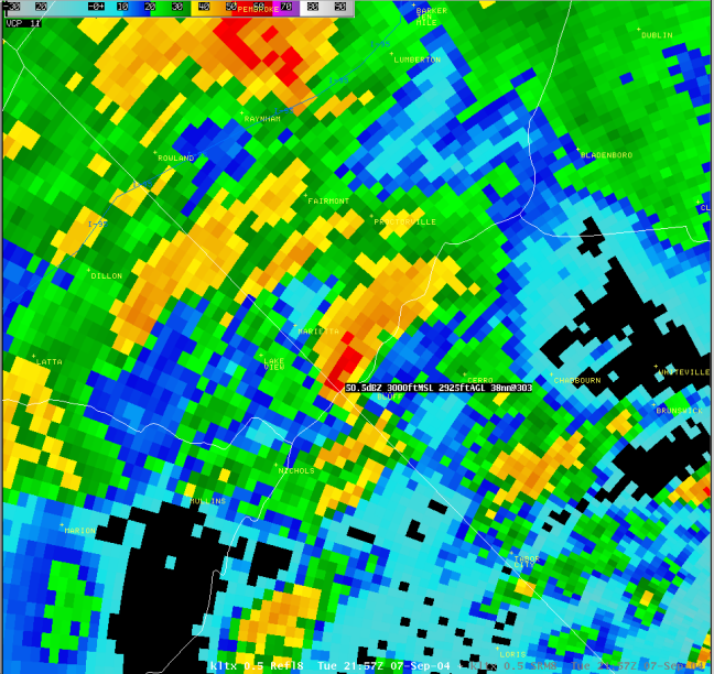
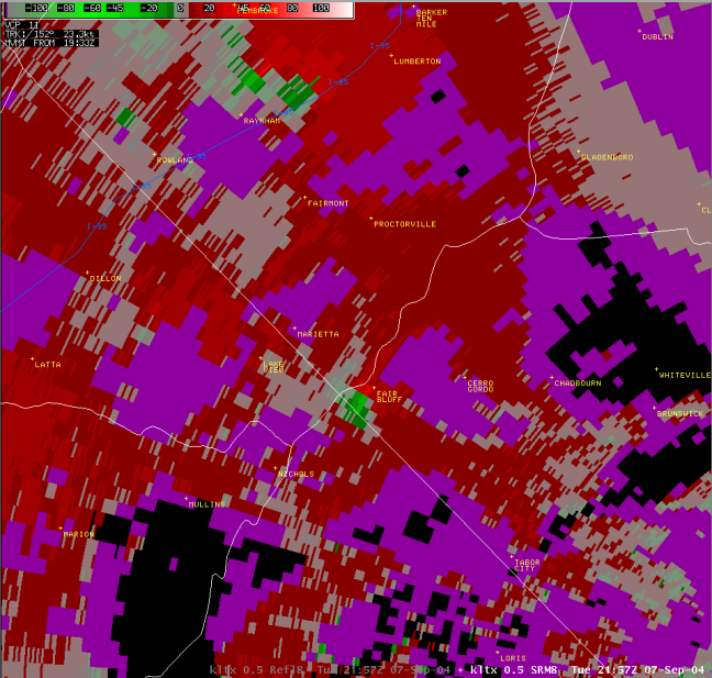
Robeson County Tornado
|
|
Time of Tornado: 3:53 pm EDT
|
|
|
| |
| Storm Information |
|
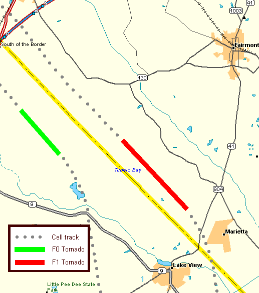
At 3:53 pm, a tornado began in Robeson County 2.3 miles NW of Marietta and ended 6.5 miles NW of Marietta at 3:58 pm. The total path length was 4.2 miles and the total path width was 40 yards.
|
|
| |
|
|
| |
| Storm Damage |
|
Spotty damage occurred along the path of the tornado. F1 damage occurred on Oakdale Church Road, three houses were damaged, one had a carport destroyed and tree damage, one had trees down on the house, and another had tree and roof damage. F1 damage occurred on White Pond Road, one house had damage to a porch and a tin shed destroyed, and there was also tree damage.
|
|
| |
|
|
| |
|
|
|
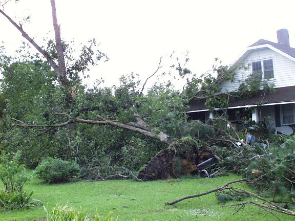
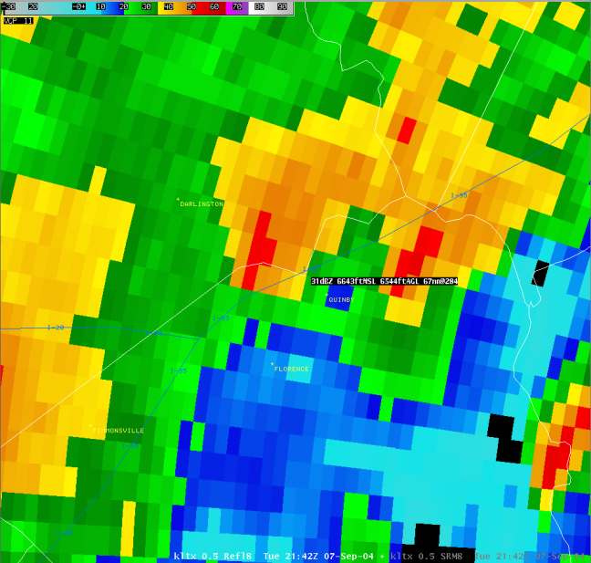
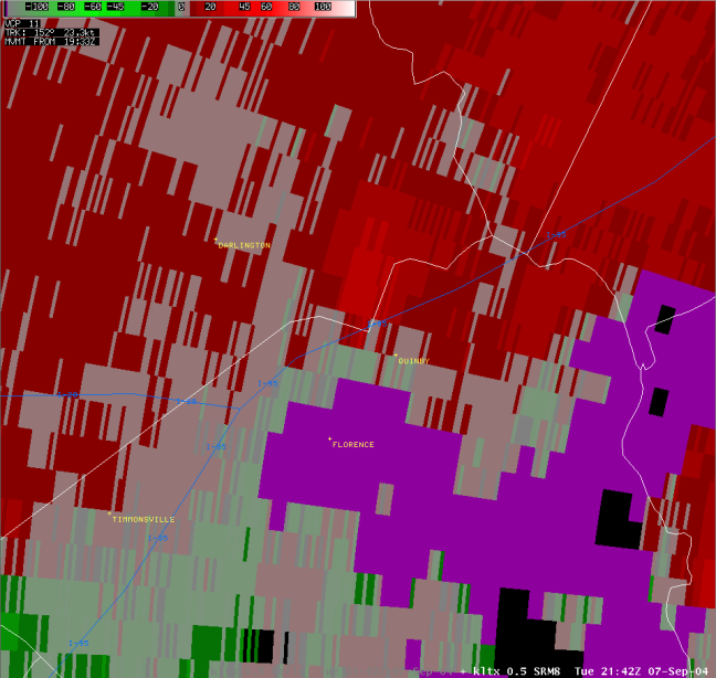
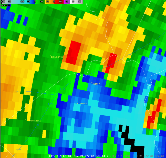
Florence and Darlington County Tornado
|
|
Time of Tornado: 5:45 pm to 5:47 pm EDT
|
|
|
| |
| Storm Information |
|
At 5:45 pm, a tornado began in Florence County 2.6 miles N of Quinby. The tornado continued 0.4 miles across Florence County and reached 3.0 miles N of Quinby before exiting the county. The tornado then entered Darlington County 7.9 miles ESE of Darlington, and continued 0.6 miles before ending 7.5 miles ESE of Darlington at 5:47 pm. The total path length was 1.0 mile and the total path width was 30 yards.
|
|
| |
|
|
| |
| Storm Damage |
|
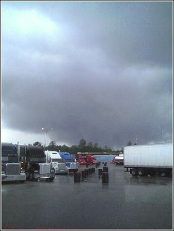
The tornado caused damage to a billboard and several trees adjacent to the parking lot of the Petro Truck Stop. It then moved across the county line into Darlington County snapping numerous trees in a rural area. Damage was rated as F0.
|
|
| |
|
Storm Damage Pictures (click to enlarge)
|
 |
 |
|
| |
|
|
|
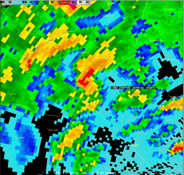
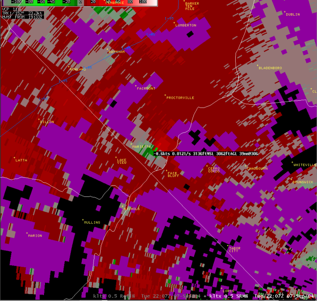
Robeson County Tornado
|
|
Time of Tornado: 6:10 pm to 6:16 pm EDT
|
|
|
| |
| Storm Information |
|
At 6:10 pm, a tornado began in Robeson County 3.8 miles ENE of Marietta and ended 2.9 miles NE of Marietta at 6:16 pm. The total path length was 1.6 miles and the total path width was 40 yards.
|
|
| |
|
|
| |
| Storm Damage |
|
Spotty damage occurred along the path of the tornado. F0 damage occurred on Fair Bluff Road, a tin shed was destroyed and many tree limbs were down. F0 damage occurred on Tobacco Raod, tree damage.
|
|
| |
|
Storm Damage Pictures (click to enlarge)
|
| |
 |
|
|
| |
|
|
|
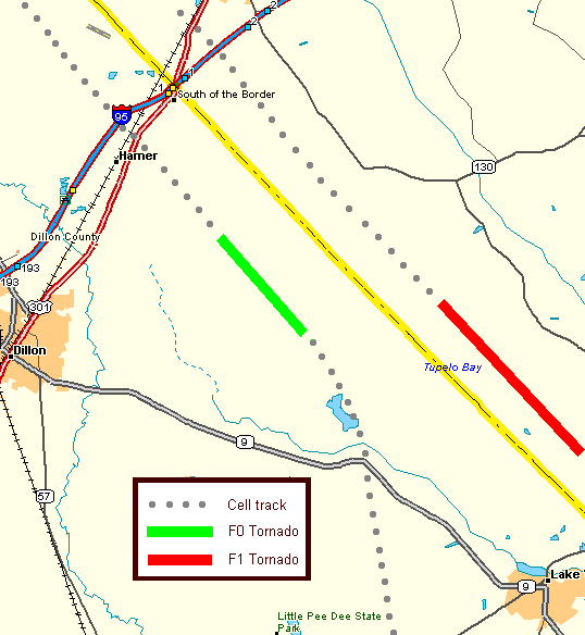
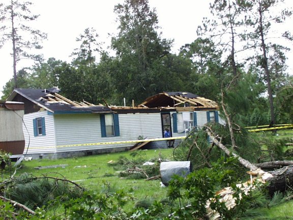
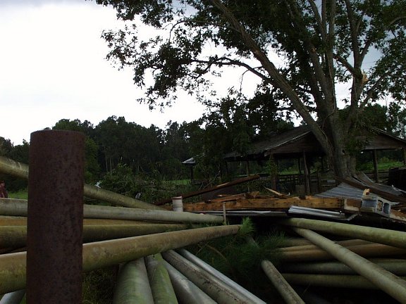
Dillon County Tornado
|
|
Time of Tornado: 7:11 pm EDT
|
|
|
| |
| Storm Information |
|
At 7:11 pm, a tornado began 6.9 miles E of Dillon and ended 6.5 miles ENE of Dillon. The total path length was 1.3 miles and the total path width was 30 yards.
|
|
| |
|
Radar Imagery (click to enlarge)
|
Base Reflectivity |

Storm Relative Velocity |
|
| |
| Storm Damage |
|
The tornado caused considerable damage to a brick house, flattened an old barn and removed part of the roof on a shed along Arnette Road. It also snapped a few trees which produced roof damage to a home near Avalon Academy on Pleasant Hill Road. Damage was rated as F1.
|
|
| |
|
Storm Damage Pictures (click to enlarge)
|
|

|
|
| |
|
|
|
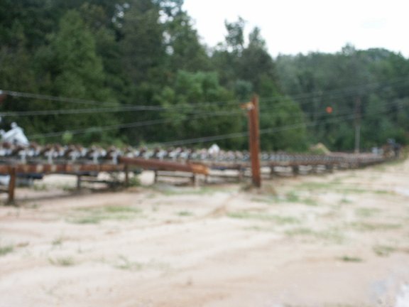
Marlboro County Tornado
|
|
Time of Tornado: 9:05 pm EDT
|
|
|
| |
| Storm Information |
|
At 9:05 pm, a tornado began in Marlboro County 4.1 miles SW of Bennettsville and ended 4.1 miles WSW of Bennettsville. The total path lenght was 0.5 miles and the total path width was 25 yards.
|
|
| |
|
Radar Imagery (click to enlarge)
|
|
-Not Available
|
|
| |
| Storm Damage |
|
Damage occurred to the Hanson Sand and Gravel Mining Property along the south side of Highway 15-401. One steel conveyor belt track was twisted. Several trees were snapped as the tornado approached 15-401. The front porch roof of a church was lifted off as the tornado crossed the highway. A few more trees and a power pole were snapped on the Hanson property on the north side of 15-401. Damage was rated F0.
|
|
| |
|
Storm Damage Pictures (click to enlarge)
|
| |
 |
|
|
| |
|
|
| |


 Coastal Flood
  Follow us on YouTube