|
Derecho During the early afternoon hours of Friday, June 29th, thunderstorms developed near Chicago and quickly intensified as they moved into northern Indiana. Producing a wind gust to 91 MPH in Fort Wayne, Indiana, the storms matured into a derecho as they entered the NWS Wilmington OH forecast area. Over the next few hours, the derecho produced widespread significant wind damage across the majority of NWS Wilmington's forecast area, with measured wind gusts over 80 MPH in a few locations. The derecho moved quickly across the area (which is typical and helps to push the high winds out ahead of the system), entering the northwest corner of the area around 3:15 PM and exiting the southeast by 7:00 PM, with an average forward speed in excess of 60 MPH. During the event, NWS Wilmington OH issued 19 Severe Thunderstorm Warnings. What is a Derecho? Derecho (pronounced "deh-REY-cho") is a Spanish word that means "straight." In meteorology, the term is used to describe a long-lived, violent straight-line convective wind storm. A derecho usually takes the form of a squall line or large bow echo, travelling hundreds of miles. Derechos produce widespread wind gusts to severe criteria (50 knots or 58 MPH), and wind gusts to 80 MPH (even 100 MPH in rare cases) are possible. Derechos are not very common, as many atmospheric conditions have to come together perfectly for one to form. The extreme winds caused by derechos are sometimes mistaken for tornadoes due to their violent and turbulent nature, the appearance of swirling wind vortices sometimes observed along the leading edge of the gust front, and the significant amount of damage they cause. Learn more about derechos from the Storm Prediction Center |
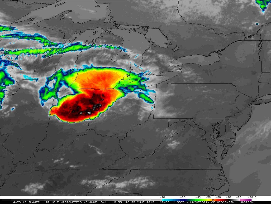 Infrared satellite loop, courtesy of
CIMSS (click for animation) |
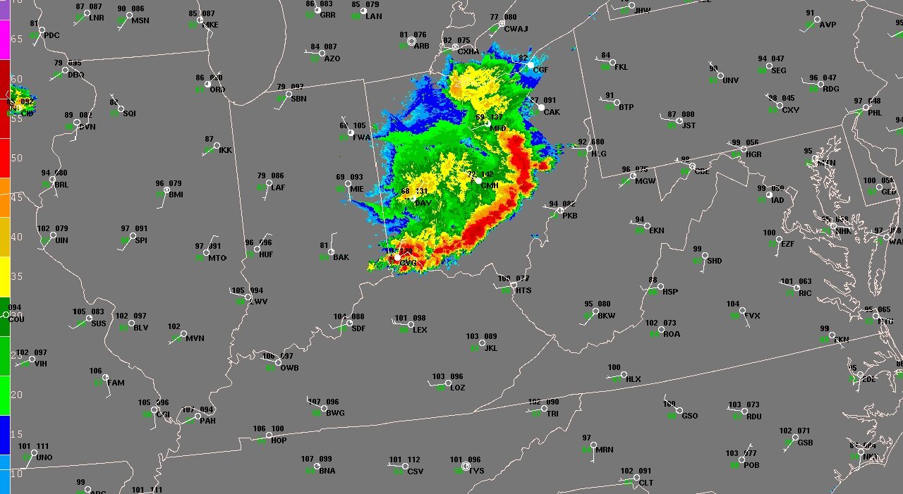 Regional radar loop, courtesy of SPC
(click for animation) |
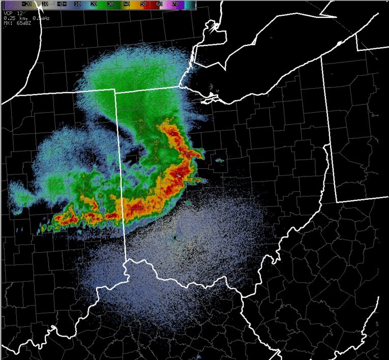 Local reflectivity loop from KILN radar
(click for animation) |
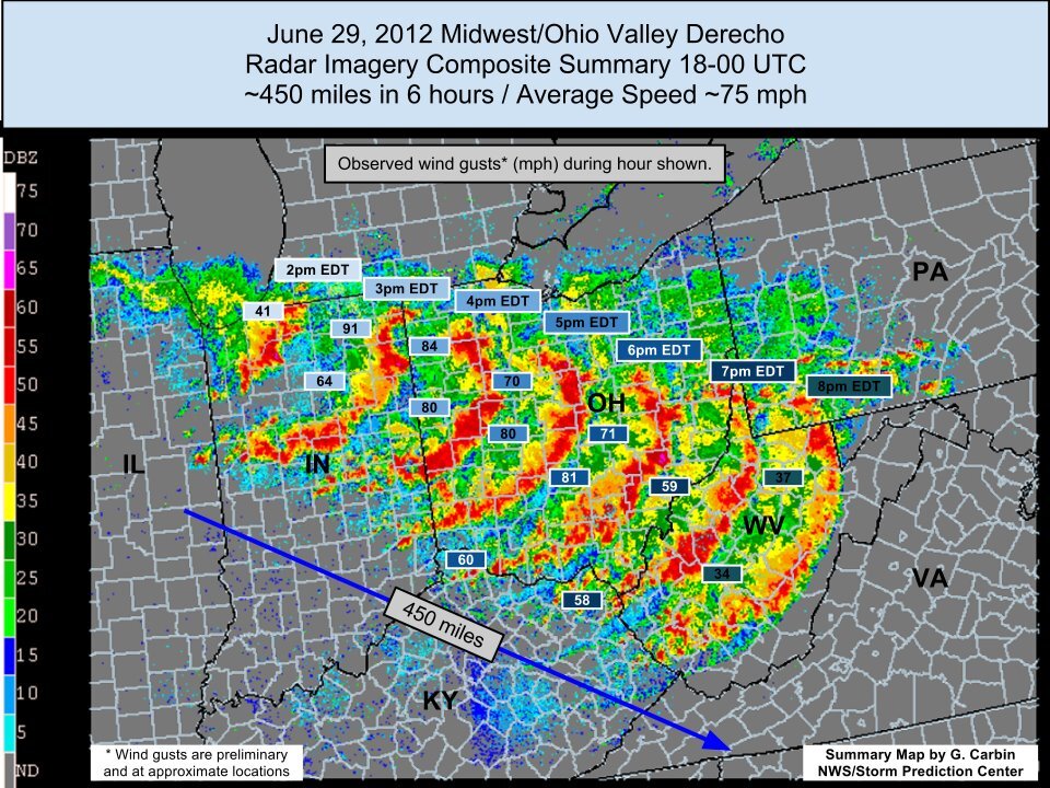 Derecho radar composite, courtesy
of SPC (click for large version) |
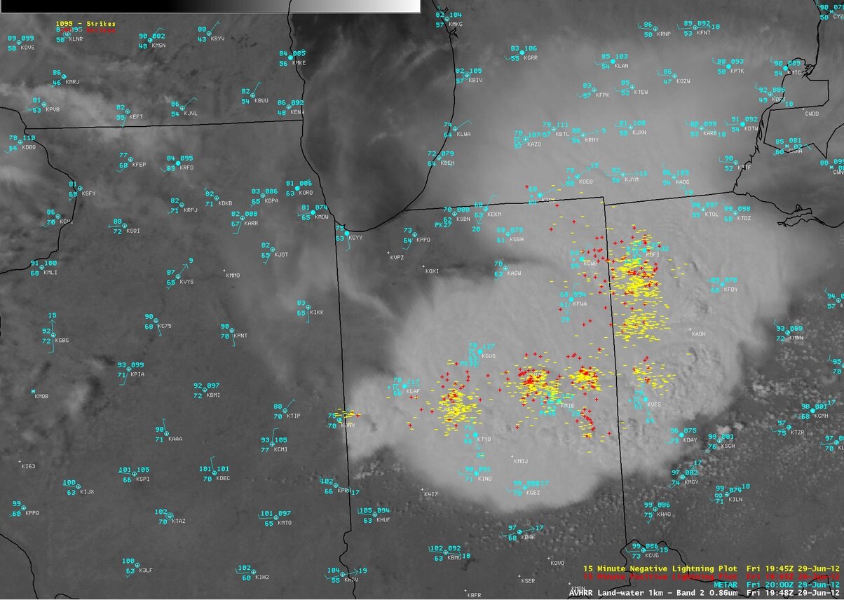 Satellite/lightning imagery, courtesy
of CIMSS (click for animation) |
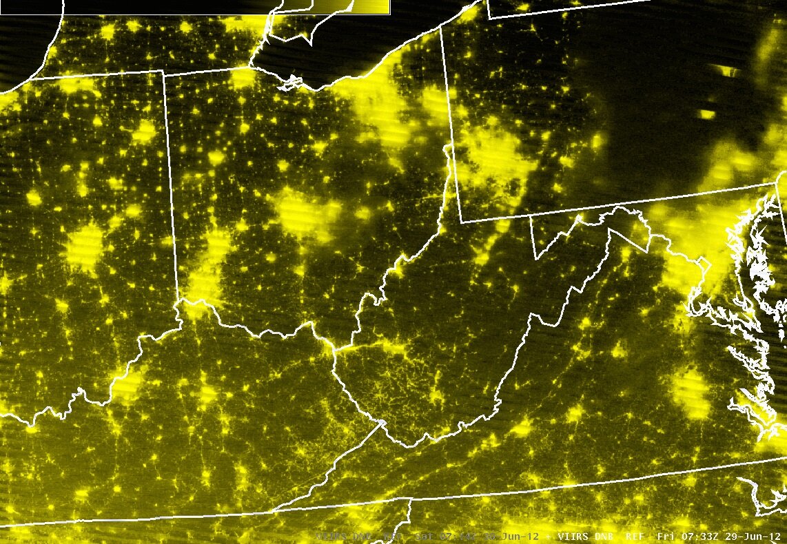 Power outages via satellite, courtesy
of CIMSS (click for animation) |
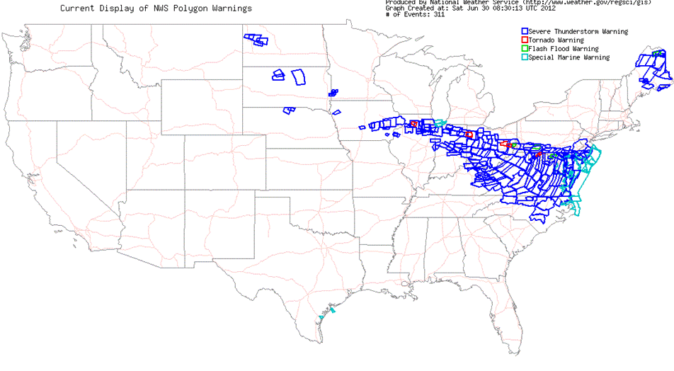 June 29, 2012 NWS warnings, courtesy
of NWS GIS (click for large version) |
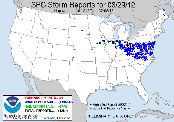 June 29, 2012 storm reports, courtesy
of SPC(click for large version) |


 Follow us on YouTube