|
Tornado northwest of Richmond, IN |
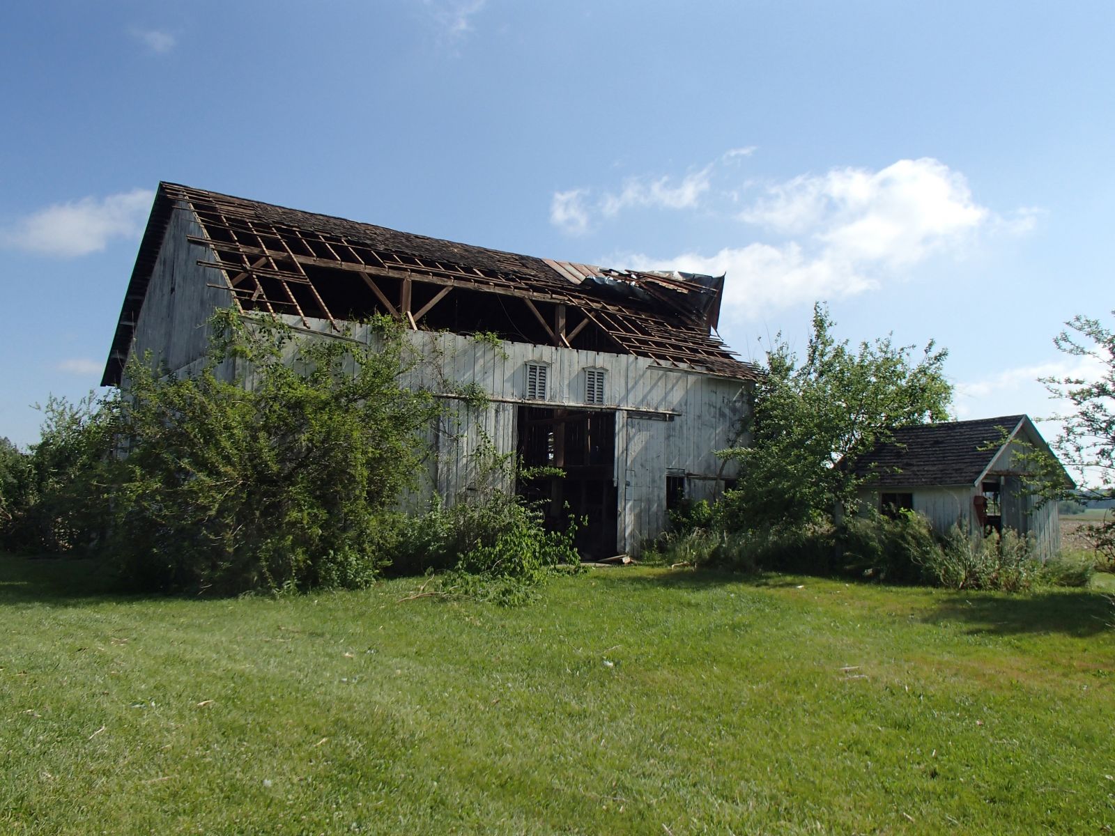
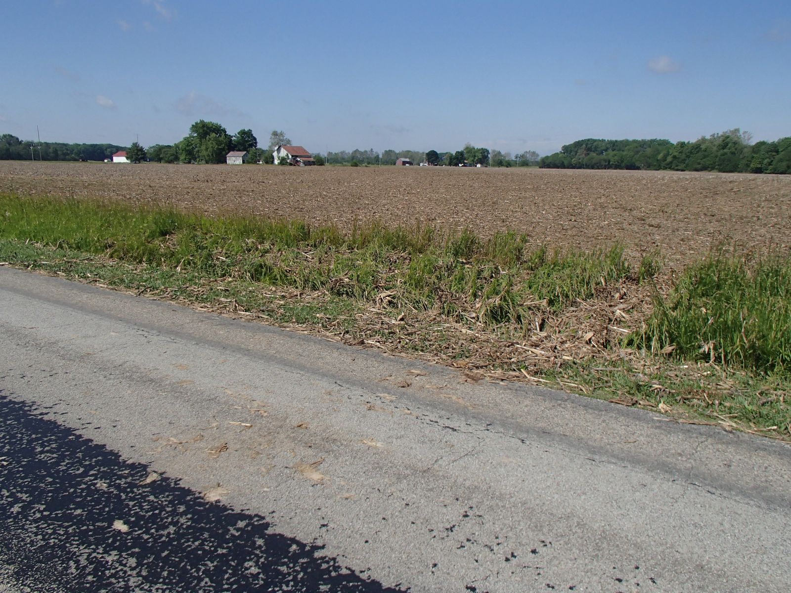
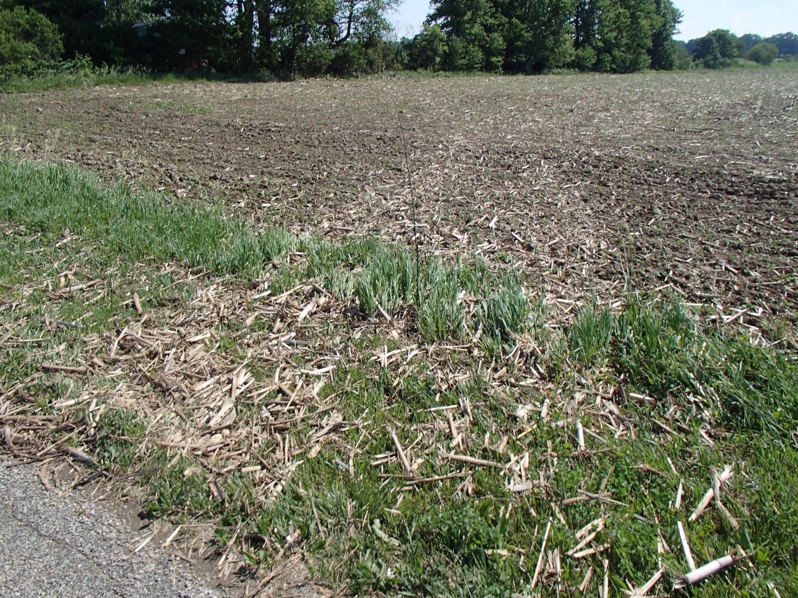
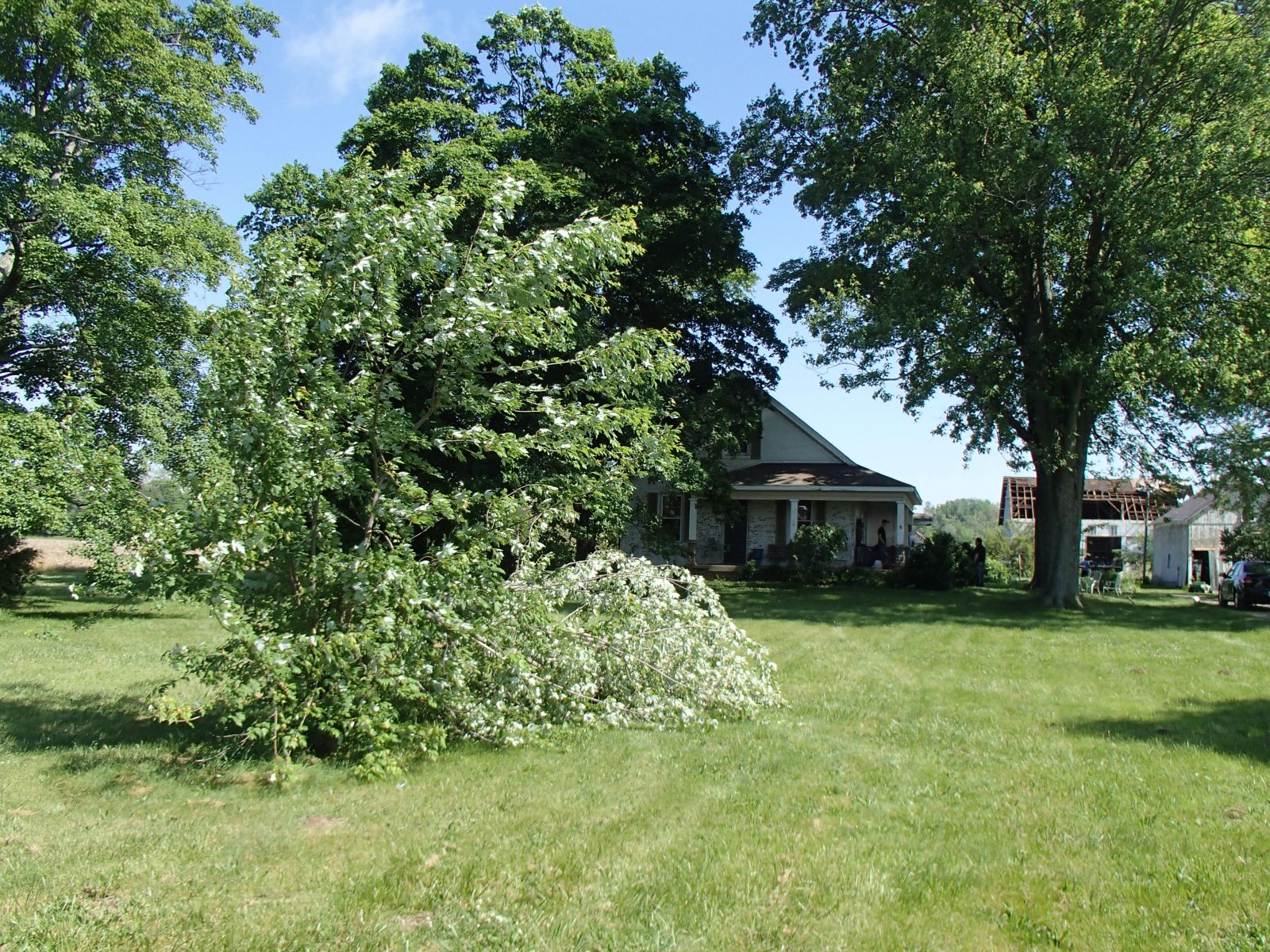
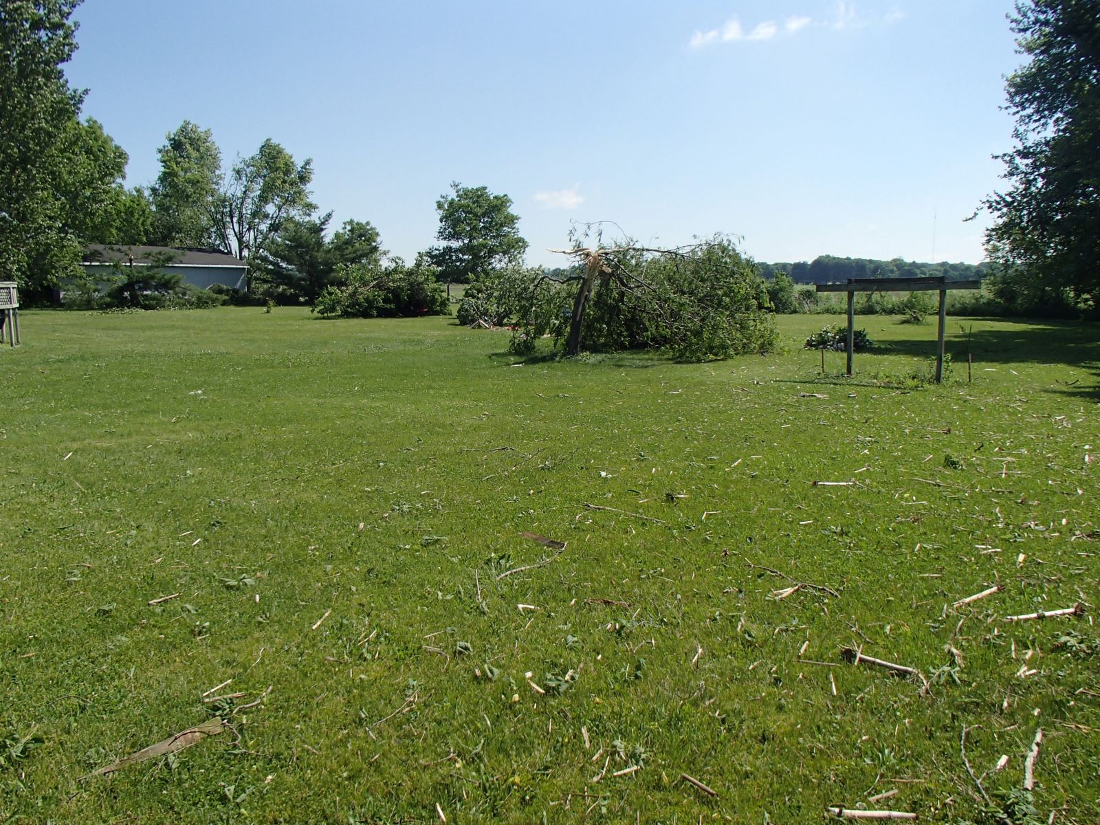
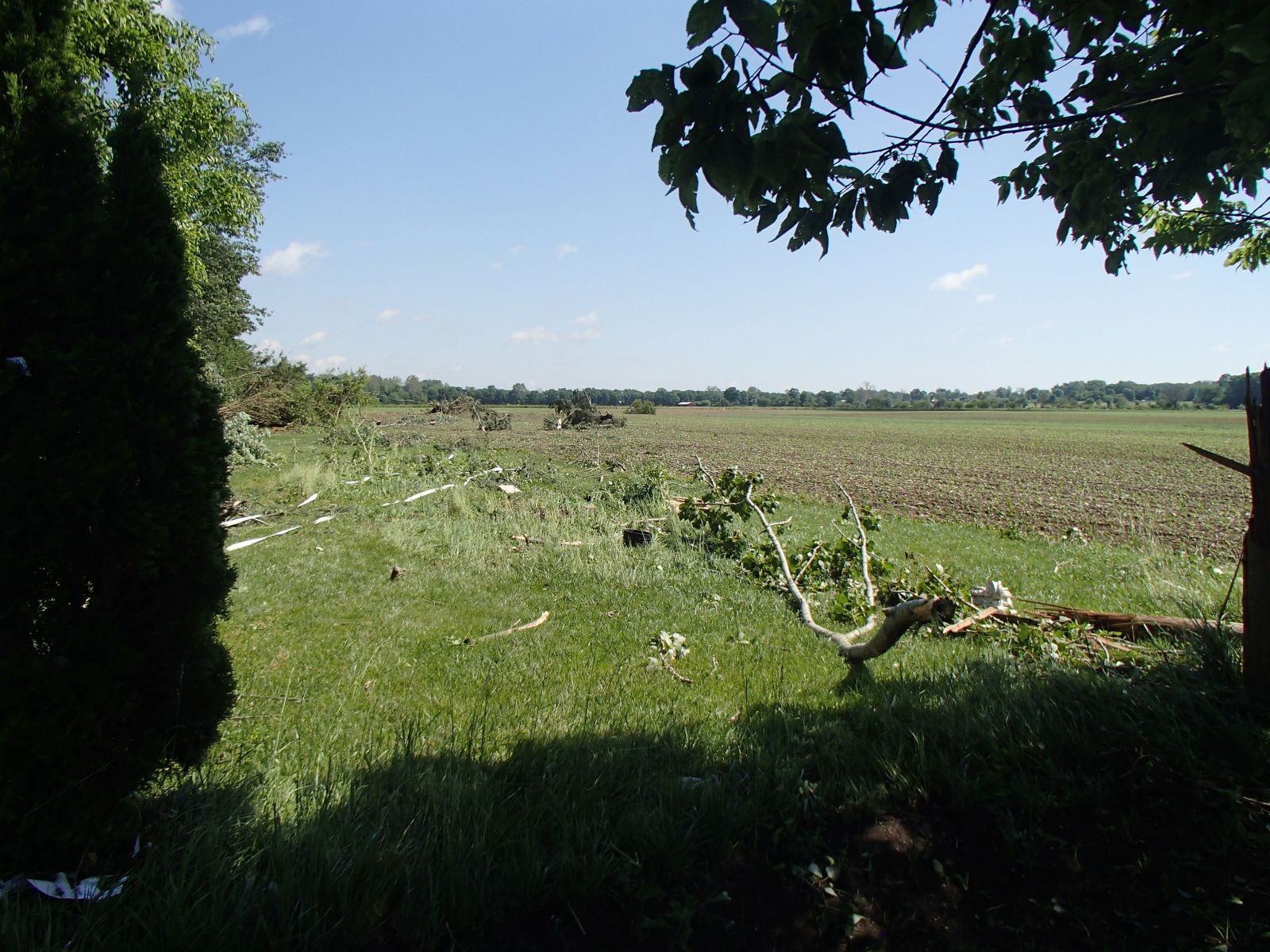
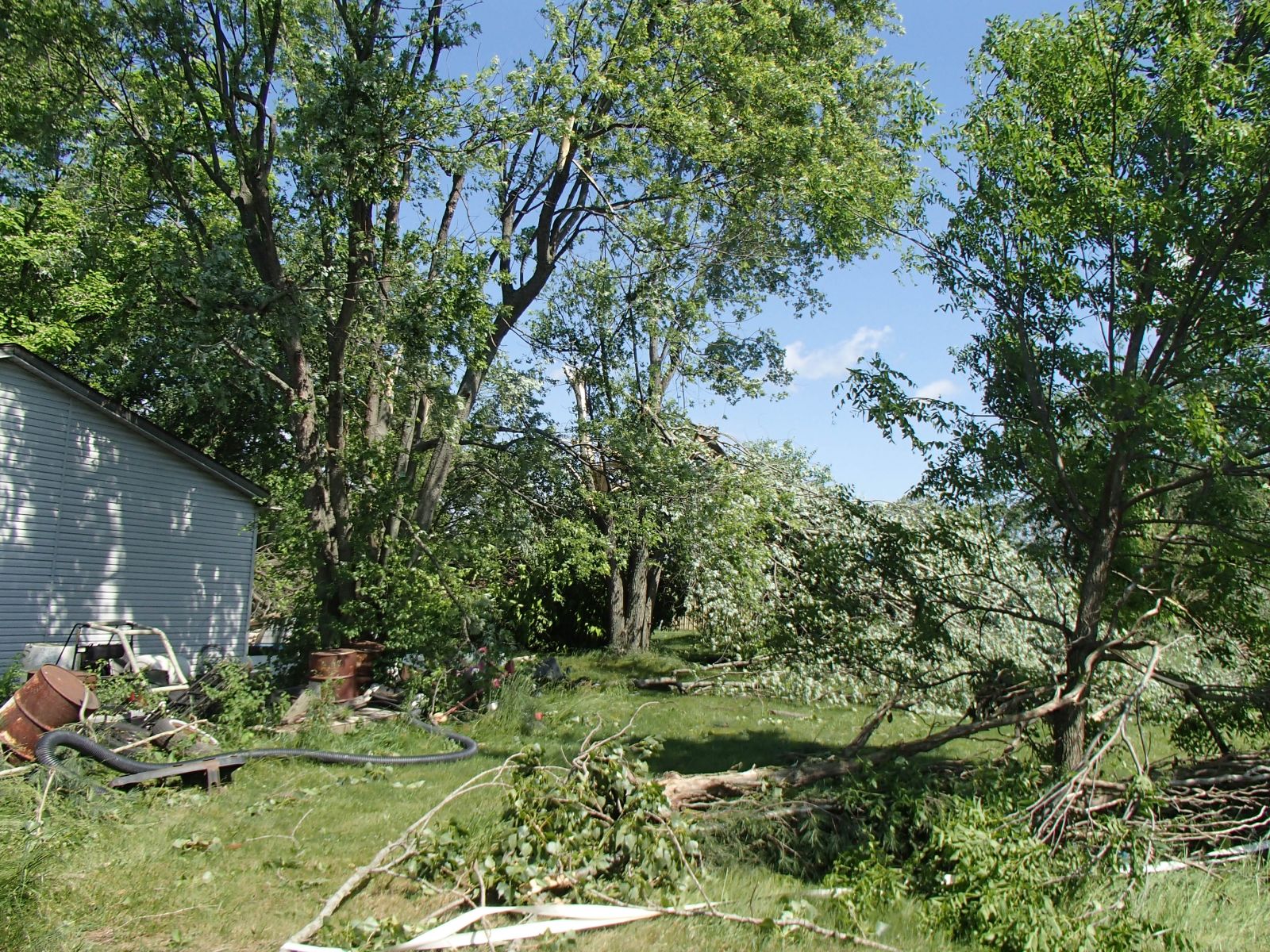
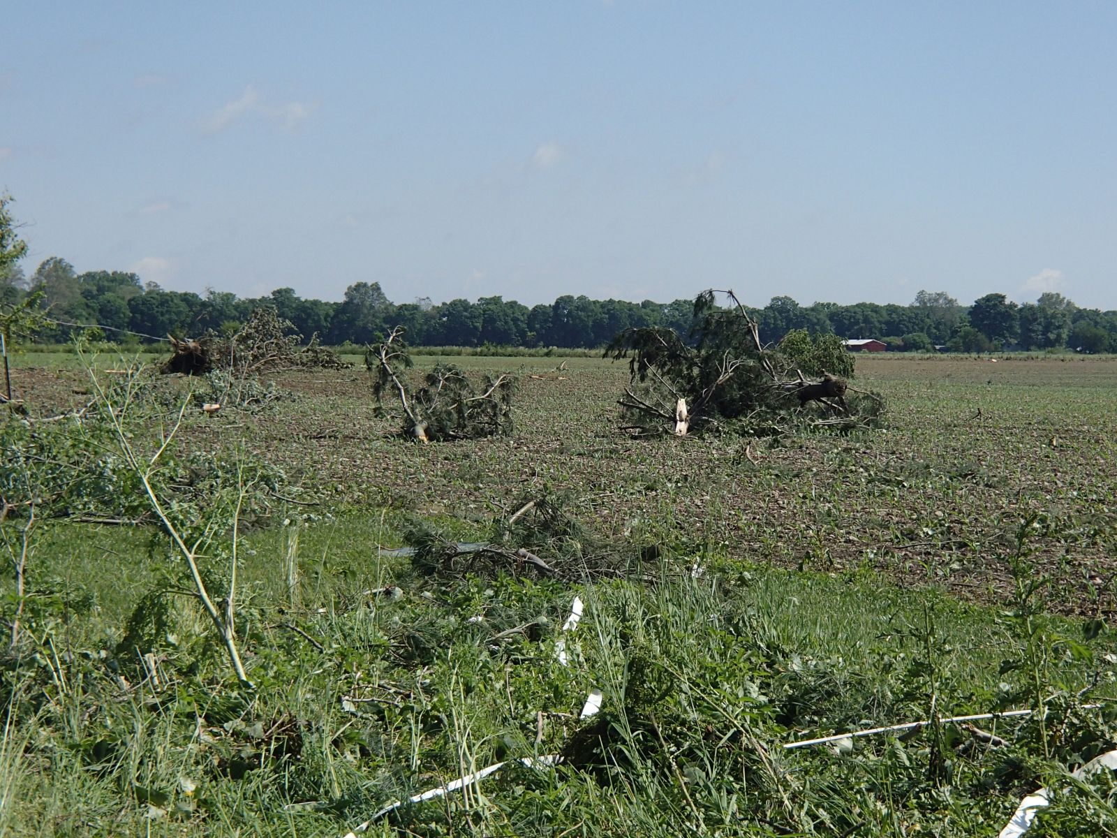
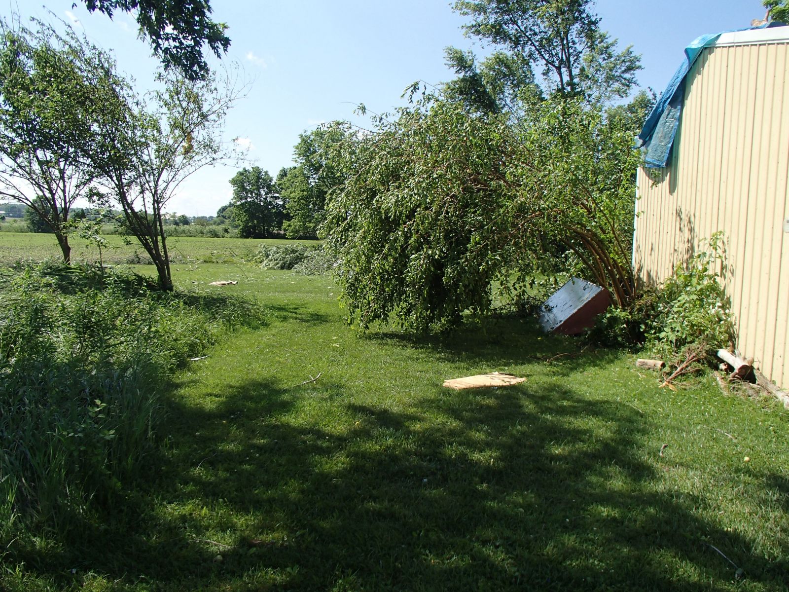
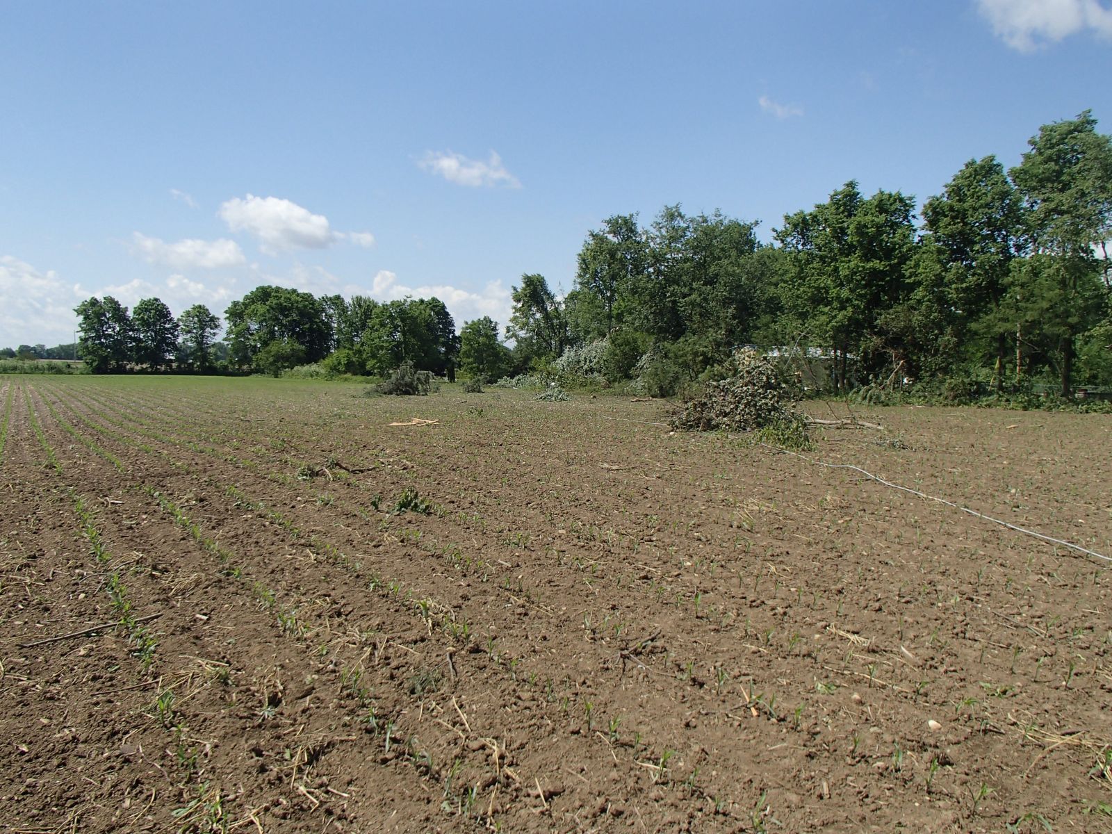
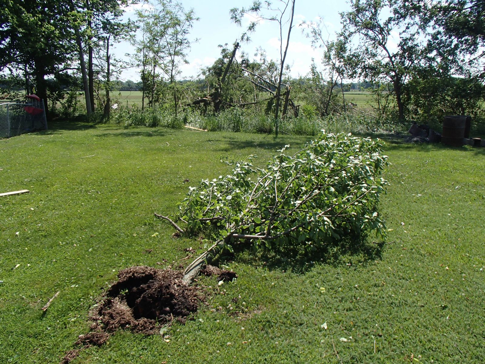
Public Information Statement...Updated National Weather Service Wilmington OH 802 PM EDT SUN JUN 5 2016 ...Additional Information for Tornado Confirmed Near Richmond in Wayne County Indiana... Location...5 Miles Northwest of Richmond in Wayne County Indiana Date...June 4 2016 Estimated Time...6:24 PM EDT Maximum EF-Scale Rating...EF0 Estimated Maximum Wind Speed...85 mph Maximum Path Width...150 yds Path Length...1.40 miles Beginning Lat/Lon...39.8822N / 84.9612W Ending Lat/Lon...39.8972N / 84.9433W * Fatalities...0 * Injuries...0 * The information in this statement is preliminary and subject to change pending final review of the event(s) and publication in NWS Storm Data. ...Summary... The National Weather Service in Wilmington OH has confirmed a tornado 5 miles northwest of Richmond in Wayne County Indiana on June 4 2016. The tornado appeared to first touch down along Indiana State Route 38 approximately 0.15 mile west of the intersection with Round Barn Road. A barn here sustained substantial damage when a section of its roof measuring approximately 45 feet by 20 feet was removed. The wood and metal material was briefly lifted then dropped immediately northeast of the structure. There were also several broken tree limbs and slate roofing material from a smaller barn strewn across this same property from southwest to northeast. All of the debris here was confined to a narrow path no more than 75 feet wide, with no divergent patterns noted. The tornado next moved across an open field before crossing Round Barn Road approximately 0.20 mile north of the intersection with Indiana State Route 38. The circulation oriented corn debris from the previous growing season in a parallel to slightly convergent pattern approximately 40 feet wide on both sides of Round Barn Road. This corridor was rather dramatic, with a quick transition to the unaffected field debris occurring over just a few feet along the edges of the path. Nearby residents related that a video posted to several media outlets showing the tornado was actually recorded looking south on Round Barn Road when the circulation crossed this location. The next area of damage occurred immediately east of Round Barn Road as the tornado tracked northeast toward Tingler Road. The circulation appeared to strengthen and widen at this point, with the greatest intensity and path width likely realized. At least 6 residences appeared to sustain some level of property damage here with many trees and limbs 10 to 14 inches in diameter broken, lifted and carried by the wind as much as 100 yards. There were also several locations in this damage area where debris was oriented at opposing angles to storm motion, as well as in semi-circular patterns. Additionally, grass and leaf spatter was observed on the east-facing wall of large shed near the open field. Mainly minor structural damage occurred to the homes in this area, with shingles and siding most affected. One small shed approximately 12 feet square was completely destroyed, though it did not appear to be firmly anchored to the ground. At least 3 residents in this area observed the tornado as it tracked through both their yards and the open field immediately to the east. They also described the rapid shift of wind direction counter- clockwise from the northeast through to the southwest as the circulation approached and passed by their location. One of these residents also related how they were literally pinned briefly against a door as the wind associated with the tornado passed through their home, knocking down a number of objects inside the home. The tornado continued northeast across an open field to a crossing with Tingler Road approximately 0.20 mile east of the intersection with Round Barn Road. Much like the field to the southwest of this location, plant material from the previous growing season was observed to be oriented in a parallel to slightly convergent pattern along the approximately 100 yard wide path. Debris from the Round Barn Road residences was also visible in random spots along this path. The tornado once again passed into an open field on the north side of Tingler Road. A large tree in this field approximately 0.4 mile north of Tingler Road was snapped, though its health was unclear as a close inspection wasn't possible due to limited access. The circulation continued on the ground to US Route 35 approximately one-half mile north of the intersection with Tingler Road. Several properties on both sides of the road sustained a number of broken tree limbs and minor structural damage to shingles and wooden fences. Broken tree branches appeared to be 6 inches in diameter or less. The tornado appeared to finally lift immediately east of US Route 35 and south of the town of Webster, where the last tree damage was visible. Thanks is extended to the Wayne County Indiana Emergency Management Agency, the Indiana Department of Homeland Security, and the affected homeowners for their assistance and eyewitness accounts during this survey. For reference...the Enhanced Fujita Scale classifies tornadoes into the following categories: EF0...wind speeds 65 to 85 mph. EF1...wind speeds 86 to 110 mph. EF2...wind speeds 111 to 135 mph. EF3...wind speeds 136 to 165 mph. EF4...wind speeds 166 to 200 mph. EF5...wind speeds greater than 200 mph. $$ Shobe2/Butner |
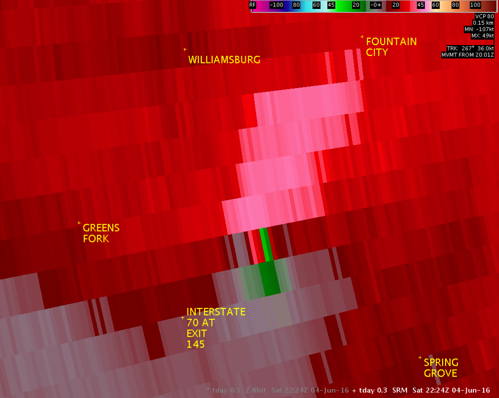
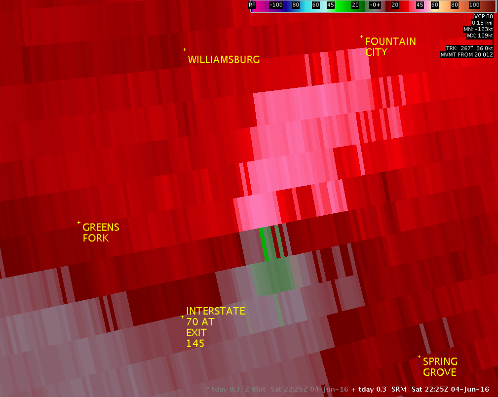
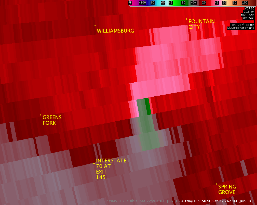
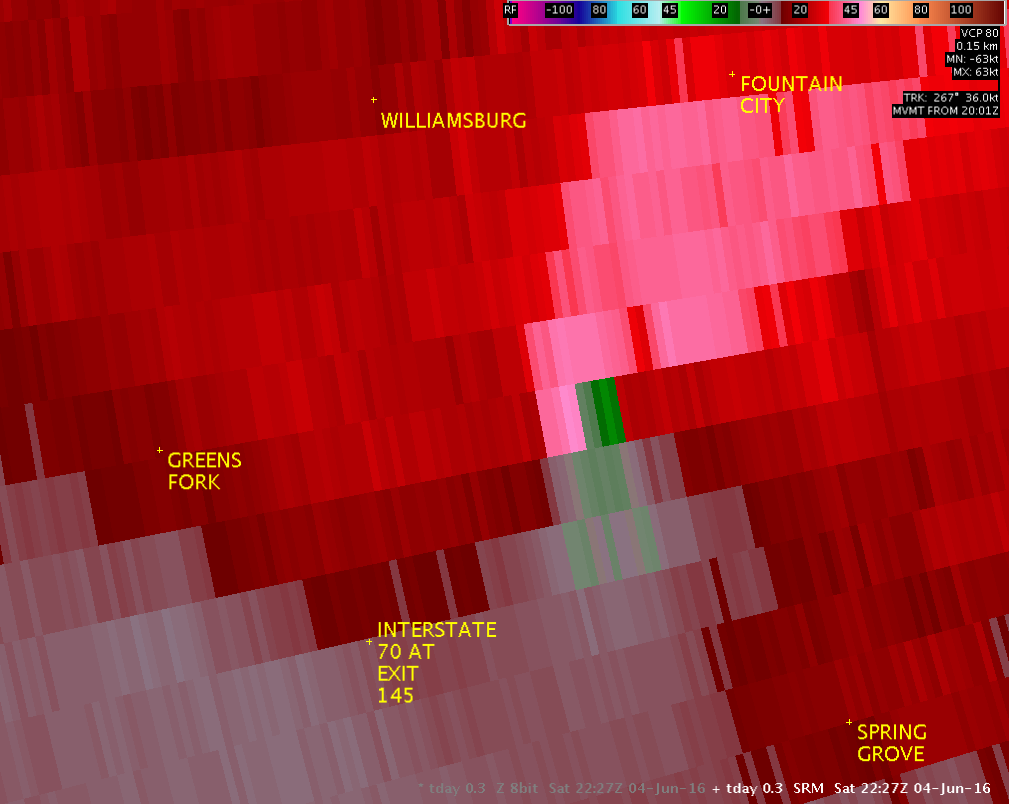
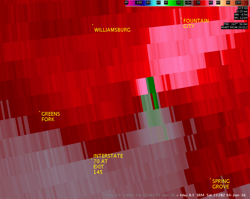
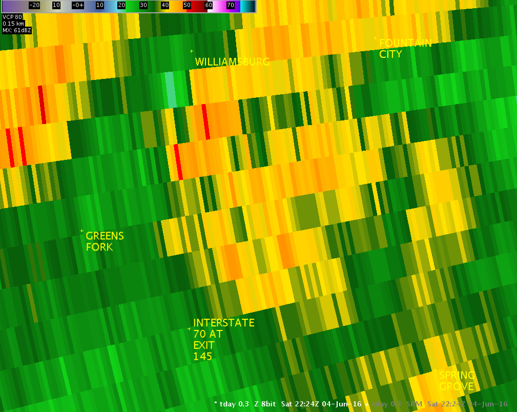
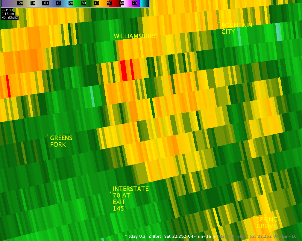
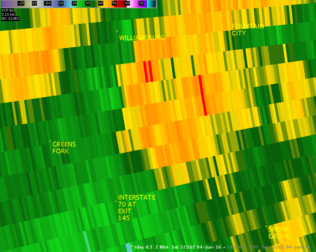
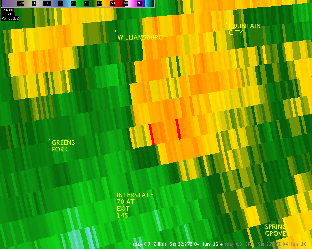
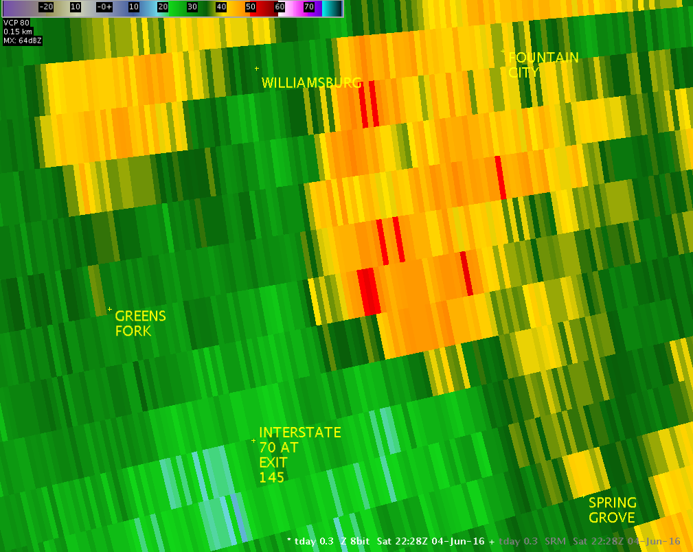
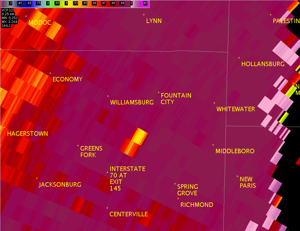
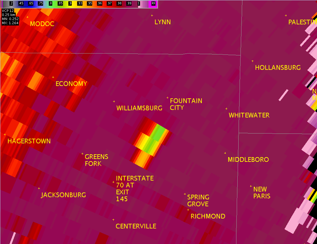
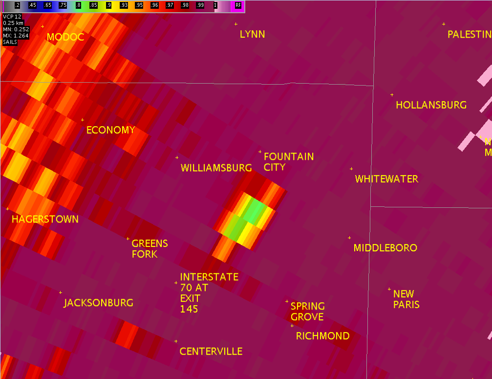
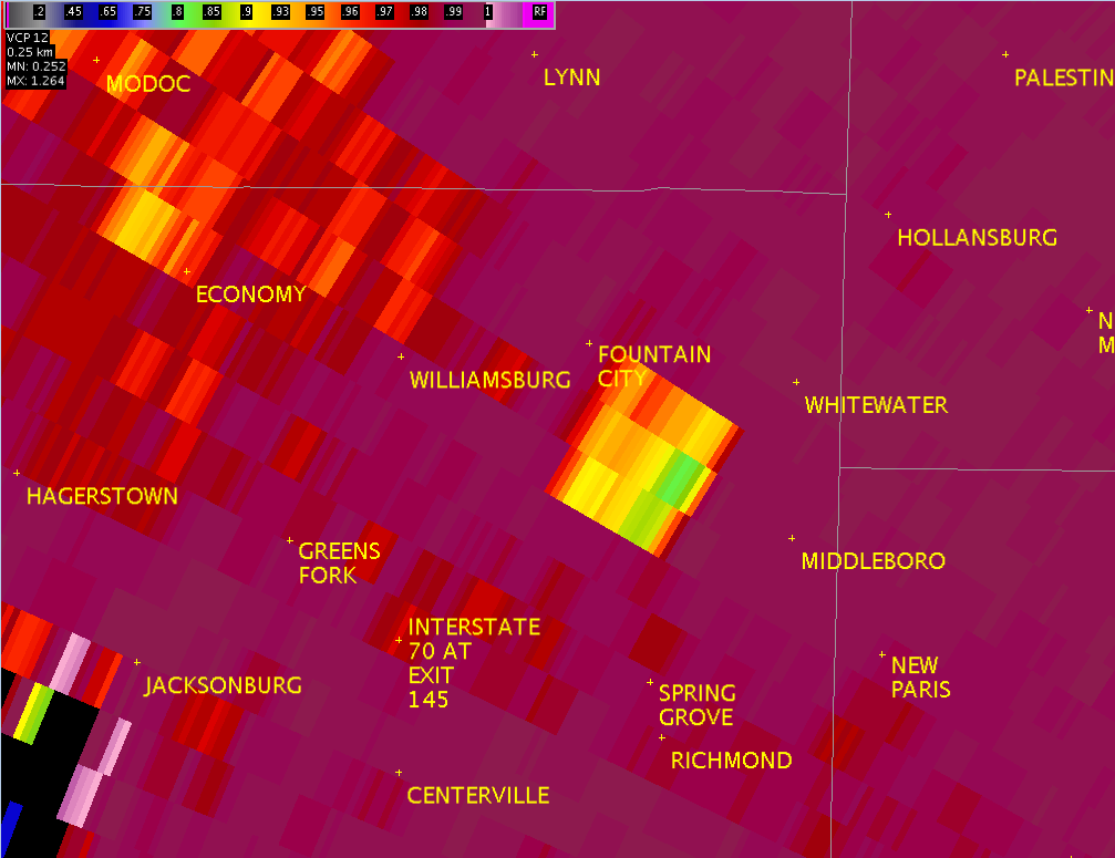
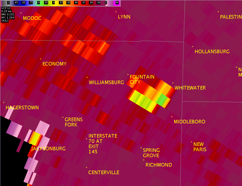
These radar images show the circulation associated with the tornado that developed near Webster/Richmond, IN. The top images are from right around the time the tornado touched down, showing storm-relative motion as seen from TDWR Dayton (TDAY). The second tier of images show the reflectivity as seen from TDAY. The bottom row shows the reduction in Correlation Coefficient (CC) from KILN. This would indicate presence of tornado debris in the air, being sampled by KILN.
| TDAY 0.3° SRM - 6:24PM | TDAY 0.3° SRM - 6:25PM | TDAY 0.3° SRM - 6:26PM | TDAY 0.3° SRM - 6:27PM | TDAY 0.3° SRM - 6:28PM |
 |
 |
 |
 |
 |
| TDAY 0.3° Z -- 6:24 PM | TDAY 0.3° Z -- 6:25 PM | TDAY 0.3° Z -- 6:26 PM | TDAY 0.3° Z -- 6:27 PM | TDAY 0.3° Z -- 6:28 PM |
 |
 |
 |
 |
 |
| KILN 0.5° CC -- 6:26 PM | KILN 0.5° CC -- 6:29 PM | KILN 0.5° CC -- 6:31 PM | KILN 0.5° CC -- 6:36 PM | KILN 0.5° CC -- 6:38 PM |
 |
 |
 |
 |
 |
These select pictures were taken by NWS Wilmington, Ohio employees during a storm survey conducted on June 5, 2016:
 |
 |
 |
 |
 |
 |
 |
 |
 |
 |
 |
 |


 Follow us on YouTube