|
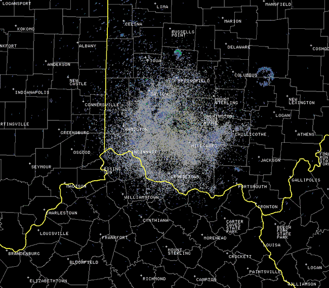
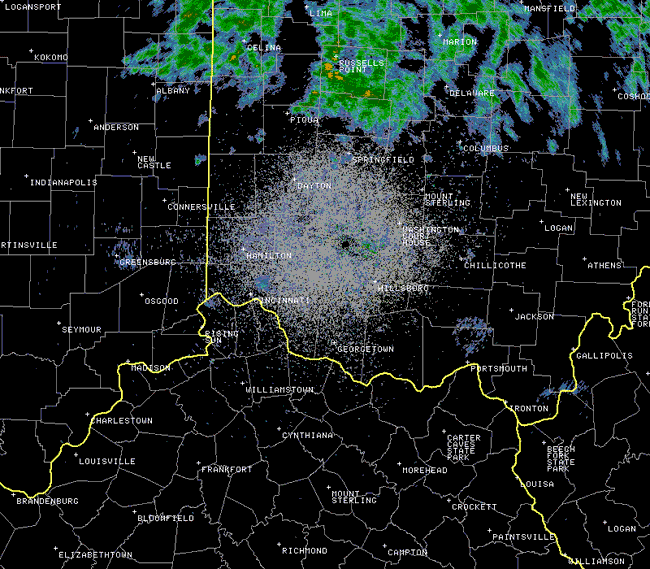
Beginning around the middle of summer, curious expanding doughnut patterns often appear just before sunrise on NWS Wilmington, Ohio's Doppler radar imagery. These features, known as "roost rings," occur when the radar beam detects thousands of birds taking off from their roosting sites around dawn to forage for insects. Leading up to fall migration, a number of bird species are known to gather at large communal roosting sites, which are often detected by NWS Doppler radar. The observed mid to late summer roost rings are most likely tied to purple martins, which congregate in enormous colonies during this time period once their fledging period has ended. By late August or early September, the martins begin their migration south, and then the roosting activity of other bird species nears its peak. The unique doughnut pattern of these roost rings is the result of the martins departing their roosting sites in various directions. As they travel farther from their roosting sites and reach higher altitudes in lower densities, the birds show up on radar as expanding, fading rings until they either fly above or below the radar beam and are no longer detected. Purple martins typically return to the same roosting sites in the evening, which are usually situated near bodies of water. As a result, the roost rings are often observed on radar at the same locations over the course of several mornings. Take a look at the two NWS Wilmington, OH radar animations below, taken around sunrise on August 2-3, 2010. Notice how the rings appear in almost the same exact locations both mornings. Rain moving across northern Ohio on August 3rd obscured some of the usual roost rings there.
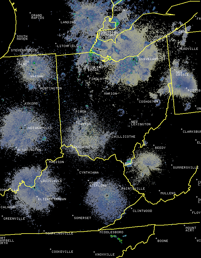
Why do the rings only appear on radar during the birds' morning departure and not during their evening return also? Atmospheric conditions have a big impact on the path that the radar beam travels. On a typical early morning, the beam is bent slightly downward due to a temperature inversion that often develops in the lower atmosphere, allowing the radar to detect objects at lower altitudes more easily. This is not usually the case during the evening, when temperature inversions are comparatively weaker or non-existent. Additionally, researchers have found that purple martins return to their roosting sites at lower altitudes than their morning departure, and thus they normally avoid detection by the radar beam in the evening. With no rain across the region, the early morning hours of August 2, 2010 and August 15, 2013 provided excellent opportunities to observe numerous roost rings all over the Ohio Valley and southern Great Lakes. In the regional radar animations below, notice how the rings appear from east to west in conjunction with the timing of sunrise.
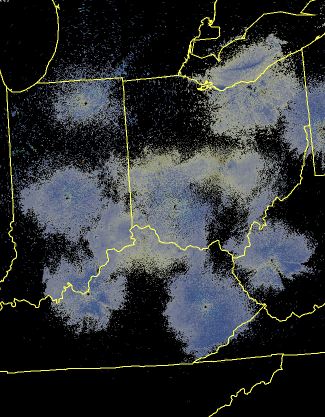
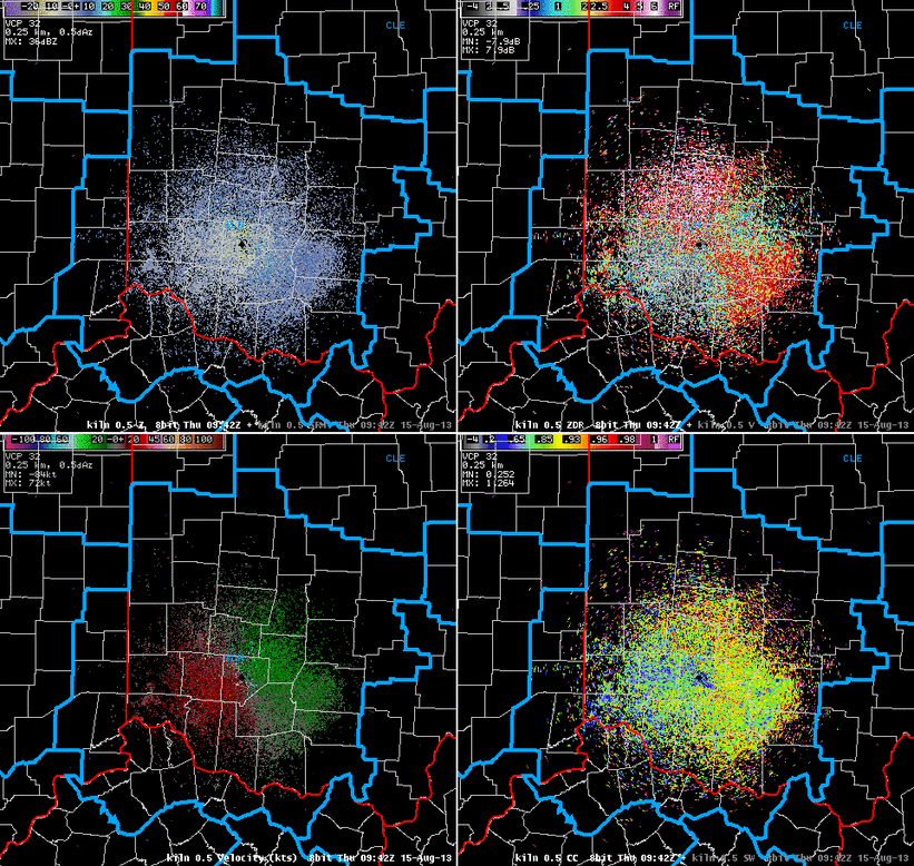
After NWS Wilmington's radar was upgraded with dual-polarization (dual pol) technology in late summer 2012, it was possible for forecasters to easily discriminate between meteorological and non-meteorological (e.g. birds, insects, smoke, etc.) echoes on radar using a new product called correlation coefficient (CC). CC is a measure of how similar in shape/size the radar targets are. Meteorological targets like raindrops have a high CC because the drops are similar in shape/size, whereas non-meteorological targets like birds have a low CC because of their varied orientation to the radar. In the four-panel radar display below, CC is shown in the bottom right. Notice the roost rings have very low CC values (blue and green colors). This tells meteorologists that these echoes are definitely non-meteorological.
|


 Follow us on YouTube