Overview
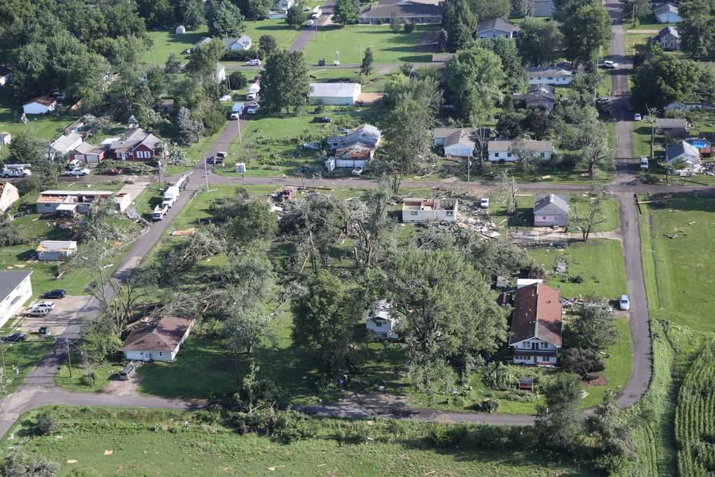
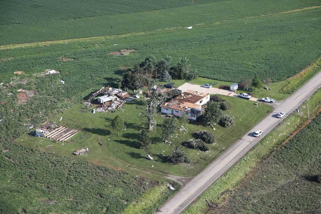
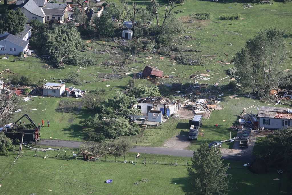
| A tornado struck Delavan, in southern Tazewell County, late in the evening of July 16th, 2015. Reports indicate that 51 homes were damaged by this tornado, six of which were determined to be a total loss. While there were no fatalities, there were two injuries. |  Damage in Delavan. Image courtesy of Illinois State Police. |
Tornadoes:
|
DELAVAN
|
||||||||||||||||
|
||||||||||||||||
The Enhanced Fujita (EF) Scale classifies tornadoes into the following categories:
| EF0 Weak 65-85 mph |
EF1 Moderate 86-110 mph |
EF2 Significant 111-135 mph |
EF3 Severe 136-165 mph |
EF4 Extreme 166-200 mph |
EF5 Catastrophic 200+ mph |
 |
|||||
Radar:
Images from Lincoln Doppler radar
Here is the radar presentation of the storm from 11:36 pm. The image on the left is the reflectivity image; the curved area from northwest to southwest of Delavan shows the storm's rear flank downdraft. On the right is the storm relative motion (i.e. the actual Doppler part of the radar), showing a circulation having just formed 1 mile southwest of Delavan (inside the yellow circle). Reports from the town indicate that the tornado struck there at 11:39 pm. (Click images to enlarge.)
 |
 |
| Reflectivity image | Storm Relative Motion image |
Additional Information:
Watches and Warnings
A Severe Thunderstorm Watch was issued at 4:55 pm, which was in effect through midnight.
Why no warning? Due to how fast this tornado developed and dissipated, the circulation was gone by the time a warning could have been issued. Local emergency officials saw a funnel and tried to sound the outdoor warning sirens, but the tornado cut off power to the town and the sirens were silenced after a couple seconds.
Delavan Tornado History
Information from the Storm Prediction Center and the National Centers for Environmental Information (NCEI) indicate 11 tornadoes have occurred across far southern part of Tazewell County since detailed records became available in 1950. Two of these came closest to Delavan:

More detailed information regarding Tazewell County tornado history can be found by clicking here.
 |
Media use of NWS Web News Stories is encouraged! Please acknowledge the NWS as the source of any news information accessed from this site. |
|


 Follow us on YouTube