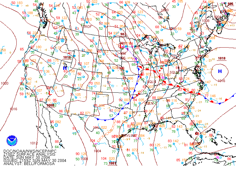
Surface Map valid at 4:00 PM EST May 30
On May 30, 2004, a warm front was draped across far southern portions of Indiana in the morning, as part of an unseasonably strong cyclone centered in Minnesota. This warm front began the day nearly stationary, taking 8 hours to move from Vincennes to Bloomington, then rocketing northward as the low pressure system quickly pushed off to the northeast late, dragging a cold front through the state during the overnight hours.
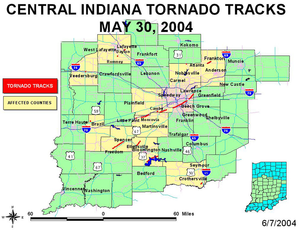
All the necessary ingredients for a major severe weather outbreak were falling into place. The first wave of severe weather came in the early afternoon, as supercells formed just south of the warm front. These supercells produced several funnel reports and confirmed tornadoes near Spencer and Ellettsville. Each of these tornadoes were rated F1 on the Fujita Scale.
Wave number two began in the late afternoon and continued into the early evening hours. This wave of storms included a storm that produced tornadoes in Fountain and Tippecanoe counties, one of which was rated F2 near Dayton, just southeast of Lafayette, and a long-lived supercell that tracked along and just south of the I-70 corridor, producing tornadoes in Brazil, Little Point, Monrovia, just south of Plainfield, Camby, and Indianapolis. Power flashes from the Camby tornado were visible from the front door of NWS Indianapolis. The strongest of these tornadoes was the Indianapolis tornado, which briefly achieved F2 strength on the southeast side near Keystone Avenue between Raymond and Troy where there was significant damage to numerous homes, a nursing home and an elementary school. 26 nursing home inhabitants were treated at local hospitals for minor injuries, and the rest were relocated as the building was inhabitable. This tornado occurred within 10 miles of the Indianapolis Motor Speedway, where crowds were leaving the Indianapolis 500 race. In addition to this tornado, the Monrovia tornado was rated F1. All additional tornadoes from this particular supercell were rated F0, a rating corresponding to moderate tree damage and damage to outbuildings and signboards. There was also a lightning fatality in Veedersburg in Fountain County as a 24 year old male was struck while on a baseball field.
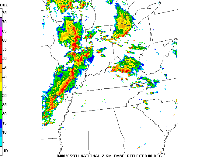
Radar image from 6:31 PM EST May 30
On the map below, click on a highlighted county to see pictures from that area. (Note that pictures from the Bloomington area are no longer available) A table is also available at the bottom of the page with links to pictures.
Please Take me back to the NWS Indianapolis Home Page


 Follow us on YouTube