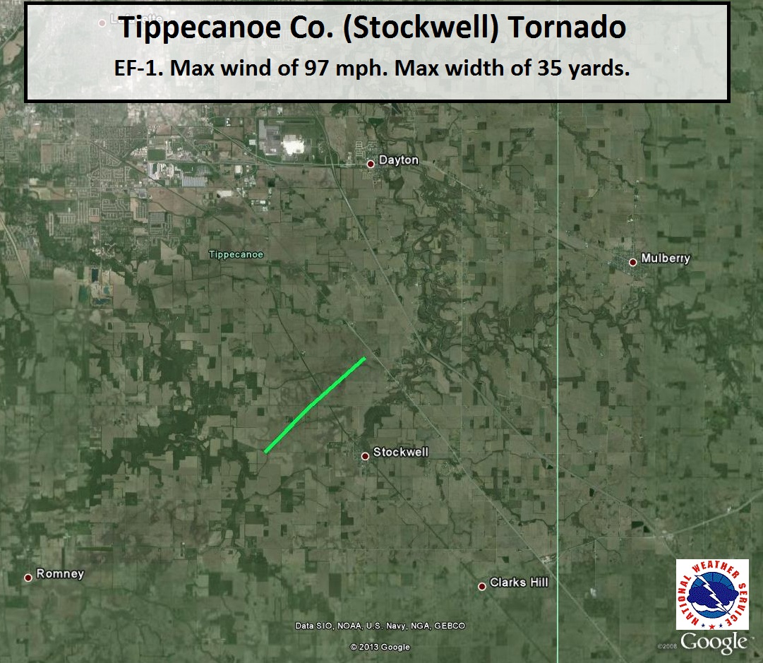
Damage Path (Click to enlarge):
Tornado Information:
RATING: EF-1 ESTIMATED PEAK WIND: 97 MPH PATH LENGTH /STATUTE/: 2.9 MILES PATH WIDTH /MAXIMUM/: 35 YARDS FATALITIES: 0 INJURIES: 0 START DATE: NOVEMBER 17 2013 START TIME: 256 PM EST START LOCATION: 3 MILES WEST OF STOCKWELL START LAT/LON: 40.2875/-86.8106 END DATE: NOVEMBER 17 2013 END TIME: 300 PM EST END LOCATION: 3 MILES NORTH OF STOCKWELL END LAT/LON: 40.3160/-86.7712 THE TORNADO CAUSED DAMAGE TO AN OLD BARN...SCATTERING SOME DEBRIS. THE TORNADO CONTINUED ALONG A NORTHEAST PATH WHERE IT VARIED IN STRENGTH AT TIMES. IT EVENTUALLY CAUSED CONSIDERABLE DAMAGE TO A SECOND BARN AS WELL AS SIDING AND WINDOW DAMAGE TO A HOUSE. DEBRIS WAS SCATTERED NORTHEASTERLY ACROSS A FIELD FOR OVER ANOTHER MILE. |
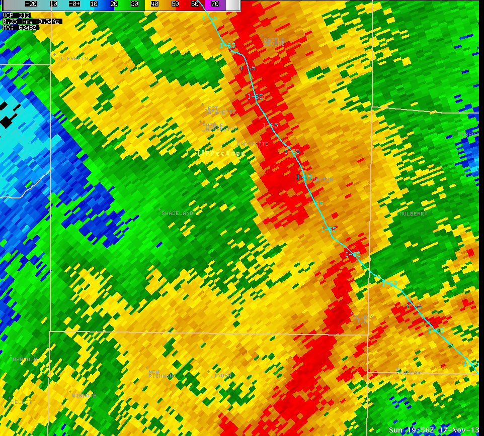
Radar Imagery: (Click to enlarge)
 |
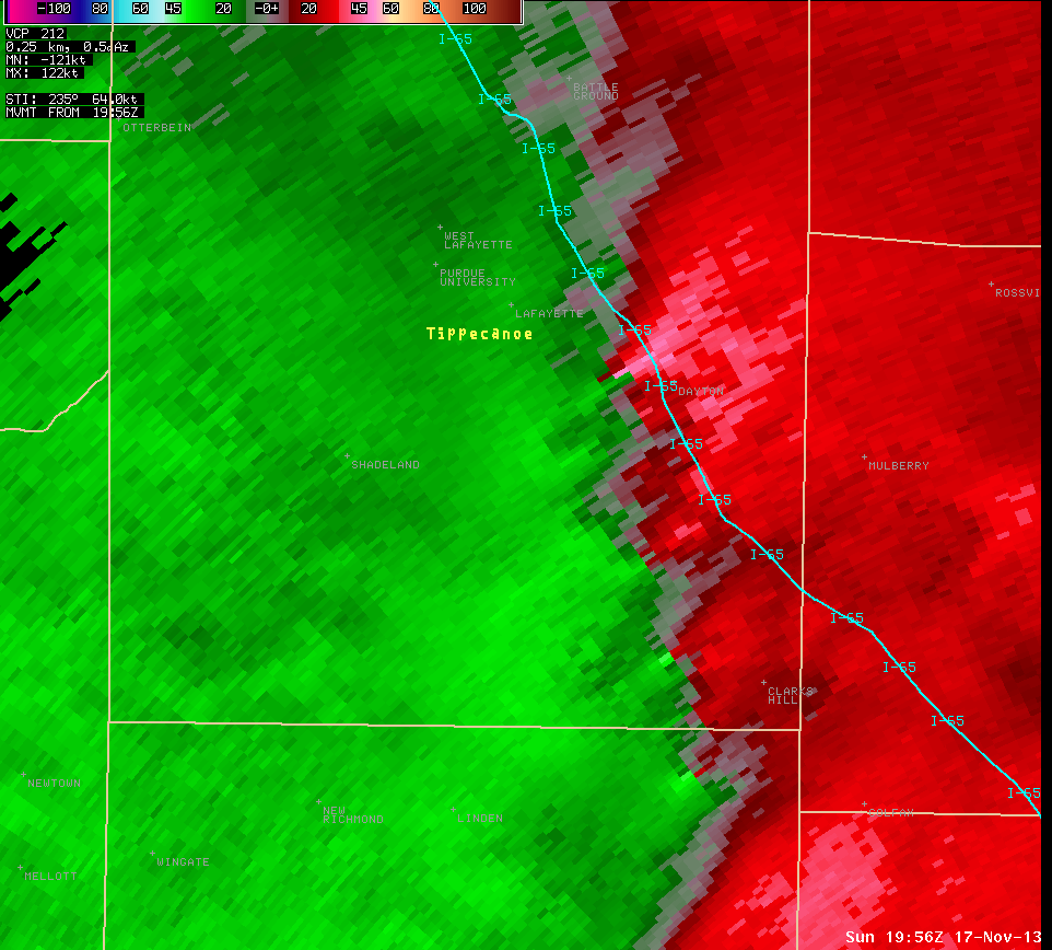 |
| Radar image at 2:56 PM centered on southeast Tippecanoe County. | Storm Relative Motion image from 2:56 PM for the same area. Radar is off to the south east of this location. Green indicates winds toward the radar while reds indicate winds away from the radar. |


 Follow us on YouTube