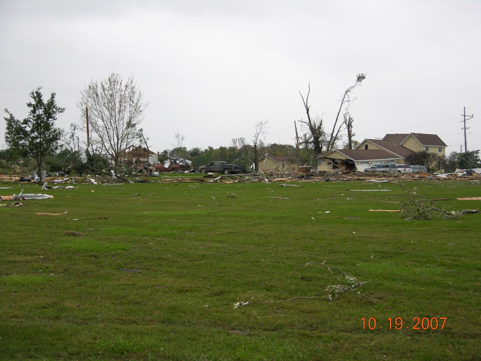
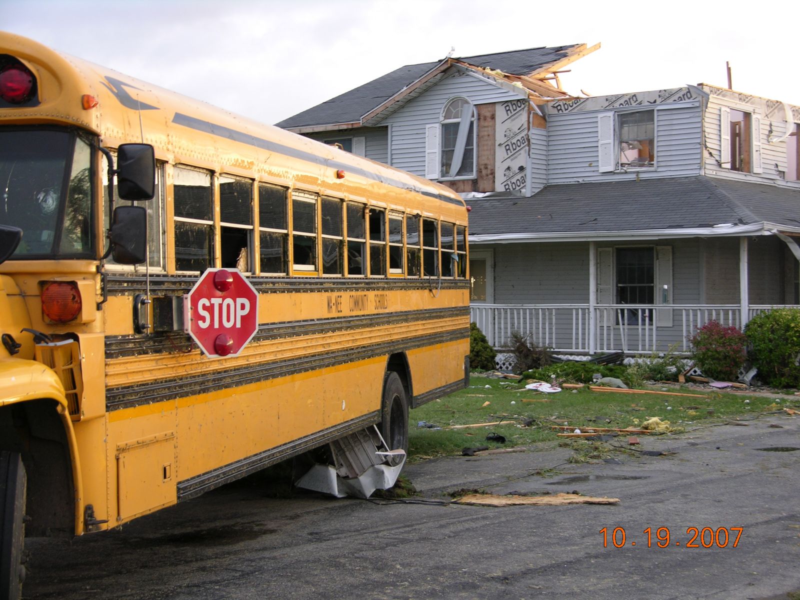
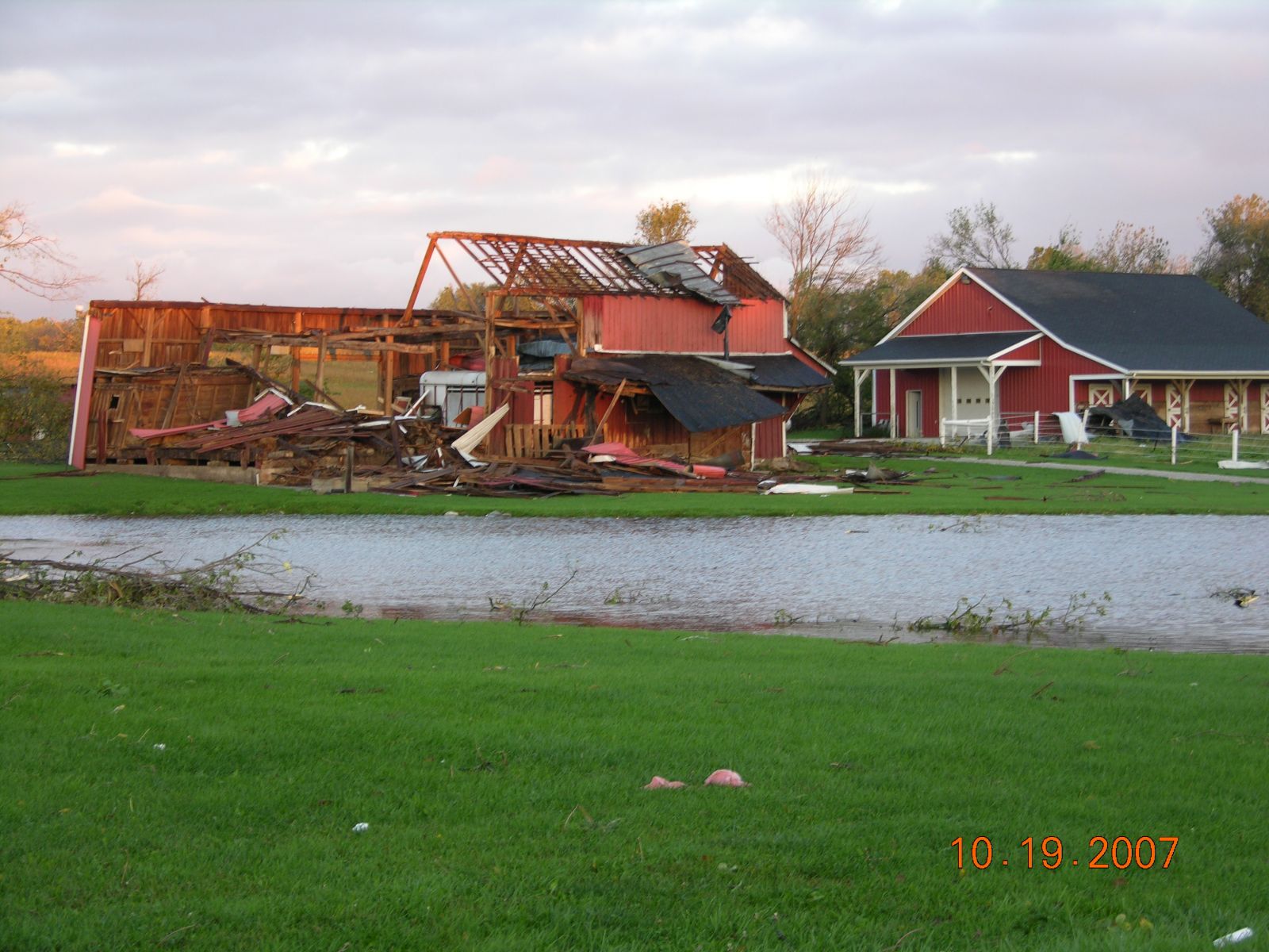
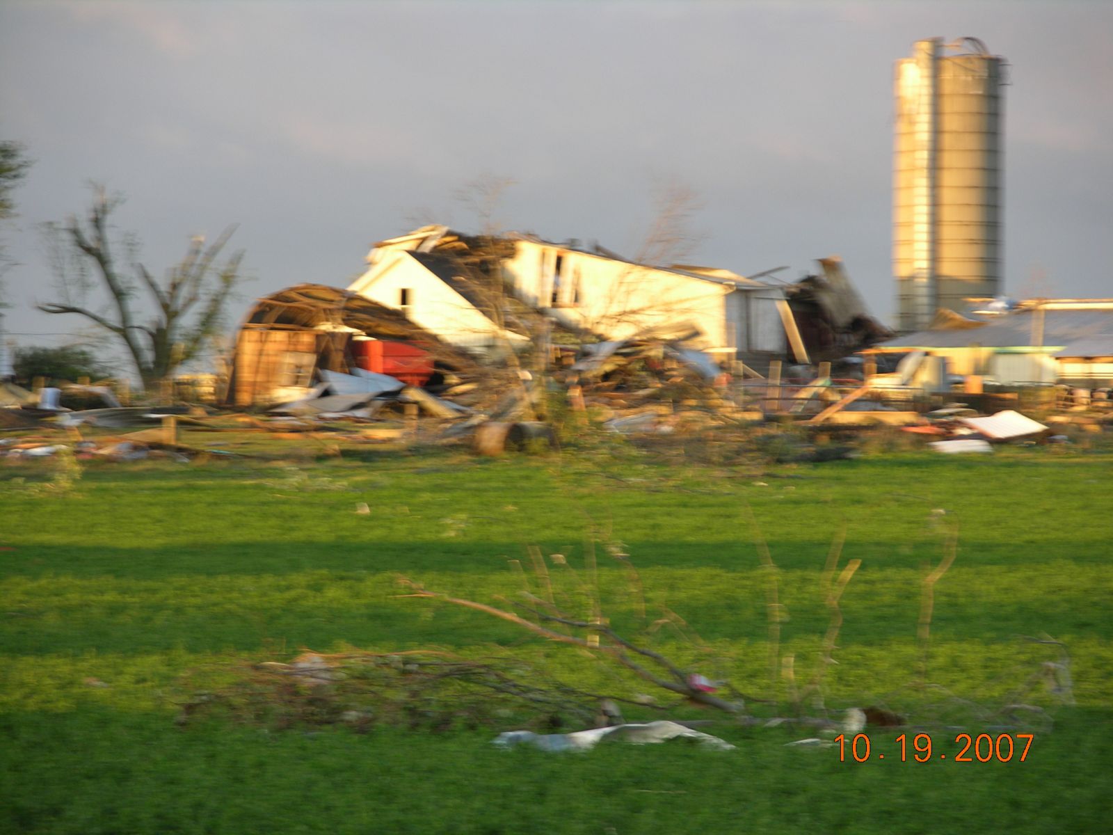
Damage assessment teams from the National Weather Service Forecast Office in Northern Indiana have confirmed a single tornado touchdown during the late evening hours of October 18th. Damage associated with this long track tornado began near the intersection of 12B road and Gumwood road...just west of Bourbon around 10:05 pm EDT. Shingle and tree damage was found...consistent with an EF0. As the tornado moved rapidly northeast at over 50 mph, it intensified rapidly, tracking between Bremen and Bourbon. Several structures, trees and power lines suffered varing degrees of damage with the intensity reaching high end EF1 intensity just prior to crossing into Kosciusko county near 1000N along the county line with a path width near 1/2 mile. The tornado continued to intensify over northwest Kosciusko county, reaching EF3 intensity, just south of Nappanee with 17 homes suffering extensive damage. The tornado contracted as it entered into southeast Nappanee, reaching max intensity of a high end EF3 with winds estimated at 165 mph, and caused widespread severe damage to homes and businesses within its quarter mile path width. Over 100 structures suffered significant damage or were destroyed in Nappanee. The tornado continued moving northeast out of town...northeast of Nappanee...but weakened with EF1/EF0 damage observed prior to lifting near the intersection of CR46 and CR17. The tornado path extended for 20 miles with a maximum width of one half mile and a peak intensity of EF3 on the Enhanced Fujita Scale.
Despite the time of day, only minor injuries, consisting of mainly bumps, bruises and cuts, were reported.
|
Note: Damage descriptions and associated photo correspond to push pin annotations in track maps above
|
|
|---|---|
|
1 - Start
|
Barn and house damage, mainly siding and shingles. Trees sheared and uprooted. Trampoline mangled. Weak EF0, beginning of tornado damage path. |
|
2 - EF0
|
Minor damage. Grain silo piece laying in field. EF0 |
|
3 - EF0
|
2 houses damaged minor. Some trees snapped. Just south of this position on highway 30 there was also a twisted large highway exit sign and a uprooted tree. EF0 |
|
4 - EF1
|
11th and Elm – Numerous power poles broke or bent north on Elm, starting just south of 11th. Poles broke or down ¾ mile length north of 11th. Farm with substantial 2nd floor damage and several grain silos damaged 0.4 mile north of 11th on Elm. EF1 to house. |
|
5 - EF1
|
House damaged, west side of 1 st floor of home torn off. Lots of sheared and uprooted trees. Metal 4 car garage completely destroyed with slab remaining. Vehicles parked in garage, J.D. Gator and small Tractor, were left intact and not damaged. EF1 |
|
6 - EF1
|
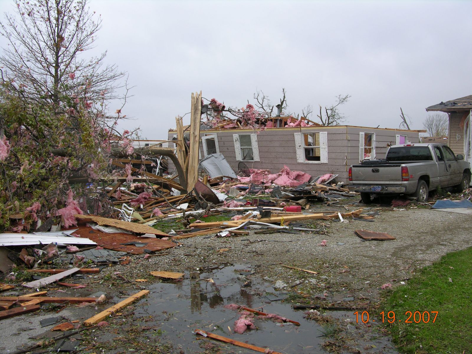
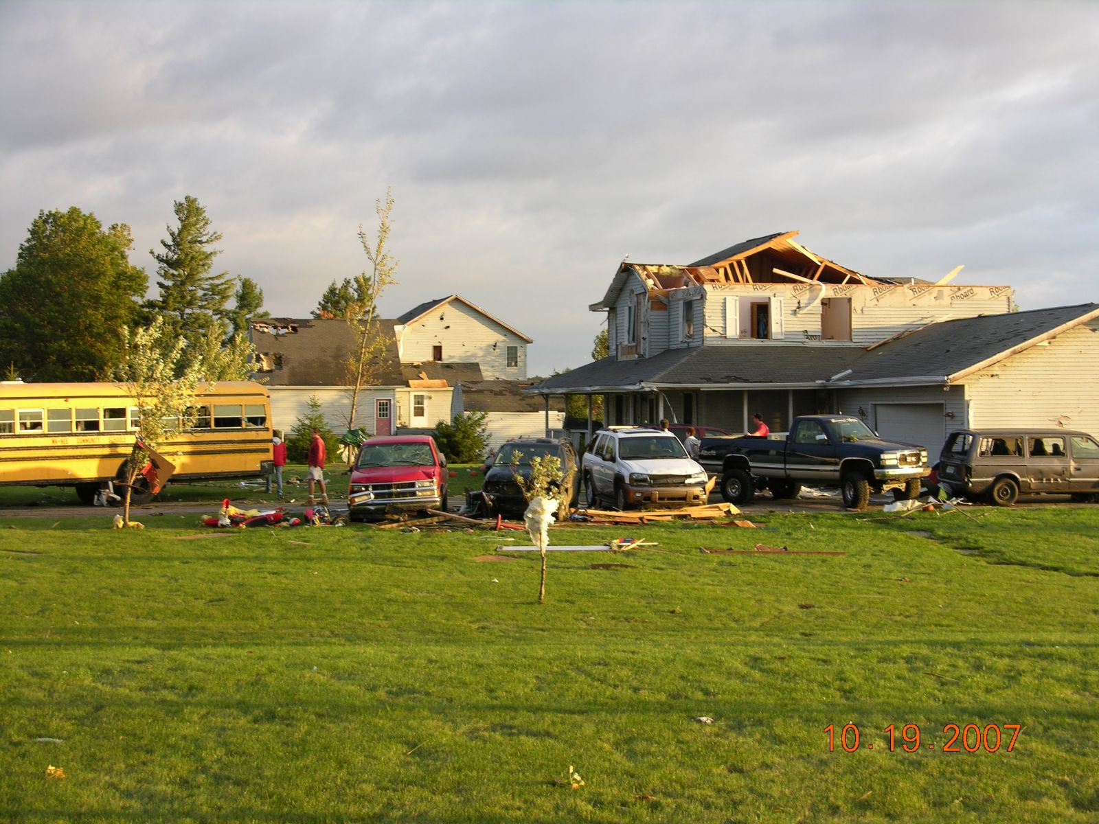
0.6 mile north of 9B on Chestnut Rd. had substantial wooded area topped and sheared. Single wide and double wide trailers on both sides of Chestnut were overturned. Some injuries to people at home during this time. 892-894.jpg |
   |
|
|
7 - EF1
|
Power poles bent and broke on 8th and Beech road. 1 house damaged substantially north of 8th on Beech Rd. |
|
8 - EF0
|
Barn and Tree damage on Apple Rd. north of 8th road. |
|
9 - EF1
|
Post embedded in ground in cornfield. Home and barn heavily damaged with second story and roof damage. Picture 891.jpg |
 |
|
|
10 - EF2
|
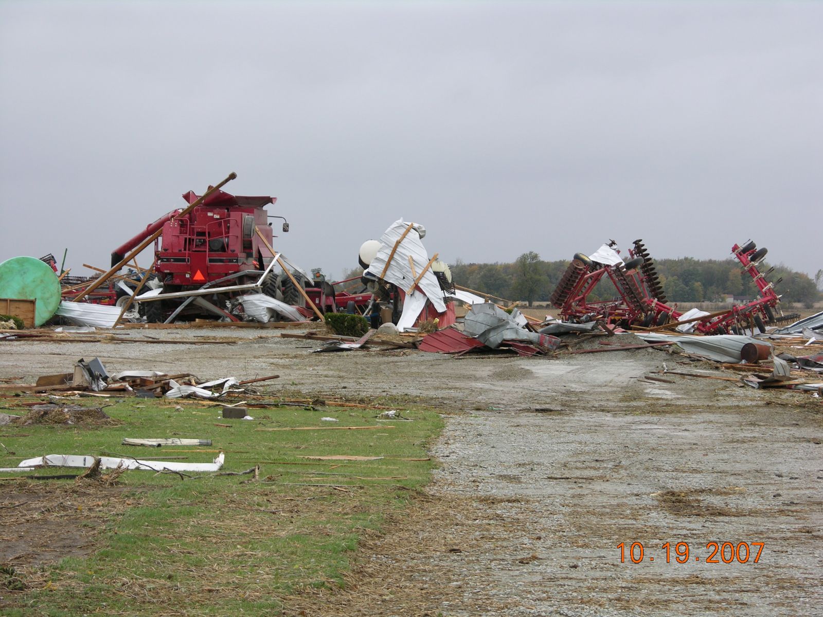
Wide Path, 0.45 mile wide, call it half mile. House with only interior walls left standing. Exterior walls leaning inside house or thrown. Older house with rather thin walls and some concern for poor nailing of walls to foundation. Wood pole type barn with metal siding northeast of home completely destroyed with debris flung northeast. Red combine left sitting in place where barn was. Trees sheared. Metal grain bins also destroyed and unwrapped. Pictures 887-890.jpg |
    |
|
|
11 - EF2
|
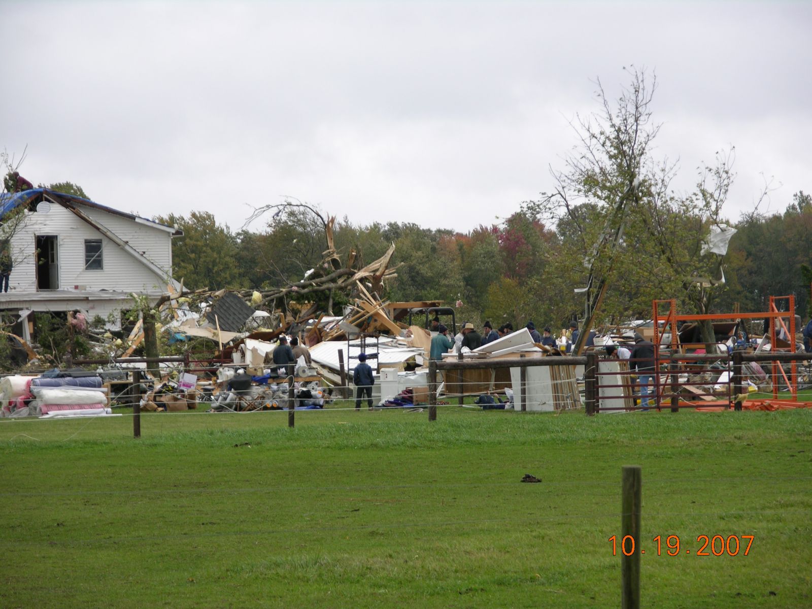
Amish houses and barn destroyed on both sides of CR 1000W. Mainly second story and roof damage with siding damage. |
|
12 - EF2
|
Several amish houses damaged. Roof/top stories heavily damaged. Barn completely destroyed. Lots of Debris .22 tenths mile wide path. This was ¼ mile east of CR 1000W on CR 1200N. Picture 886.jpg |
 |
|
|
13 - EF1
|
Extensive roof and tree damage. Outbuildings destroyed. |
|
14 - EF1
|
Woods with trees topped and broke. Several homes with substantial roof damage at 850W and CR 1350N. Pictures 869-870.jpg. |
  |
|
|
15 - EF2
|
½ mile wide damage path Lots of trees topped and broken on south side of Nappanee. Church heavily damaged with EF2 damage. EF1 damage to an old school and house. Pictures 871-872.jpg |
  |
|
|
16 - EF2
|
Area of Indiana and Jackson Streets. Substantial home and tree damage with roofs and second stories destroyed or heavily damaged. EF2 Damage. Pictures 873-874.jpg |
  |
|
|
17 - EF2
|
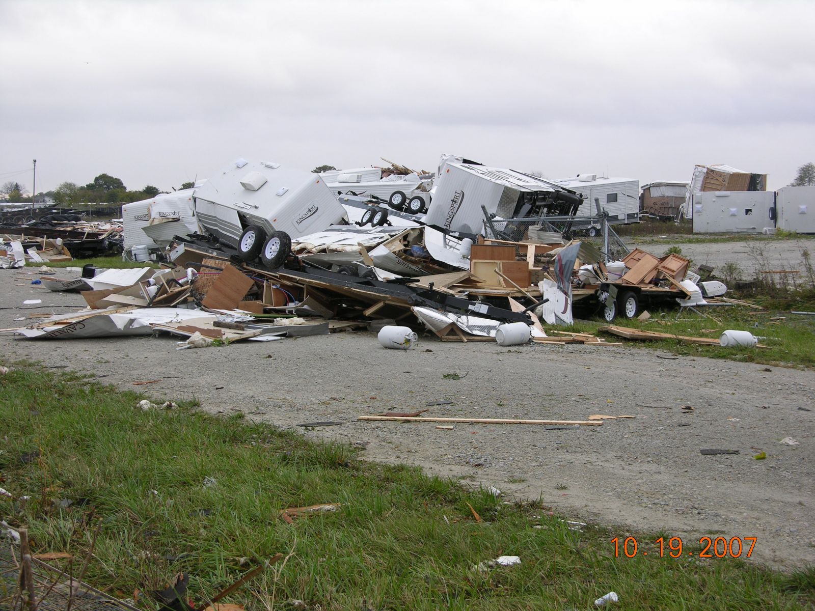
Substantial damage to new mobile homes and RVs at Fairmount Homes and VITCO factory damage. Picture 875.jpg |
 |
|
|
18 - EF3
|
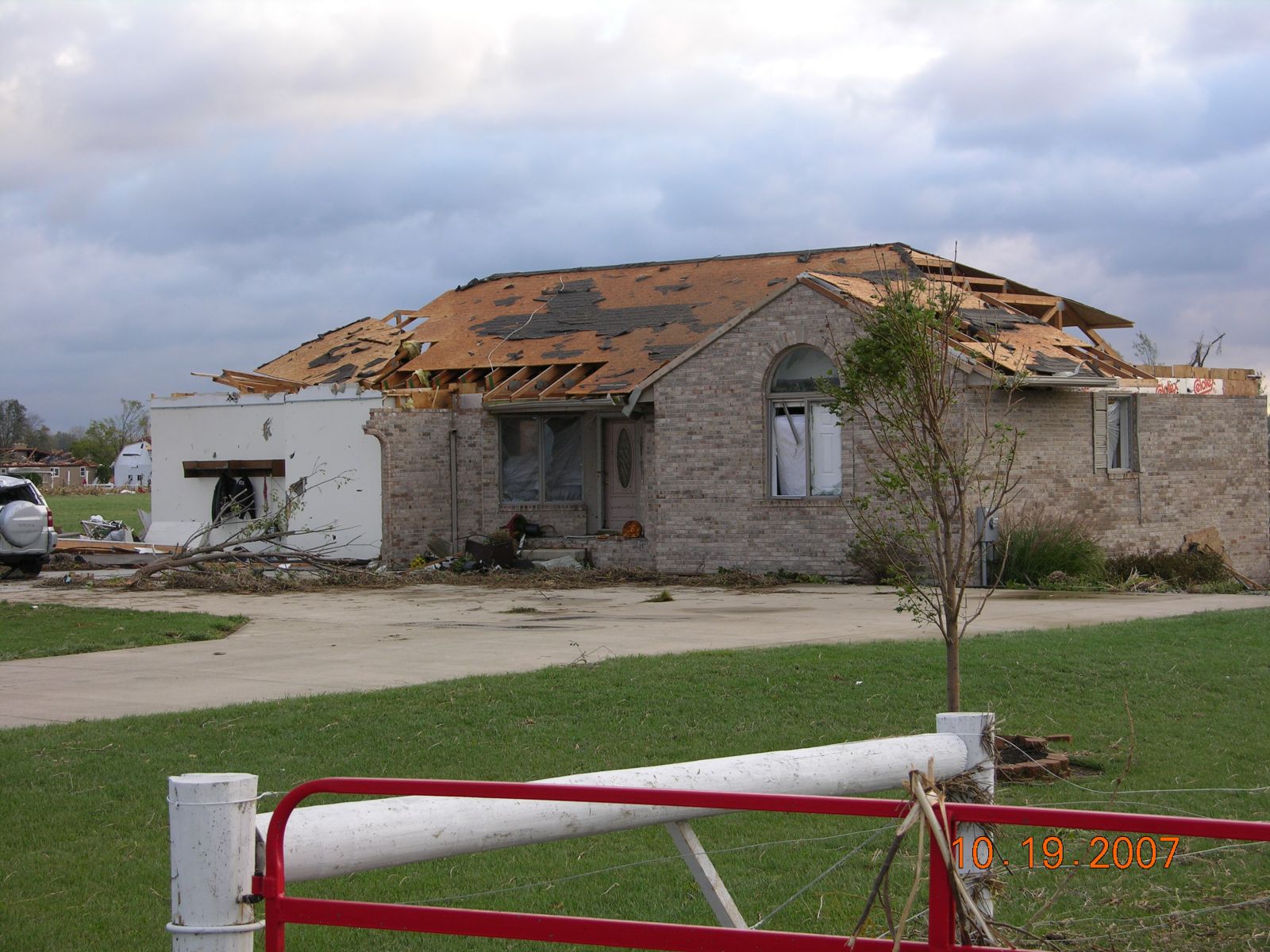
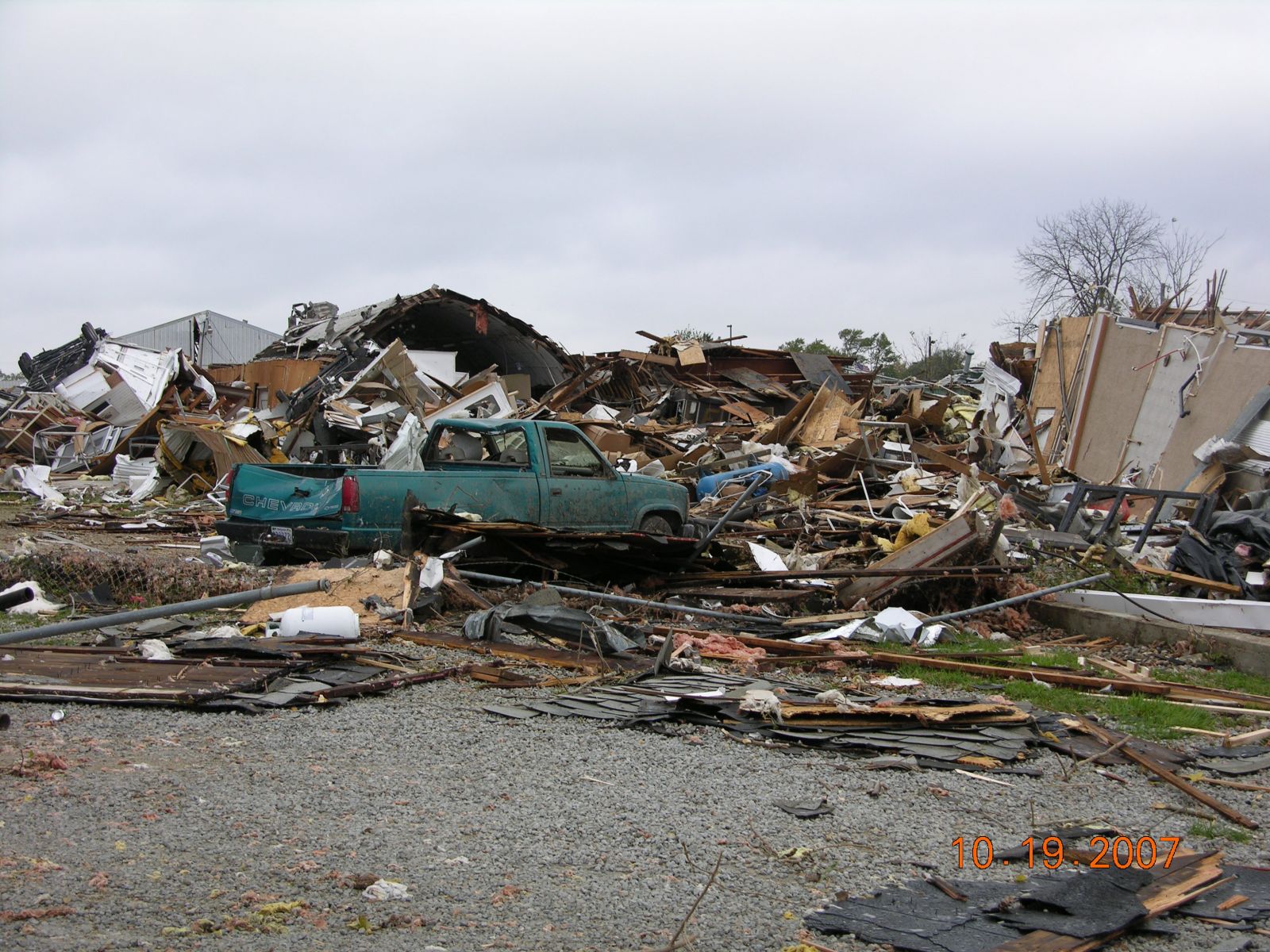
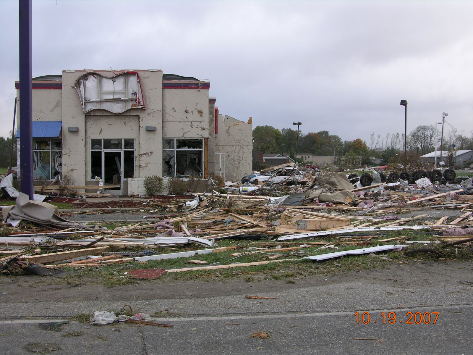
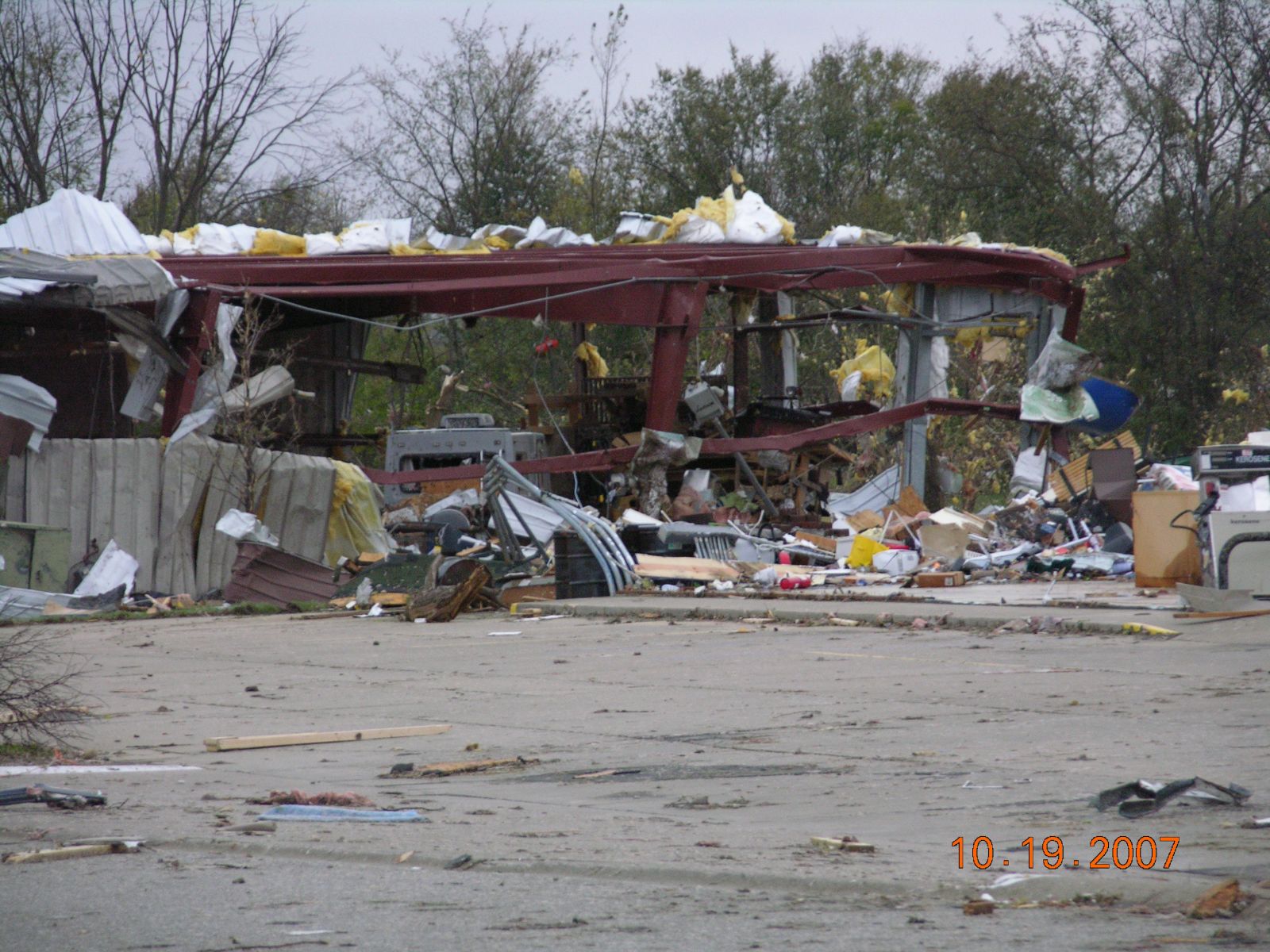
Gulfstream cinderblock building walls knocked down (First 3 pictures 876-878.jpg). Boats and vehicles in building still in place. One other building had exterior walls completely gone. High end EF2. Northeast of Gulfstream on south side of Highway 6, Taco bell (879.jpg) and Dairy Queen sustained substantial damage. Gas station building completely leveled but canopy suffered minor damage. A steel frame building immediately behind the gas station had metal siding torn off. Steel frame was intact but steel I beams were twisted and damaged (880.jpg). EF3 |
     |
|
|
19 - EF3
|
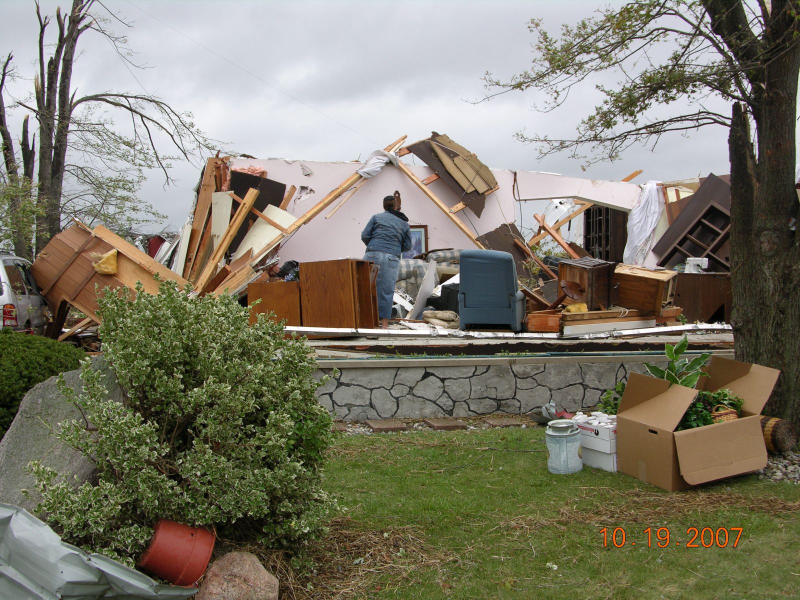
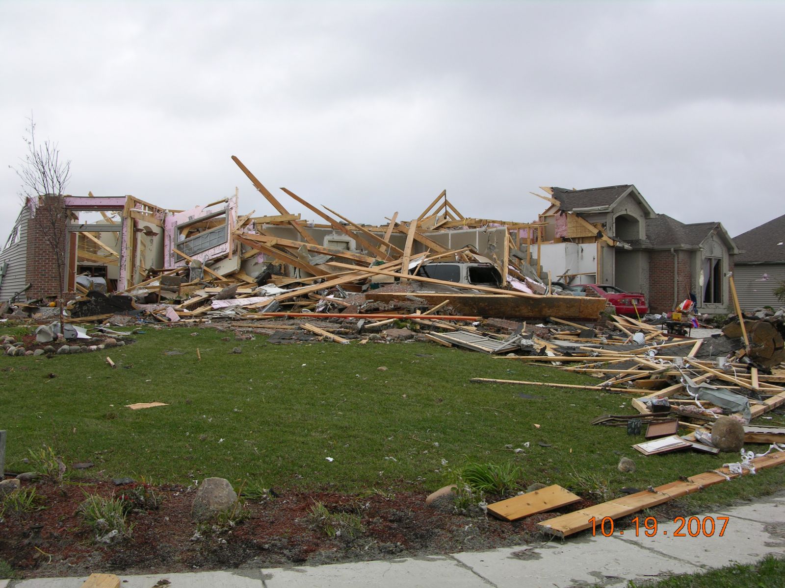
Blackstone Subdivision at CR 54 just west of CR 9 heavily damaged homes. Roofs off of several homes. 1 home had second story completely gone and exterior walls collapsed. Interior walls still standing. Direct hit in subdivision with EF3 damage. Woman was trapped in home and crawled out afterward. Only 5 minor injuries known at this time in Nappanee. Pictures 881-885.jpg
|
    |
|
|
20 - EF2
|
Lots of structural damage to houses on both sides of CR 9. Lots of missile damage to houses. Bus moved in driveway. Strong EF1. Pictures 866-868.jpg |
   |
|
|
21 - EF1
|
Several barns damaged and lots of trees snapped/uprooted. Large circulation area. Well built homes have little damage. 0.3 mile wide. Pictures 864 and 865.jpg |
  |
|
|
22 - EF0
|
Several houses had minor shingle and siding damage. Lots of trees topped off. Lots of debris. Width around 300 yds. |
|
23 - EF1
|
0.6 mile north of CR 50 on CR 15. Damage to barn siding, silo roof torn off, trees twisted and snapped. Large Debris field. Little damage to house. EF1 100 yards wide. |
|
24 - EF0
|
House and barn on south side of CR 46 at CR 17 sustained some damage. Damage width 300 yards wide EF0. 863.jpg |
 |
|
|
25 - end
|
Ending point of tornado just north of intersection of CR 17 and CR 46. Power lines down on north side of CR 46 with some minor structural damage to a house. EF0 |
Convective initiation occurred shortly after 4 pm from central Illinois into northwest Indiana in response to a secondary mid level shortwave trough ejecting out of central Missouri and increasing forced ascent. 18Z special sounding from Lincoln Illinois (KILX) showed dramatic mid level cooling as a result of the ejecting mid level shortwave trough. Rapid scan visible imagery showed aggravated CU/TCU development by late afternoon with continued surface based destabilization and low level moisture advection within mid level dry slot left behind lead shortwave trough which spawned widespread showers and thunderstorms earlier in the day. An unseasonably strong upper level wind maxima associated with this ejecting trough and backing surface flow led to extreme deep layer wind shear. Several broken lines of discrete supercells developed in the evening although the storm responsible for this tornado developed toward the end of the event. Numerous storms exhibited intense low level rotation with several reports of funnel clouds but all but this particular storm failed to produce actual tornadoes.
|
Time |
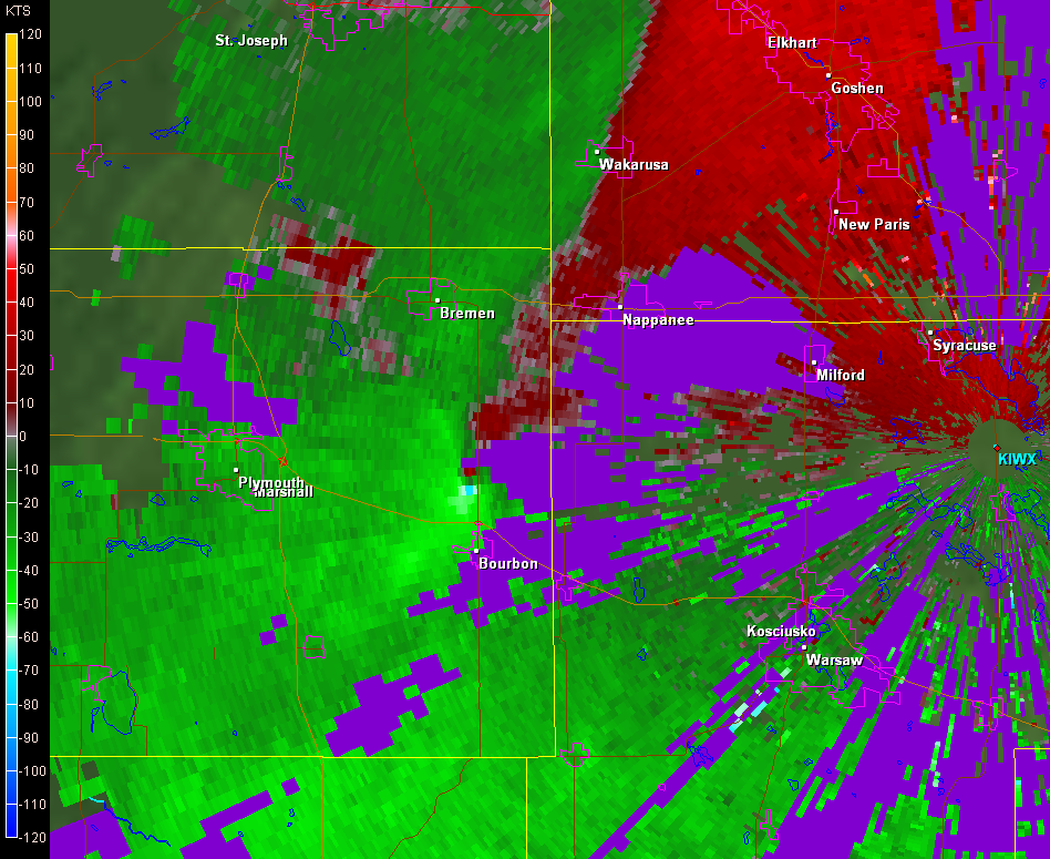
0.5 base reflectivity / 0.5 base velocity |
| 0957 pm | Supercell over Plymouth embedded within large line segment which extended into southern Michigan. Weak cyclonic convergence noted within inflow region of intensifying supercell. |
  |
|
| 1003 pm | Inflow region of supercell intensified further with developing hook echo. Low level circulation was undergoing rapid intensification west of Bourbon yet was non-tornadic at this time. |
  |
|
| 1008 pm | Hook echo develops further at this time as low level circulation contracted. Tornado developed near 1005 pm 3.2 miles west of Bourbon. |
  |
|
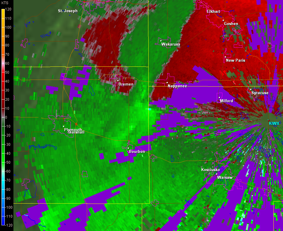
| 1013 pm | Well developed hook echo southwest of Nappanee in northwest Kosciusko county. Range folding at 0.5 degree partially masks the intense low level circulation at this time. |
  |
|
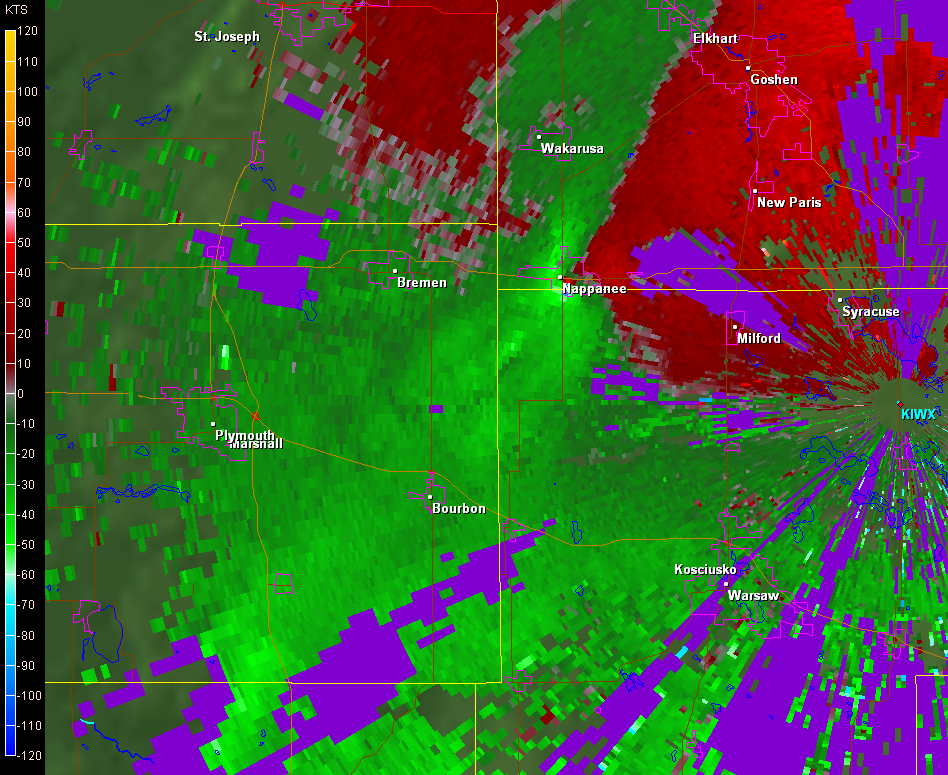
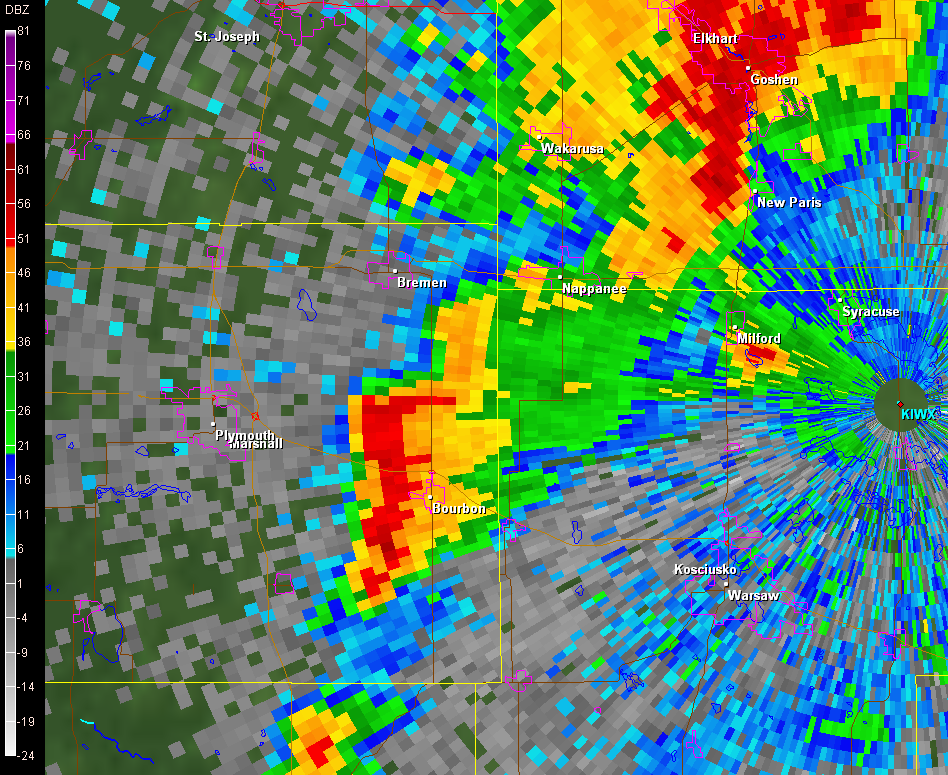
| 1019 pm | Debris ball loading noted in reflectivity. Height of return is 865 ft above radar level (ARL). Intense velocity couplet at this point with a velocity differential across the circulation of 130 knots. |
  |
|
| 1025 pm | Debris ball still intact. Intense couplet continues but was in a weakening trend at this point. |
  |
|
| 1030 pm | Circulation breaks down in response to hook echo collapsing. Debris continues to fall out of the parent updraft as far away as Constantine Michigan (32 miles from Nappanee) with vinyl siding found. This same supercell produced 4 additional tornadoes in the Michigan Thumb region after midnight. |
  |
|
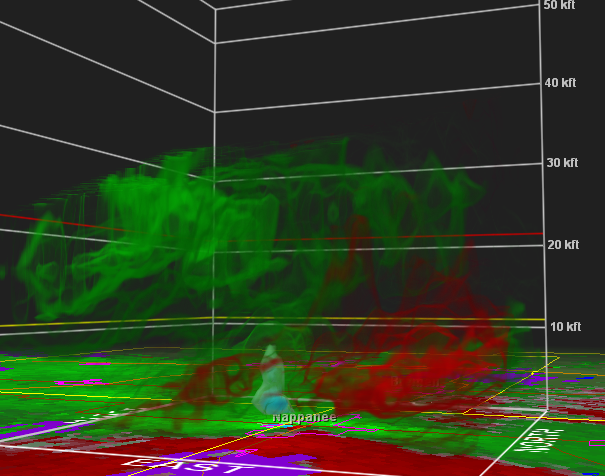
| 1019 pm | 3-dimensonal look of reflectivity and velocity. |
  |
| Storm chaser Chad Cowan* captured this image along the Fulton/Kosciusko county line at 745 pm EDT. Note the well developed wall cloud in the lower center portion of the image. | Storm chaser Kurt Hulst* captured this image on the south side of Warsaw around 8 pm EDT. Note the large cone funnel illuminated by the lights from the city. |
 |
 |
* Photos used by permission


 Follow us on YouTube