This page contains pictures of funnel clouds, as well as tornadoes and the associated damage they can cause.
(Historical account of the April 11, 1965 Palm Sunday tornado outbreak)
(Historical account of the April 3, 1974 Superoutbreak)
(Photos from the May 30, 2004 F3 tornado at Peru)
(Photos from the April 20, 2004 tornado outbreak)
(Photos from the Huntington/Wells tornado of July 4, 2003)
(Photos from November 10, 2002)
(Photos from October 24, 2001)
(Photos of the aftermath of the March 16, 1942 Goshen tornado)
(Photos of the aftermath of the March 28, 1920 tornado in Defiance County)
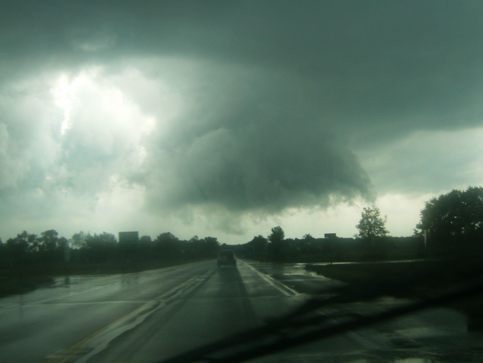 |
Ominous looking wall cloud near Coldwater on July 22, 2010. This storm did produce a weak EF0 tornado just southwest of Coldwater. Photo courtesy of Samantha Sharpley. |
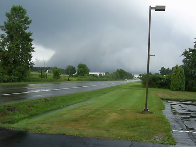 |
Another view of an ominous looking low hanging wall cloud near Coldwater on July 22, 2010. This storm did produce a weak EF0 tornado just southwest of Coldwater. Photo courtesy of Justin Lopshire. |
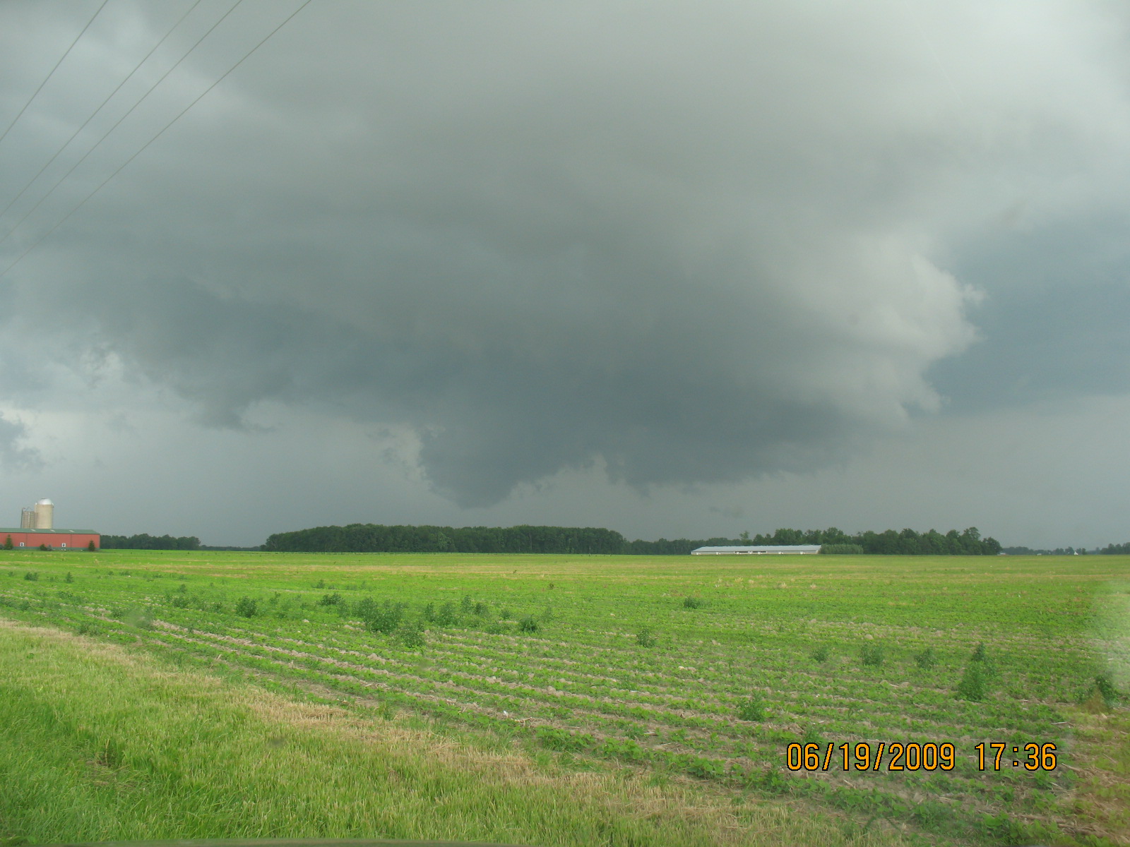 |
Ominous looking wall cloud 10 miles northeast of Peru on June 19th 2009. Although this storm did not produce a tornado, it did drop grapefruit sized hailstones on Rochester. Photo courtesy of Forrest Asaur. |
 |
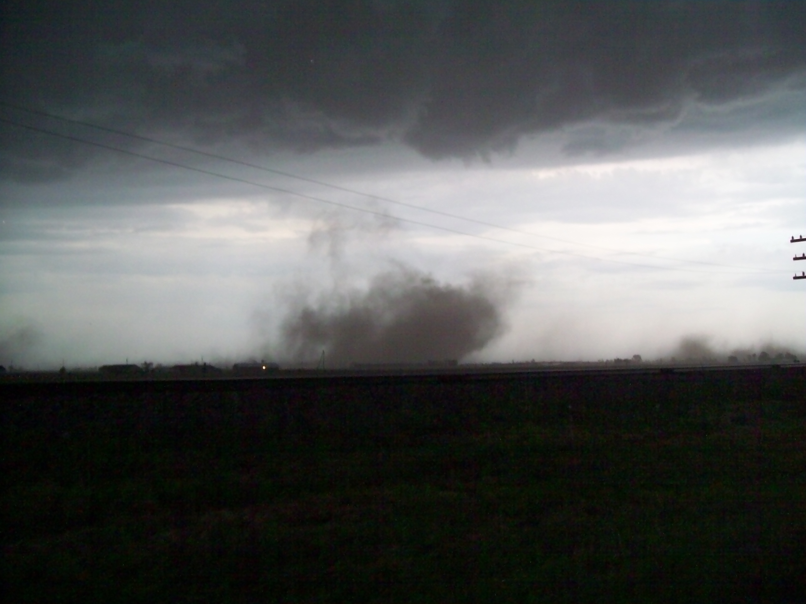
Tornado near Cecil-Williams Center Road and Jericho Road in Defiance county on March 8th 2009. No damage was reported as this tornado remained over open ground. Photo courtesy of Eric Martinez and Derek Tanner. |
 |
Beautiful cone tornado and wall cloud near Stuart Nebraska on June 17, 2003. This tornado intensified into a 1/2 mile wide wedge later on...damaging several farmsteads in northeast Nebraska. Photo courtesy of Todd Holsten. |
 |
Gustnado along Gilliland Road east of Van Wert on June 6, 2008. As the gustnado crossed Lincoln highway, it struck a car carrying 2 occupants blowing out a window and taking down a number of large trees. It also damaged a pole barn and caused considerable roof damage to several homes. Photo courtesy Rick McCoy, Van Wert county EMA. |
 |
A very small funnel cloud on August 10, 2003 at 7:47pm. The photo was taken looking west from the intersection of Middle Point Road and Ringwald Road in Van Wert County. The funnel is probably located around the intersection of Mendon Road and State Road, about three miles southeast of Van Wert, Ohio. Photo courtesy Eric Germann. |
 |
Video capture of small, distant tornado over southern Jay County on August 1, 2003, that lasted about 45 seconds. The video was taken from near Boundary City along CR 300E, two miles north of the Randolph County line, facing west. Photo courtesy James Covington. |
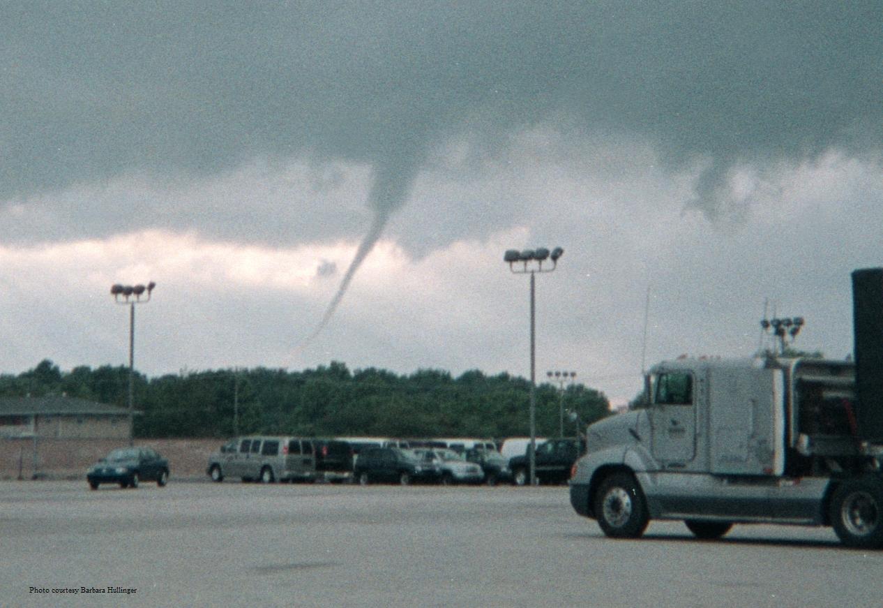 |
Funnel cloud over Marion, Indiana, July 10, 2003. Photo taken from the Kem Road Marsh Supermarket parking lot at 7:03pm by Barbara Hullinger. The funnel cloud did not develop into a tornado. |
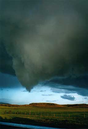 |
Funnel cloud at Clayton, New Mexico. Photo courtesy Doug Berry and the Ball State University Storm Chasing Team. |
 |
In one of the most incredible tornado photographs ever taken, monstrous double tornadoes rip through Midway, Indiana, between Goshen and Elkhart on Palm Sunday, April 11, 1965, at 6:32pm. These two massive funnels were rotating around each other, and produced F4 damage. Photo courtesy Paul Huffman, who worked for the Elkhart Truth at the time. |
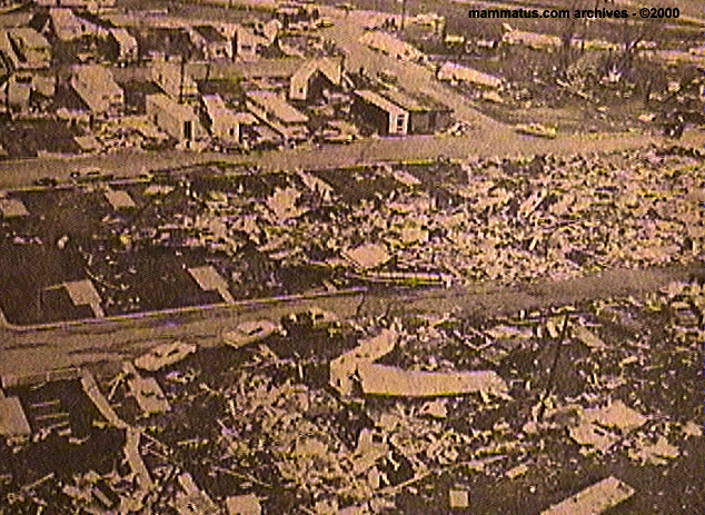 |
Damage from the above tornado at Midway. |
 |
Additional damage from the double tornado at Midway. Some of the intact trailers along the bottom of the photo may be temporary housing that was quickly set up for survivors of the storm whose homes were obliterated. |
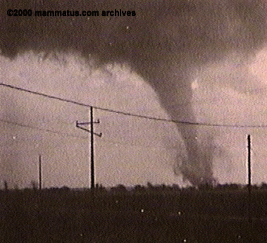 |
A classic tornado. This photo was taken at Wanatah, Indiana, facing south, at 6:30pm April 11, 1965. Photo by Nick Polite. |
 |
Tornado at LaPaz, Indiana, at 6pm April 11, 1965. With dark clouds to the east and bright sky behind the photographer, the funnel appears very light in color. Photo by Indiana State Trooper Nick Chandler. |
 |
Here's the same LaPaz tornado, at about the same time, but viewing it from the opposite direction. With the bright sky now behind the tornado, the funnel appears dark. |
 |
Damage from the Lapaz tornado. |
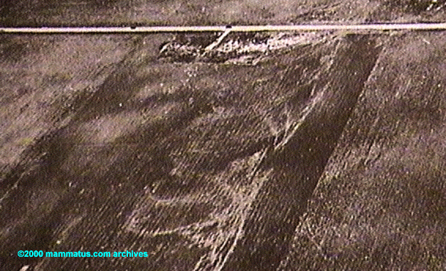 |
Swirl marks left in the fields of northwest Marshall County after one of the Palm Sunday 1965 tornadoes. Photo by Dr. T. T. Fujita. |
 |
Never seek shelter from a tornado in a vehicle! |
 |
Tornado aftermath at Alto, Indiana, from the Palm Sunday 1965 tornadoes. Note the sheet metal wrapped around the tree branches. |
 |
Tornado near Knox, Indiana during the 1965 outbreak. |
 |
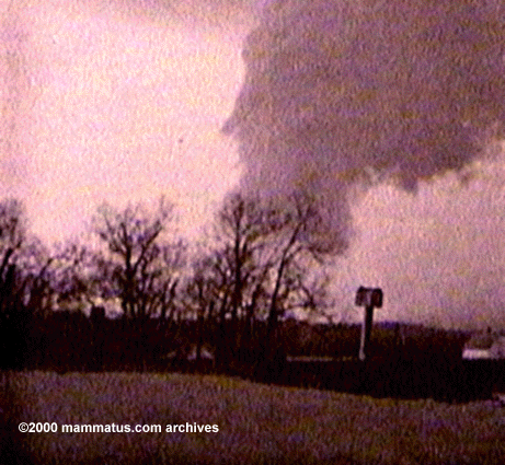
On March 16, 1982 President Reagan came to Fort Wayne to witness that spring's terrible flooding. Just moments before his plane landed, this funnel cloud was spotted at the airport. |
 |
Tornado damage near the Wabash/Kosciusko County line June 14, 2000. |
 |
Tornado damage near the Wabash/Kosciusko County line June 14, 2000. |
 |
Tornado damage near North Manchester June 14, 2000. |
 |
House near Gilboa, Ohio, struck by a small tornado on July 19, 1998. |
 |
Truck pushed over by a tornado between Greentown and Marion, Indiana, June 11, 1998. |
 |
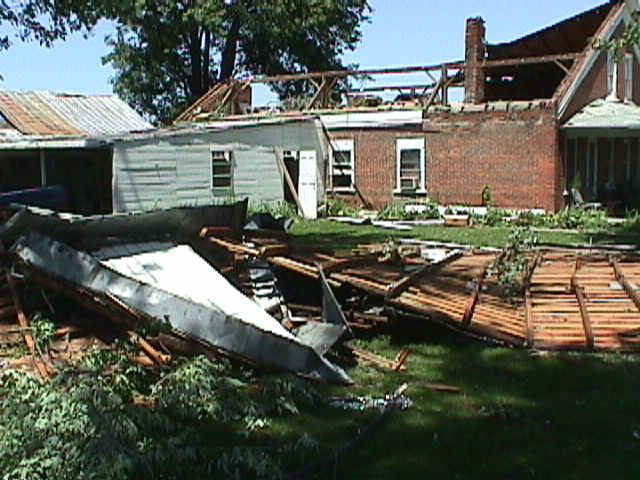
House damaged by a tornado between Greentown and Marion, Indiana, June 11, 1998. |
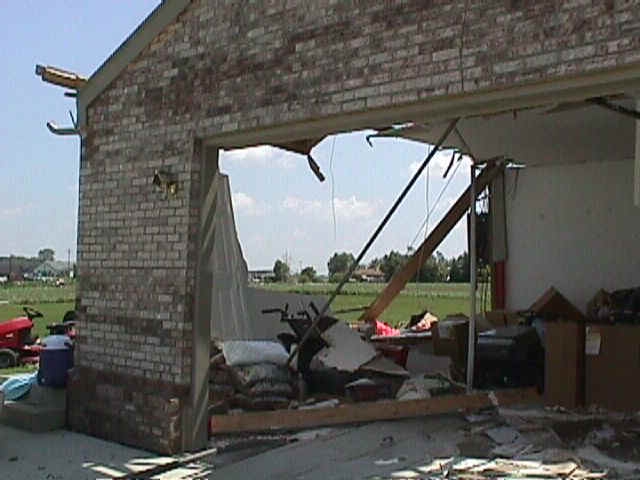 |
A close-up of the garage of the above tornado-damaged house, June 11, 1998. |
 |
Telephone poles blown down near Marion, Indiana June 11, 1998. |
 |
Mobile home destroyed by a tornado near Etna Green, Indiana June 11, 1998. |
 |
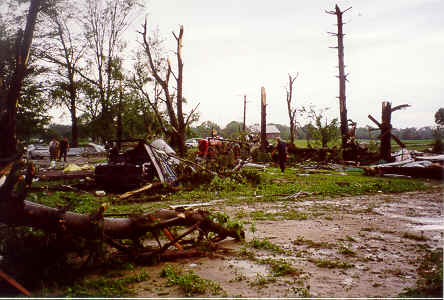
Destruction from the Kendallville Tornado of July 14, 1992. The twister produced F2 damage as it damaged 208 homes, 2 apartment buildings, 23 businesses, and wrought $13,000,000 in damage. |
 |
Kendallville Tornado damage. |
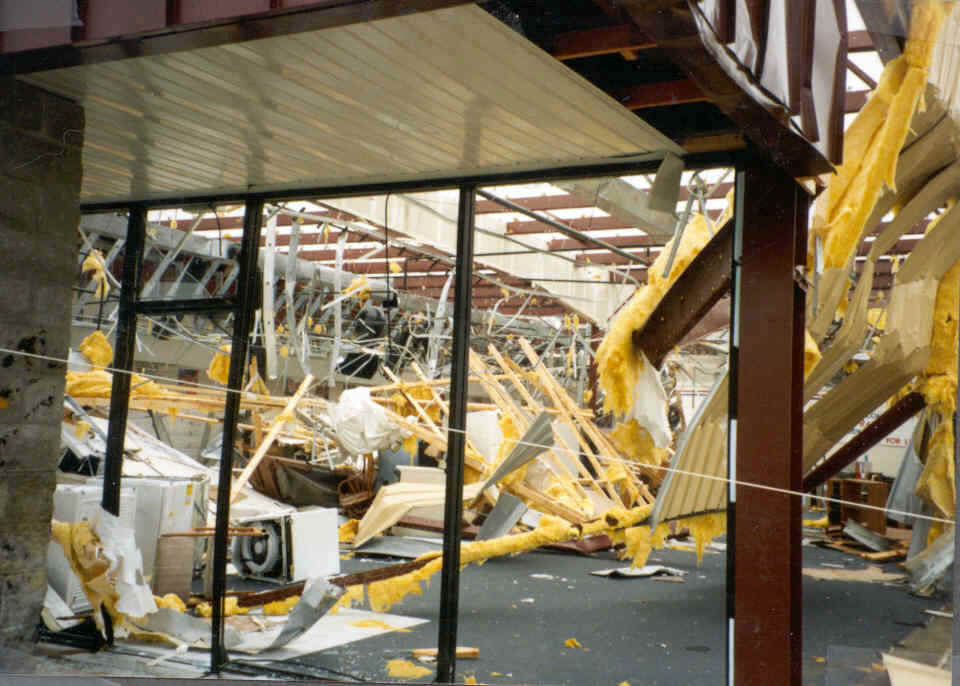 |
Kendallville Tornado damage at a local mall. |
For funnel cloud look-alikes, see our Clouds and Sun page
Select Another picture page
|
Tornado / Lightning, Wind, and Hail / Winter/ Flooding / Clouds and Sun / History / Main |


 Follow us on YouTube