Damage Survey from Simpson & Smith Counties
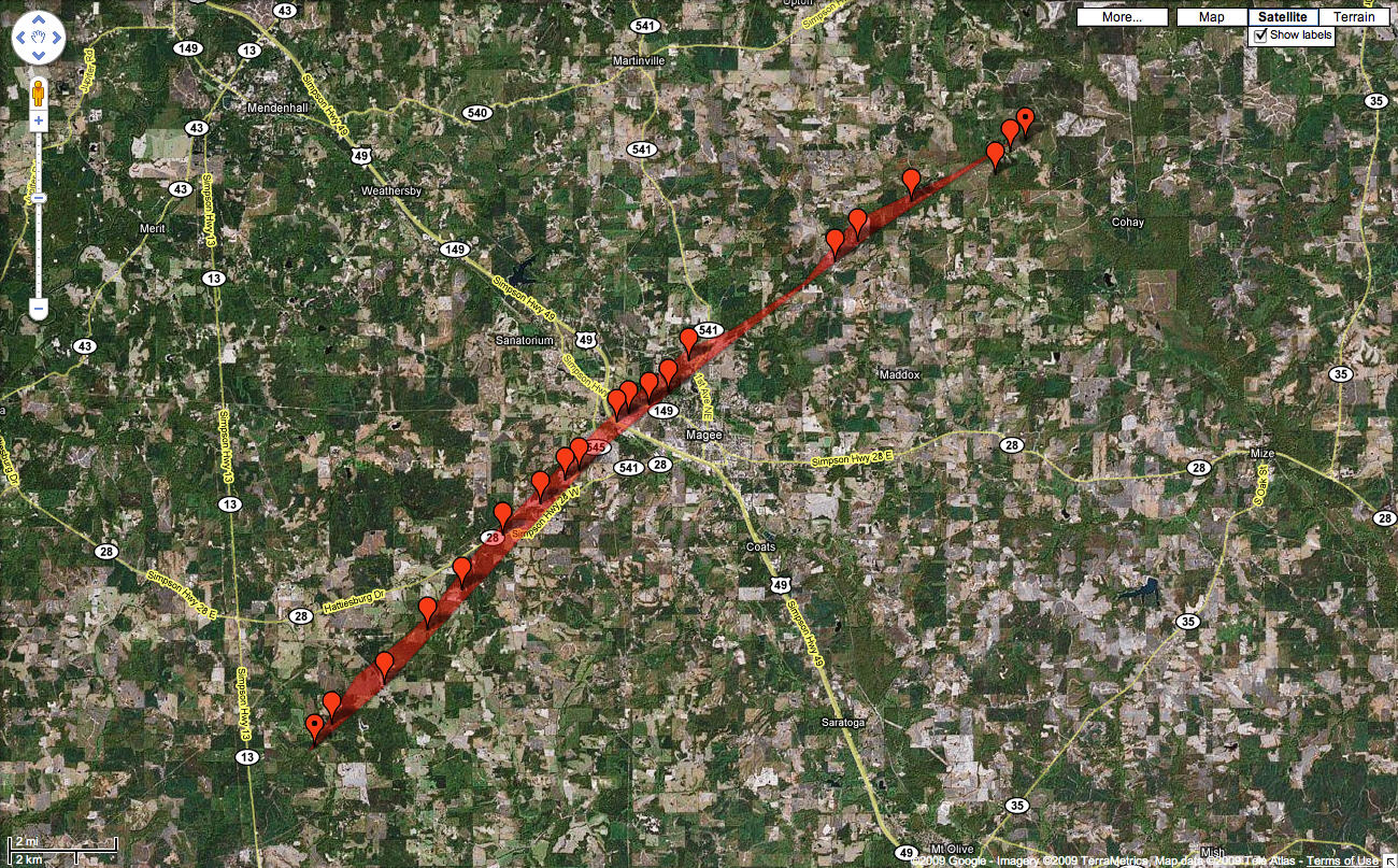 |
Location: Simpson & Smith Counties
Time of Event: 1:37am to 1:57am, 03/26/09
Beginning Point: 9 miles SW of Magee
Ending Point: 8.5 miles NE of Magee
Rating: EF3, maximum winds of 150 mph
Path Length: 17.5 miles, with 16 miles in Simpson County and 1.5 miles in Smith County
Maximum Width: 500 yards
Fatalities: 0
Injuries: 25
Summary of Damages: 60 homes were damaged or destroyed. A large, well-built church was destroyed. A warehouse was significantly damaged and a radio tower was snapped. Numerous hardwood and softwood trees were snapped and uprooted. The highest winds occurred at the church and nearby houses and trees just southwest of Magee.
The tornado first touched down just north of Mount Zion Road in Southwest Simpson County and continued northeast through the northwest side of Magee and then across the Smith County line before lifting near South County Road 503.
The EF3 rating was in Simpson County while the highest rated damage in Smith County was EF1.


 Follow us on YouTube