
New Year's Day 2011 Attala County Tornado
Click on Map Below for More Details
|
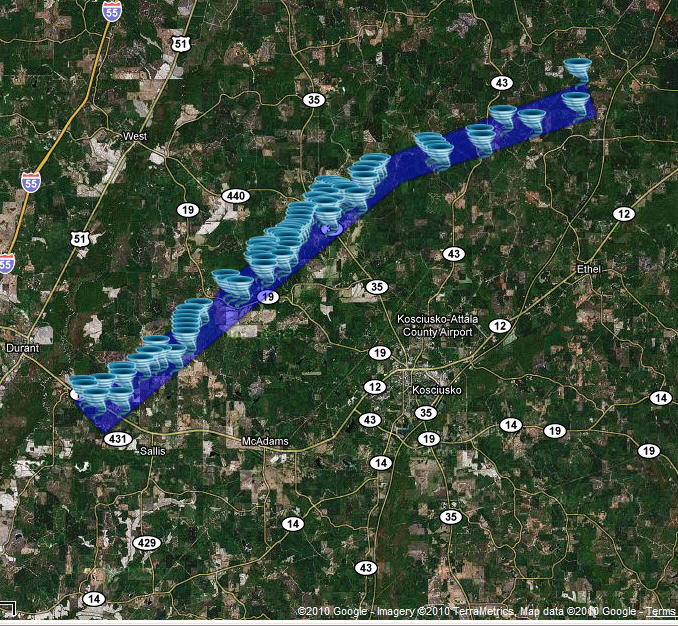
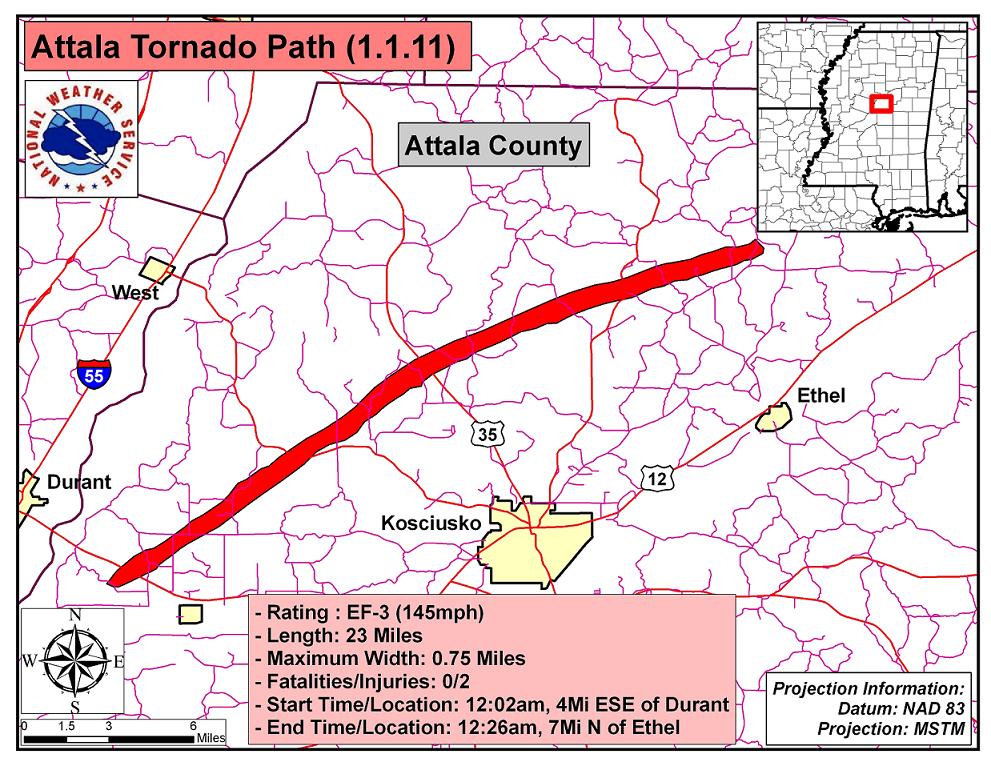
Event Summary The tornado began in the vicinity of state highway 12 east southeast of Durant. The tornado moved east-northeast to northeast, initially producing damage of EF1 intensity to trees, and damaging the roof of at least one home. As the tornado approached state highway 19, it intensified and began causing extensive tree damage, snapping and uprooting hundreds of trees. After crossing highway 19, it caused extensive damage to a church conference center, heavily damaging the roof of the main church building and causing major damage to several camp buildings. In this area, the tornado also caused significant roof damage to several homes and destroyed a number of outbuildings. From here, the tornado continued east northeast, continuing to cause major tree damage as it crossed state Highway 35 at Hesterville. As a wide, strong tornado moving through a heavily forested area, this tornado was a major destroyer of timber, snapping or uprooting thousands of trees. The tornado eventually weakened and dissipated to the north of Ethel. |
|


 Follow us on YouTube