February 24, 2011 Severe Weather Event
Event Summary
A line of severe thunderstorms tracked from west to east across the ArkLaMiss region on the evening of February 24th. These storms were prolific wind producers, with measured wind gusts over 50 mph common in areas along and north of the I-20 corridor. As a result, widespread wind damage occurred over portions of southeastern Arkansas, northeastern Louisiana, and northern portions of central Mississippi. Downed trees and power lines were reported across several counties, and relatively minor structural damage was reported. Power outages were widespread in these areas. In addition, embedded areas of circulation developed within the squall line. Two tornadoes were confirmed - an EF-1 that tracked across northern West Carroll Parish, and an EF-2 that tracked from northern Issaquena County into northern Sharkey County.
Survey Information
| Location | Start/ End Time |
Event Type | Fatalities/ Injuries |
Path Length | Path Width |
| West Carroll Parish 6 WSW Kilbourne to Kilbourne |
7:25 pm - 7:31 pm |
EF-1 Tornado 95 mph |
0 | 6 mi | 75 yds |
| Issaquena/Sharkey counties Grace to 1.5 SE Nitta Yuma |
7:50 pm - 8:01 pm |
EF-2 Tornado 115 mph |
0 | 6.5 mi | 400 yds |
Local Storm Reports
The map below shows locations where severe weather was reported to the National Weather Service. Click on the map for additional details.

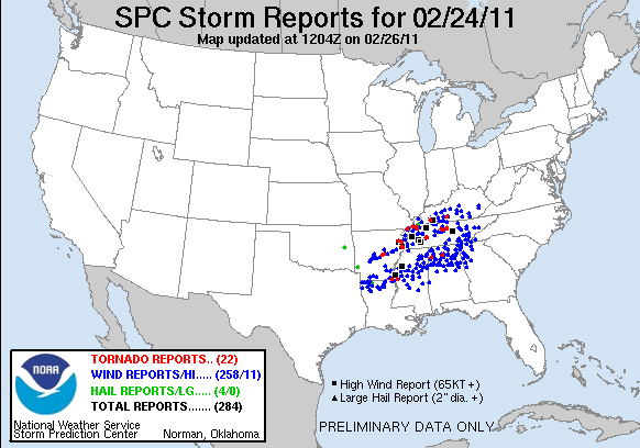
Regional Storm Reports
This severe weather event effected a large area of the southeastern United States. The map below from the Storm Prediction Center shows severe weather reports from around the country. Click on the map for additional details.
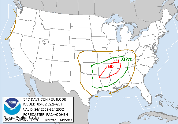
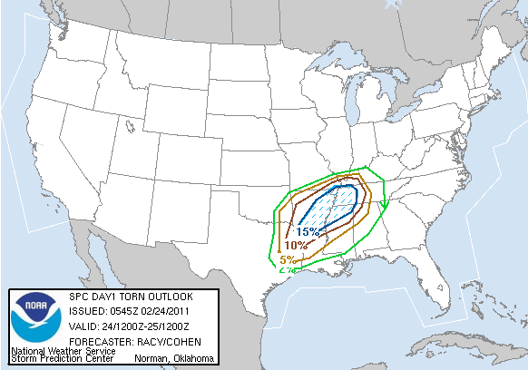
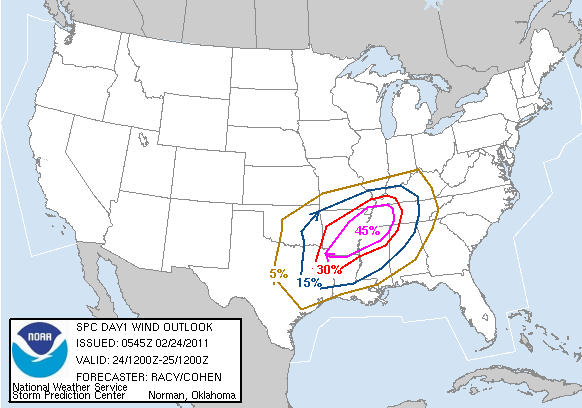
Outlooks
The severe weather event was well anticipated. The Storm Prediction Center and the National Weather Service in Jackson highlighted the threat of severe weather over northern portions of the area several days ahead of time. Here are the Day 1 Convective Outlook maps from the morning of February 24th. Click on the maps to see the outlook text.


 Follow us on YouTube