
Clinton/Jackson Tornado
Click on Map Below to Zoom In/Out and Damage Notation
|
Event Summary
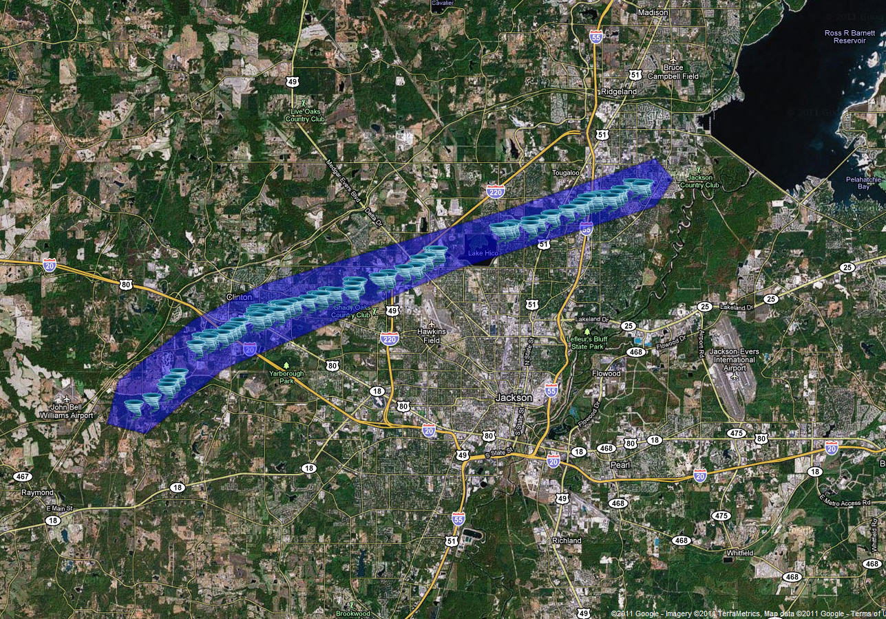
This tornado began along Airport Road to the southwest of Clinton and moved northeast across Interstate 20, US Highway 80, Interstate 220, and Interstate 55 before lifting near the intersection of Old Canton Road and Pear Orchard Road in southeast Ridgeland.
The most intense damage occurred in Clinton and western Jackson. In these areas, numerous homes and businesses were damaged and destroyed both by the tornado wind and from falling trees, cars were flipped and smashed, thousands of trees were snapped or uprooted, and numerous power lines and power poles were downed or snapped. The basis for the EF-3 rating was houses that were destroyed in neighborhoods just southwest of US Highway 80 and just south of Clinton Blvd in Clinton. The tornado maintained EF-2 and EF-1 strength as it moved through western Jackson. However, once it crossed Interstate 55, the tornado weakened to EF-0 and low end EF-1 damage.
|
|
|
EF-3
|
|
Estimated Maximum Wind:
|
140 mph
|
|
Fatalities/Injuries:
|
10 injuries
|
|
Damage Path Length:
|
17 miles
|
|
Maximum Path Width:
|
3/10 mile
|
|
Approximate Start Point/Time:
|
|
|
Approximate End Point/Time:
|
2 SE Ridgeland
11:17am
|
|


 Follow us on YouTube