
Holmes County Tornado
|
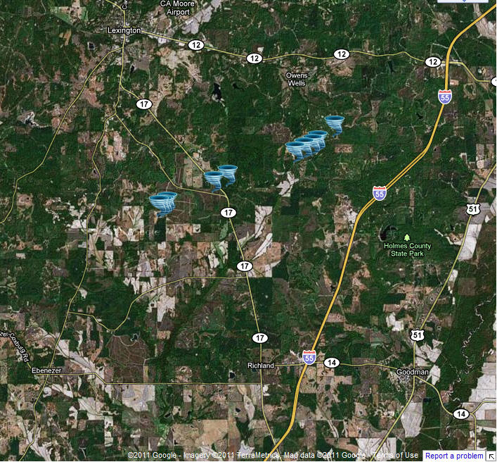
Event Summary This tornado began by downing some trees and snapping large limbs along Yates and Springhill Roads. It began to intensify as it crossed State Highway 17, snapping numerous pines along the highway. As it reached the intersection of Castalian Springs and Owens Cutoff Roads it reached its most intense, snapping and uprooting numerous hardwood and softwood trees into the road. The tornado continued northeast along Castalian Springs Road, downing numerous trees, before gradually weakening and dissipating before reaching Teal Road. |
|


 Follow us on YouTube