
Holmes/Carroll Counties Tornado #1
|
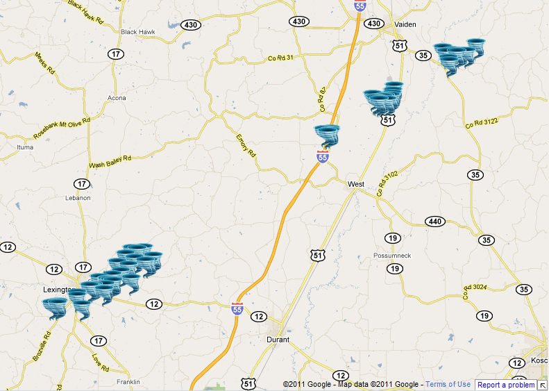
Event Summary
This tornado started near the intersection of State Hwy 433 and Hebron Rd southwest of Lexington. A couple of trees were snapped at the point. The tornado continued northeast across Hwy 17 were a few trees were snapped. The tornado continued northeast where it caused significant damage to a couple of mobile homes on Arenia Mallory Rd along with several trees and a few power poles snapped. The tornado crossed Hwy 12 where it caused some roof damage to a business along with numerous snapped trees. The tornado continued northeast to Doe Rd and this is where it reached its widest point. Hundreds of hard and softwood trees were snapped along with 3 wooded high tension poles. The tornado was rated an EF3 at this point. The tornado continued northeast to Bethesda and Bowling Green Road where hundreds more trees were snapped along with some roof damage to a home. The tornado crossed Hwy 55 just west of West snapping trees and several power poles along the way. The tornado continued northeast to just south of Beatty where it merged with another tornado.
|
|


 Follow us on YouTube