
Bunker Hill Tornado
|
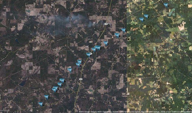
Event Summary The tornado started in Marion County on Goss Bunker Hill Road with mostly minor tree damage. As it moved northeast, crossing Stuckey Road, more minor tree damage occurred along with home TV and radio antennas being blown down. As it moved along E. Reservoir Road, more substantial tree damage occurred along with roof damage to a few homes and mobile homes. As it continued northeast, more major tree damage occurred along with snapped power poles on Bufkin and Grice Roads. The most significant damage occurred along Bunker Hill Road where home with roof damage occurred along with many trees uprooted and snapped. Several metal sheds were either severely damaged or destroyed. A cattle trailer was picked up and thrown approximately 200 yards. As it crossed Hwy 35, major tree damage continued where pines and hardwood were either snapped or uprooted. A carport was collapsed at a residence near Bryant road. The tornado continued northeast crossing Robbins and F. Mcneese Road where mainly tree damage occurred. As the tornado crossed S Williamsburg Road, the roof of a newly built barn was torn off along with major tree damage. As it continued northeast from there, mostly tree damage occurred until it ended near Gates Road, just south of Hwy 42 in Jefferson Davis County. |
|


 Follow us on YouTube