Event Summary
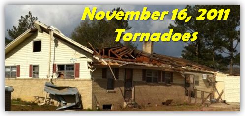
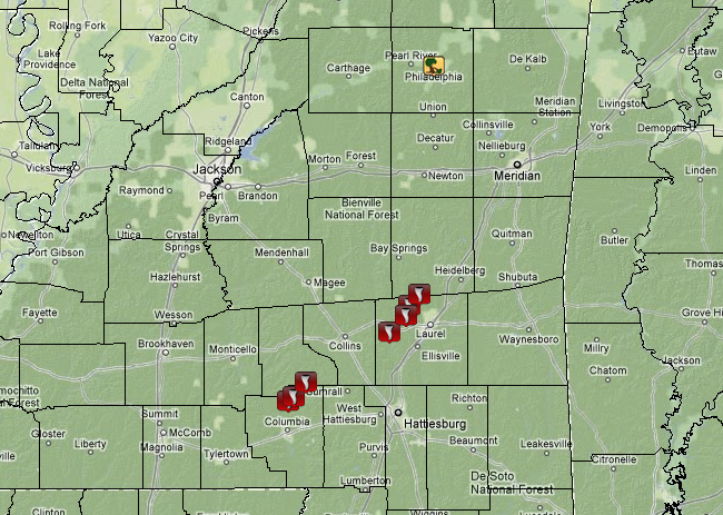
During the morning hours of November 16, a supercell thunderstorm tracked across the southeast portion of the service area and produced three tornadoes. Actually, this particular cell was responsible for two other tornadoes, one in southeast Louisiana and the other in west-central Alabama. This activity occurred as an upper level disturbance moved over the region and combined with increasing wind shear and instability. Initially the storm activity associated with this disturbance was rather weak. However, after 3 am, there was a resurgence in activity, and storms intensified across southeast Louisiana and southeast Mississippi. The primary storm, that produced all the damage, developed in the location where instability and high wind shear were maximized. The result was a cyclic supercell which produced several tornadoes. Across the NWS Jackson service area, three tornadoes impacted four counties: Marion, Jefferson Davis, Jones, and Jasper. Two of the tornadoes were rated EF1 and the other rated EF2. Nearly two dozen structures were damaged or destroyed by these tornadoes along with 15 people injured. Below are specific details and track maps for each tornado.
Survey Information - Click on the location in the table for additional maps and details
| Location | Start/ End Time |
Event Type | Fatalities/ Injuries |
Path Length | Path Width |
| Marion/Jefferson Davis counties 8 N Columbia to 3 SE Bassfield |
4:11 am- 4:25 am |
EF-1 Tornado 100 mph |
0 injuries | 11 mi | 1/4 mi |
| Jones County 4 SE Hebron to 4.5 ESE Hebron |
5:03 am- 5:07 am |
EF-1 Tornado 95 mph |
0 injuries | 2 mi | 50 yds |
| Jones/Jasper counties 7 W Laurel to 2.5 N Sharon |
5:12 am - 5:30 am |
EF-2 Tornado 130 mph |
15 injuries | 12 mi | 300 yds |
Local Storm Reports


 Follow us on YouTube