January 17, 2012 Marion County Tornado
Click on Map Below to Zoom In/Out and Damage Notation
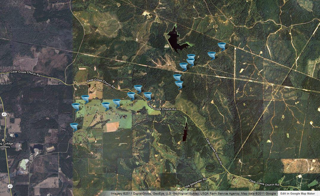
|
Event Summary The tornado first touched down along Mail Route Road and tracked across a farm, uprooting and snapping trees and causing minor damage to sheds and fences. The tornado then crossed Clear Creek Church Road where it reached its maximum intensity. A well anchored single wide trailer was destroyed with the contents tossed into the nearby woods. A well built shed was also destroyed with the contents deposited into the woods. A wood frame home received damage to one wall and had numerous shingles torn off. Two power poles were snapped off at this location. An impressive number of hard wood trees were snapped in this location as well. The tornado continued moving northeast producing low end EF-1 tree damage, while crossing several dirt roads before dissipating. |
|


 Follow us on YouTube