Hinds County Tornado
Click on the map above for a detailed, interactive track map and damage pictures.
|
Event Summary
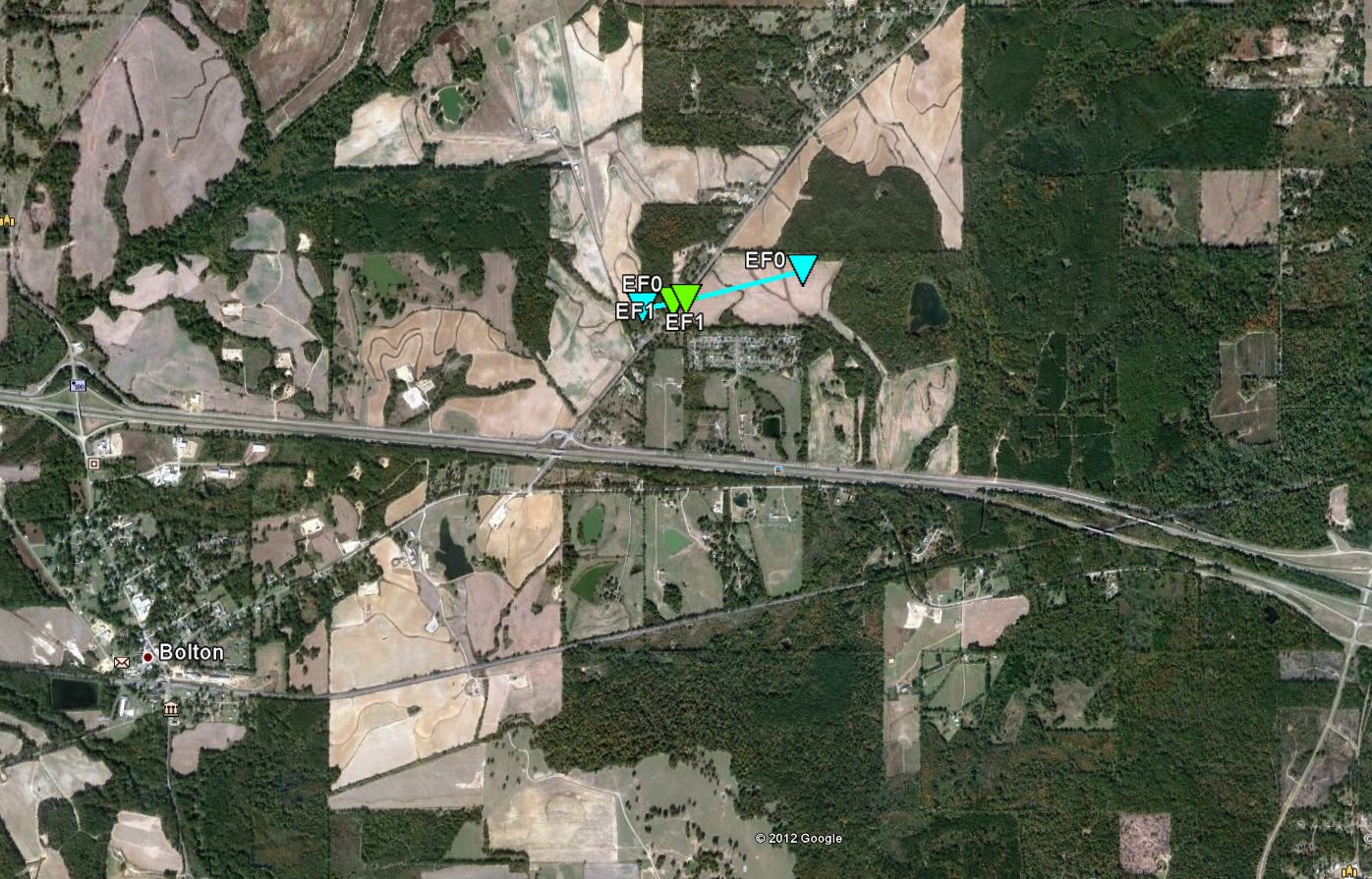
This tornado touched down just to the west of W Northside Dr. and tracked east northeast. Initially, a handful of trees had broken limbs. As the tornado neared and crossed W Northside Dr. almost a dozen hardwood trees were snapped and one power pole was taken down. Maximum winds here were 100 mph and the tornado was 50 yds wide. The tornado continued to the ENE into a cotton field and dissipated. Total path length was 0.52 miles and rated EF-1.
|
|


 Follow us on YouTube