
Event Summary
A very warm and unstable airmass was in place over the region on the 10th with temperatures reaching into the mid to upper 80s across the region. A very slow moving cold front moved through Texas into Louisiana during the day on the 10th, bringing tornadoes to portions of central Arkansas near Little Rock. Some thunderstorms developed ahead of the approaching squall line, bringing some hail to portions of northeast Louisiana. Without a strong push behind the front, it lingered across locations west of the Mississippi River through most of the evening and overnight hours of the 10th through 11th.
The cold front and squall line finally pushed east early on the 11th. Temperatures across east Mississippi were able to remain warm and conditions remained unstable and supportive of severe weather. A few supercells developed ahead of the cold front. One that tracked through Kemper and Noxubee counties spawned a tornado that caused structural damage in this area. Unfortunately, five injuries and one fatality also occurred in Kemper County near Liberty. Another 4 injuries occurred in Noxubee County as well. Additional damage was noted in Clarke, Jasper and Forrest counties where trees were downed and some damage to structures was reported.
The cold front and post frontal rains finally moved out of the ArkLaMiss by mid afternoon, causing additional damage east to Alabama and Georgia.
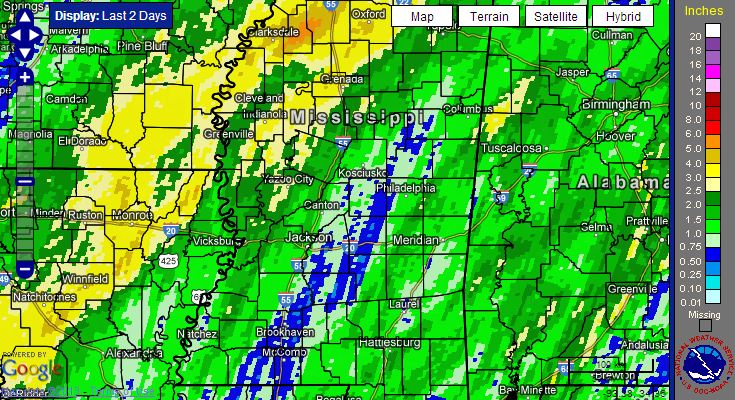
In addition to severe weather, the region once again saw plenty of rainfall. On the 10th, locations across the Delta saw 1.5-3.5 inches of rain. The rain was more progressive as it tracked east but 1 to 2 inches was seen.
Tornado Track Map
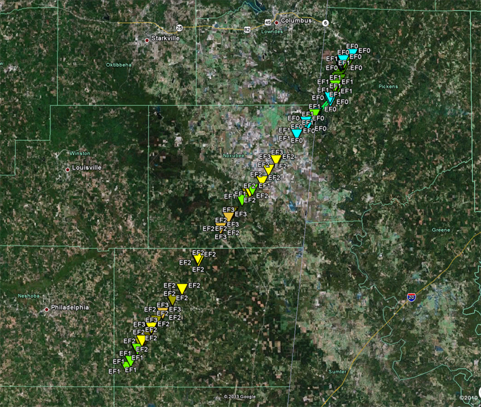
Click on map above to see entire event tracks and damage point notation.
Individual track maps also available on individual tornado pages.
Survey Information - Click on the location in the table for additional maps and details
| Location | Start/ End Time |
Event Type/ Max Winds |
Fatalities/ Injuries |
Path Length | Path Width |
| Kemper and Noxubee counties 3 SW Damascus to 3 ENE Bigbee Valley* |
11:33 am - 12:48 pm* |
EF-3 Tornado 145 mph |
Deaths: 1 Injuries: 9 |
56 mi in MS (68.4 mi total) | 3/4 mi |
*The tornado continued into Alabama. The track ended at 1:06pm CDT 0.77 miles east of Ethelsville, AL (33.4142/-88.1995)
Tornado Photos
Image courtesy of Leonard Kingery of tornado near Prairie Point, MS in Noxubee County.

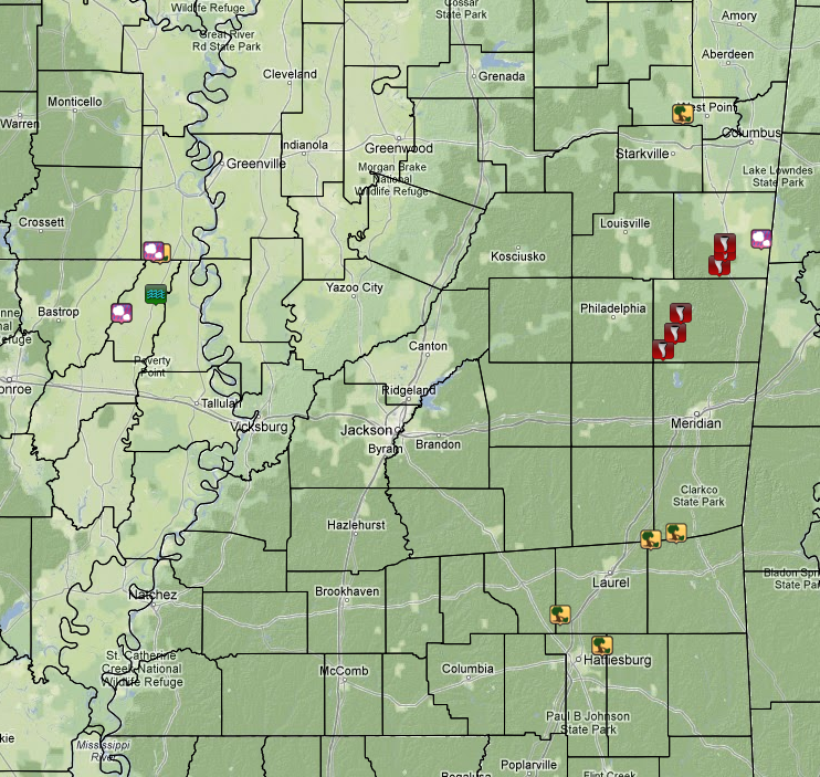
Local Storm Reports
Click on the map below for additional details.

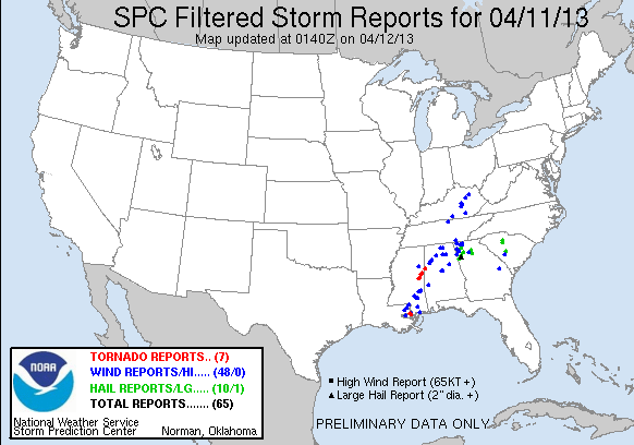
National Storm Reports
Rainfall Totals
(2 day storm total: April 10-11, 2013)


 Follow us on YouTube