
Banner photo: Lightning in Starkville, courtesy Allen Gresham
Event Summary
During the afternoon of the 20th and into the early morning hours of the 21st, a large part of the central United States experienced severe weather. Across the NWS Jackson forecast area, severe weather was more sporadic, but portions of the area did see the brunt of the strongest activity. This system was driven by a large scale long wave trough which developed a large and deep surface low pressure area over the Great Lakes region. Trailing this surface low was as strong front which encountered strong wind energy aloft and raced through the Mississippi River Valley. It was when this fast moving front encountered deep moisture that it triggered thunderstorms which resulted in severe weather.
While most of the severe weather was focused north and northeast of our service area, portions of our area did experience a combination of damaging winds, hail, a few tornadoes and flash flooding. Damaging winds were more common along the US Highway 82 corridor as the line of storms pushed east. The other area was more across the southeast where the main concentration of severe weather and flooding occurred. Three weak tornadoes occurred, two in Jones County and the other in Marion County. The most impactful severe weather was from the flash flooding as 3-6 inches of rain fell within a stripe from Brookhaven to Laurel to Hattiesburg to Columbia. Multiple flooded roads were reported in these areas with the worst flooding outside of West Hattiesburg in Lamar County. Here water rescues took place and some 20 homes had significant water in the structures.
Tornado Track Map
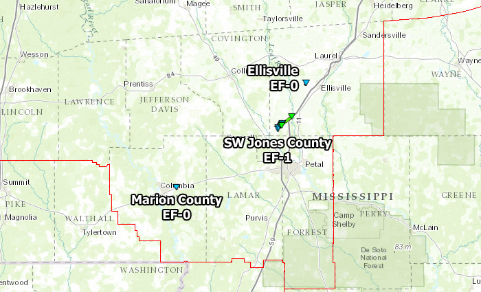
Click on map above to see entire event tracks and damage point notation. Individual track maps also available on individual tornado pages.
Survey Information - Click on the location in the table for additional maps and details
| Location | Start/ End Time |
Event Type | Fatalities/ Injuries |
Path Length | Path Width |
| Marion County 3 E Columbia |
7:48 pm - 7:48 pm |
EF-0 Tornado 75 mph |
none | 1/4 mile | 50 yards |
| Jones County 6 WSW Moselle to 2 W Moselle |
9:28 pm - 9:35 pm |
EF-1 Tornado 90 mph |
none | 4.5 miles | 100 yards |
| Jones County 2 W Ellisville |
9:50 pm - 9:51 pm |
EF-0 Tornado 80 mph |
none | 1/2 mile | 50 yards |
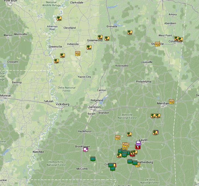
Local Storm Reports
Click on the map below for additional details.

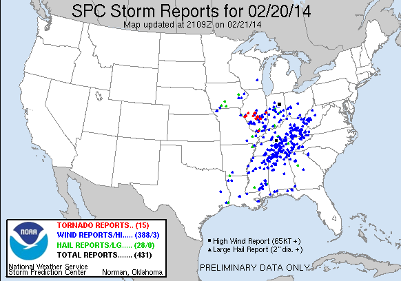
National Reports
Rainfall Totals
Storm Total Rainfall


Mississippi Rainfall Totals


 Follow us on YouTube