April 6 & 7, 2014 Severe Weather Event
Event Summary
A cold front moved through the region on April 4th and stalled along the northern Gulf Coast. Over the next several days, moisture increased over the region ahead of a strong upper level system. Beginning in the early morning hours of the 6th, bands of showers and thunderstorms moved north across the ArkLaMiss region. This continued through the day as heavy rain fell over some already saturated ground. During the late afternoon and evening hours of the 6th, the stalled front started to move slowly north as a warm front. This occurred as a surface low developed across the Texas coast and began to track northeast. This was able to bring mid 60 degree dewpoints into the region to just north of the Highway 84 corridor and allow for storms to become more surface based with a threat for damaging winds and tornadoes. As the surface low tracked east across the southern sections of the forecast area, storms exhibited some rotation and a tornado developed in Covington County, northwest of Collins. This tornado, rated an EF2, tracked for 16 miles and dissipated northeast of Hot Coffee. The tornado damaged homes and a church, leaving 8 injured. Another tornado, rated EF1, occurred in Neshoba County. This tornado tracked for a mile near Forestdale.
The most significant impact from this weather system was from the prolonged rainfall. Flash flooding occurred, which unfortunately swept a young girl into a drainage canal where she died in Yazoo County. Roads were washed away in some locations from the copious amounts of rain that fell. Area rivers overtopped their banks as river levels rose to the minor and moderate flooding categories. The Strong River at D'Lo in Simpson County crested at a record flood stage of 34.3 feet. Due to its close proximity to U.S. Highway 49, flood waters crept across the road and forced closure for a few days. Tallahala Creek at Laurel rose to major flood stage, cresting at 19.36 feet on April 8th.
Tornado Track Maps
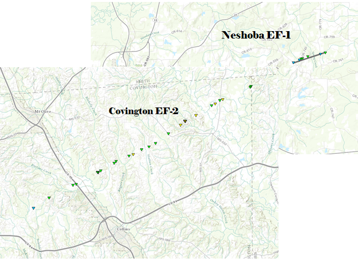
Click on map above to see entire event tracks and damage point notation. Individual track maps also available on individual tornado pages.
Survey Information - Click on the location in the table for additional maps and details
| Location | Start/ End Time |
Event Type | Fatalities/ Injuries |
Path Length | Path Width |
| Neshoba County 4 WNW Forestdale to 3 NW Forestdale |
7:41 pm - 7:43 pm |
EF-1 Tornado 95 mph |
0 injuries | 1.25 miles | 150 yards |
| Covington County 6 WNW Collins to 4 NE Hot Coffee |
2:02 am - 2:24 am |
EF-2 Tornado 125 mph |
8 injuries | 16 miles | 600 yards |
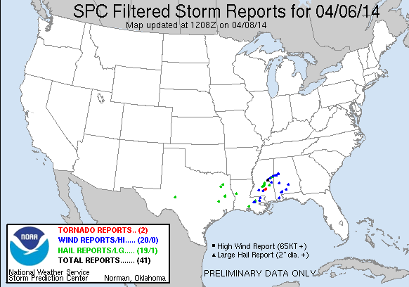
Local Storm Reports
Click on the map below for additional details.


National Reports
Rainfall Totals
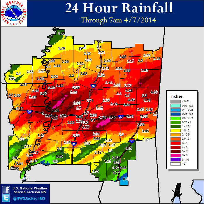
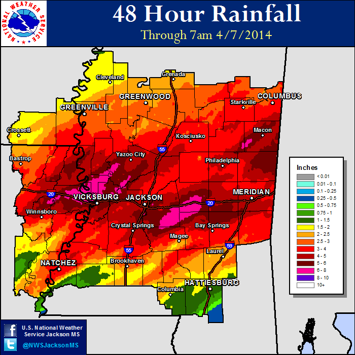
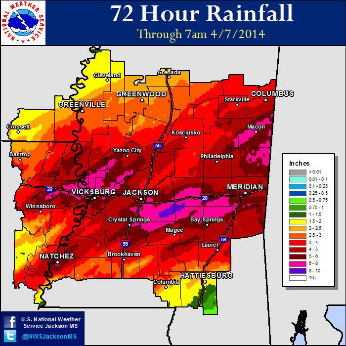
Mississippi Rainfall Totals


 Follow us on YouTube