
Banner image courtesy Mark Anderton
Madison County EF-0 Tornado
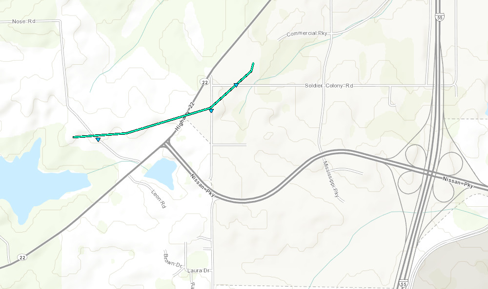
Click on map above to see entire damage point notation and damage pictures at select points.
|
Event Summary
This brief tornado touched down near Nose Road where it knocked down large limbs. From there, the tornado traveled east-northeast across Highway 22, then crossed Old Jackson Road where it broke a door and window glass at a home. It turned northeast as it crossed Soldiers Colony Road and broke out more door and window glass in another home and knocked down two trees. It also caused shingle damage to several homes along the path. The tornado ended just north of Soldiers Colony Road.
|
Rating:
(Click for EF Scale) |
EF-0 |
| Estimated Maximum Wind: |
80 mph |
| Fatalities/Injuries: |
none |
| Damage Path Length: |
1.0 mile |
| Maximum Path Width: |
75 yards |
| Approximate Start Point/Time: |
3 SW Canton
6:13 pm
|
| Approximate End Point/Time: |
2 SW Canton
6:14 pm
|
|
Radar Imagery
These images from the Brandon, MS Doppler radar show the storm at 6:13 pm. The image on the left shows 0.5° base reflectivity data, and the image on the right shows 0.5° storm relative velocity data. Click on the thumbnail below for a higher resolution image.


 Follow us on YouTube