 |
Multiple rounds of wintry weather had occurred prior to this snowfall event. A cold front had moved through the region four days earlier on February 21st with a cold airmass in its wake. Several waves of upper level disturbances moved through Mid-South, over the course of the next three days. The first, on the night of the 22nd, brought mostly rain to the region but some light icing occurred in the far northern Delta early on the 23rd. A second, more potent disturbance, moved through Central Mississippi during the afternoon and evening hours on the 23rd. This brought a better icing event to locations generally along and north of I-20, causing some power outages and accidents.
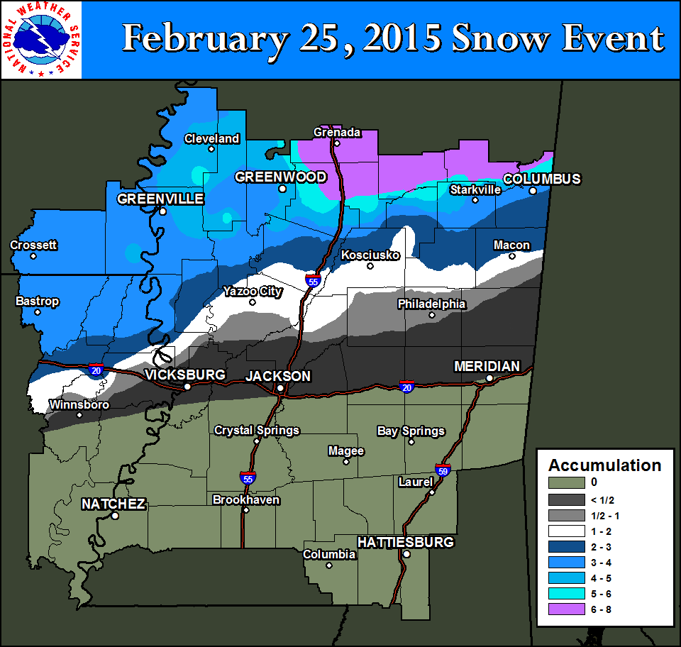
With the cold remaining in place, the final round of wintry weather moved in on the morning of the 25th. A strong upper level disturbance moved across the region, which induced a low pressure system to move east across the northern Gulf of Mexico. With the cold air already entrenched over the region, this brought the needed moisture and atmospheric lift needed to generate precipitation. At first, the precipitation started as rain and freezing rain, with some light icing reported across the ArkLaMiss. As the atmosphere cooled through the late morning, the rain began to change to snow in the early afternoon across southeast Arkansas, northeast Louisiana and the Mississippi Delta. The changeover line from rain to snow slowly progressed from northwest to southeast across northern portions of the ArkLaMiss region. By the time the changeover occurred near the I-20 corridor, the precipitation was moving off to the east into Alabama.
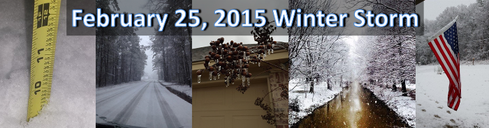
Those who got snow north of I-20 saw several heavier bursts, which led to some high snowfall totals. The highest totals were generally along and north of the Highway 82 corridor. Locations from Grenada to northern Lowndes county saw the highest amounts in our county warning area, with totals ranging from six to eight inches. Those who saw the higher totals also dealt with trees being weighed down by the heavy snow. This led to snapping trees and numerous power outages.
Highest reported snow accumulation totals from February 25, 2015. Click to enlarge.
| Arkansas | ||
|---|---|---|
| Station | County | Snow Amount (inches) |
| Eudora | Chicot | 4.5 |
| Dermott | Chicot | 3 |
| Portland | Ashley | 3 |
| Crossett | Ashley | 3 |
| Louisiana | ||
|---|---|---|
| Station | Parish | Snow Amount (inches) |
| Bastrop | Morehouse | 3.5 |
| Oak Ridge | West Carroll | 3.5 |
| Delhi | Richland | 3 |
| Lake Providence | East Carroll | 2.3 |
| Tallulah | Madison | T |
| Mississippi | ||
|---|---|---|
| Station | County | Snow Amount (inches) |
| Bellefontaine | Webster | 8 |
| Mantee | Webster | 8 |
| Caledonia | Lowndes | 8 |
| Duck Hill | Montgomery | 8 |
| Gore Springs | Grenada | 8 |
| Elliot | Grenada | 8 |
| Montpelier | Clay | 7 |
| Grenada | Grenada | 7 |
| Holcomb | Grenada | 7 |
| Carrollton | Carroll | 7 |
| Cedar Bluff | Clay | 7 |
| Eupora | Webster | 7 |
| Grenada 8 NNW | Grenada | 6 |
| West Point | Clay | 6 |
| Shaw | Bolivar | 6 |
| Columbus Air Force Base | Lowndes | 6 |
| Cleveland | Bolivar | 6 |
| Reform | Choctaw | 5.5 |
| Cruger | Holmes | 5 |
| Mathison | Webster | 5 |
| Minter City | Leflore | 5 |
| Maben | Webster | 5 |
| Steens | Lowndes | 4.8 |
| 1N Indianola | Sunflower | 4.5 |
| 1N Starkville | Oktibbeha | 4.3 |
| Vaiden | Carroll | 4 |
| Belzoni | Humphrey | 4 |
| Columbus | Lowndes | 4 |
| Glen Allan | Washington | 4 |
| Fitler | Issaquena | 3.7 |
| Greenville | Washington | 3.5 |
| 4 W Ackerman | Choctaw | 3.5 |
| Duncan | Bolivar | 3.4 |
| Moorhead | Sunflower | 3 |
| Rolling Fork | Sharkey | 3 |
| Tchula | Holmes | 3 |
| Durant | Holmes | 2 |
| Holly Bluff | Yazoo | 2 |
| Louisville | Winston | 2 |
| Lexington | Winston | 2 |
| French Camp | Choctaw | 2 |
| Possumneck | Attala | 2 |
| Crawford | Lowndes | 1.5 |
| Mccool | Attala | 1.5 |
| Way | Madison | 1.5 |
| Kosciusko | Attala | 1.5 |
| Yazoo City | Yazoo | 1 |
| Carthage | Leake | 0.5 |
| Pearl River | Neshoba | 0.5 |
| Jackson Intl. Airport | Rankin | T |


 Follow us on YouTube