January 19, 2017 Severe Weather Event
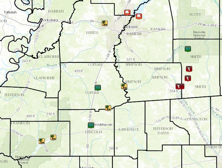
Local Storm Reports
Click on the map for additional details.

Back to the top
Simpson/Smith County EF-2 Tornado
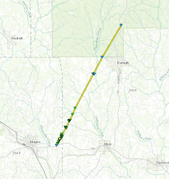
Click on map above to see entire damage point notation and damage pictures at select points.
|
Track Summary
This tornado touched down just east of Magee along Highway 28 at the intersection of Pine Grove Road. The tornado snapped a few trees here, then quickly grew and intensified. In the first half to 1 mile along Pine Grove Road, numerous trees were snapped and uprooted along with power lines being knocked down and some power poles snapped. Multiple homes had minor to moderate roof damage and most of these were along the edge of the tornado. However, there were a few that were more directly in the path. These sustained heavier damage with one home completely destroyed. The roof was blown off along with most of the outer wall off. Here peak intensity was reached with winds estimated at 120 mph. Multiple sheds or large barn type structures were heavily damaged or destroyed in this area as well. High end EF1 damage continued through the remainder of Simpson County where the tornado crossed C Stringer Road, Pine Grove Road again, and County Road 65 before moving into Smith County. Once in Smith County, most of the damage was from downed trees. The heaviest damage occurred as it crossed County Road 65 and County Road 108 where dozens of trees and several power lines were downed. A few homes also sustained minor roof damage in this area. As the tornado crossed County Road 503, it weakened some but remained at EF1 intensity as it continued to the north-northeast and crossed County Road 114. The remainder of the damage was EF0 intensity as the tornado tracked west of Raleigh before it dissipated at Highway 35, roughly 5 miles north of town.
|
Rating:
(Click for EF Scale) |
EF-2 |
| Estimated Maximum Wind: |
120 mph |
| Fatalities/Injuries: |
Injuries: 1 |
| Damage Path Length: |
19.2 miles |
| Maximum Path Width: |
500 yards |
| Approximate Start Point/Time: |
3 E Magee
7:53 am
|
| Approximate End Point/Time: |
5 N Raleigh
8:36 am
|
|
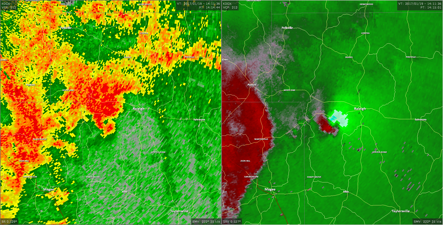
Radar Imagery
These images from the Brandon, MS Doppler radar show the storm at 7:54 am as the tornado approached the Simpson/Smith County line north of Highway 28. The image on the left shows 0.5° base reflectivity data, and the image on the right shows 0.5° storm relative velocity data. Click on the thumbnail below for a higher resolution image.

These images from the Brandon, MS Doppler radar show the storm at 8:15 am as the tornado passed Highway 540 west of Raleigh. The image on the left shows 0.5° base reflectivity data, and the image on the right shows 0.5° storm relative velocity data. Click on the thumbnail below for a higher resolution image.
Back to the table


 Follow us on YouTube