Overview
A stalled frontal boundary and southerly winds transporting ample moisture into the region, led to widespread precipitation crossing the region from late Wednesday (February 10th) into Thursday (February 11th). Cold air, related to the surge of arctic air over the central and northern plains was present at the surface, while warm air surged northward just above the ground. This led to widespread freezing rain across east Kentucky. Many locations saw 0.25-0.50" of ice from this event. Along with difficult travel conditions, power outages were reported due to falling trees on powerlines.Photos
 |
 |
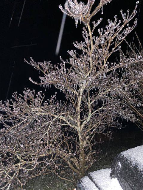 |
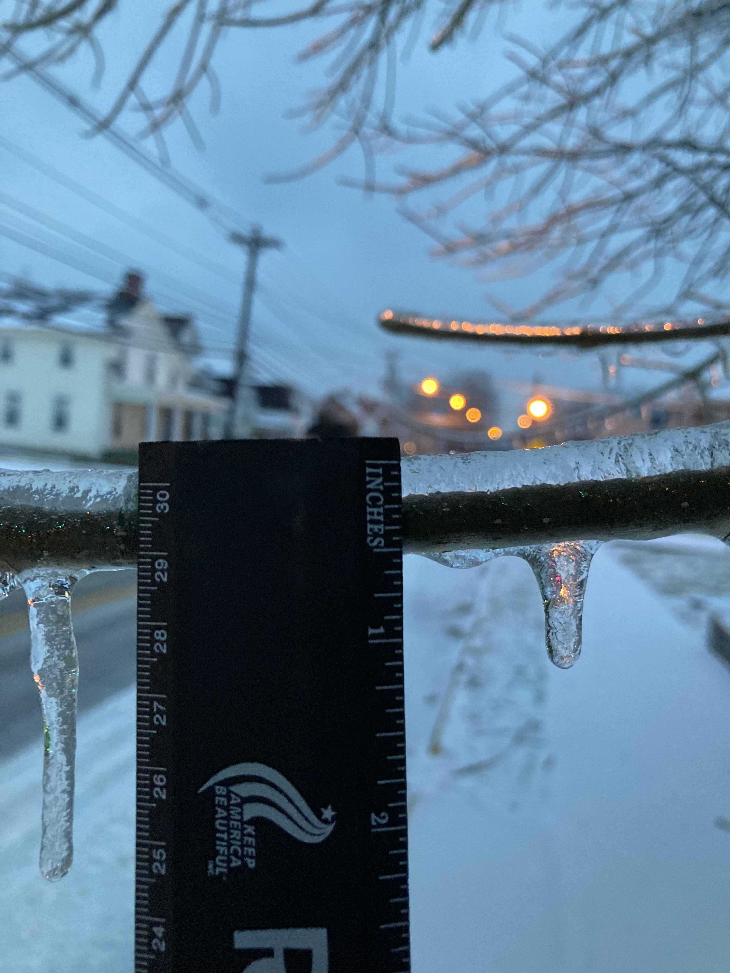
| Burnt Ridge Rd in northern Rockcastle county (Howell Holbrook) | Owingsville in Bath county (Jason York) | Rowan and Elliott county line (Brandon Johnson) |
Radar
| Local Storm Reports received from February 11, 2021 | ||
 |
||
FREEZING RAIN REPORTS

Location                     Amount    Time/Date       Lat/Lon

...Bath County...
1 NNW Owingsville            0.30 in   0733 AM 02/11   38.14N/83.76W

...Elliott County...
Sandy Hook                   0.25 in   0927 AM 02/11   38.10N/83.12W

...Estill County...
Willow Tree                  0.10 in   0152 PM 02/11   37.70N/83.92W

...Fleming County...
Flemingsburg                 0.40 in   0800 AM 02/11   38.42N/83.73W

...Floyd County...
Allen                        0.25 in   0620 PM 02/11   37.61N/82.73W

...Harlan County...
Cranks                       0.25 in   0900 PM 02/11   36.76N/83.18W

...Jackson County...
1 WSW Clover Bottom          0.20 in   0730 AM 02/11   37.49N/84.17W

...Johnson County...
Flatgap                      0.25 in   1109 AM 02/11   37.93N/82.89W

...Knott County...
Hindman                      0.25 in   0900 PM 02/11   37.34N/82.98W

...Leslie County...
Hyden                        0.20 in   0924 AM 02/12   37.16N/83.37W

...Letcher County...
1 N Oven Fork                0.25 in   1000 PM 02/11   37.07N/82.81W

...Magoffin County...
1 SSW Bradley                0.25 in   1059 AM 02/11   37.70N/83.01W

...Martin County...
1 ENE Inez                   0.25 in   0900 PM 02/11   37.87N/82.52W

...McCreary County...
Whitley City                 0.10 in   0500 PM 02/11   36.72N/84.48W

...Menifee County...
1 NW Mariba                  0.50 in   0915 AM 02/11   37.92N/83.59W

...Morgan County...
West Liberty                 0.25 in   1030 AM 02/11   37.92N/83.26W

...Perry County...
1 ESE Delphia                0.50 in   1000 PM 02/11   37.02N/83.07W

...Powell County...
1 W Stanton                  0.30 in   0820 AM 02/11   37.85N/83.87W

...Rockcastle County...
1 W Rockford                 0.50 in   0800 AM 02/11   37.52N/84.29W
1 SW Hiatt                   0.30 in   0800 AM 02/11   37.41N/84.39W

...Rowan County...
1 SSE Morehead               0.25 in   0815 AM 02/11   38.18N/83.44W

...Wolfe County...
1 WNW Koomer Ridge Camping G 0.25 in   0952 AM 02/11   37.79N/83.65W
Environment
 |
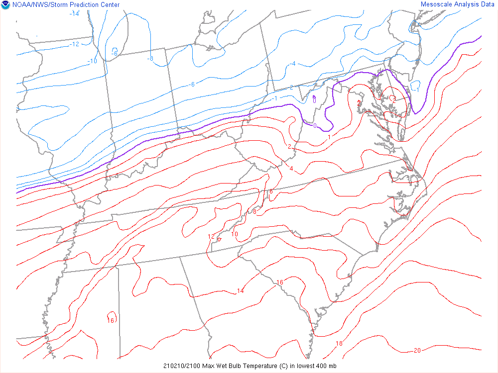 |
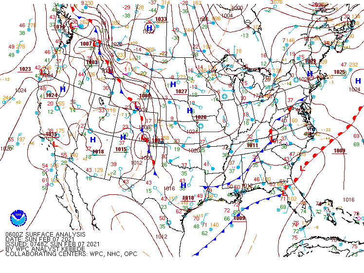
| 1 AM Surface Map, Sunday, February 7th, 2021 | 4 PM, February 10th - 7 AM February 11th Max Wet Bulb Temperature Lowest 400 mb |
 |
Media use of NWS Web News Stories is encouraged! Please acknowledge the NWS as the source of any news information accessed from this site. |
|


 Follow us on YouTube