Overview
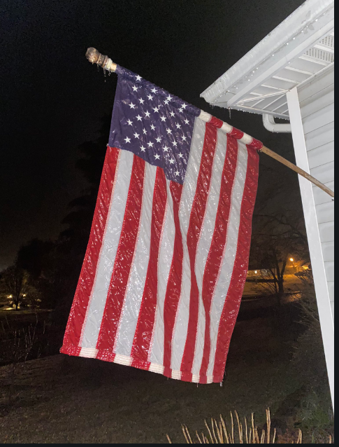
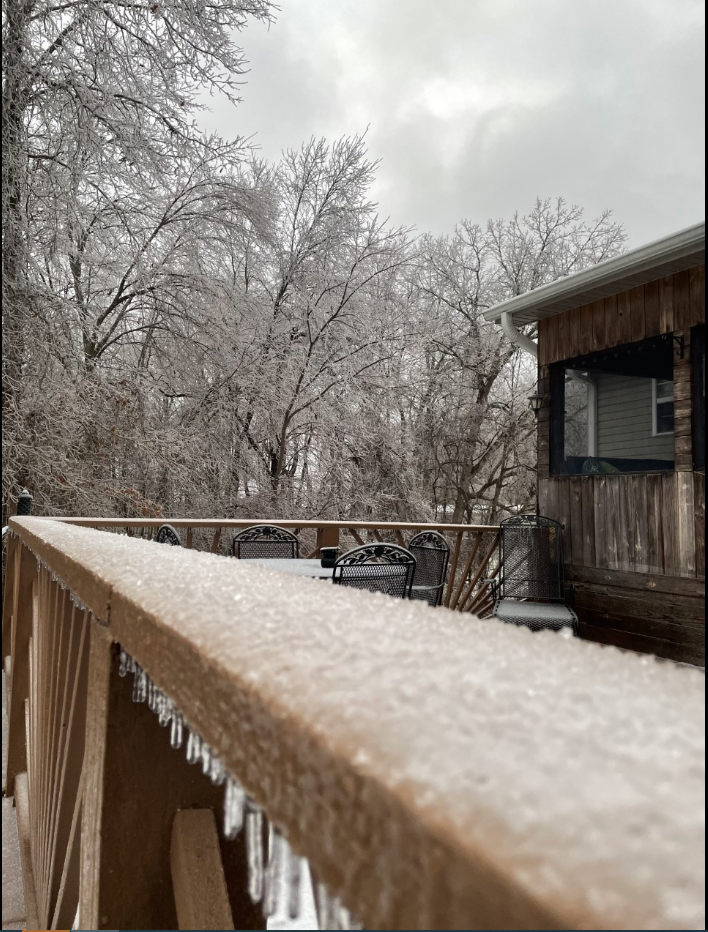
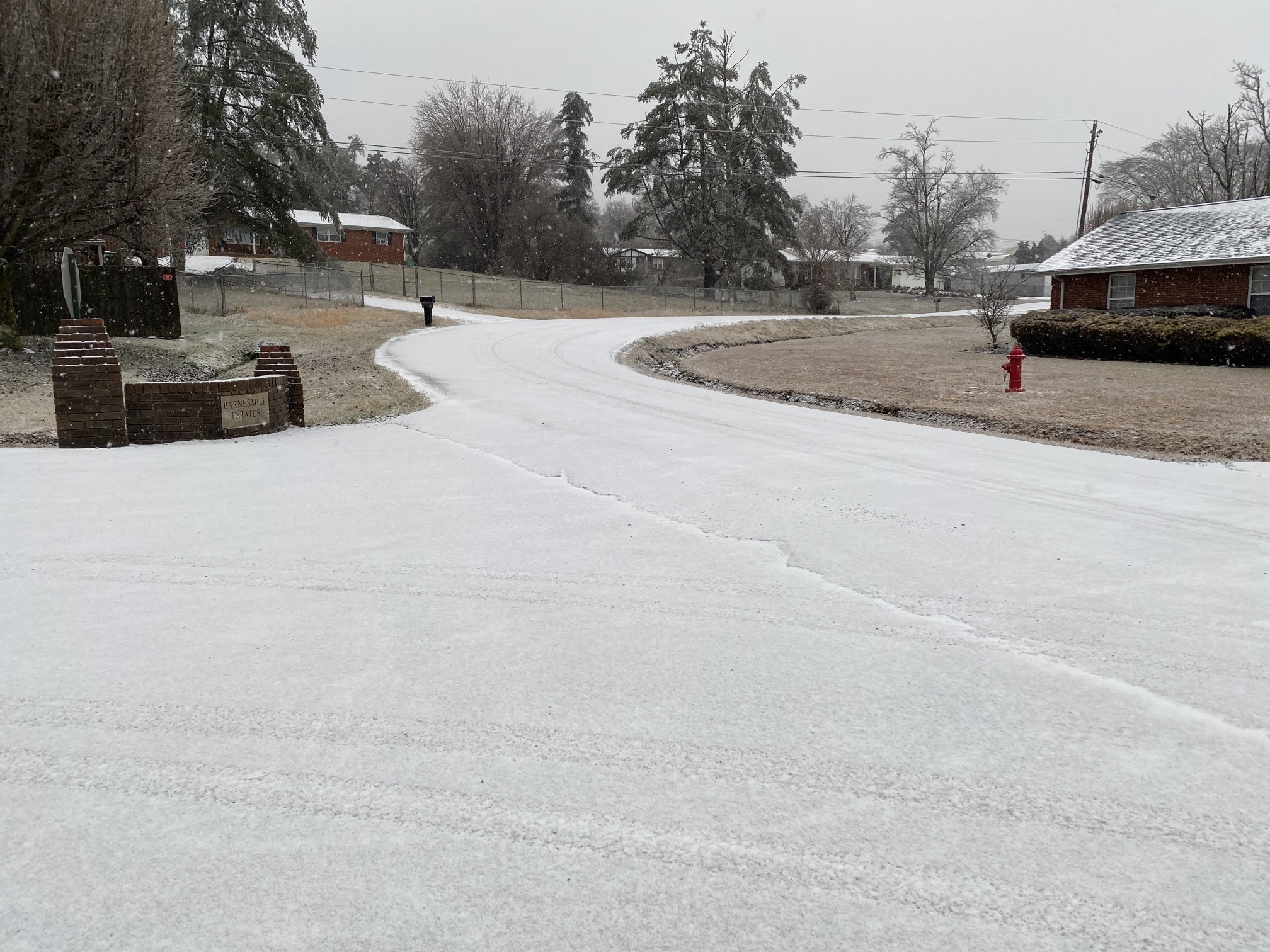
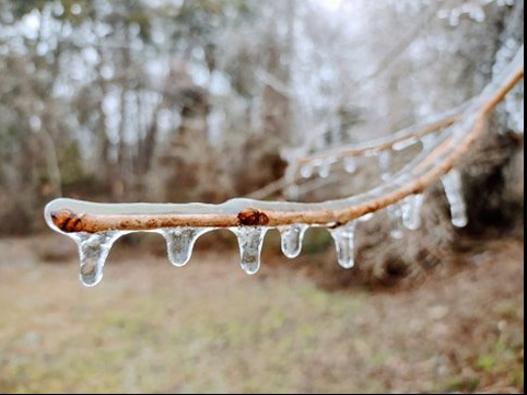
An area of low pressure tracked across east Kentucky from Monday, February 15th into Tuesday, February 16th. Widespread precipitation spread into east Kentucky during the afternoon hours on the 15th, with locally heavy precipitation during the evening hours. With temperatures below freezing across most of east Kentucky, and warmer air just off the ground, freezing rain dominated with significant ice accumulations.
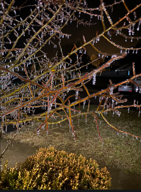
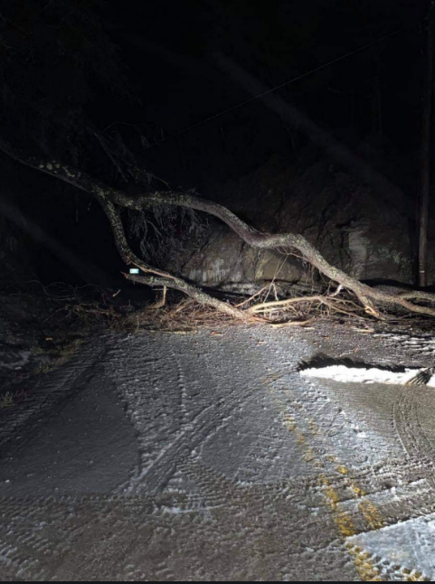
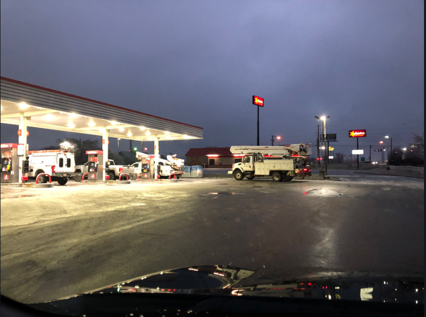
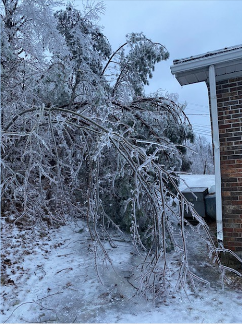
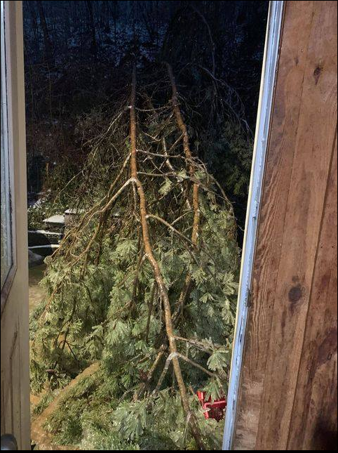
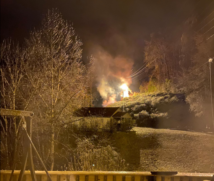
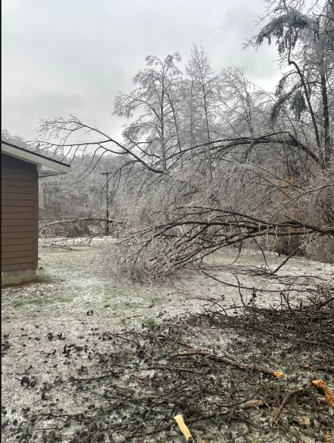
Power outages during the peak of this event reached 150,000 across east Kentucky with numerous trees snapping off due to the weight of the ice. Many roads became impassable due to downed trees and electrical lines.
Photos
 |
 |
 |
 |
| 3 Miles South of London Airport (Shane Smith) |
3 Miles South of London Airport (Shane Smith) |
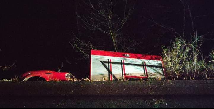
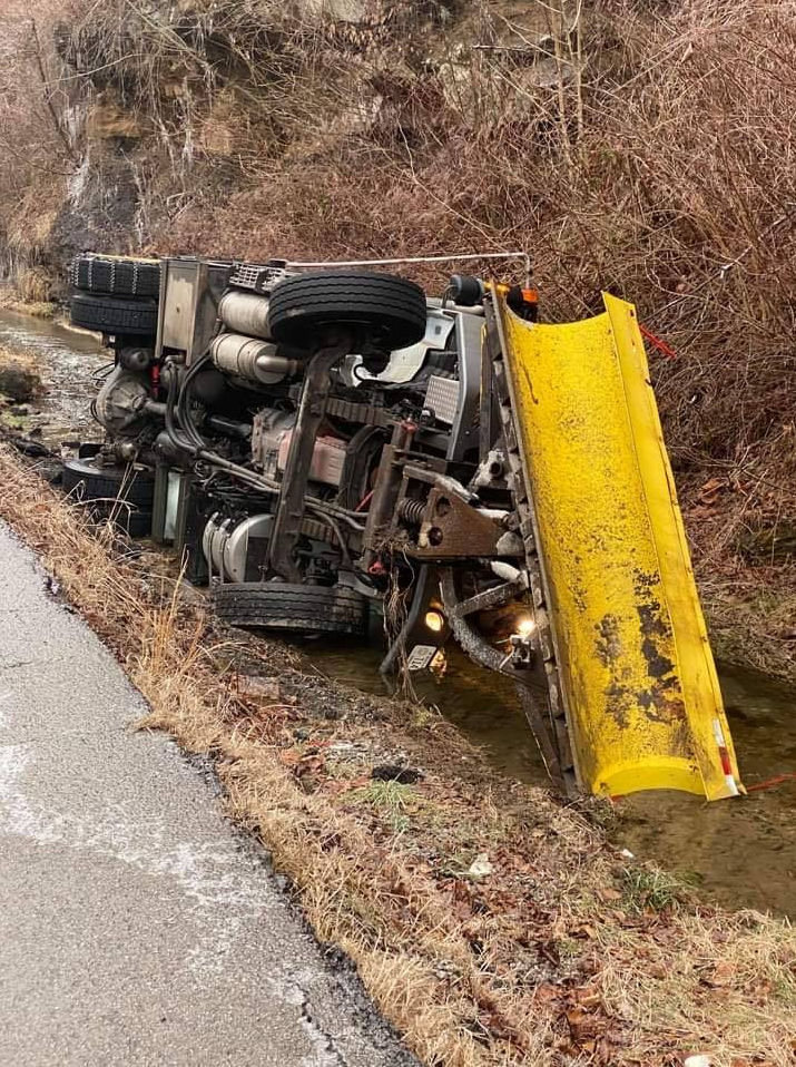
Fire Truck Off the Road (WYMT) |
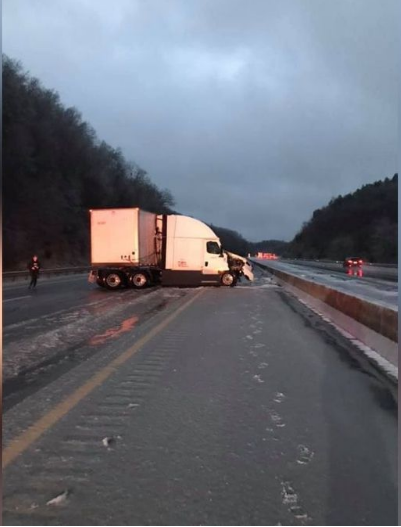
I-75 Accident (WYMT) |
 |
 |
 |
 |
| Jackson County (Danny) |
Sleet Accumulation in Hilda, KY (Jen O'Keefe) |
KY 1812 in Breathitt County (Johnny Ray Feltner) |
Hardburly in Perry County (Kenneth) |
 |
 |
 |
 |
| London in Laurel County (Johnnie Nicholson) |
London in Laurel County (Shane Smith) |
Magoffin County (Gary) |
Sitka in Johnson County (Bobbie) |
 |
 |
 |
| Staffordsville in Johnson County (Brandon) |
Staffordsville in Johnson County (WYMT) |
Whitley County (Robbie) |

| Local Storm Reports received from February 15th-16th, 2021 | ||
 |
||
FREEZING RAIN REPORTS

Location                     Amount    Time/Date       Lat/Lon

...Breathitt County...
NWS Office/Julian Carroll Ai 0.41 in   1253 AM 02/16   37.59N/83.31W
1 W Jackson                  0.20 in   0535 PM 02/15   37.56N/83.39W

...Clay County...
2 NW Littleton               0.25 in   1210 AM 02/16   37.18N/83.77W
Oneida                       0.25 in   1100 PM 02/15   37.27N/83.65W

...Elliott County...
Sandy Hook                   0.50 in   1100 PM 02/15   38.09N/83.13W

...Floyd County...
1 E Bays Branch              0.25 in   0728 PM 02/15   37.72N/82.75W

...Johnson County...
1 ESE Stambaugh              0.50 in   1047 PM 02/15   37.88N/82.78W

...Knott County...
2 SW Bolyn                   0.30 in   1150 PM 02/15   37.42N/82.93W

...Knox County...
1 SSE North Corbin           0.25 in   1100 PM 02/15   36.95N/84.09W

...Laurel County...
1 WSW North Corbin           0.30 in   1000 PM 02/15   36.96N/84.11W
London-Corbin Airport        0.27 in   0653 PM 02/15   37.09N/84.07W

...Lee County...
1 W Beattyville              0.60 in   1130 PM 02/15   37.58N/83.73W

...Leslie County...
Essie                        0.50 in   1200 AM 02/16   37.06N/83.46W

...Magoffin County...
2 E Gullett                  0.25 in   1025 PM 02/15   37.74N/83.09W

...Martin County...
1 WNW Inez                   0.33 in   1048 PM 02/15   37.87N/82.56W

...McCreary County...
Whitley City                 0.32 in   0715 PM 02/15   36.73N/84.47W

...Menifee County...
Frenchburg                   0.75 in   1118 PM 02/15   37.95N/83.62W

...Morgan County...
1 NNE West Liberty           0.50 in   1113 PM 02/15   37.92N/83.26W

...Owsley County...
1 WNW Booneville             0.66 in   1210 AM 02/16   37.48N/83.70W

...Perry County...
3 W Bulan                    0.25 in   1100 PM 02/15   37.30N/83.21W

...Pike County...
2 SW Sidney                  0.50 in   1140 PM 02/15   37.59N/82.38W

...Powell County...
Stanton                      0.50 in   1100 PM 02/15   37.85N/83.86W

...Pulaski County...
Eubank                       0.75 in   0354 PM 02/15   37.28N/84.65W

...Rockcastle County...
Spiro                        0.30 in   0350 PM 02/15   37.35N/84.40W

...Wayne County...
1 S Monticello               0.25 in   0658 PM 02/15   36.83N/84.85W

...Wolfe County...
Campton                      0.30 in   1103 PM 02/15   37.74N/83.55W

SLEET REPORTS

Location                     Amount    Time/Date       Lat/Lon

...Bath County...
1 SW Owingsville             1.5 in    0633 PM 02/15   38.13N/83.77W

...Estill County...
Ravenna                      2.0 in    0843 PM 02/15   37.68N/83.95W

...Fleming County...
Flemingsburg                 1.0 in    0820 PM 02/15   38.42N/83.73W

...Jackson County...
Sandgap                      0.5 in    0505 PM 02/15   37.48N/84.09W

...Montgomery County...
1 S Oggs Station             1.2 in    0600 PM 02/15   38.01N/83.82W
2 WNW Jeffersonville         0.5 in    0425 PM 02/15   37.97N/83.85W

...Rowan County...
Hilda                        2.0 in    0750 PM 02/15   38.24N/83.51W
1 S Waltz                    0.5 in    0430 PM 02/15   38.31N/83.44W
Morehead                     0.5 in    0405 PM 02/15   38.19N/83.44W
 |
 |
| Warmest Web Bulb Temperature in Lowest 400mb (4 PM February 15th to 1 AM February 16th) - As you can see, there is significant warm air above the surface, helping to produce all liquid at the ground, where surface temperatures were well below freezing. | Surface Analysis (4 PM February 15th to 1 AM February 16th) |
 |
Media use of NWS Web News Stories is encouraged! Please acknowledge the NWS as the source of any news information accessed from this site. |
|


 Follow us on YouTube