Overview
|
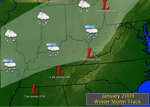
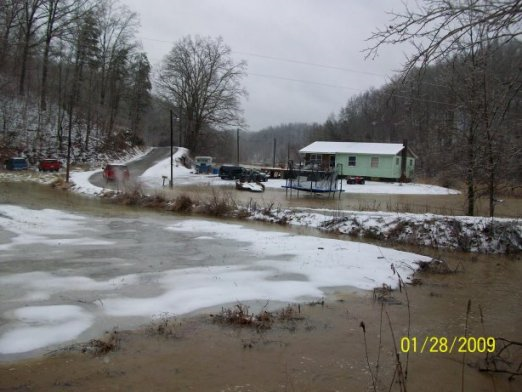
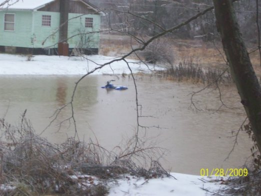
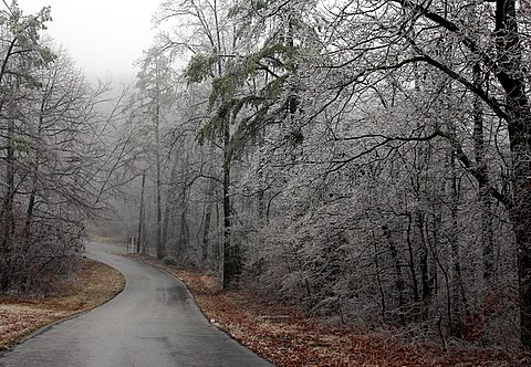
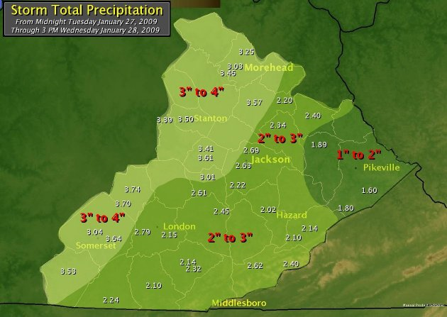
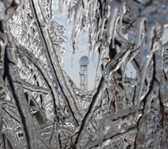
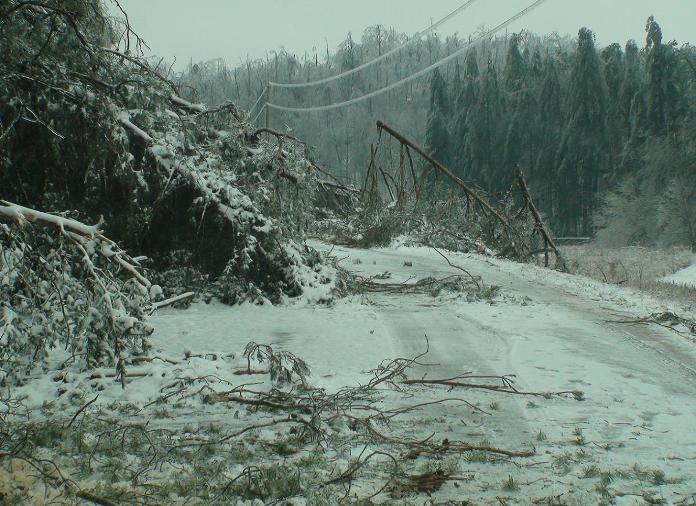
Low pressure developed over Texas on Tuesday January 27th and moved across the Tennessee Valley into southeast Kentucky during the early morning hours of January 28th. By the time this system exited the region late on the 28th, it had brought the worst ice storm since February 2003 to most of central and eastern Kentucky. Particularly hard hit were areas along and north of the Mountain Parkway where up to an inch of glaze from freezing rain brought down numerous trees knocking out power to thousands. Flooding was also a problem, especially on the Red River. Runoff from the rain combined with debris and ice jamming up the river forced the river out of its banks, closing roads in Clay City and Stanton. |
 |
 |
 |
 |
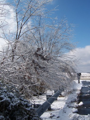
| Photo fron NWS Jackson, KY | Photos from Elliott County Emergency Manager Director Jim Skaggs. | |
 |
 |
 |
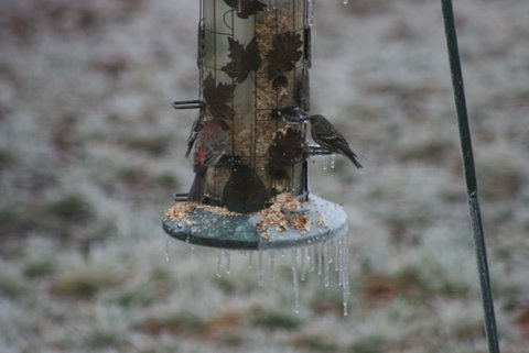
| Photos courtesy of Cliff and Sandy Steele, Colo, Kentucky Cooperative Weather Observers. | ||
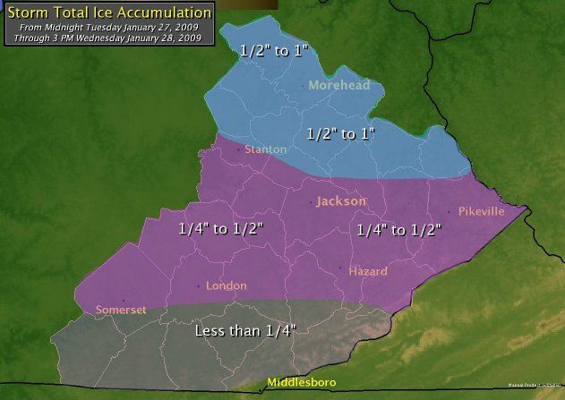
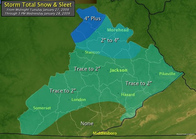
Ice/Snow
 |
 |
Liquid Precipitation
 |
Temperatures
Another interesting feature of this system was the incredible temperature gradient observed across southeast Kentucky around dawn on Wednesday January 28th. A warm front inched northward, scouring out the colder air near the surface. Gusty southeast low level winds downsloping off of Pine and Black Mountains helped warm this air even more sending the mercury above 60ºF in several locations. To the north of this front, temperatures remained in the 30s. The distance between locations in the 30s and locations in the 60s was less than 10 miles at times!
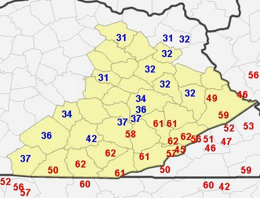 |
| Observed Temperatures Around 7 AM Wednesday January 28th (based on Coop Observations). |
 |
Media use of NWS Web News Stories is encouraged! Please acknowledge the NWS as the source of any news information accessed from this site. |
|


 Follow us on YouTube