Overview
|
Flash flooding during the evening of May 8th and 9th 2009 left a lingering impact on portions of east Kentucky. During a 14 hour span from the afternoon of Friday May 8th through the late morning of Saturday May 9th, 4 to 6 inches of rain fell from Jackson County eastward to Pike County. Initially, a complex of severe storms rolled through the area on Friday afternoon, however the rainfall didn’t stop there. A nearly stationary boundary set up south of the Ohio River and nearly perfectly bisected the state of Kentucky from west to east. Strong southwest flow around the 3000 to 5000 foot level allowed ample amounts of moisture from the Gulf of Mexico to pile into Kentucky before being stopped by the boundary. The result was a steady “train of rain” that continuously moved from west to east across the state. |
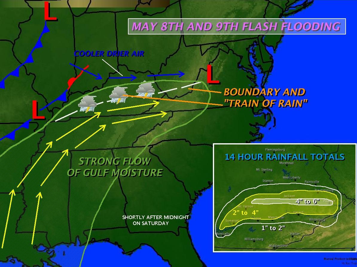 |
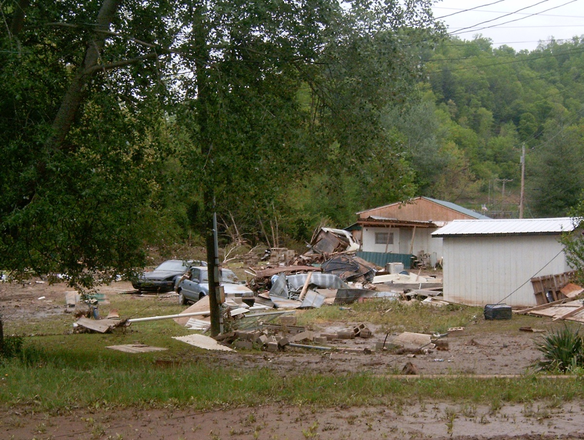
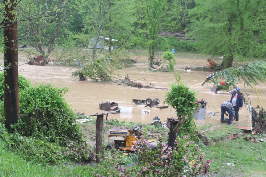
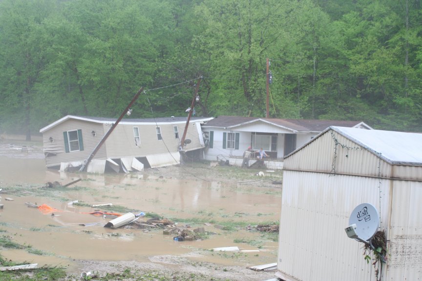
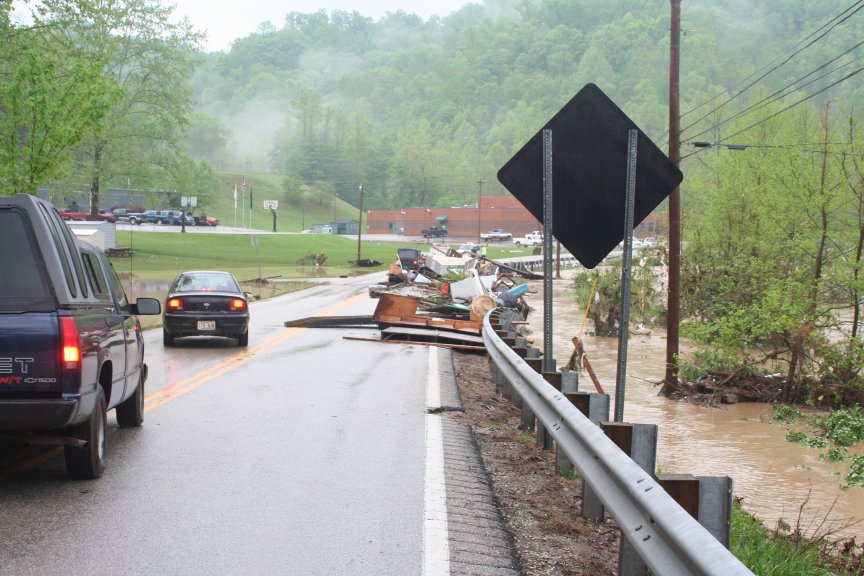
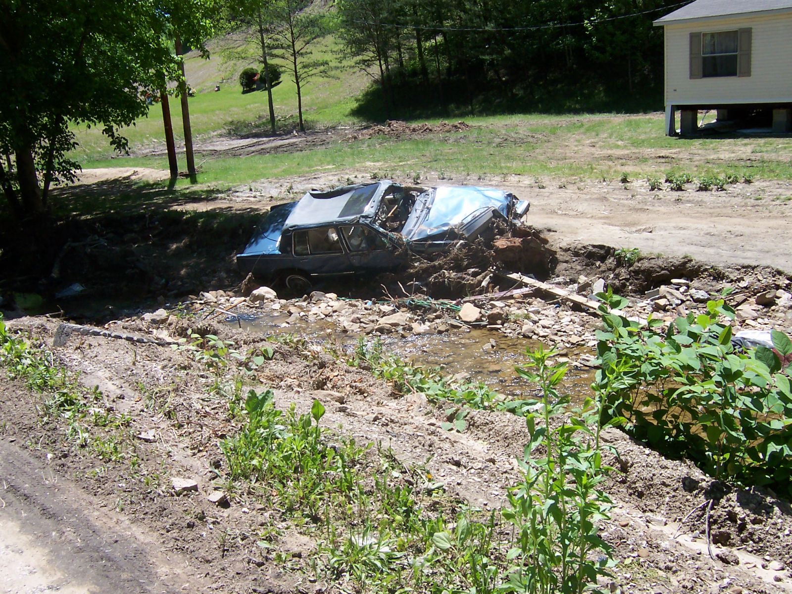
The area that received the most rainfall was the west to east line from McKee in Jackson County, through Booneville in Owsley County, to just south of Jackson in Breathitt County, eastward to Pikeville. One thunderstorm after another kept pounding this area and eventually 4 to 6 inches of rain had fallen. The already saturated grounds could not absorb anymore water, and with the steep and rugged terrain of east Kentucky flash flooding commenced from excess runoff. Shortly thereafter, small creeks and streams overflowed their banks as the overwhelming amounts of water kept coming. The end result was the destruction of many homes, buildings and infrastructure as the devastating power of water was shown. Luckily, no lives were lost, however hundreds of water rescues had to be performed. In Floyd County alone, 281 water rescues were executed.
Interviews with local residents in Breathitt County revealed that this was the highest Cane Creek in the western part of the county had ever been in a 31 year memory. Also, Quicksand Creek in the central part of the county was the highest it had ever been in memory as far as pure floodwater coming down the creek was concerned. A few residents remembered a time when the portion of Quicksand Creek near the North Fork of the Kentucky River had been higher due to back water from the river. 13 of the 33 counties in the Jackson National Weather Service’s jurisdiction were declared federal disaster areas for either public or individual assistance.
 |
 |
 |
| Flood damage along Highway 30W in Jackson, KY | Flood damage along Highway 30W in Jackson, KY | Flood damage along Highway 30W in Jackson, KY |
 |
 |
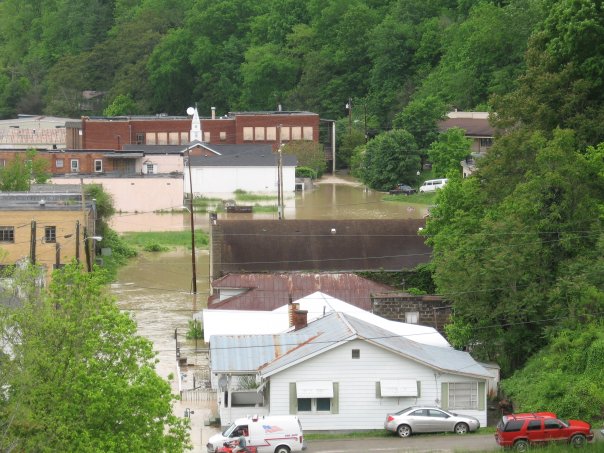 |
| Flood damage along Highway 30W in Jackson, KY | Flood damage along Highway 30W in Jackson, KY | Flooding in Martin, KY |
 |
Media use of NWS Web News Stories is encouraged! Please acknowledge the NWS as the source of any news information accessed from this site. |
|


 Follow us on YouTube